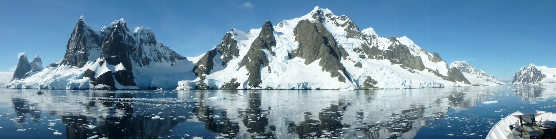
Days 0, August 25-31st: I skipped the PCT NoCal section since I already hiked most of it a 2nd time in 2023 (along with the Oregon Coast Trail, part of the Bigfoot Trail, and entire Tahoe Rim Trail). I spent nearly a week with trail friends Scott and Alan, both of whom helped me out tremendously on past hikes of the Pacific Coast Bigfoot Crest Rim Trail and Desert Winter Thru-hike. I stayed with Alan in Sacramento for about 4 days. He was so kind to host me, let me borrow his bear canister for the Sierra and provide his address for a box of supplies I shipped from home. I received paper maps of the high routes, new Salomon Speed Cross shoes, and my over quilt for the expected cold (pairing a 30 degree Katabatic quilt with a synthetic EE 40 degree quilt). I swapped out a few items to send home, as well. Thanks again Alan for your hospitality and friendship over the past year, it meant a lot to me.
On Saturday, I took a greyhound bus to Stockton (perhaps the worst bus and route combination ever), in order to meet with Scott / Cookies. He was on his way back from San Francisco to his cabin in Pinecrest. Picking me up in Sacramento would have been far out of his way and he was already doing me a huge favor, thus my unsavory side-trip to Stockton. Thankfully I survived the excursion and we met as planned. These logistics actually worked out perfectly, as the other options I’d researched involved taking a bus to Reno, then the Eastern Sierra Transit south…a much more time-consuming and costly plan. This way I got to spend some quality time with Scott and bring things full circle to where I finished my 2023 PCBCRT hike. I knew from my previous experience staying at Scott’s cabin that a hitch to Sonora Pass would be a piece of cake (and it was!).
I’d planned to begin my Sierra hike on Sunday, but the peace and tranquility of the Pinecrest cabin sucked me in. That’s ok, because I spent such a wonderful and memorable day there. Scott and I went for a 5 mile loop hike around the lake, giving me a chance to break in a new pair of shoes, and completely new brand and model for me, at that. The Solomon Speedcross had a much narrower toe box than the Topos and Altras I was used to, so I’d see how that went soon enough. In the afternoon, we went sailing on his sunfish, which was absolutely delightful. A pair of hikers joined us in the evening, so we cooked an excellent dinner, then all went for a bike ride around Pinecrest, nabbing some ice cream from the store. It felt like a mini vacation and was such a welcomed day of R&R…but not really, since I was doing activities all day! LOL. There’s never a boring moment with Scott.


The Sonora Pass / Pinecrest Hiker Cabin and me with Cookies (Scott)…I love this little sanctuary so much!
Day 1: Sonora Pass, Monday, Sep 1st, 2025, 0930-1830.
22 mi to Falls Creek\Grace Meadows, Yosemite, mm 1660.8, 3740’up\4600’down, elevation 8800′. Starting the Sierra portion of my hike on the first day of September felt like the perfect timing, back to work on a Monday and with a clean slate, so to speak. The only factor weighing me down was the Garnet fire to the southeast near Fresno, which was pumping lots of smoke into the region. I knew it was going to become more of a factor as I headed south, but I set off hoping for the best. Already there was some smoke in Pinecrest, but thankfully the sky was pretty clear once I got up to the crest. It was sad to say goodbye to Scott. He made us hikers french toast in the morning and drove me to the intersection with the highway. He stores a sign at the corner, for repeat use by all the hikers that regularly visit him, but we didn’t even get a chance to put it up before someone stopped. We were both surprised by how easily I got a ride, but with all my luck, I guess I shouldn’t be surprised anymore. It’s one of my superpowers. The driver was taking her boyfriend and young son over the pass for a visit to a mine museum. On the way up, she handled the curves with the most proficient shifting I’d seen in a long time, I was impressed. Not many people know how to use shifting to their advantage in the mountains.
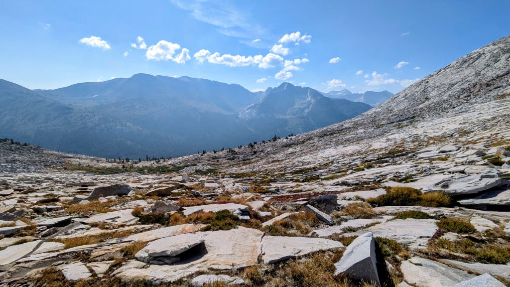
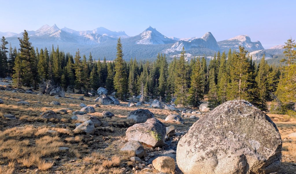
At Sonora pass, I was so excited to begin exactly where I left off in 2023. The scenery was just as I remembered it….that is to say, epic! There were open views everywhere as I ascended to the ridge and walked the long sweeping traverses. What a stunning way to begin the Sierra! I felt pretty good, but definitely noticed the heavier new items in my pack (bear can and over quilt), plus the higher elevation…highest I’d been all summer. I passed quite a few backpackers and day hikers until I got to the junction where Emigrant Pass Trail departed. Here I began my first of countless deviations from the PCT. In fact, the ruling theme of my Sierra section hike was to complete as many new routes as possible. So while my original goal had been to re-hike the PCT, I’d decided that this was too good of an opportunity in experiencing remote parts of the Sierra, and that I was ready to challenge myself navigating these much harder routes.


Except that this first alternate on the Emigrant Pass Trail to the Bond Pass Trail was marked and pretty straightforward, as I’d already hiked a portion of it on the Pinecrest Loop Trail. I was dead-set on taking it, even though it added a little bit of elevation gain. It was more in-following with my high route theme, because the PCT goes down low in a valley at this juncture and is somewhat dull compared to this alt. I’d reluctantly passed it by in 2023 because there were still parts covered in snow. Not this time. I took a lunch break at the base of the climb, then started up around 2 pm. The views at the top of Big Sam Peak were fantastic. Then walking down through the high meadows and past several tranquil lakes in the Emigrant Wilderness was breathtaking. I was able to see much of the route I took past the lower lakes on the PLT, so it was fun to reminisce about that lovely hike.
I stopped for a break at High Lake, followed its prompts. The rest of the afternoon passed blissfully, retracing my steps across Grizzly Meadow and over Bond pass. This time there was no herd of mules and horses to swarm me. I guess it’s still too early for the outfitter camps that bring hunting tours into the area. I rejoined the PCT in the early evening and walked another few miles south to the departure for the Yosemite High Route. I hoped to maybe get a mile or 2 into the route this day, but my watch beeped to remind me that sunset was only an hour away. It was just as well that I stop by Falls Creek for the night, enjoying the sound of the water and a tranquil meadow nearby. I’d get started on the high route first thing in the morning.
Day 2: YHR Love & Thunder, Tuesday, Sep 2nd, 2025, 0630-1700.
13 mi to Kerrick Meadow, elevation 9320′. I began the Yosemite High Route this morning, which is a series of high passes and off-trail travel all in Yosemite NP, packaged into a product of maps and notes, disseminated by Andrew Skurka. The Sierra High Route starts further to the southeast and is described in a 90’s guidebook published by Steve Roper. I’d decided to follow the YHR for a few days in order to connect to the SHR. I was going for a complete thru-hike of the Sierra by connecting the YHR to the SHR to the Southern Sierra High Route. But as with many thru-hiking plans, I’d end up pivoting quite a bit in order to deal with fires, smoke, weather and permits.
My first order of business was to climb 1300′ to Keyes pass, then down to Tilden creek. It was fun going up cross country through the woods, my first taste of such travel in the Sierra. In fact it was liberating, being free of any trails. Thankfully I was already well-practiced in route finding and had studied this particular route description beforehand. Still, there’s always a bit of a learning curve, getting accustomed to new kinds of terrain. I would come to love both the glacially-smoothed slabs and ice-broken blocks of granite of the Sierra, and this day was kind of my introduction to such formations. Yes, I’d experienced similar rock in the Winds, but there’s always some new subtleties. I also came to love and seek out those sweet grassy ramps that are so prolific in the high country. Successfully navigating such features, so as to avoid endless rock hopping, cliff bands, and talus, can really make or break a day. Route-finding to a large feature such as a pass or lake is one thing, but it’s the micro-navigation from minute to minute where the artistry really comes into play. My brain is so engaged by such travel, it’s way more fulfilling than mindlessly following a trail.
The trees dissipated and I easily found the pass and my way down to the creek. Then it was straight back up to Tower Peak Pass and down into Stubblefield canyon. Yes, the theme of these high routes quickly became apparent…up and down all day, pass after pass. There is really no such thing as walking a ridge line for any amount of time, nor is there much in the way of easy traverses or switchbacks…save for the ones you make up. But I’d accepted this fate and was in good shape to tackle it. After walking down along the classically U-shaped Stubblefield canyon (obviously once glaciated), I gained another 1k up to a shelf and lake 9774. I took a short lunch break and dip in the lake, but it was not very enjoyable since the thunder clouds started to form and the sun went away. I started hiking again hastily, both because I was cold and also nervous about the weather. Just past the lake, I saw 4 garter snakes together, which must have been doing something kinky. It was striking to see snakes at this elevation.


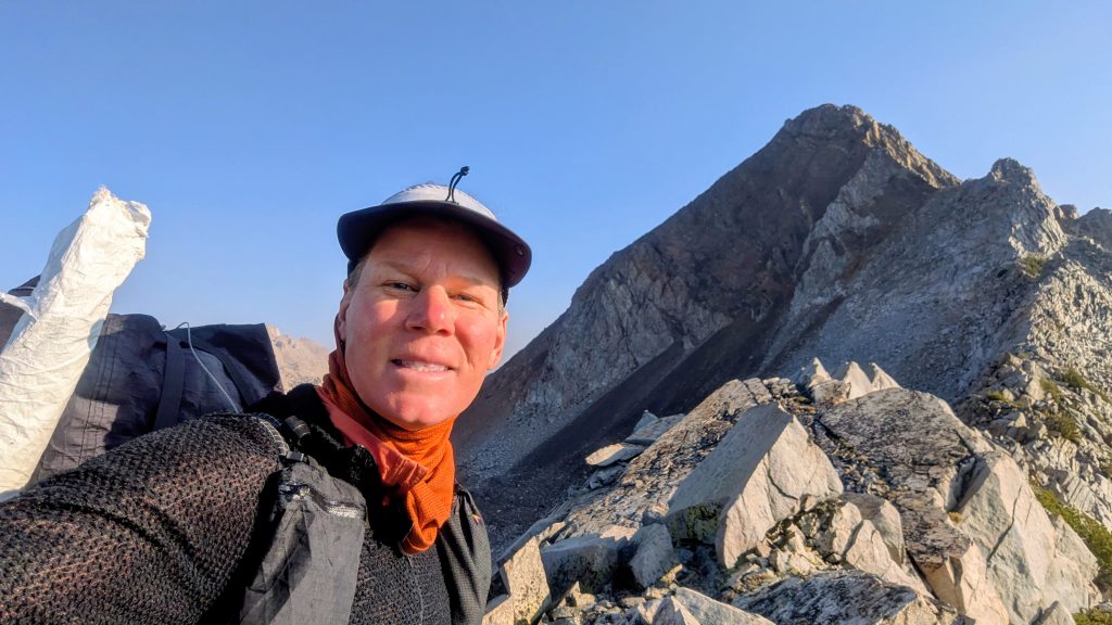
I got to Shelf pass just as distant thunder started rumbling. This was the most fun pass yet, as true to it’s name, there were a series of rock shelves to negotiate. There was nothing too challenging, as in dangerous, but it was complicated enough to be like a big puzzle. I found some great ramps that brought me to the top pretty fast. A few rain drops hit me there, so I hurried down before the rocks got slick. I also spied 2 other hikers heading down, which I caught up to as we contoured through the woods. They were Lightweight and Saint…and crazily enough, I’d met Lightweight on the PCT in 2023, just south of Mt Shasta! What were the chances? I hadn’t expected to really see anyone on this route, let alone someone I knew! You know another crazy thing, when referring to my blog to link to the day I met Lightweight, I noted that it was Day 44. Technically, not counting zeros, Trail Days, and transition days, this was day 44 of this hike! I’m so amazed at all the random connections that occur during my hikes.
I was really glad to have some company and enjoyed catching up with Lightweight. She’s a pretty impressive lady, both a professional doctor and an accomplished hiker. Once we got down into the valley, it started raining pretty hard, and once again, my umbrella saved me. I almost didn’t bring it on this Sierra hike, figuring the weather would be pretty stable in September, but thank goodness I did! Lightweight had an umbrella too, so we marched on through the rain as Silver twins. Perhaps feeling safety in numbers, the 3 of us decided to go over one last pass for the day, since Willow Pass was at least covered in trees all the way to the top. But oh man did the lightning get crazy up there! Then it started hailing so hard, the ground turned white in minutes. It was perhaps the most intense storm I’ve ever been through in the mountains, and that’s saying a lot after all the hiking I’ve done in Colorado and on the CDT.


We got pretty soaked and the descent was tricky with the slick, icy surfaces and no trail. We picked up a trail in the valley, which was so flooded we ended up hiking cross country anyway. We made camp in some lodgepole pines, somewhat protected but with everything quite wet. My quilt even got a little wet, as it was sitting at the bottom of my pack where the water tends to seep in and collect. It was inside a silnylon storage bag, but obviously I needed a new one, or maybe I could just put something else at the bottom…like my bear can? I could also put the quilt inside the bear can, then it would be very protected. I really didn’t think I’d be fretting and planning new strategies over so much moisture in the Sierra this time of year, but you just never know. These intense thunderstorms hadn’t even really been forecasted this day…something like a 20% chance last time I looked. On the bright side, I hoped the rain might suppress the smoke and fire by the next morning. The smoke had been kind of bad this day and I was fearing that it was about to get much worse.
Day 3: Matterhorn Pass, Wednesday, Sep 3rd, 2025, 0700-1840.
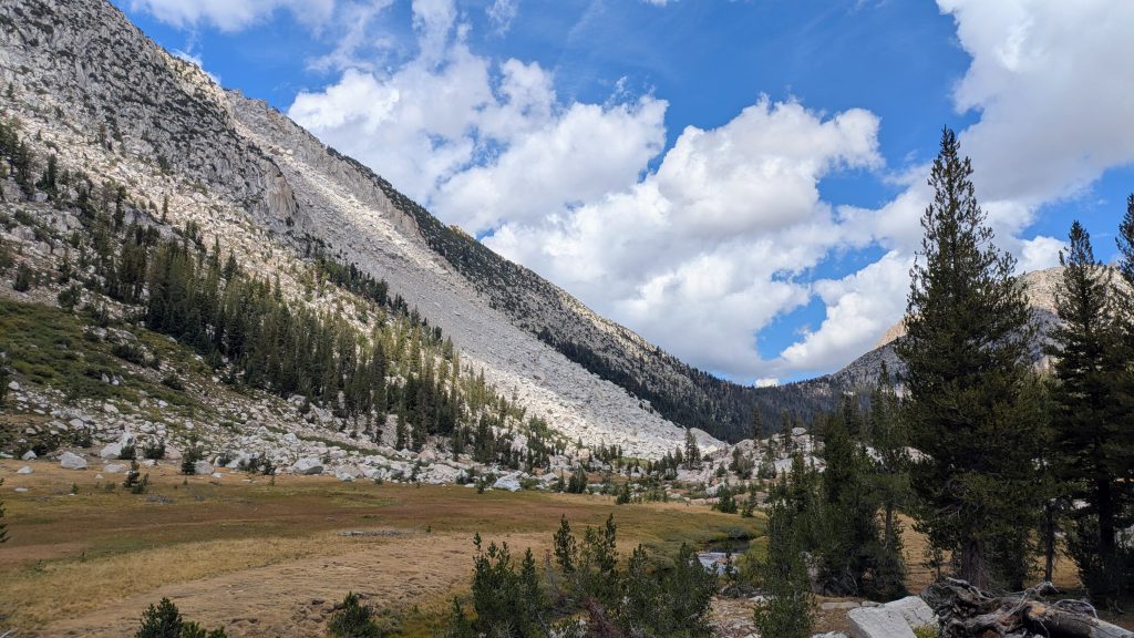
14 mi to Spiller Canyon below Stanton pass, elevation 10,000′. It rained a little bit more overnight with some thunder but nothing as bad as the previous afternoon. Everything was soaked in the morning and I couldn’t wait to find a sunny spot to dry out. I departed before Lightweight and Saint were packed, as they were planning to take an alternate route anyway. I hoped we’d meet up again. The smoke was indeed gone, with beautiful blue skies greeting me once the mist burned off. I followed the trail down to turn off for Rock Island and Burro Pass Trail. Then the route broke to go up a steep chute, but the footing was good in the wet, soft mineral sand. I charged up to find a beautiful vista across Rock Island Lake. I took many blissful steps through the mellow meadows down to and past the lake, then up again to an easy saddle.


It’s funny how the nature of these routes changes so dramatically from one minute to the next, as I then negotiated an intense gully descending into Crazy Mule Gulch. Immediately there was another climb to a ridge, where I came out too far south of the pass and was overlooking nothing but sheer cliffs on the other side. I made the mistake of not following the contours towards the saddle (but an extra map or GPS reference point at the pass would have helped, too). I had to work my way along the ridge over towards a stream (the only reference in the notes) where there were some more forgiving contours. This all took awhile to puzzle out. Then I still struggled with the navigation as I went too far north away from the stream and got into some incredibly steep slabs. Rockin, whose blog descriptions I’d been following very closely, also had trouble with this descent into Piute Canyon. She mentioned getting cliffed-out and having to deal with some class 4 scrambling. I started to get into such territory as I perhaps not-so-smartly worked down several cracks in the slab, using them to wedge my hands and feet into for purchase. I started sliding once but caught myself in time. Finally I made it down to more neutral slabs and was in the clear. It was definitely the most intense pass yet, but only a sampling of what lay in store for me at the end of the day.


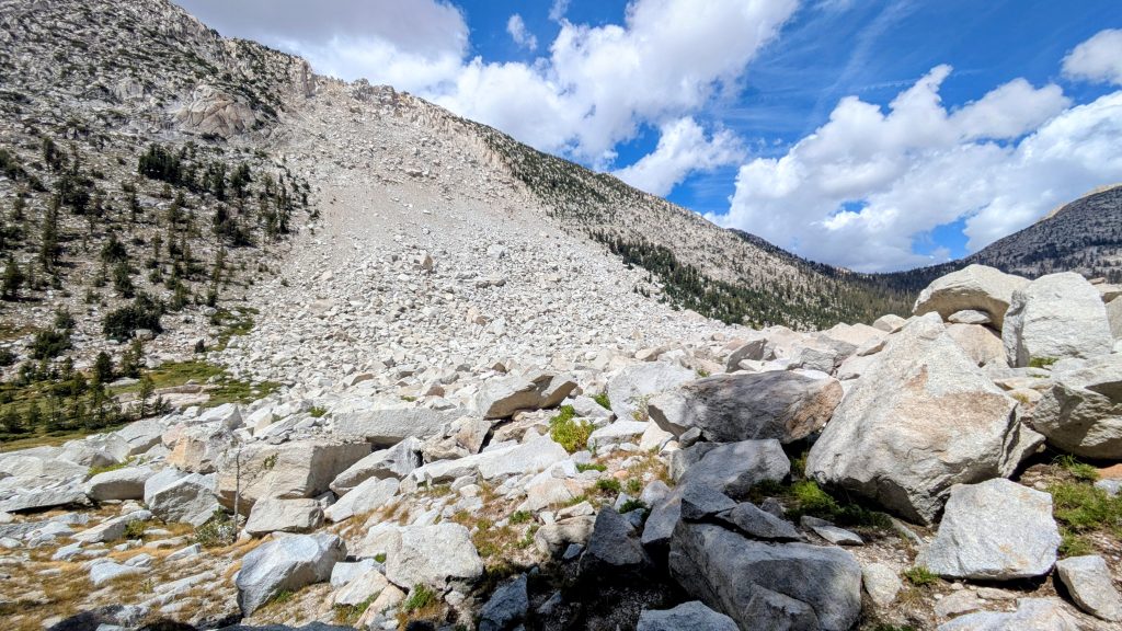
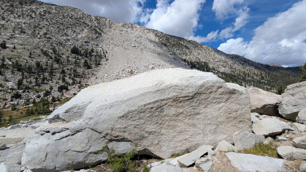
I walked up canyon along Piute creek, which was so dreamy going through the lush, pristine forest. I stopped for a long lunch break to dry my gear. It was certainly a well-deserved break after a tough section. In the afternoon, I went past the The Slide, which was indeed a most impressive feature. Mind-boggling, really. A stupendous avalanche of rock dislodged in the near past, exerting enough force to catapult building-sized boulders a 100 feet up the other side of the canyon! I skirted the south edge, mesmerized by the forces of nature. Mountains such as these will definitely alter ones perspective of the world. After another mile, I picked up a nice trail leading east towards Burrow Pass. This was in fact the same trail I’d been on in the morning and the alternate that the other 2 hikers had planned to take. It would have been far easier, but then I would have missed beautiful Rock Island Lake, the crazy unnamed pass and The Slide, all highlights of the route thus far. As my reward for traveling through such rough country, I got to zone out along the trail for a few miles.
I saw many footprints, some I thought were Lightweight and Saint’s, but I never caught up to them, nor did I see any other hikers all day. At the top of (easy) Burrow Pass, I spied my last challenge, and boy did it look like a doozie: Matterhorn pass. Actually, the the traverse and climb to the west side was very mellow from a technical standpoint, just a long ways up to 11,300′, my highest point yet. It was the east side that threw me for a loop…and nearly ended very badly. The standard route was down a scree chute, with a class 4 move required to get into the chute. I glanced at it and didn’t like what I saw. But Rockin had described a continuous narrow ledge that only reached class 2, which sounded great to me, the only trick was to find it. I’d gone so far as to download all her pictures, but they were taken from the bottom looking up, while I was trying to decipher the line from the top looking down. I pondered it for awhile, but as the day was growing short, decided to start down a slab ledge that didn’t look quite right but started off ok.
Well, it did go, but not before I faced some death-defying moments. Every 10 feet I went down, it got steeper and more tilted, definitely not class 2. I resorted to crab walking / butt scooting and then started to feel frozen. There was a bit of a crack formed by the intersection of a cliff face and less vertical slab where I thought I could get just enough purchase, but if not, the slap tilted precariously into the abyss. I decided to retreat, then thought well maybe if I just lower my pack down (thankfully I was carrying about 15′ of line), I can get past this bad spot. So that’s what I did, and even with my pack weight off, there was a moment I was down to just one good hand hold on the crack and feeling like I was starting to slip. I somehow gained my balance over gravity and made it past the worst gauntlet…honestly letting gravity pull me down, just more slowly, was all I did. I don’t think I could have gone back up at that point, which is always a terrible situation to put yourself in. Extremely lucky for me, there were still a few more step downs, but with no more than 6 ft drops. Recounting it even now, my hands get cold and clammy. In fact, I had some night terrors about this moment, reliving it over and over in my head even while safe in my tent that night. I hope I never have to go over Matterhorn Pass again, or that if I do, it will be with someone that can pick a better line.

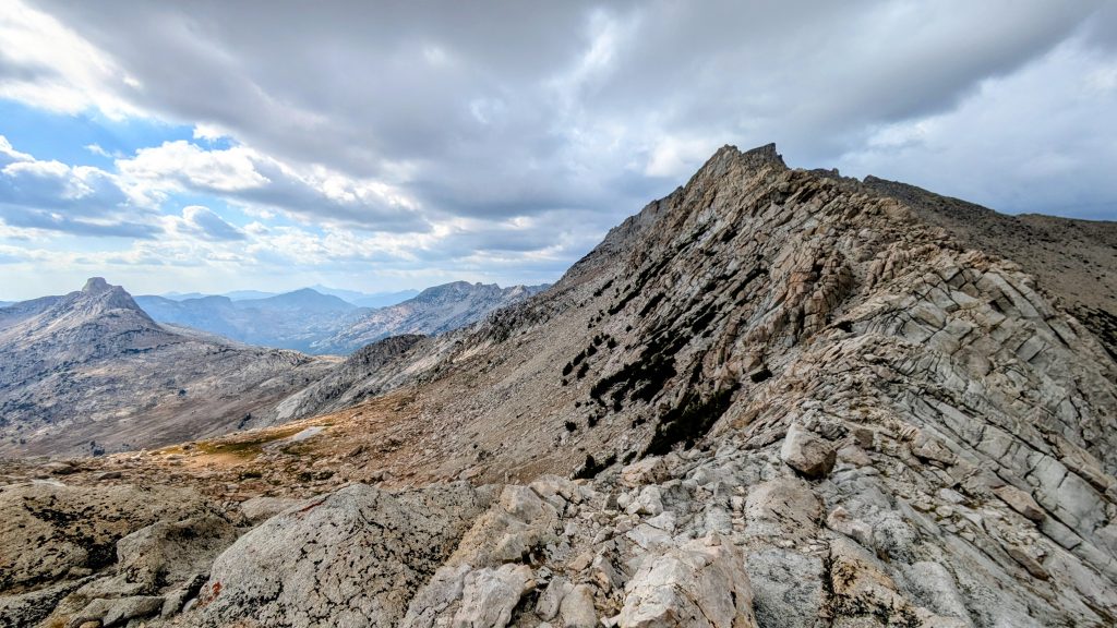
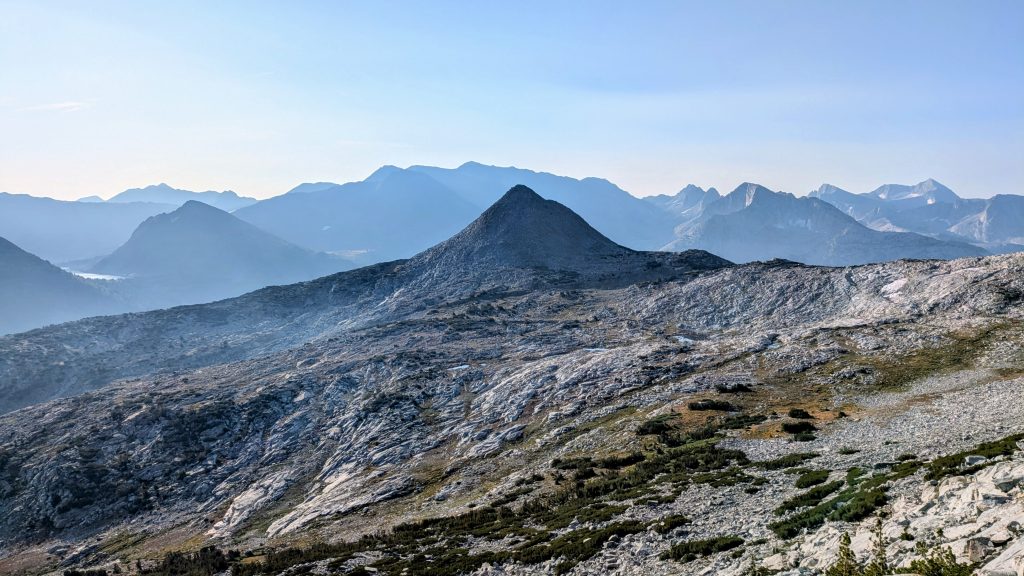
With the ugliness behind me, I turned to study the cliffs once again. I still didn’t really see the class 2 ledge Rockin was talking about, but what I came down instead was altogether much worse, too far to the right. This blunder really shook my confidence, but hey, I made it. I navigated the rest of the rugged pass into the valley, now feeling like everything else was child’s play. It was here that I officially joined the SHR going southbound though Spiller Canyon (it terminates about 10 miles north at the Twin lakes, on the other side of Horse Creek pass). The stress of the day melted away when I took in the beauty of this wide basin, awash in the late day sun. Though the terrain was pretty harsh by most standards, it felt pretty welcoming to me. I picked up some water in a stream and found a lovely cluster of whitebark pines to settle into. It was a fantastic site, from which I enjoyed the moonrise. What a day!


Day 4: Don’t Be a Smart Pass, Thursday, Sep 4th, 2025, 0640-1800.
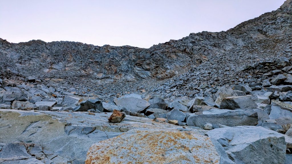
14 mi to Lower Young Lake, elevation 9,900′. I didn’t sleep all that well, perhaps because of the high elevation. I was tired enough, but also had an uneasy feeling about my antics the day before. Then I immediately had to face a class 3-4 scramble up Stanton Pass, considered to be one of the hardest on the SHR. It had to be easier compared to Matterhorn, right? From a distance, the last 100 ft of the head-wall looked pretty daunting. But as I got closer, I started to see some cracks that ran at angles seemingly feasible. A few of these even looked somewhat easy? I navigated a large field of talus first, which can be just as treacherous as scrambling. There’s always a good potential to place a foot on what I call a dump-truck rock, causing a slip or fall. I worked my way all the way to the right side of the pass, close to Stanton Peak. The cracks I had seen from below started to look intimidating again.
I went up a preliminary crack that was okay, then traversed to a loose gully. I suspiciously eyed several cracks that suddenly looked very treacherous and finally settled on the farthest to the right. About halfway up, I began feeling a little frozen again, realizing just how far I could fall. I actually do worse going up than down, which is the opposite of most people. I took off my pack, tied my line, then inched my way up, hauling the pack behind me in a few stages. It was much harder fighting gravity, but at least I felt a lot safer not having the weight throwing me off balance. My pack took a beating, but I didn’t really care. I just wanted to get through this. After what felt like forever, I made it to the top. The climb was a lot harder than I thought it would be and left me shaken once again. Maybe I wasn’t cut out for these high routes after all? I suspected it would all be a lot easier if I wasn’t by myself and I was just being too hard on myself. I made it this far, after all!
I paused only to take some pictures and survey my line over the next few miles. Far across the valley, I could see where the SHR led up over Sky Pilot Col, east of 12,550′ Mount Conness. That was to be my massive afternoon conquest, but first I needed to navigate many miles and drop thousands of feet, oh joy. The east side of Stanton pass was pretty steep but had lots of good shelves to utilize, thank goodness. A few days prior, I might have thought it was challenging, now it felt very straightforward. I crossed nice tundra and slabs all the way to Soldier Lake, then followed more amazing slabs all the way down into Virginia Canyon, dropping over 2,000 ft. The morning really zapped my energy, probably because of the adrenaline rush going up Stanton pass. I crashed and sat down in the forest for a bit, trying to make sense of my condition. I was heading for the long ascent to Sky Pilot Col in order to remain on the Sierra High Route. But the description of the extensive talus leading up to that pass really turned me off. So I abruptly decided to change course, sticking with the Yosemite High Route instead. Both routes were congruent from Spiller Canyon up to this point.

The advantage of staying on the YHR was that I got to spend a little more time in lovely Virginia Canyon. There was actually a trail in this valley, which I would have ideally taken advantage of for an easy mile. But as I was previously committed to the SHR, I’d already crossed the creek and was about 200 ft up the eastern slopes. Rather than backtrack down, I just continued my slow traverse through the dense woods. It was very peaceful in the trees, so I didn’t mind. I turned to ascend to a ridge, entering the McCabe basin. I stopped for a lunch break in a meadow near a pretty stream, where I watched a deer walk closely past, seemingly unaware of my presence. My appetite was low, maybe because of the elevation, so I kind of had to force myself to eat. The break restored my energy just enough to continue to McCabe Lake and Don’t Be a Smart Pass beyond that. Mercifully, it was an easy walk on mineral sand and gravel to the top. The notes warned of late-season snow fields, given it’s north facing aspect, but there were none. I was so grateful for this forgiving pass and it got even better on the other side.
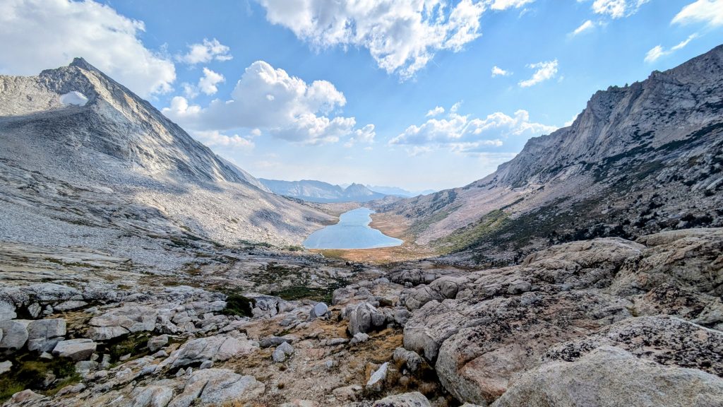
For over a mile, an almost continuous grassy ramp to the lake greeted me. With wide open views towards the Yosemite valley and the ability to keep my eyes pointed up instead of at my feet, this was my favorite pass yet. The smoke made the visibility a little less than ideal, but I could still pick out Half Dome and a bunch of other prominent points. The view of Roosevelt Lake was the best part. It felt like I descended a carpet of bliss for hours until past this mile-long lake. It was one of the longest stretches of easy and glorious hiking of any of the high route sections I did, so I was really glad I stuck with the YHR here. I definitely recommend a trip through these basins, which reminded me of Titcomb Basin in the Wind River range, minus the hordes of people.
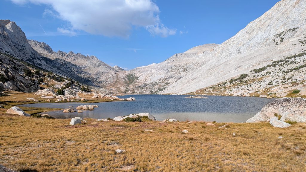
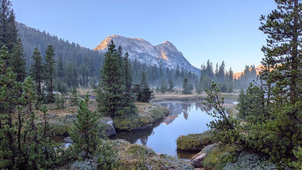
I still hadn’t seen a single person all day and I was very surprised there were none along the gorgeous, huge lake. I should have stopped to camp there but there were a few hours of daylight left to press on. I worked my way into the Conness valley, across a creek, and a minor ascent to Young Lake. This is where the route finally met up with a trail that goes to Tuolumne Meadows. So of course there were suddenly a plethora of people camping near the lake. I pretended not to see them, so as not to break my people-free stretch, and went to the far end for a secluded spot in the trees. A dip in the lake was the perfect ending to the day. Of course someone bumbled into my campsite at dusk, looking to dig a cat hole, which sent my heart racing. It’s pretty funny that I don’t get scared when bears come by anymore, but a lady poking around to do her business startled the hell out of me. I probably gave her a bit of a fright, too, all secluded in my weird camo tent. Whelp, at least I made it through all the hard parts on this section and could breathe a big sigh of relief this night.
Day 5: Tuolumne Meadows, Friday, Sep 5th, 2025, 0640-2000.
11 mi to Rafferty Creek, elevation 9,400′. I knocked out a quick 6.5 miles into TM for breakfast, all on trail. I was already bored by this, especially when I joined the PCT for the last couple miles. I yearned to get back to the route-finding and free-form walking, but first I needed to take care of some business. I had sent a resupply box to the PO and also planned to visit the ranger station for a permit that more officially covered my High Route plans. I was playing a little fast and loose with the terms of my PCT permit in this first stretch, which I didn’t like to do (not that I saw hardly anyone on the route). Yosemite is particularly strict about these terms, so the last thing I wanted to do was upset one of the nice rangers, especially since they already had so much on their plate with government cuts and a busy tourist season. I was also hoping to tag a Half Dome permit onto my schedule, having learned from some other hikers about the ‘loopholes’ in the system. The lottery for HD permits is highly competitive and requests need to be submitted either months ahead or 2 days in advance for a daily. But if one is starting an overnight hike from a few certain locations, Rafferty Creek being one of them, then one can simply ask to add Half Dome to their wilderness permit (plus an extra fee of something like $15). I first ate some goodies from the cafe at TM, then caught a ride to the wilderness center from a guy named Alan, who was supporting his wife while she hiked the JMT. This saved me a 1 mile road walk, and hey, every little bit helps!
Then rangers were so nice and helpful, I was amazed. I was planning to camp at the PCT site in TM overnight, but there was exactly one permit left for Rafferty creek quota this day, so I jumped on it. Thus my Half Dome side-trip became official and I was now committed to a rather tight deadline to get out of town. There’s a 4 mile camping restriction around TM, and for good reason, since it’s such a crowded area. So I’d need to put some distance on in the late afternoon/evening. I had a really nice conversation with thru-hiker and ranger Bradley (Pika), who told me about his plans to hike the ECT, starting in Key West in December. I gave him my number in hopes I might be able to help him in Miami. Later when I was hiking out into the dark, he passed me on his trail run and gave me a hug! What a sweet guy.
I walked back to the store and PO, since a hitch didn’t immediately jump out at me and I was now in quite a hurry. I picked up my box from Postmaster Michael, who I found to be so incredibly nice and helpful. I was impressed to learn that he’s been the postmaster for over 20 years! I’m certain I talked to him on the phone in 2018 (confirming they’d still be open when I got there and not to bounce my box back), plus also received my box from him then, too. He’s an incredible one-man show and draws a decorative name label on every box he receives, for his own ease in finding them. I actually kept his drawing as a memento this year. I sat down to eat more from the cafe and chat with a friendly PCT section hiker named Iceman, who gave me a really cool PCT sticker. He was the only one I could identify, as the rest were all hiking the JMT. I was way ahead of most of the SOBO’s, so this wasn’t surprising.


I hiked out around 7 pm, knowing I’d be walking in the dark for a bit. The evening colors were lovely and the moon rise spectacular as it reflected on the polished granite domes. I passed the 4 mile restricted zone and quickly found a great make-shift spot under some lodgepoles, all in the dark or course (picture from the next morning). It was a pretty great and productive town stop, along with a positive accomplishment of the northern section of the Yosemite High Route. I’d decided to rejoin the Sierra High Route from TM, which more aligned with my original plans, and was just a great excuse to have to come back to complete the southern YHR later. I went to sleep excited for Half Dome the next day!