August 24th, 2019
Indian Peaks Trailhead mm 1673 to Bill Moore Lake mm 1699.5
Distance in miles: 26.5
0615-1900
Whoa, is today tough. We hoped to do 32 miles to get over two 13 ers but we fall way short. We severely underestimated this whole section. Between the altitude and crazy ups and downs, we should not have planned 30 mile day averages. We should have gone with 25 miles or even less. I’ve gotten complacent about being able to knock out the miles no matter what. But I failed to realize just how hard this 130 mile stretch to Breckenridge is.
We’re on the trail plenty early, spotting several moose right off the bat. It’s an easy descent for awhile and we’re making good progress. Then we have to go about 2000′ up a steep hill to gain a ridge. This is also where we gain the wind. I should have known from the hellacious mountain wave that is set up across the entire front range.
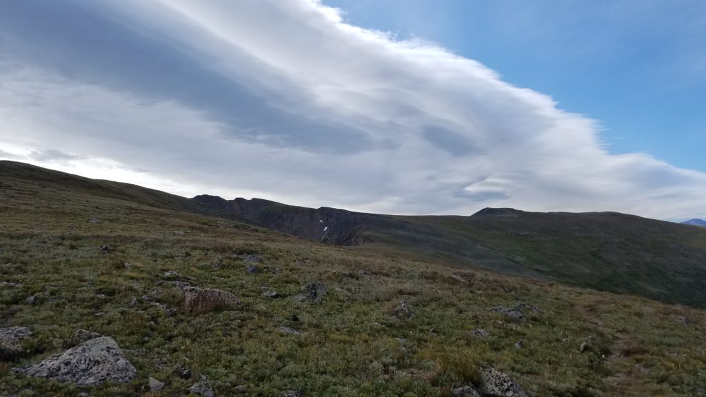
My dad, who was a private pilot, used to talk about this phenomenon a lot. The mountains and atmosphere often duke it out and the result is a mountain wave, signified by very characteristic lenticular clouds. They are impressive to see from far below but spell big bumpy trouble for pilots. As I found out today, they also spell trouble for little hikers walking ridgelines on the divide.
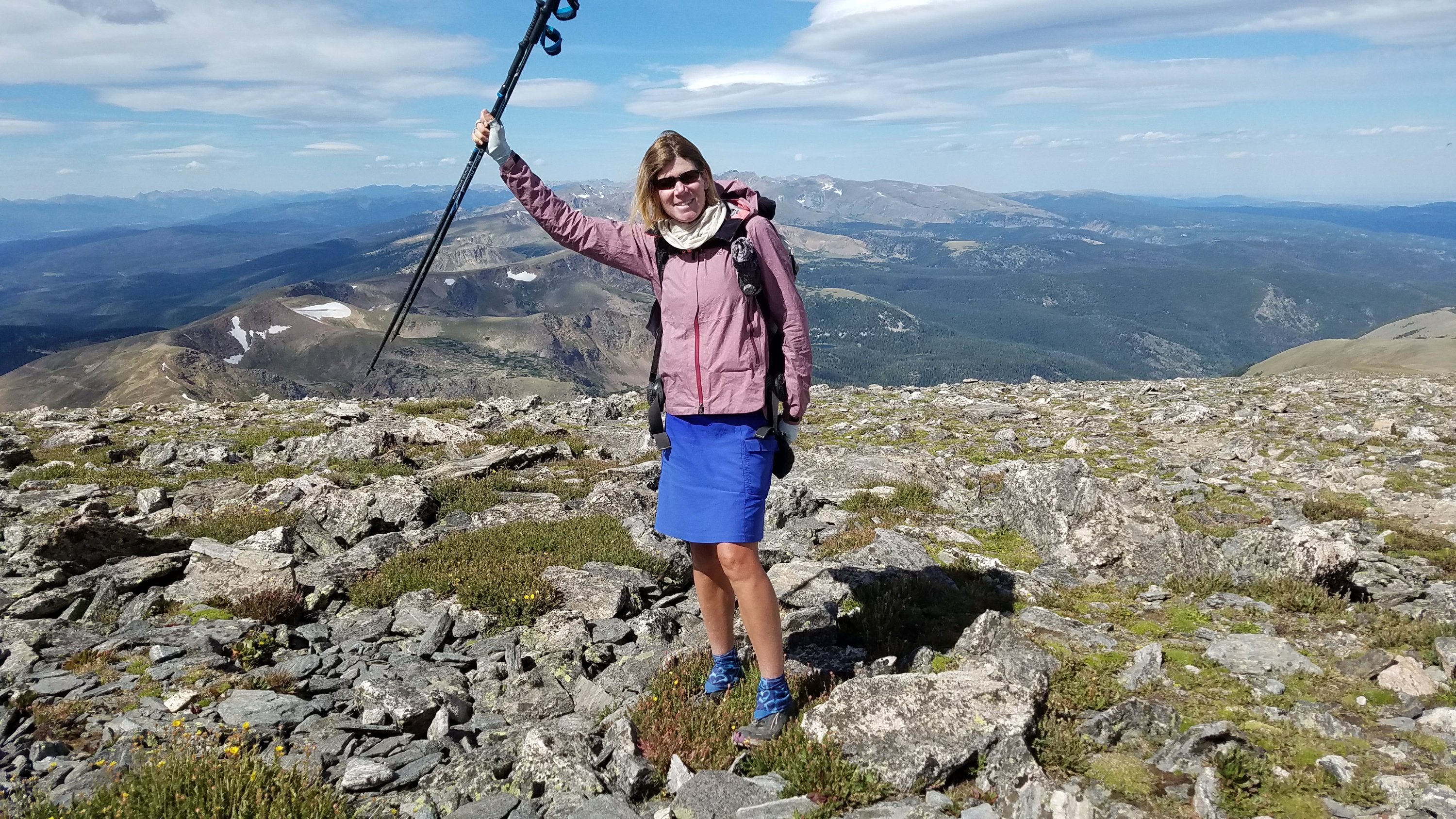
I immediately have to put on several layers because the wind is also frigid. The skies are mostly clear except for this huge lenticular cloud that is right above us, so the sun is obscured. We begin the very tedious task of heading along the ridge, fighting a crosswind and sometimes with it in our faces. I have to stop again and dig out my fleece pants to put on…I haven’t had to wear pants while I walk yet this trip, that’s how bad the wind is.
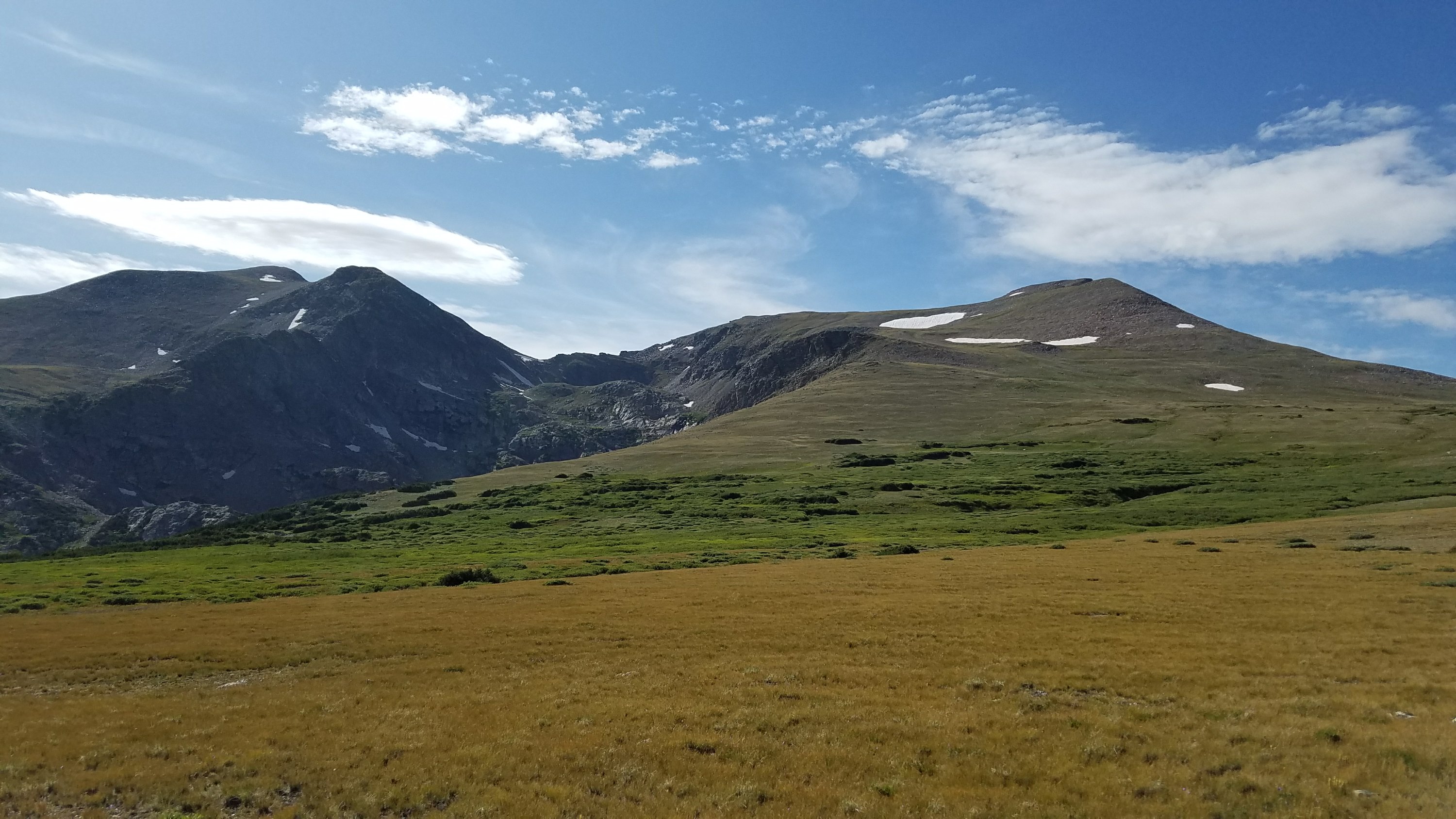
I can’t feel sorry for myself in this situation because for one, the scenery is spectacular. I can see down to the front range and perhaps spy some of the suburbs of Denver, Denver! I departed from there 2 months ago, bound for Montana. And now I have nearly walked back. I can also see so many mountains…so many that we have to climb.
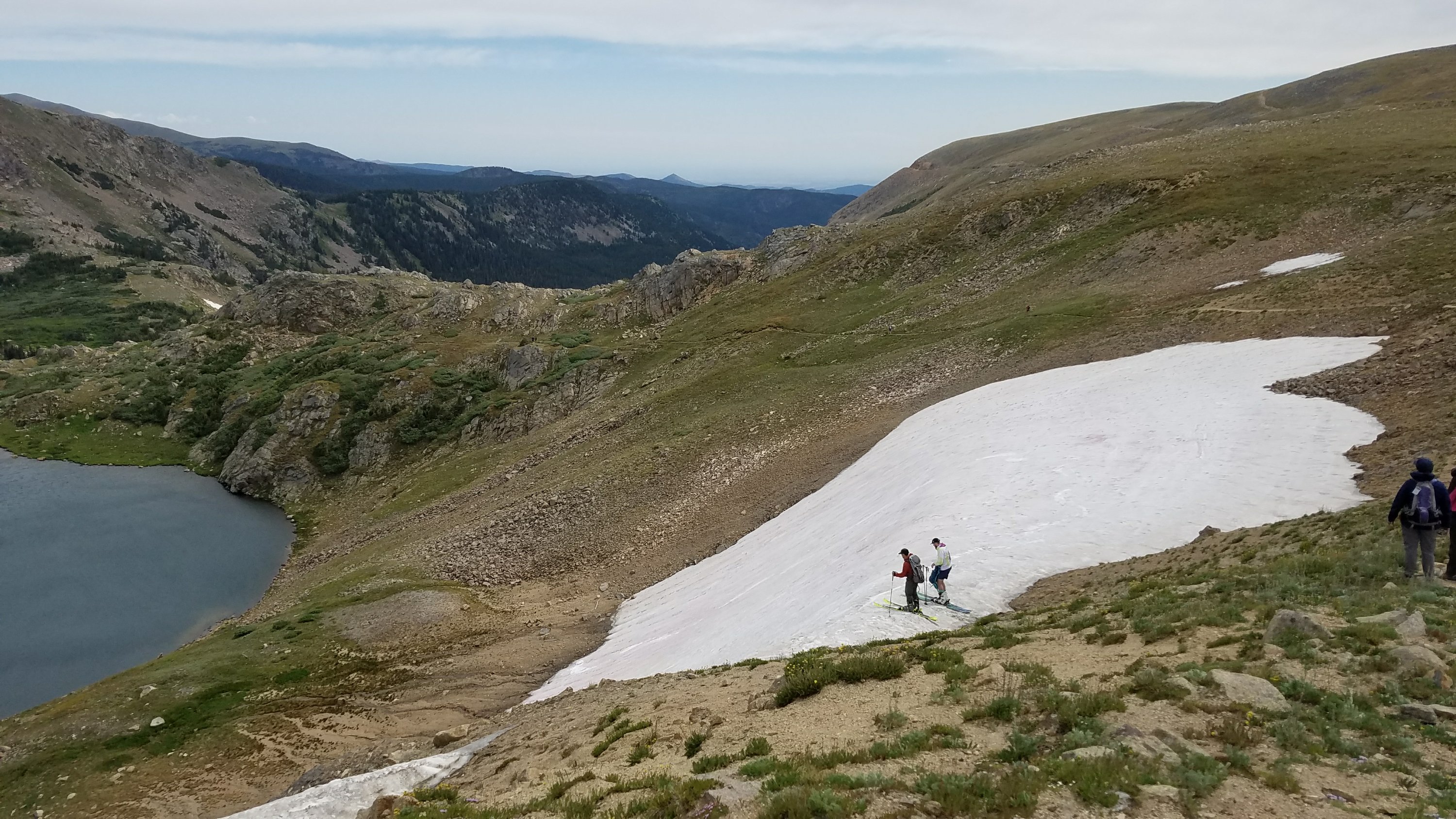
Then there are all the people. We start seeing them on the way up to the ridge and on top, they are everywhere. Day hikers, backpackers, runners, photographers, mountain bikers, you name it. I see a guy sliding over the ridge with a snowboard on his back. There are 2 guys with full ski gear getting ready to dive off a cornice onto a remnant snow field. Everywhere there is someone doing something crazy and no one seems to give a damn about the wind, so why should I? After all, I’m one of these crazy adventurous people from Colorado, doing my crazy thing for the love of these mountains.
 During one of my stops to put on layers, Relentless breaks another trekking pole. He never got new ones after the first one broke but rather has been using one he found in a hiker box. It’s terrible timing since he really needs both to do all these climbs efficiently. Then we see a guy with 2 poles strapped to his daypack and ask if we could possible have one. He obliges and his wife gives me a sandwich and nuts! What awesome people…fellow Coloradans, of course.
Crisis averted, we take a break from the wind to follow a road that parallels the ridgewalk. It warms up and the road provides entertainment from all the various users: every kind of vehicle, mountain bikes, and even other hikers. The road winds down to Winter Park, which we have great views of, but we break off at another road that goes up to Rogers Pass. This rejoins the trail just before James Peak, our first 13er.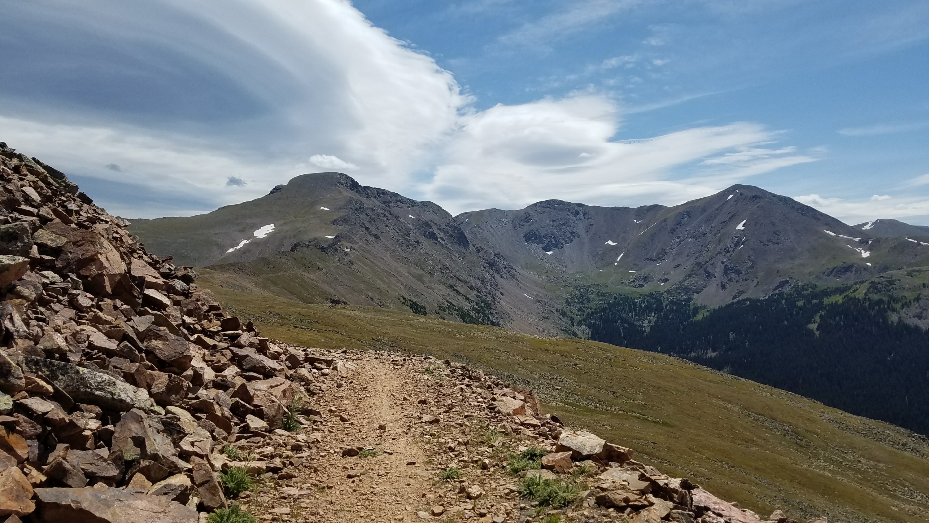 The winds resumes near the pass and gets worse as we begin the climb up the peak. At times it’s at my back and then I turn a switchback and it’s in my face. I take baby steps into the wind, feeling like I am spinning my wheels and getting nowhere. It makes it so much harder and I’m exerting a lot of energy in just bracing myself for the gusts. My whole body is tense from the cold and uncertainty of maintaining my balance. At times I have to plant both feet and poles, my head and back bent into the wind, just to keep from getting knocked over. My pack is like a sail, creating even more instability.
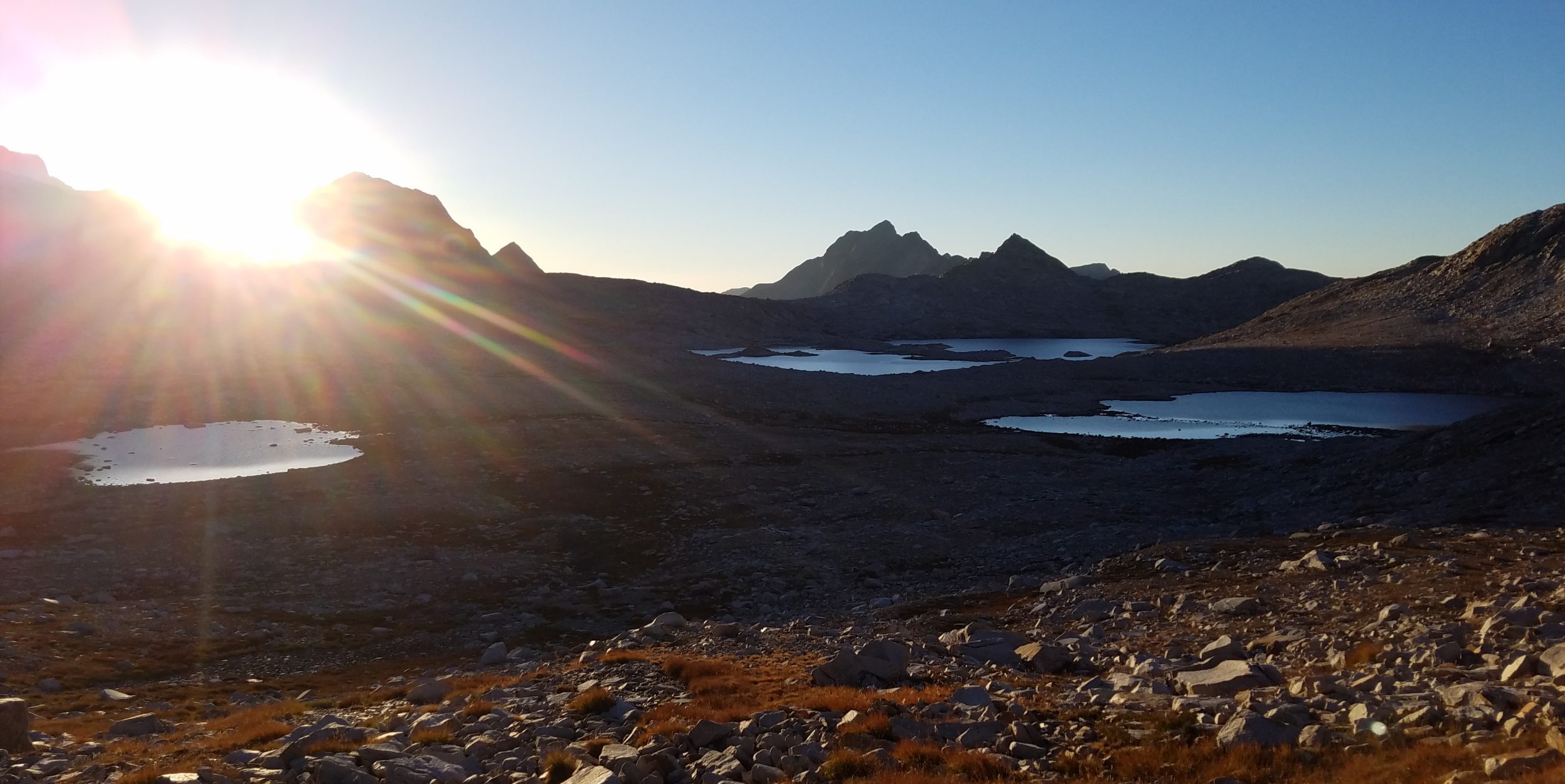
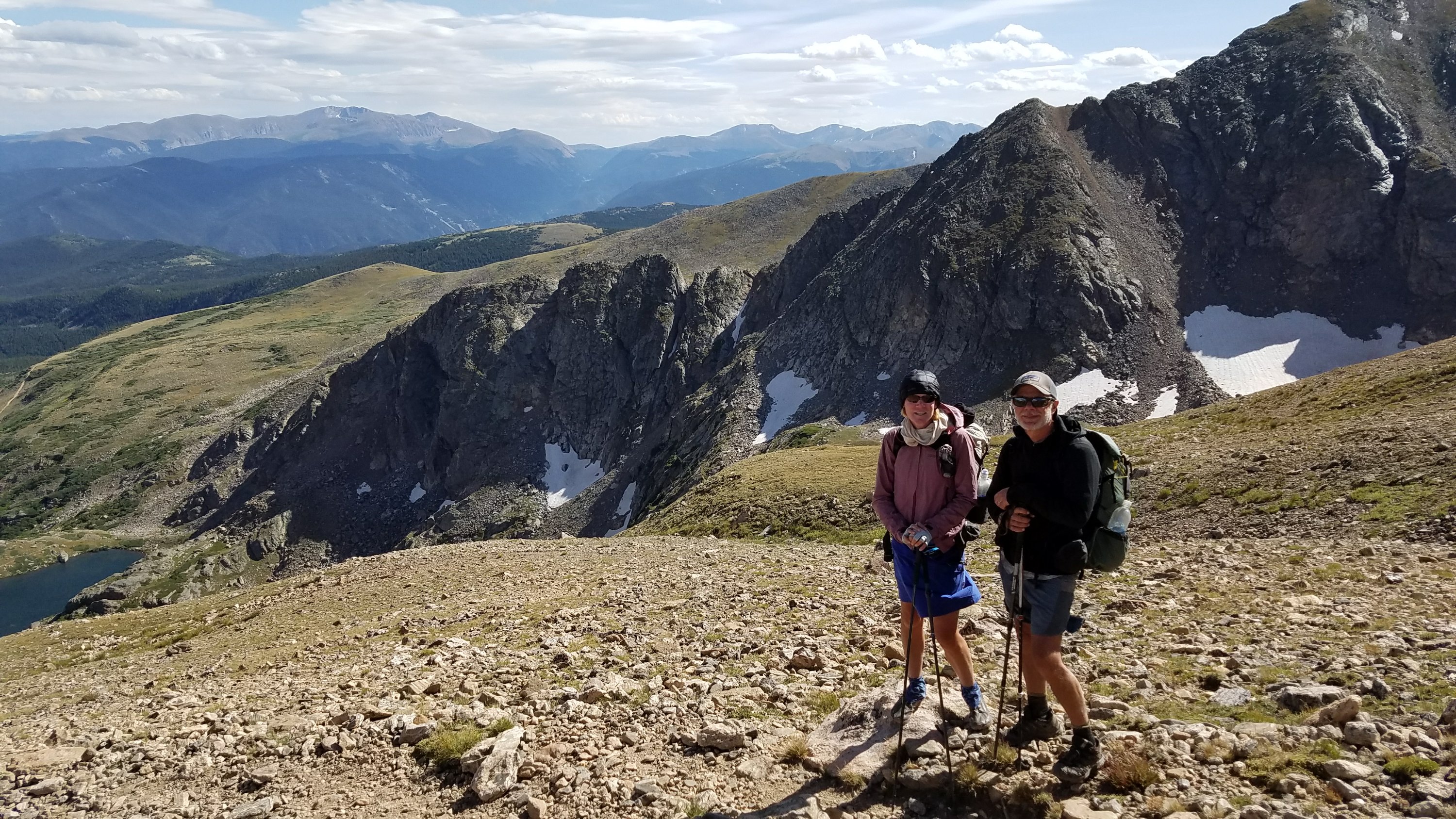
I get to the 13,310′ top after a seemingly endless struggle and find a stone bivy, built by others to seek shelter from the constant wind. There’s a guy there, Blu, who is section hiking the CDT after already having biked most of it this summer. We chat for a bit, catch our breath, and warm up some. I take in the view, seeing all the way back from where we have come and ahead towards all the mountains we still have to cross. I can see Pikes Peak and many other 14ers. I can also see right down into Denver.
 We begin the descent and find another bivy, this one full of young, happy people drinking beer. They offer us some and I can’t resist the novelty of having one at the top of this mountain. The people are really enthusiastic about our mission and have lots of good questions about thru-hiking. I’m happy to chat some more.
Instead of descending some 3000′ down, only to go right back up to 13,123′ Mt Flora, there’s an alternate route that stays high. It connects five 13er peaks in 4.5 miles but is estimated to take 3-5 hours because of all the climbing, scrambling, and route finding. I would love to do it but it’s late in the day and we’re already exhausted. Plus, it might be a little terrifying in this wind. I can see that there are some knife-edge ridges connecting the peaks. Next time!
We go down into a valley, past a campground and stream, then are climbing again. We wish to at least get half the climb done to camp above 11,300′ at a lake. We’re out of the wind since the descent and it’s balmy in the valley. The trail fortunately has nice switchbacks and we get to the lake with time to settle into a good camp. I find a hole between trees that is very sheltered from the wind and hope for a warm, dry night.