November 9th, 2019
Bathtub Spring mm 780.5 to USA-Mexican Border mm 788.6
Distance in miles: 8.1
0605-1220
This post is about my last day on the AZT and of a very long 2019 hiking season. Between the CDT and AZT, I calculated that I hiked around 3,500 miles. This is not including all the day hiking and short segments I did in Florida and Colorado, which probably brings my total to around 3,800 miles. I will follow up with summary posts but in the meantime, enjoy this last day, as I did.
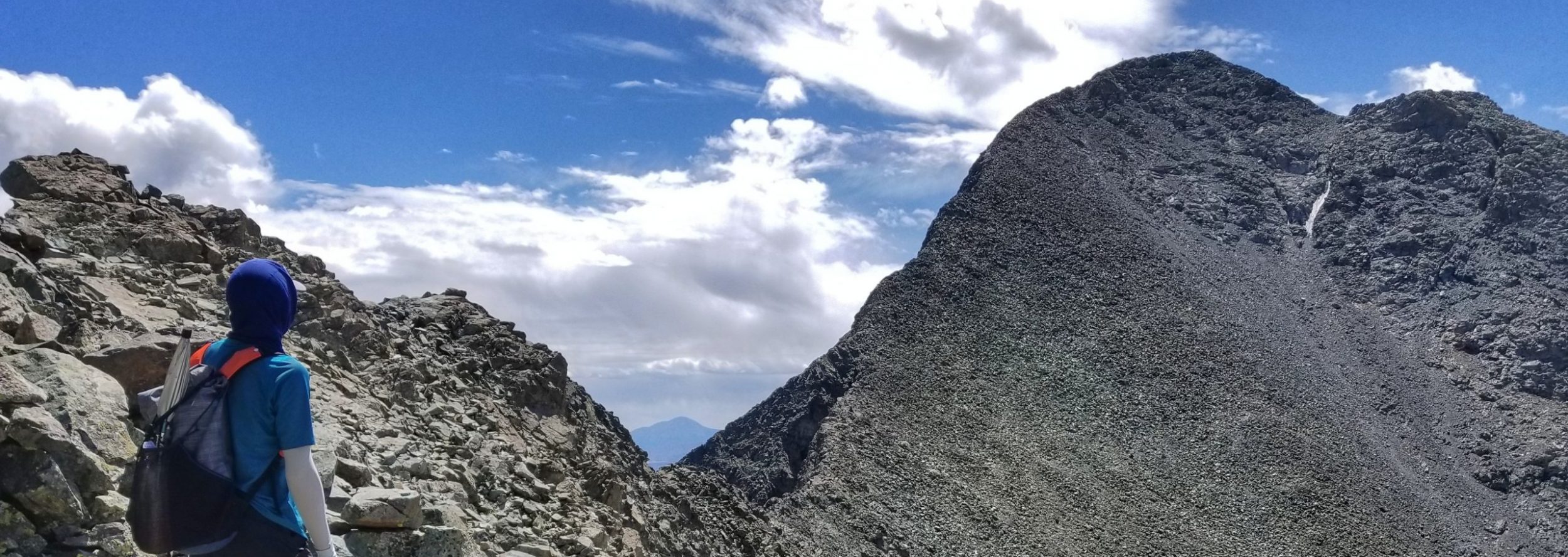
It was very quiet overnight and I had one of the best night’s sleep, ever. I was right about the condensation, though. My tent hadn’t been so wet inside and out in over a month. It wasn’t the worst though and I knew everything would dry very quickly when I aired it mid-day. The trail was also wet. The overgrowth delivered the condensation to my legs and for the first time on the AZT, I had slightly wet feet. I climbed just a little ways and came to a trail junction leading to Miller Peak at 9466′. It was only another half mile to the top and I had tons of time, so heck yeah, it went for another side trip. Getting up to this highest point for the entire Arizona Trail was the perfect way to finish.
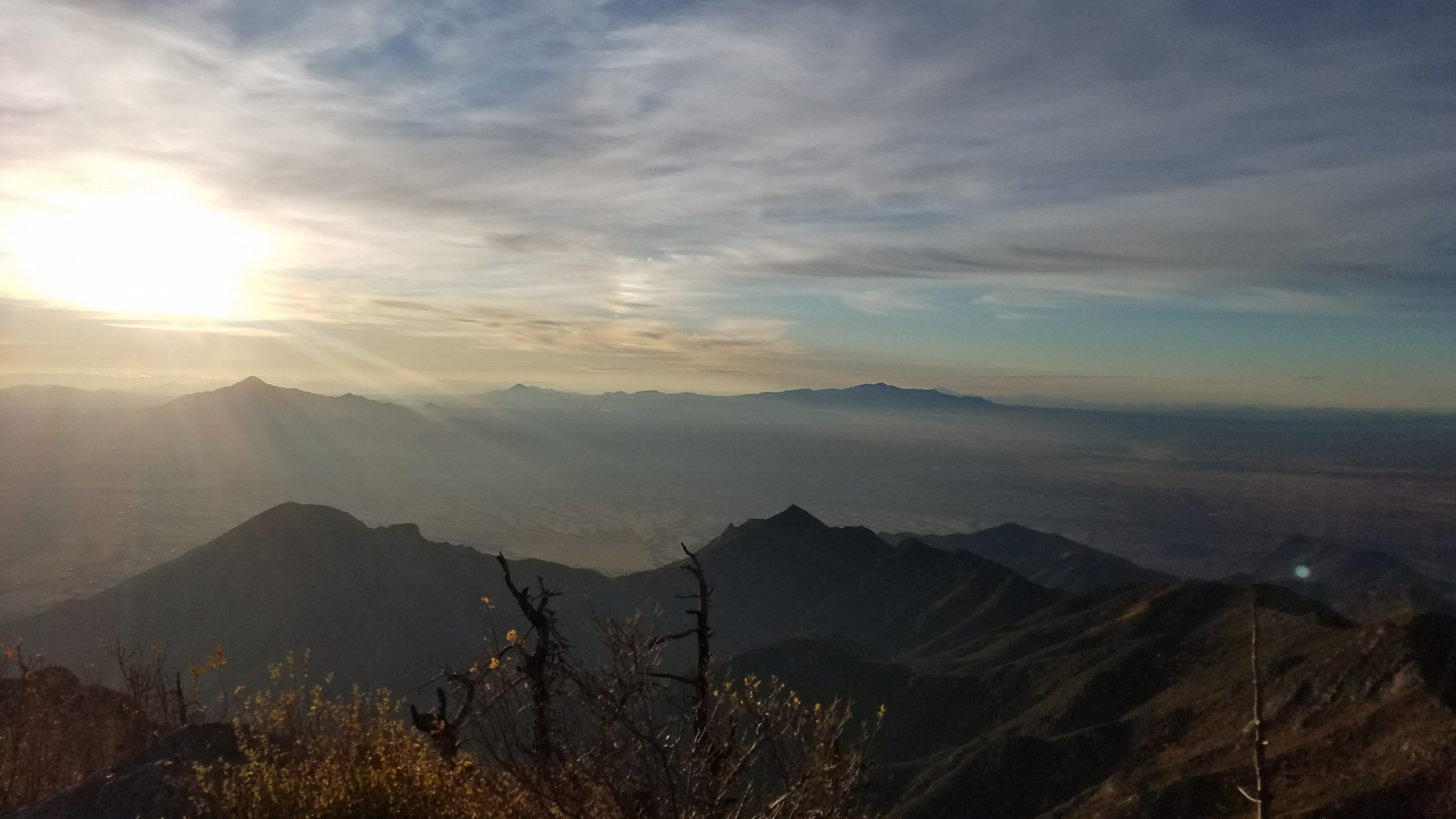
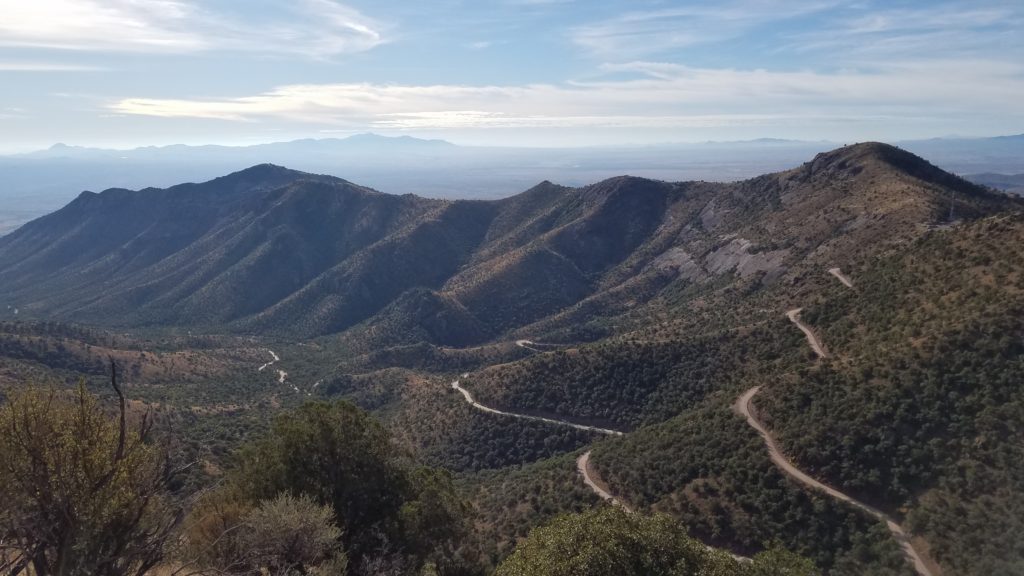
The views at the top were some of the best. The sun had just come up and the clouds were beautiful. Sky islands dotted the landscape as far as the eye could see. I almost thought I could see where I started the CDT in the New Mexico bootheel, only about 100 miles distant. Looking at all the mountains to the south, I felt compelled to keep going. Too bad politics and strife would make that very difficult. I’m so lucky to live a country where I can hike freely and safely for so many thousands of miles. There’s really no other place on earth where one can so easily see all these magnificent landscapes, walk seemingly endless trails and enjoy living in the wilderness relatively worry-free, especially as a solo female. This, walking through so much of my country, made me proud to be an American.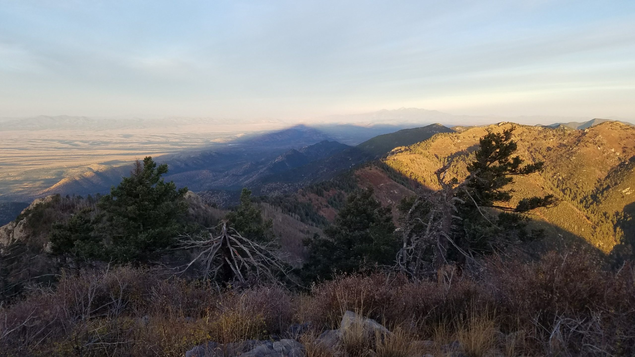
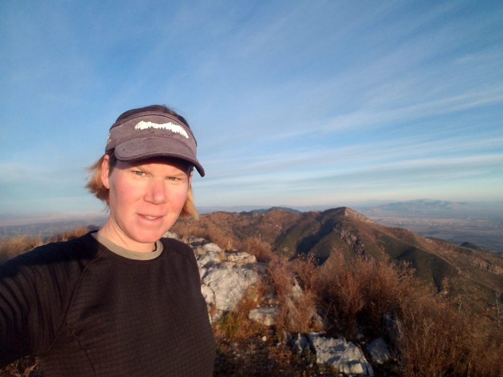
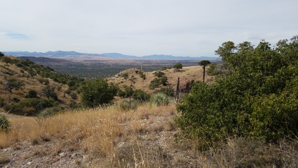
I wanted to stay forever but it was a little too chilly. So I headed down down down towards the trailhead at Montezuma pass. The trail continued to be overgrown but all the switchbacks cut into the rock indicated that it was a trail that had been established for a long time. There were remnant slabs of concrete at the top of the peak, so I assume the trail was built to access the former structure…perhaps an old fort or lookout for the nearby army base?
At the pass, I took over a picnic table in order to explode my pack and yard-sale my gear. It felt good to spread it all out…the last time I would have to do so. I made some coffee, using the last of my gas canister. I texted Jon and nailed down our rendezvous. He wanted to meet me with beers at the border but I wasn’t sure if he could make it from the road to the trailhead. We’d find out shortly. I relaxed at the scenic overlook, watching tourists come and go. This delayed finish felt a bit off but then, so did the whole hike. I wasn’t feeling the overwhelming joy and sense of accomplishment that I felt at the end of the PCT. Maybe it was just too much after the CDT. Maybe I shouldn’t have tried to combine the 2 hikes. The CDT experience was very overpowering…perhaps I needed more separation to give the AZT its own special consideration. Regardless, it still had been a fun and interesting trail. (Spoiler Alert: I probably was feeling off because I had a blood clot in my brain, but didn’t know it yet).
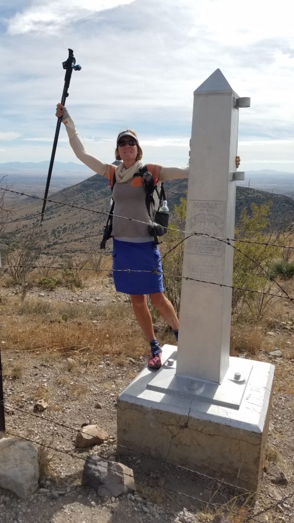
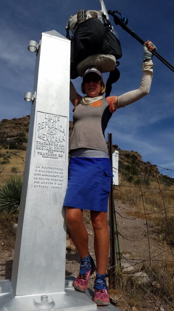
I decided to wait until Jon got to the pass so that I could confirm our plans. He arrived along with his friend Randy, just as expected. I begin the last mile+ down to the border while they tried to drive the road along the border. We could see this road from the pass and it looked viable. The last bit of the trail went by fast and shortly I came to the monument. It sat on the other side of a simple barbed-wire fence that had been cut and tied open, allowing easy access to the monument. It was pretty funny to see this level of border “security” in times of the “wall.” They still needed to work on this section a little, I guess. (A wall was since constructed right up to this point, then abandoned.)
I crawled through the fence to take some pictures. The trail ended on top of a ridge and I couldn’t see down to where the border road was. I presumed that’s where Jon was waiting or maybe he was trying to hike up to the monument? I wasn’t sure.
Standing on the monument, I felt happy but very little else. For the second year in a row, I hiked all the way from Canada to Mexico. But it didn’t feel like it. This season has been a lot more drawn out and convoluted. But hey, I hiked all of the Arizona Trail and things did feel like they had come full circle since I first saw it a year ago, visiting Jon after finishing the PCT. I was glad I did it.
After a few pictures, my focus quickly changed to finding Jon. If we couldn’t meet at the border, the plan was to return to the pass. I decided to deviate from our plan and hike along the fence to where the road began. It was pretty easy going at first but then I saw that the fence went down a very steep hill. About the time that the road came into view, I suddenly became paralyzed by a very close gunshot. Up until this point, the border seemed benign. Suddenly, I was picturing all sorts of scenarios about who might be shooting at me. Coyotes, border patrol, the Mexican army? No, it was just some hunters shooting at a deer that my movement flushed. After making contact with the hunters, I continued down the hill, noting that there was no white jeep waiting at the end of the road.
So I decided to just walk the road back to the pass. This would add many more miles but I hoped to either get a text to Jon or get a ride from the hunters. I walked for a few miles along the border and then north to where it turned back towards the pass. I managed to get in touch with Jon, who drove back down from the pass to pick me up…at least he followed the plan!
I drank my finishing beer while Jon recounted the story of how he and Randy tried to walk up the hill but found it way too steep. Instead of finding me, they met an AZT thru-biker named Dani and gave her a ride back up the pass. They told her that they were looking for me and she knew who I was from the trail registries. In fact, she had been just a little bit behind all along and hoped to catch up and meet me before it was all over. I was surprised to hear that a bikepacker was trying to catch me, though to her credit, she did take a week off along her journey.
On the way to Sierra Vista, we caught up to Dani along the road and shared another beer with her. We all agreed to meet at a Mexican restaurant in town. There we found Lake Placid Dan (who I met on the trail about a week before) plus another thru-hiker, Gardener. A trail angel named Dar drove from Tuscon to give them all a ride back to her house. She was running a hiker hut in her backyard. I wished that we could visit her place but at least we got to meet her at the restaurant. It was a fun and festive way to celebrate the end of the trail.
Again, a huge thanks to Jon and Dar for being such great trail angels and helping us thru-hikers and bikers find our way back to civilization. Jon even bought lunch for everyone, despite a lot of protest. After lunch, we drove a few hours to his house, where I’d be relaxing for a couple days. And that was it. The Arizona Trail. About 800 miles, 34 days, and some of the best trail angels and magic in the universe. Thanks for sharing in the adventure.