Day 16, Saturday, July 26th, 2025, 0610-1830. Trail Magic.
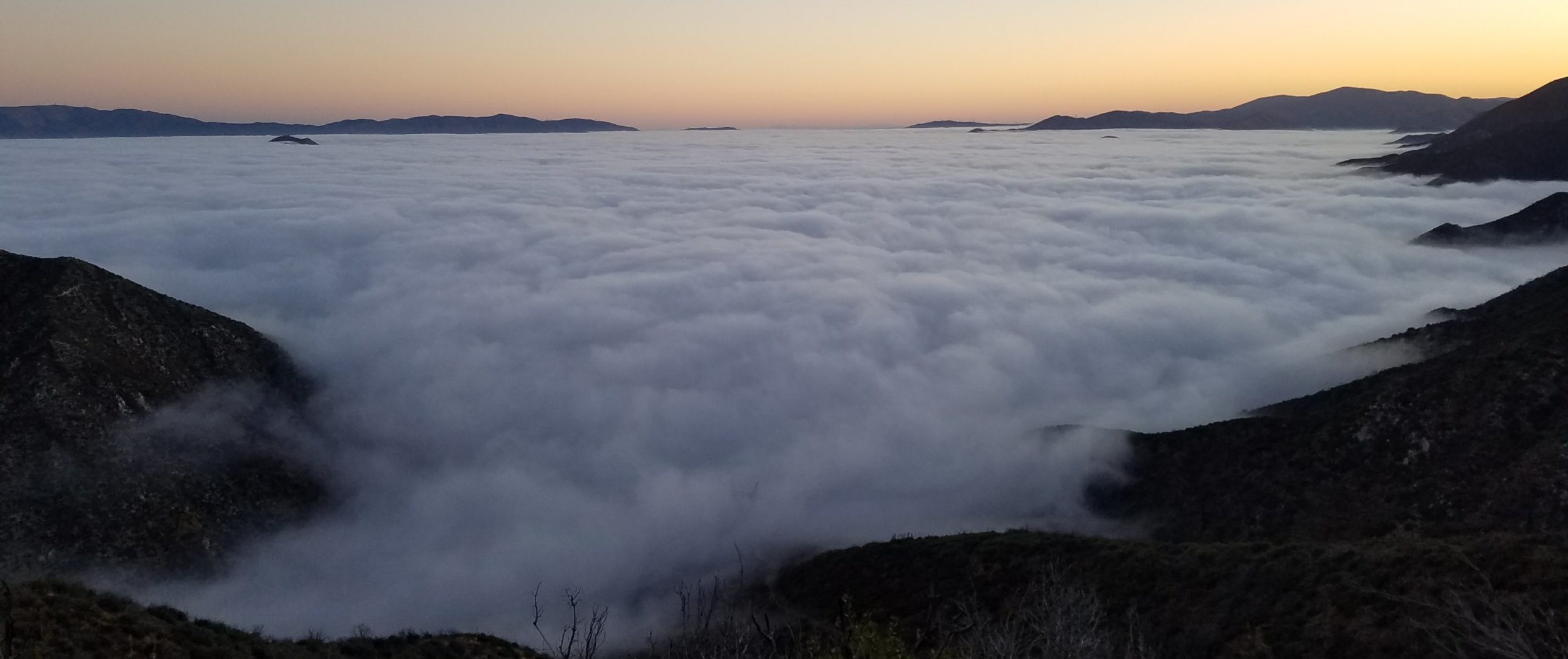
25 mi to 1\2 mi south of Tacoma Pass, mm 289, 6060’up\5830’down, elevation 3830′. I really enjoyed my fresh-picked blueberries with my breakfast. It was an uneventful morning as I passed by Mirror Lake. There were tons of weekend campers and all I could think of was how many of them must be pooping too near the lake. I saw one kid with a trowel in hand, off to look for a spot to lay down his treasure. The trail was fairly busy through the morning, not surprising for a weekend with great weather. I caught up to and passed Foggy. I figured he was going to be way ahead of me, considering how fast he caught up to me, but then again we’d both gotten into a routine of hiking pretty long days and not stopping for long in towns. Our pace was pretty evenly matched and the only difference was that he liked to sleep in and hike late into the night, while I followed an opposite schedule. Even though we hadn’t yet hiked together, it was nice to be hopscotching and seeing his friendly familiar face. Just before noon, I went to a lake slightly off trail along a busy dirt road to collect water that was pretty gross…it tasted strongly of algae. People were riding dirt bikes, fishing and flying drones around the lake, so I got the sense that it was probably a bit polluted. I eagerly walked back to the trail and down a ways to have lunch.


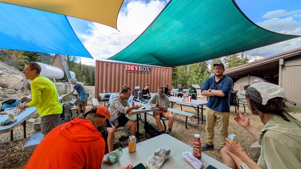
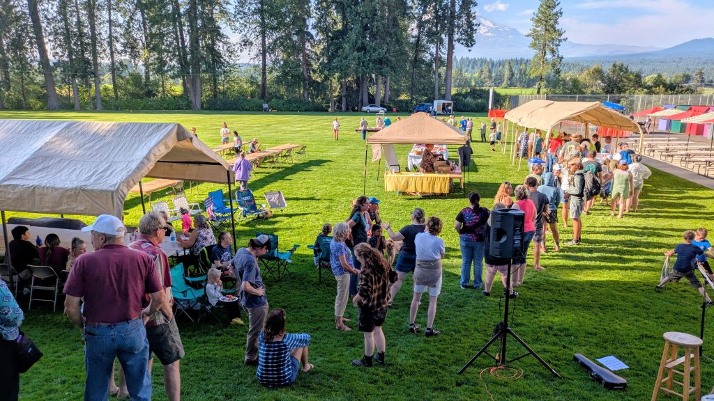
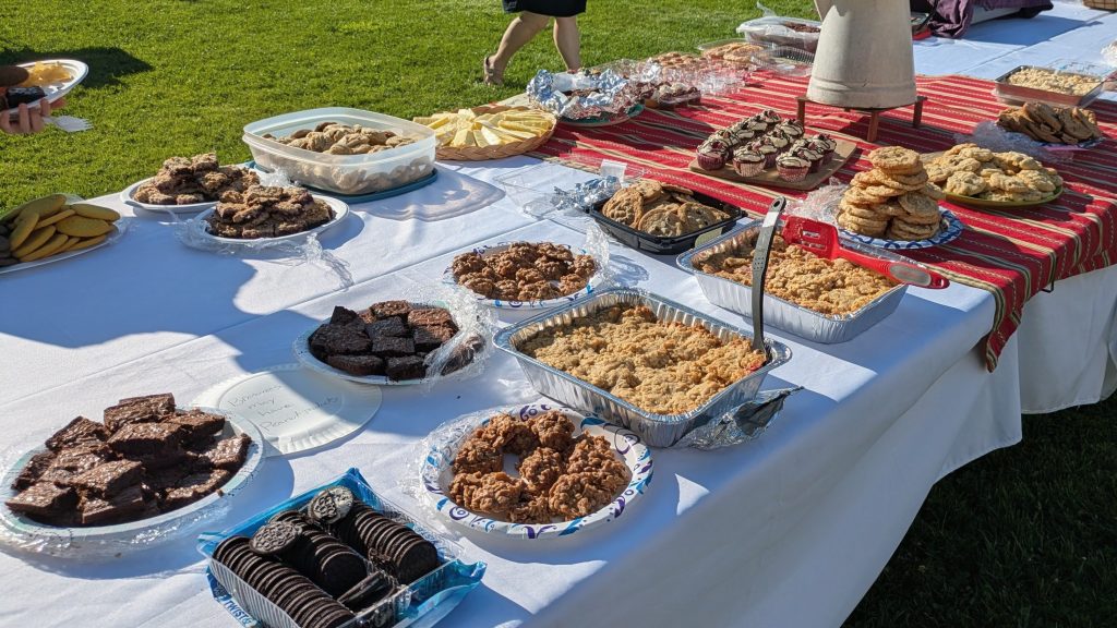
Then after hiking only a few more miles, I came across awesome Trail Magic, with burgers, chips, watermelon, chocolate chip cookies, and delicious cold beverages. I hate when I stop for lunch and then immediately come across a situation where I should have stopped instead…so it goes. This was indeed one of the best hiker feeds and deserved some time. I was also happy to be able to dump my gross lake water and replace it with their cold water. Foggy was there, along with a lady named Stingray, another SOBO, then later a NOBO showed. I regret that I didn’t get the names of the 4 trail angels, but they were so kind and I greatly appreciated their efforts! I stayed for over an hour and could barely walk, I was so stuffed. Then of course I passed some areas with the most huckleberries I’ve ever seen! I kept stuffing my face, even though I was so full….just like a bear, gearing up for hibernation.
It was a long 10 more miles to where I planned to camp. I got there pretty late and there weren’t many tent sites left. I briefly chatted with 2 NOBO women who very expressly told me how put-off they were by the sudden increase in SOBO’s. Yep, this is about the time it hits. I’d barely uttered a greeting to the one before she pointed a finger at me and exclaimed “We counted over 30 of you today!” Well, sorry? was all I could say. Should I apologize for just existing? From my perspective, hiking alone and barely seeing any other SOBO’s, it seemed like a stretch that there could be more than 30 in the 20 mile spread ahead of me. But as I’ve contemplated and tried to describe before, if both NOBO and SOBO hikers are each covering 20-30 miles a day, then that equates to a span of 40-60 miles of trail. This effectively doubles the amount of people you see each day. I was determined to not get put-off by such facts of life this time around, hoping to spread a more positive message that we’re all the same and should be friendly towards one another. But being tired at the end of the day, short on water, and needing to hunt for a campsite, this lady certainly tried my patience. I did the right thing by simply smiling and walking away. I picked up some nice creek water and found a tiny spot nearby to crash.
Day 17, Sunday, July 27th, 2025, 0610-1810. Let the Burns Begin.
29.5 mi to Big Crow Basin, mm 318.5, 6430’up\4010’down, elevation 6210′. I woke to dense fog but at least it was dry where I camped. As I climbed higher, it got very wet and cold. I was glad I hadn’t ended up on this ridge for the night. For a little while, I walked and talked with Stingray. We moved fast all morning in hopes of making it to breakfast Trail Magic in 14 miles, but no luck. The Trail Angel was sadly long gone. It’s one of the disadvantages of the comments on FarOut…getting hopes up. Since I was on a roll, I blazed right past the Ulrich cabin, not even stopping to read the log (I slept inside in 2018). The area was full of side-by-side drivers, joking about getting COVID from the cabin. What actually happened was that Foggy told them to watch out for norovirus, which apparently the cabin was a hot zone for. This was why I gave it a wide-berth, but also I wanted to avoid the loud ATV people. I also avoided the nearby creek, even though I needed water.


I hiked many more miles all the way to a spring in a big fire area. In all, I hiked 21 mi before stopping for a break. It was indeed time for lunch. Unfortunately there was no shade and I had to get out my umbrella since the sun was beating down so harshly. What a contrast from the morning, when I was wet and cold. On my break, I met a nice couple with an adorable standard poodle that was very affectionate. He seemed to really take a liking to me, or maybe he was just interested in the shade from my umbrella. I learned from them later that he’d gotten sick, probably the norovirus that was going around. Quite a few hikers I knew also got sick. I caught ‘the noro‘ from my hiking partner on the Grand Enchantment Trail in 2021, so I know how much it sucks. Thankfully I dodged the bullet this time. I hiked another 8 mi in the afternoon, much farther than planned, but I made so many miles in the morning that it was easy to log a big day. This way I ended up at a creek, making it almost all the way through the burn area. I found a nice site in unburned trees all to myself, near only one other camper. I had to backtrack about 0.2 miles for it, but it was worth it.
Day 18, Monday, July 28th, 2025, 0620-1750. Bumping.
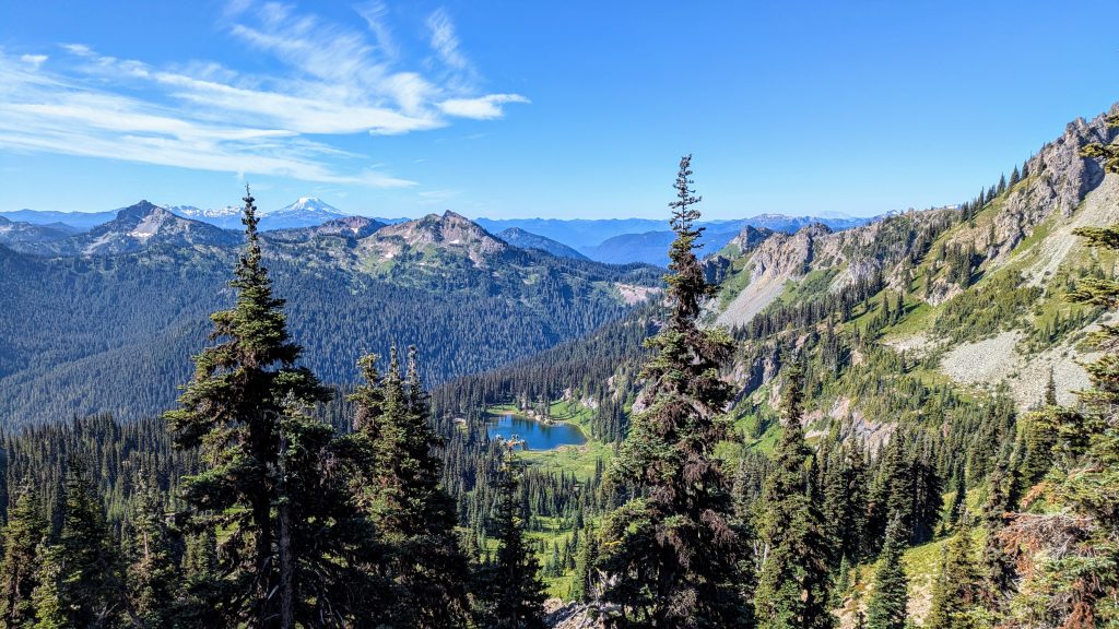
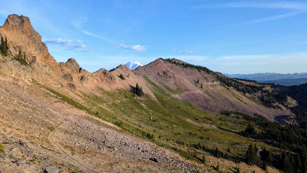
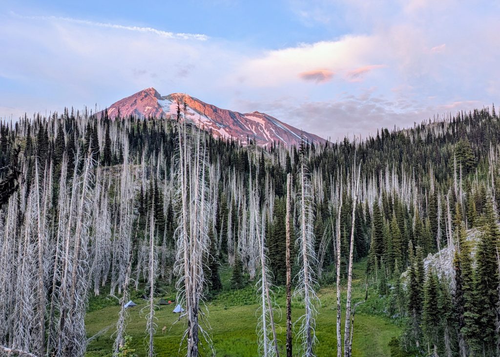
25.5 mi to Bumping River, mm 344, 3700’up\5800’down, elevation 4100′. First thing in the morning, I chatted with the man camped nearby, Chris from Wisconsin, who was very nice. He told me about his buddy meeting him at Chinook Pass, who planned to offer trail magic to other hikers, something to look forward to! He also told me he heard an animal pounding around at night, probably a deer but also maybe an elk. Sure enough, I followed elk tracks for several miles around Scout Pass until finally coming across the herd, right on trail around the bend in the burn area. Hiking solo, I crept up on them pretty close. There were somewhere between 20 and 30 animals and I heard one bugling as well. Last time, I’d seen an elk herd near the Ulrich cabin, so they’re pretty common to this area, I guess It was a really nice high traverse all the way to Chinook pass, with great views of Rainier, Crystal ski area, and even the Olympic peninsula mountains in the distance. At Sourdough Gap, I was able to see Goat Rocks, Mount Adams, Mount St Helens and even Mount Hood…just the little tip of it sticking up over the ridge, so cool! I think this is the first spot a SOBO can see Hood…in my 2018 notes I said I could see it just before Snoqualmie but I think I got that wrong. I’m not sure what I was seeing and I didn’t have peakfinder to confirm things back then, so I think I was just being overly-optimistic. I’m very serious about being geographically-correct and it drives me crazy when others aren’t, LOL. Anyway, Oregon here I come!
I met tons of people day hiking towards Sheep Lake. Then I ran into Kiss (a Canadian guy I stayed with near Lake Isabella) and a lady from Wisconsin that I met in Kennedy Meadow South. It was so great to see them and they looked exactly the same as when I last saw them 3 months prior. Most NOBOs are looking pretty dirty and thin by now, but these 2 looked great! Later in the day, I ran into Spooky and another guy that both recognized me from Julian, even remembering my name. It’s fun to finally be seeing people I met in the desert. Chris’s friend, Homer, was doing Trail Magic at Chinook Pass, just as promised. He had various chips, grapes, bananas, apples, and donut holes among other snacks, plus flavored sparkling water. It was great to have Trail Magic here again, the sight of some of my first Trail Magic in 2018. I was joined by Australian SOBO hiker Hannah and later hopscotched with her the rest of the day, then camped together. There were tons of day hikers heading south for about a mile from Chinook pass, then just a few from Dewey Lake onward. I went for a swim in the lake and it was one of the best. Not too cold and felt great when I got out. But after I dried, I really bonked going up a hill. I was worried I might be getting “The Noro!”, but then realized it was because I was about to start my period. Sucks, but a relief as opposed to noro. I had to do a shot of caffeine and lots of candy to get through the last 7 miles. I stopped at the Bumping River, which was a really nice spot with barely any mosquitos. Two NOBO’s camped nearby and one of them also recognized me, 3rd time this day.
Day 19, Tuesday, July 29th, 2025, 0520-1940. White Pass.
18 mi to Kracker Barrel, then back to trail, mm 360.8, 3150’up\1580’down, elevation 5670′. I got an early start, which allowed me to make 14.3 mi to the store by 10 a.m. I walked fast on the cruisey trail, mostly because I was being chased by the most viscous mosquitos part of the way. I remembered this stretch as being the worst the whole trail and I guess it’s just always bad. At least this year I camped just before the bad stretch and then had lots of energy in the morning to outrun them. I passed a PCTA trail crew sawing logs, who had started from Chinook pass and worked all the way to White Pass. I’d been seeing their handiwork (sawdust and clippings) for the last 20 miles. They did an awesome job and I got to talk to them later at the store, thanking them profusely for their hard work. I even made an announcement to the other hikers, prompting everyone to acknowledge their efforts and give them a round of applause.
There were tons of hikers at the store, both NOBOs and SOBOs, which was really fun. Foggy was of course there, bragging about the awesome trail magic he’d hit the night before. There was also a new SOBO named Plate, who was the first (and only) to recognize me from my Backpacker Radio podcast. Plate had just run into another SOBO named Meat Wagon, realizing they’d first met on the Colorado Trail. Meat Wagon was hiking with his friend Jockstrap (I know, what a pair!), and the 2 of them had apparently just caught up to me, though I didn’t know it at the time. I assumed I was seeing them for the first time because I had caught up to them at the store. More about this later. Around the same time, I was thrilled to spot Steady, the guy that saved me from a charging cow just past Tehachapi. I was glad to have some time to catch up with him. He’d lost a lot of weight, even though he was very fit before, but he still looked great. I loved the feeling of community this day, with everyone telling stories and figuring out when they’d last seen each other and where. It gave me such a warm feeling, kind of like when I saw everyone at Kennedy Meadows South.
Alas, I also needed to get some chores done! I paid $10 to take a shower (really a great deal that comes with a towel / toiletries) and raided the hiker box all day… I found a Mountain House and so many other good things in there. The store also gifted us multiple boxes of busted bags of chips, forcing me to walk away with so much junk food. I didn’t send a box here and was pretty much able to do a full resupply off the hiker box and chips. I bought only a few items from the store, which I thought had a decent selection and fair prices. Based on feedback I was getting from the NOBOs, I decided to not to send ANY boxes through OR and see if I could make it on the tactics I found worked so great here. I hoped my luck would continue.
Late in the afternoon, I had no reason to linger longer, other than the fact that it was very hot and I was having too much fun socializing. A trail angel left a bunch of beers up for grabs, so that sealed the deal. I ended up drinking 3 over the course of the whole day, which really isn’t conducive to hiking out later. I talked to another cool NOBO named Purple Haze, who knew a lot about the more obscure routes I’d done. (He’d later hook me up with a ride to Bishop Pass in the Sierra). Purple’s mom had just visited him and left plates of fruit for trail magic. The treats kept rolling in! It hurt so bad to hike out around 6:00 p.m., but I was able to make it a few miles down the trail to a nice little meadow all to myself. The mosquitoes were terrible, however. I wasn’t expecting them to be so bad on the south side of White Pass, but at least they seemed to be occurring only in pockets…I just happened to end up in one this night.
Day 20, Wednesday, July 30th, 2025, 0550-1830. Goat Rocks.
28 mi to Walupt lake junction mm 388.1, 6100’up\6810’down, elevation 4960′. I’d read that there was a good chance of thunderstorms this day, so I tried to push fast in the morning to get to the top of Old Snowy well before noon. Unfortunately, I hadn’t made as many miles out of White Pass as I’d hoped the day before, leaving me 15 or so miles. The day started off perfectly clear, which gave me a false sense of security. I had yet to deal with thunderstorms this summer, so I also wasn’t in the practice of worrying about them. I was in hiking bliss traversing the ridges towards Goat Rocks, taking a few short breaks to admire the views. I passed Jockstrap and Meat Wagon early on, along with a few other SOBOs, so I felt like I was moving fast enough.
I stopped mid morning to collect some water, which is when Meat Wagon and Jockstrap caught up to me again. I thought I was setting a pretty fast pace, but finally realized that they were moving even faster. They’d actually started from the border a few days behind me, casually mentioning that they’d been seeing my name in the registries. Of course I perked up when it dawned on me that I might have been a rabbit in someone else’s game. A little friendly competition is hard to avoid on trail, and I’m very guilty of falling into it. Yes, I even enjoy it. So seeing them go past spurred me on, which is a good thing because I’d suddenly become aware of the gathering clouds. They stopped to take a short break and I surged ahead again. As much as I wanted to take my time and enjoy the views climbing the ridge up to Goat Rocks, one of the most spectacular stretches on the PCT, the weather demanded a different strategy this day. Every minute that went by turned into more of a race to the top. I’ve felt such urgency many times before when summiting 14ers, so I didn’t mind the challenge. Even better, Jockstrap had keyed into my concern over the clouds and caught up again. Together we pushed each other up towards Old Snowy. I didn’t need to summit the peak for a second time, but I’d planned to, and once a thing is stuck in my head, so go my feet.


Here the weather still looked great, both forward and ahead. I love this section!


But it kept looking more and more ominous as we hiked right towards the storm, yikes!
We heard the first thunder right as we got to the summit spur trail off the knifes edge section. The thunder was quite far away still and it didn’t seem like the storm was moving towards us, just building. Perhaps not too wisely, we decided to keep going. If I’d been by myself, I probably would have continued down, but company equals courage. The top was less then half a mile away, after all. We dashed up and man were the views impressive, as I remembered from before. And the growing thunderstorm over Mt Adams sure made for some impressive photos! But believe me, I was keenly aware that we were standing on top of a rock pinnacle, the very kind that lightning loves to strike. We lingered perhaps a little too long, finally running down in a desperate attempt to outpace the growing storm. We’d even seen some lightning strikes in the distance. Nothing like living on the edge!
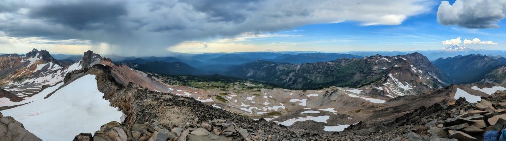


Flaunting the weather gods, I summoned the clouds from atop Old Snowy! Mt Rainier looks nice, while Adams is getting pelted…so too am I about to. Notice the cut on my left shin…I made a blood sacrifice to Thor.
On the mad dash down, we made it to a large snow field just in time to get stuck behind a bunch of teenagers on a day hike. None had poles and they seemed really sketched out by the steep and slippery traverse. One kid bent down and began crab-walking while trying to use his pocket knife like an ice axe. With the lightning starting to hit pretty close and the rain beginning to drop, I had no patience for these antics. I noticed a boot pack just a little higher and quickly switched to it, practically running across the snow to pass the kids and get to a less exposed area. We caught up to Meat Wagon just after this, as he’d skipped the Knife Edge alternate. We all laughed about our adventures and breathed a sigh of relief as we hiked into a cluster of trees. It started to rain pretty hard, then lightened up just in time for a late lunch brake. I really enjoyed these 2 guys company and hiked with them the rest of the day. The storm cleared late in the afternoon and we enjoyed nice views of Mt Adams to the south. We also noted some smoke in the valley, figuring the lightning probably started a few small fires. We found a decent campsite and quickly crashed. I did bigger miles than planned but it was a fun day. Goat Rocks went by way too fast, but it did not disappoint.
Day 21, Thursday, July 31st, 2025, 0600-2840. Mt Adams.
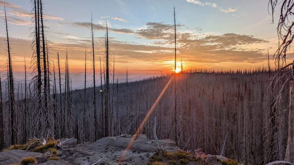
30 mi to sw of Mt Adams, mm 418.1, 4050’up\3380’down, elevation 5630′. It was such a car wash from all the rain and overgrown trail early in the morning. Talk about a green tunnel for hours on end, and not a very fun one. As I’d done several times prior, I caught up to Foggy, still in his tent. He told me about how he’d gotten absolutely dumped on all afternoon the day before. We’d had a harrowing time with the lightning on the ridge, but at least the rain had been pretty brief. Foggy and I began our game of hopscotching each other all day, as per usual. Meat Wagon and Jockstrap also caught up. When we all took a break at a road crossing, we learned that there was a fire on trail and that we should wait for a shuttle at the next road crossing in about a mile, near Potato Hill. One woman even had a video from some hikers that had walked through the fire right after it started, and they’d almost been hit by burning debris falling from the tree tops. That convinced me to wait for the shuttle.


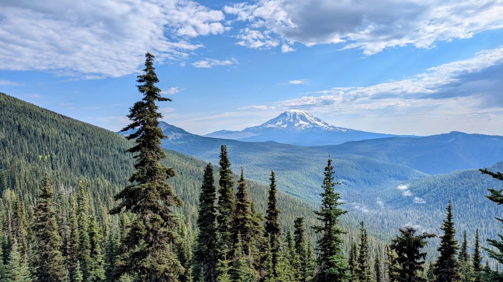
But then we talked to another hiker who had walked through the area in the morning, after the fire crew was on scene, and he said that they’d already put it out and it was okay to hike through. So we decided to go for it after all. I was kind of fond of the excuse to skip those miles, but I’d forgotten that the section was actually pretty scenic, working along the flanks of Mount Adams with nice close views of the peak. Like Glacier Peak, I’d been toying with the idea of trying to summit the mountain. But I gave up on it, since I figured it was a good idea to get past the fire while the getting was good and in the company of the other 3 guys. I need not have worried. The fire section was only about 100 meters long and there were at least 8 firefighters on scene, putting out the remaining hot spots. They were using a small pump to spray water from the nearby stream. It was pretty cool to see them in action and they were really chill about us hiking through. We hiked for another 5 mi or so to a meadow in a burn area, but it was really beautiful. Again, I stupidly refrained from collecting water until the very last stream, thinking there would be some in a meadow, but it was bone dry. I walked up and down the stream a ways, figuring I’d find at least a puddle, but still nothing. Foggy came to my rescue, giving me some of his water and I returned the favor with a treat from my pack. Meat Wagon and Jockstrap arrived shortly after to also camp in the meadow, so we had a pretty awesome little SOBO party going. Not since my travels with Amber had I camped with the same people multiple nights in a row. Foggy and I climbed up to a rock for sunset and it was the best one yet this summer.
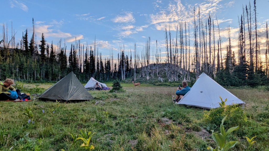
In the shadow of Mt Adams. Notice the tiny tents in the meadow to the left…3 are visible but of course the 4th, a camo one, is not!
Day 22, Friday, Aug 1st, 2025, 0600-0830. Trout Lake.
6 mi to FS 23 road, mm 423.8, 100’up\1870’down, elevation 3850′. There were lots of hucks and strawberries on the way down in the morning, along with some blowdowns, but I easily made it to the road for the 8:30 am Trout Lake shuttle. Driver Pat informed us that there were many events going on both Friday and Saturday…a potluck dinner, pancake breakfast and parade! Even better, I got a text from Anna and Kidzmeal that they were coming into town, too. What perfect timing! I’d hiked with them quite a bit in the springtime and was really looking forward to our reunion. Jockstrap, Foggy and Meat Wagon decided just to do a quick in & out of town, but I was all in for staying at least a day. I was going to miss the crazy guys, but figured I couldn’t match their pace for very long anyway. So much for me sticking with a tramily. I also wasn’t about to pass on free food and hanging out with my previous tramily.


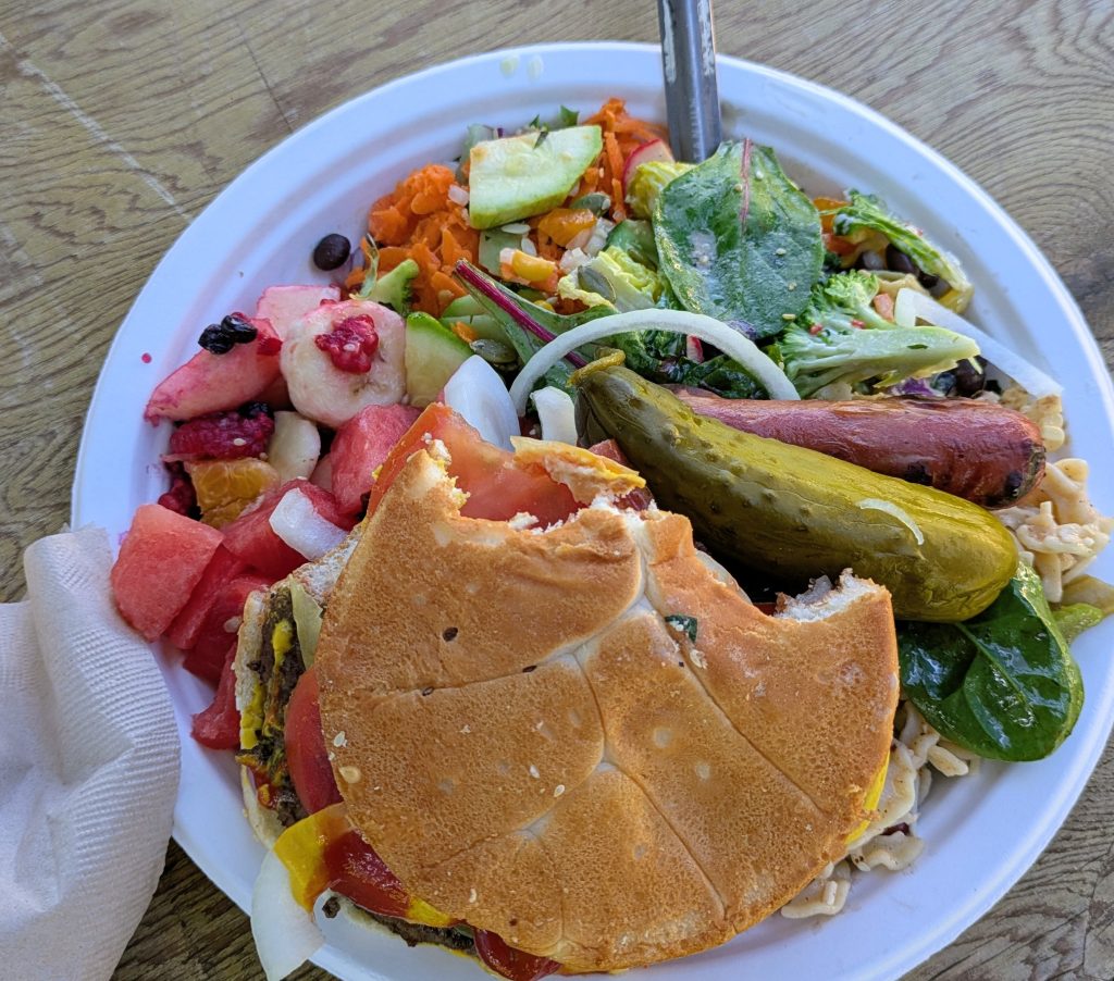
I hung out behind the general store all day, took a shower at the park, and talked to many hikers, including a guy named Rocketman from Truckee. I also loved on all the local cats, which were the very same ones I loved on in 2018. Anna and Kidzmeal made it in and we had a blast sharing a six pack while getting caught up on all our adventures. Then we walked to the town potluck for dinner. There was an amazing spread of colorful salads, grilled meats, and homemade deserts. I ate so much my stomach really hurt for awhile and I had trouble falling asleep. We camped on the general store’s lawn, which was surprisingly noisy from lots of road traffic and kids playing around until late. I guess the town was just really pumped-up for all the festivities and I can hardly complain about the accommodations, given the price (free). I was so grateful for all the hospitality the locals showed us vagrant hikers this weekend. I really felt welcomed into their small community. It reminded me of summers in my home town. Trout Lake is such a great trail town!
Day 23, Saturday, Aug 2nd, 2025, 1240-2040: A Parade and Sawtooth Mountain.
17 mi to Sawtooth mountain junction, mm 440.5, 3060’up\2070’down, elevation 4850′. I enjoyed a lazy morning lounging around town in the back lawn. We did get moving early for the Pancake Breakfast at the Firehouse, though. A trail angel also brought donuts to the General Store, so we were all high on food. Around 11 am, the long-awaited parade got going. Blink and you might have missed it but also, I was glad I stuck around to see it. There were classic cars, monster trucks, tractors, motorcycles, horses, ponies, donkeys, dogs, Sasquatch, water balloons, squirt guns, and some uniquely decorated home-made floats. Naturally, candy was being thrown to the kids, which might have ended up in the pockets of a few hungry hikers, instead. It was fun sharing all this excitement with Anna and Kidzmeal. They were going to double down on the town experience by attending a nearby music festival that night, but I decided I’d had enough stimulation for the weekend and took the noon shuttle back to trail. I sure packed in a lot (namely food) in 24 hours, even more impressive considering none of this was planned.


While I was sad to say goodby to my friends and Trout Lake, this hearty town immersion left me with quite a lasting glow. I’m an introvert after all, so I need to balance my socializing with time alone. I’m also an antsy hiker, satisfied most by movement and forward progress. Back in the woods on trail, I enjoyed a very quiet afternoon. I went for a dip in a creek and rolled along over easy terrain. There were many dirt road crossings. I was passing by one when 2 women called out, asking if I needed anything. I didn’t and was actually feeling quite full after my glutenous town stop. But Alana and Brook from Vancouver WA were so excited to offer me trail magic, I couldn’t let them down in not stopping. They procured some home-made delicacies which turned out to be delicious…I even took some to go, serving as my breakfast the next morning. We also had a surprisingly deep chat about female energy and companionship, it warmed my heart so much. I just love the PNW, especially WA. The people are so great. I bid farewell to these lovely ladies so they could resume their huckleberry picking and enjoyed hiking in the cool of the evening.


Just before sunset, I came to an alternate that went to the top of a small mountain. The timing seemed perfect for some cool sunset views, and boy did I call it! I scrambled up some volcanic duff to the top of Sawtooth Mountain and was amazed to see, count them, 5 mighty VOLCANOES. Rainier and Adams to the north, Helens to the west, and Hood and Jefferson to the south…my first sighting of the latter! This was one of the top 5 volcano viewpoints I had on the whole PCT. Best of all, the sun was setting directly behind Helens, giving the appearance that she was erupting once again. How fantastic…certainly my most memorable sunset all summer. What a blessed week it had been and now this was the icing on the cake. I was buzzing as I made my way down the slope and found a perfect campsite at the trail junction, just as darkness descended. My month in WA was nearly at and end, but what a perfect adventure it had all been, from start to finish.
Day 24, Sunday, Aug 3rd, 2025, 0600-1900. Panther Creek & Carson WA.
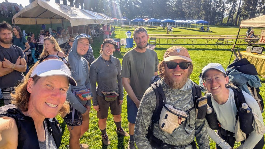
14 mi to FS 60, mm 454.7, then 13.5 miles down FS 60\65 Panther Rd, then 5 mi hitch into Carson, 1300’up\5300’down, elevation 520′. It was such a quiet camp spot, breezy overnight but well protected. I covered some fast miles in the morning, especially after a NOBO hiker told me there was Trail Magic at the next road crossing. I made it there just before they pulled away. Abazaba (PCT 22) and Carmen were gifting chips, Oreos, frog gummies, and even pulled pork. So delicious! I enjoyed meeting them and sharing trail stories. I’d been on a roll with the trail magic for days! Like I said, WA people are so great! While there, I met SOBOs Two Bucks and Kitchen with their dog Dynamo, then started hiking with Two Bucks afterwards. We opted to take a rather big short cut by walking a series of dirt roads. Besides skipping some elevation gain and miles, the road walk also allowed a visit to Panther Creek Falls. Having walked the PCT once before allowed me to more easily justify such alternates…why not see something just a little bit different, especially when it involved a specific attraction?


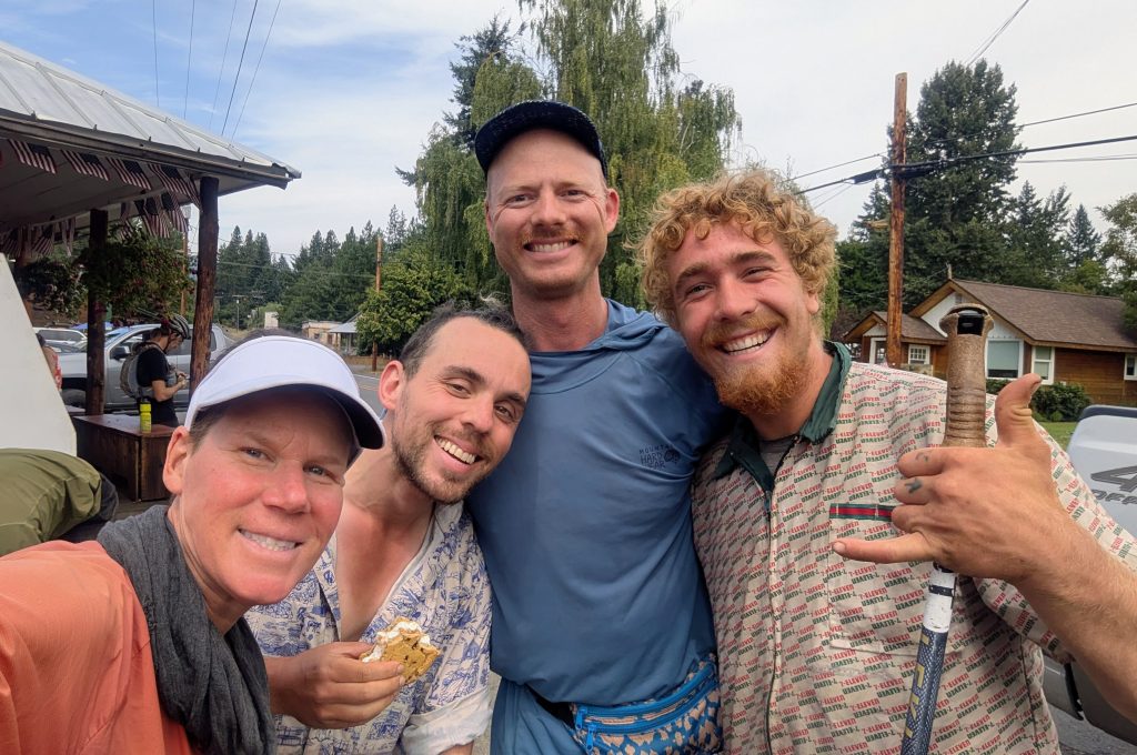
Abazaba (PCT 22) and Carmen, Panther Creek Falls
Two Bucks and I kept each other company on the long road walk, enjoying the ease of walking downhill for 8 miles. The PNT also had a lot of dirt-road walking and I gotta admit, as long as there’s not much vehicle traffic, I don’t mind it. It’s a change in pace and can be pretty fun where there are others to walk with. We took the short side trail to see the falls, then stopped by a bridge for a dip and lunch break. Two Bucks departed to resume hiking with her boyfriend and I walked the last few miles of the road alt, now all pavement. Upon reaching where the PCT crossed again, on a whim I decided to go for the ultimate deviation and skip directly to the small town of Carson, situated due south along the Columbia River gorge, just up the river from Cascade Locks. I blame Kidzmeal for putting the idea in my head and corrupting my completion of the last 50 miles or so in Washington. He’d pointed out all these shortcuts south of Trout Lake and also showed me a picture of the brisket mac and cheese plate he’d gotten at the brewery in Carson. I just couldn’t get it out of my mind and figured I’d reward myself with a beer and hearty meal at the end of the day.
I didn’t really have a plan for where I’d stay afterwards, but knew I could easily make it to town, or at least most of the way. I walked for about 5 miles down the road, debating whether to hitch. There wasn’t much traffic and I felt the need to earn my meal by walking most of the way. It ended up being a long day of 27.5 miles in total (I kept track with my watch). When a lady in a minivan stopped to ask if I was ok, I decided to take her up on her offer to drive me the final 5 miles into town. She was very friendly and even gave me a little tour. She dropped me off at the brewery and I enjoyed my dream meal while contemplating where I was going to sleep this night. I’d been spending a fair amount of $ on food in towns, but I saved a lot in WA by simply camping in towns, or just past them. In fact, I only paid for 1 hotel, the night I flew into Seattle. This small town was no exception, as my time on the Oregon Coast had taught me well. I studied google earth closely and my stealth-camping sense told me there were plenty of options. Sure enough, a nearby tree farm provided the perfect cover. I slipping in unnoticed and set-up among the lines of perfectly uniform trees. It was a really weird forest but very quite, plus so dense that it concealed me completely. It was perfect for just one night. No bed or solid roof over my head for 24 days and counting suited me just fine.
My plan for the next morning was to pack early (an obvious obligation when stealth camping), get coffee at the nearby general store, then take a bus or hitch to the Bridge of the Gods so that I could rejoin the PCT and walk into Oregon. I didn’t feel any regret about skipping the last 50 miles, since I didn’t recall the terrain being very exciting, mostly passing through logged areas on the way down into the gorge. Plus, this way I might catch up to Foggy, Jockstrap and Meat Wagon. I later added all my daily recorded miles in Washington to come up with a figure of 524, with an average of nearly 22 miles a day. The official WA PCT section is 506 miles, so I still exceeded that. The extra miles came from my start at Ross Lake, which more than made up for my shortcuts on the southern end. As they say, it all balances out in the wash.
Next up, Oregon!