Monday, August 29th, 2022, 0615-1330
Chilean Memorial to Cape Alava, then to Ozette via connector trail, WEBO mm 1248.2, Section 10 Olympic Coast
16.6 plus 3.3 miles, Gain 890′, Loss 870′, elevation 0′
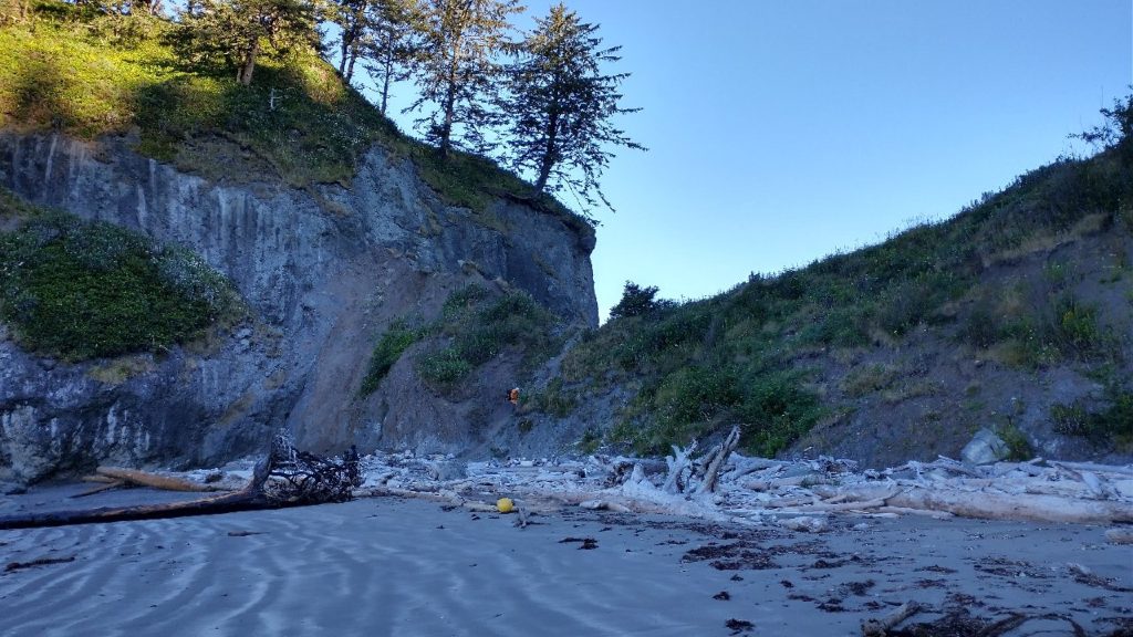
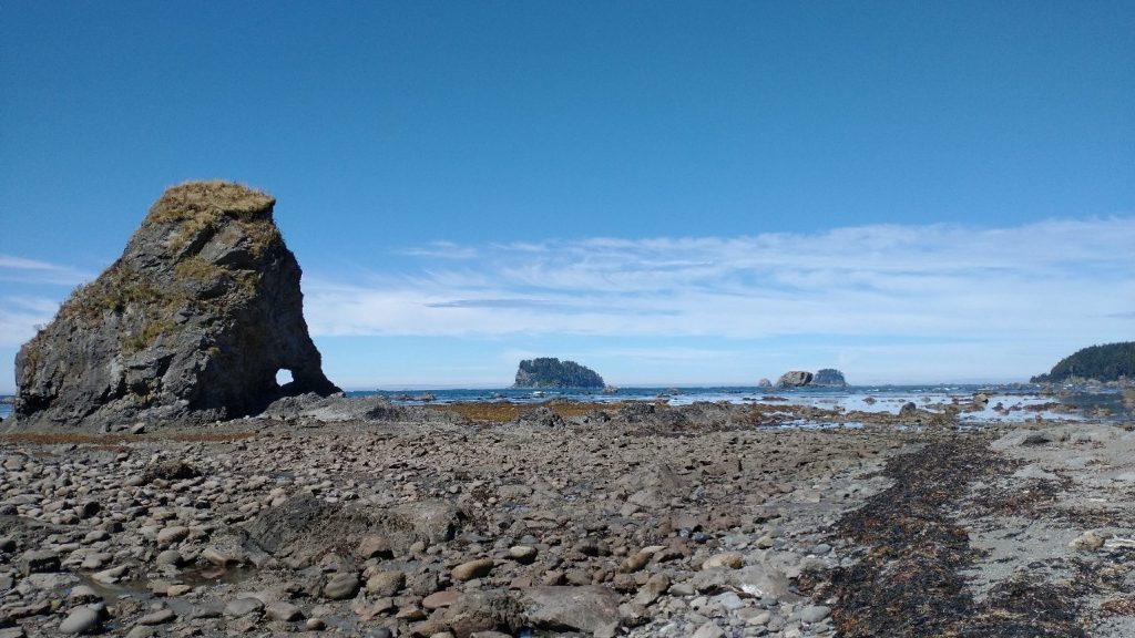
Another perfect night on the beach and this day we awoke to clear blue skies, not even a hint of fog. I must admit, aside from a kinda wet start (which I didn’t even mind), I’d been blessed with nearly perfect weather the whole route. While the trail might have been punishing at times, at least I didn’t have the complicating factor of punishing weather to deal with. I packed quickly but was second to last out of camp. I found everyone just ahead, slowly beginning the day’s routine of picking their way along the rocky beaches. I’d read some blogs and comments on FarOut and knew we were in for a slog, especially around Cape Johnson, our first headland of the day. It did not disappoint, with some large boulders, endless loose rocks, and massive amounts of slippery seaweed. The tide was way out again, very much in our favor, so that was great. It had revealed a world of what mariners would classify as ‘reef’, a term used to describe any rough substrate, emphasizing the fact that it’s nothing you’d want to run your hull up against. It’s also not something you’d want to have to walk over… I can barely begin to describe how treacherous rocks covered by wet seaweed and barnacles can be. But it’s what you get in this section of the ONP coast, so we just had to deal with it. Very slowly.
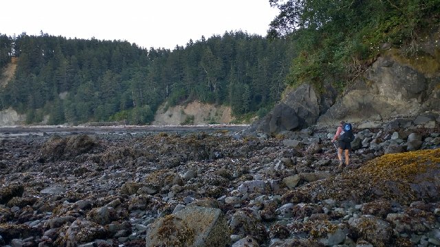
I actually discovered that I have quiet a knack for reef walking. At first I tried to stay above the high tide line where the rocks were dry. In the early morning, with the tide recently receded and the seaweed slick as snot, it seemed to be the least treacherous way. The other hikers did the same. A ‘trail’ becomes such by being a vote for the path of least resistance. But following the curvature of the shoreline adds a lot of extra distance, as one has to weave in and out of every little cove. Plus the slope of the beach can be very steep and taxing. Cliffs routinely pop up in the way, requiring rock scrambling or a diversion into the wracks of seaweed lining the shore. The wrack covers unseen and very slippery rocks beneath, so I learned to avoid this at all costs. It became a game of finding the least sucky substrate, growing weary of it, trying something else, then back to the kind before it once that became annoying, too. But with the tide out so far, I found it best just to cut straight across the coves and sometimes even larger bays.
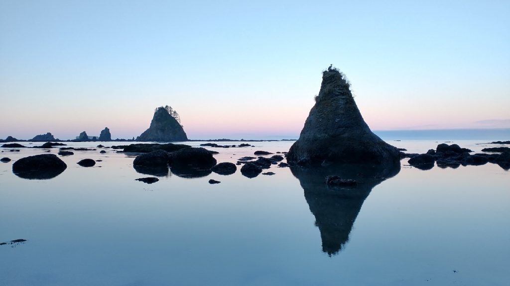
Faster but not necessarily easier, as this meant skirting over lots of live seaweed attached to slanty rock ledges, and also stepping in all the puddles in between. Early on, I committed to wet feet for the day and did not regret this concession. I was able to take the shortest path between apexes and quickly found myself well ahead of the others. Plus, it was kind of fun being so far away from the shore, like I’d become part of the sea once again. I guess I should have been fearful of falling and breaking a leg, becoming stuck to wait for the tide to come claim me. But this never crossed my mind. I guess I’m pretty comfortable being ‘out to sea’, surrounded by the ocean…or what lies beneath it, as was the case here. A calm and bright sunny day also helped to ease any concerns. Tall offshore sea stacks became my companions, like sentries standing watch over a foreign world.
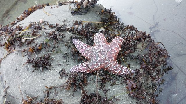
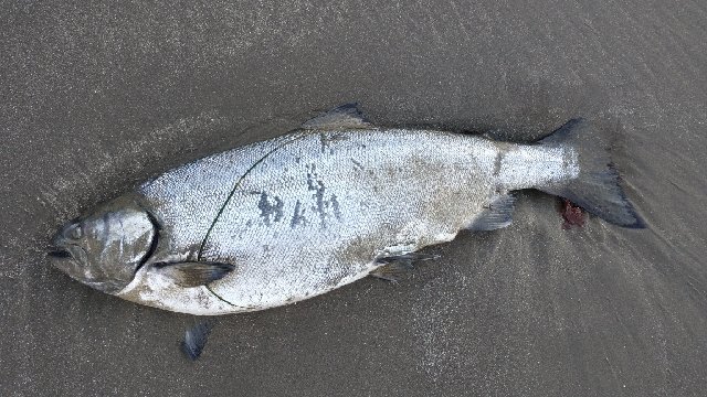
Finally coming to a perfect hard-packed sandy beach, I waited a bit for everyone to catch up, then strolled along easily. What a relief. I could finally look up and all around, spotting a few bald eagles in the trees. Sunlight filtered through these tall trees, casting brilliant sun rays across the sand. The chuckling of the eagles set a joyous mood. It was so beautiful and peaceful. What a way to end this hike. I began zig-zagging along the beach, checking out every tide pool and little blip on the surface of the sand. I found a lot of starfish clinging to the rocks and a dead salmon.
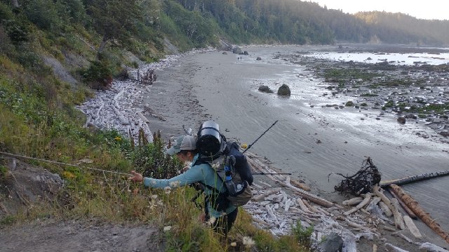
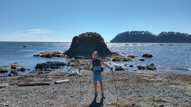
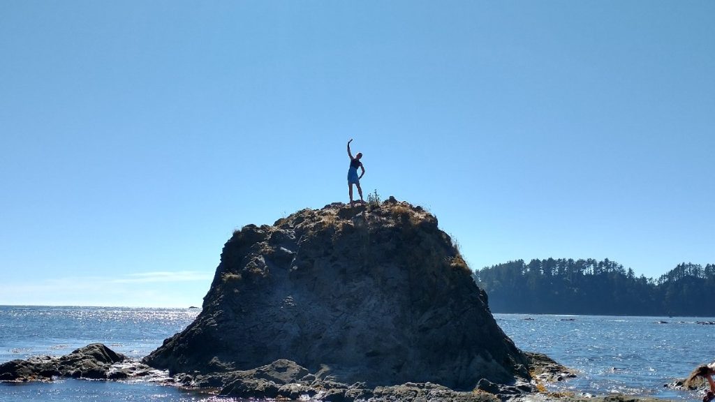
As a group, we approached a headland (Sandy Island) that jutted far out towards the sea, attached to the coast by a narrow neck. We could see a few figures coming down the neck (fellow backpackers), indicating a direct path over it, rather than having to go around. A short but steep climb with fixed ropes provided a fun diversion from the shore walking, along with nice views. There were some more overland trails north of this, but since there was no need for them, I didn’t bother to check them out. Path of least resistance.
A few hours in, I’d made it to Norwegian Memorial camp, which was previously my permitted campsite for my last night on the beach. Obviously I wasn’t stopping here, the day still being early in the morning and me being on a roll with only 11 miles to go. We were all confident in our finish of the PNT this day…nothing would stop us, not even an alluring beach camp. Others were taking it much more leisurely. I noted a string of backpackers stretched out in front of me, just setting off from their camp. The beach started to get rough again and I resumed my reef walking. My progress across the bays was an interesting thing to contemplate. I felt like I was crawling along, yet every time I glanced towards the shore, I was pulling ahead of my friends and closer to the big group in front. Pretty quickly, I passed them too and was all alone in my slimy slippery world. With the sun up and the tide out for many hours, the rocks dried a bit and it became easier to make progress. I was actually having a lot of fun and feeling pretty motivated by my fast pace (all things being relative). I came to some points of land that provided some amusing scrambling options: up and over the small headlands via rope assist or squeezing through small holes along the shore…choose your own adventure! I navigated the holes, squeezing through with my small pack (so much fun!) and also went up and over one of the points, when I could have much more easily gone around. I know this because I passed a few backpackers just before the point, only to find them in front of me once again on the other side. No matter, whatever way I went, I had a good time.
I’m sure I must have elicited a few stares as I bobbed my way along the beach, passing group after group. I know this rough beach hiking can really give people fits but I was embracing it. Did you ever take a test or exam that you actually enjoyed? The PNT was a study in 1200 miles of obstacles, so this last little obstacle course was like taking the final exam. I’d been studying for it so hard the past 2 months that I aced it. Not surprisingly, the PNT was true to its nature to the very end, with blowdowns on the beach in the last half mile. The tide had finally come up in the early afternoon, leaving no way around…Just Climb Over…I had plenty of practice with this, after all. We later joked that we were glad it wasn’t easy in the last few miles. We had to earn this trail, thru and true.
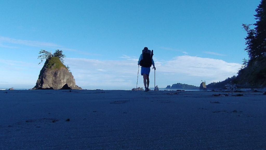
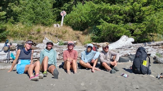
At last, I reached the point where my GPS indicated the beach walk was over and the spur trail went inland. There was no marker, no fanfare, and the shoreline didn’t look like what one might expect of Cape Alava, the most western point in the contiguous US. I noted the offshore island in the backdrop, the only landmark giving the site away, as I recognized the scene from other PNT finisher photos. Just like everyone before me had said, it was nothing too special or distinguishable. But I’d gotten over the need for a grand monument or plaque a long time ago, having done unofficial routes with arbitrary termini such as the GET and MRT. This was a actually a very fine spot to finish the trail because I was in the company of 4 friends that had gone through the same struggles and scenery, with a beautiful day and vista to surround us all. Perfect. Since I’d arrived a little before everyone, I had time to wash my shoes in the nearby creek, filter water, and dry my things. I switched into my camp shoes so my feet could rejoice. One by one, my friends rolled in and we cracked open our festive beverages. Probably not since the PCT have I enjoyed such a fun and celebratory finish.
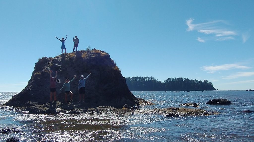
We solicited some other backpackers to take our pictures, who were kind to wait while we waded to a nearby island and clambered up. A few went swimming but I was content to just get my legs wet. I’m not a fan of being covered in salt water then having to hike some more. But yeah, I should have at least taken a dip in the Pacific after walking all that way. Especially since daily dunkings are a signature trademark of mine. Oh well.
After what seemed like several hours loitering at the beach, we reluctantly turned inland to walk the 3 bonus miles to the trailhead. We hadn’t been in much of a rush because we were all hoping to score a ride with Quetzal’s parents, who were driving out to meet her. We met them halfway along the trail, forming a line of 7 very happy people like a pack of smurfs, coming back from a fun day at the beach. At the parking lot, we did some hiker math, realizing that the rental car was short 2 seats. Without hesitation, I volunteered to stay behind and hitch, as did my talented hitching buddy Wolverine. Funk and Costanza valiantly protested but none could out-argue us: 2 women would have a much better chance hitching from the remote spot, especially given our particularly auspicious combination (based on previous luck getting from Spokane to Oroville and a long list of other exploits). The 4 of us would hopefully meet up later in Port Angeles.
As we waved goodby to Quetzal, her parents, and the lucky guys, a depressing reality sank in. There were only 2 cars in the parking lot, one of which seemed deserted. As for the other, we’d already asked the couple if they were going towards Port A and they’d said no. It was 5 pm on a Monday. We were at the end of a remote road, in the middle of nowhere, without cell reception. The direness of our situation suddenly hit us. We were going to have to be extraordinarily lucky to get all the way to Port A. In all likelihood, we wouldn’t, at least in the same day. We quickly reassessed and came up with a better plan. The trailhead wasn’t likely to see any more traffic in the evening, so we needed to go elsewhere. There was a campground and a general store a short ways up the road, perhaps an employee might be heading home that we could get a ride with? If nothing else, we could get some treats at the store and stay overnight at the campground. We each had extra food and weren’t really in dire straights. It’s just that we’d been so excited to be done this day, neither of us had thought of the possibility of getting stuck at the trailhead.
We walked past the campground, where everyone seemed to be in for the night. I stopped at the turnoff to the general store, making sure to catch any vehicles that might come by, while Wolverine went up to check things out. This was a smart move. Shortly the couple from the trailhead came by in their jeep, waving at me as they passed. I hadn’t even stuck my thumb out, since they’d already said no. Perhaps seeing my sad face, they stopped and turned around. The man asked “could we at least give you a ride to the next intersection?” I hadn’t realized that when Wolverine asked if they were going to Port A, this was the wrong question. In a situation like this, the question to ask is “can you give us a ride to anywhere?” I’m always willing to take a chance on getting further down a road, even if it means ending up in a worse spot. We had a general store and campground with showers and bathrooms, and perhaps absolutely nothing further on. But screw it! I was game and figured Wolverine was too.
The couple got out to make room for us, which was in short supply given that they had a bunch of gear plus an infant in the back! Can you believe it, the woman volunteered to climb in the trunk so that we could squeeze into the remaining 2 seats with our packs! For the umpteenth time this summer, I found myself sitting next to a sweet little child, marveling at the unimaginable generosity and trust from strangers. I guess the 2 of us really did give off good vibes and had all the hitching luck in the world. The man even drove up the hill to the store to get Wolverine, who came out with a huge grin and milkshake in her hand. I didn’t begrudge her score, as I felt like I’d gotten a score of my own. The family could take us about 20 miles down the road to a busier highway, the one coming from Neah Bay. I didn’t even have a clue that it was so far and was feeling terrible the whole time I sat in the seat next to the baby, while the poor mom was crammed into the jeep trunk. I don’t think she realized it was so far either. I would have gladly traded places with her. None-the-less, we made it there, profusely thanking them the whole way. I regret I don’t recall their names but THANK YOU!
They seemed regretful dropping us off in yet another middle-of-nowhere spot but we assured them we’d be just fine. Already our confidence was high. In the short time it to took get out of their jeep, a few cars had gone by. We waited only about 5 minutes until another vehicle stopped. The man was on his way home from USCG station Neah Bay and thought we’d run out of gas or broken down, since there was a conveniently abandoned car nearby (hint…another hitching trick). We explained our need to get to highway 101 and he was heading to Forks. I of course played my Coastie card and we were shortly having a fun discussion about his work as a small boat mechanic. Wolverine took advantage of some cell service on the way to discover that there was a $1 bus running from Forks to Port A and that it would be stopping at our next intersection only 10 minutes after we got there via our ride. Serendipity! And that’s about all she wrote. Two hitches and a bus ride later, we made it 85 miles to Port A only about 1 hour behind the guys, who had a direct and private ride! None of us could believe our luck but more so the guys. Wolverine and I kind of suspected that we still had plenty of magic up our sleeves. We all split a room at the Riviera Inn and went out for pub food and beers, happy to be reunited and able to celebrate our finish in town. Quetzal and her parents had plans to stay in Port Townsend, so they’d already moved on. Even if I didn’t directly benefit, I was still very thankful to them for giving half of us a ride. There’s probably no way all 4 of us would have made it otherwise. All’s well that ends well, and this trail ended very well. But really, I was extraordinarily happy with almost all of it. There were many struggles but the overall experience was superb. Three cheers for the PNT!
As always, I will follow up with several more summary posts, as well as one or two post-hike excursions. Stay tuned and thank you for sharing in this adventure.
Just stunned. No need to tell you that you are a blessed woman.
Thank you finishing up your story — us fans appreciate it ❤️ And that sea stack pic with the crystal Reflection…One the best I’ve seen😍
Thanks for hanging in there for the final posts!