Wednesday, August 10th, 2022, 0945-1700
Mt Baker HWY to Mt Baker Hot Springs, WEBO mm 824, Section 7 North Cascades
19.6 miles, Gain 3520′, Loss 4200′, elevation 1330′
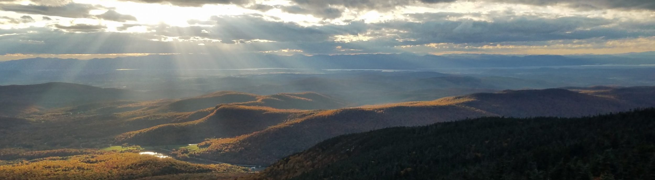
It was a day of all things Mt Baker. First I awoke to a sunlit valley with Mt Baker overseeing the realm. I heard a bald eagle chuckling down along the river. We hung around the camp for awhile in the morning. Then David picked us up, ready to deliver us back to the trail. I think he was a little sad that none of us took him up on his generous offer to take a zero at Camp Baldy. It was no knock against his place. He just didn’t quite understand how us thru hikers work. We were desperate for cell service, wifi, and a full bathroom. It was day 9 without a shower and laundry. Relaxing by the river all day was not a priority …we get to do that nearly every day while on the trail. Plus, there’s an innate sense to always be moving on. I needed to get to the next town by Friday in order to pick up a package…my beloved trekking poles were waiting.
We made a pit stop at a convenience store on the way out of town. I didn’t need more supplies but bought some junk food anyway. I didn’t like any of the water bottles, so I got a 1 liter of mt dew instead. The selection was pretty dismal but the store did make toasted bagel sandwiches that were on the small side but very tasty. David dropped Wolverine and me off at the junction where we’d hitched into town while Karaoke opted to get a ride to the ski area. It was about 8 miles of paved road walking, noted as one of the most dangerous ones. It seemed very quiet on a Wednesday morning but I can totally understand wanting to skip it. I’d read that the views near the top were nice, so I wanted to at least give walking a try and I didn’t regret this.
I guess it is funny that I hadn’t been an absolute purest in connecting my steps but that I was still opting to walk curvy paved roads when I could have easily gotten a ride, instead. Thus far, I’d missed 2.5 miles connecting Oroville to Whistler canyon and now 2.5 miles along the dirt road from where I’d gotten a ride the day before. I didn’t feel like troubling David to take me back to the exact spot. It just didn’t matter and he’d already given so much of his time and hospitality. So officially my un-connected steps now totaled 5 miles, which was pretty insignificant to the 800 some miles I’d already walked along the PNT. With so many alternates and road walks, it had felt pretty disjointed anyway. Besides, the minute I committed to flip-flopping, I gave up on the ideal of truly connected steps (i.e. point A to point B without any interruptions). If it sounds like I’m trying to justify or explain my actions, I’m not. I just like to be as honest as possible about my hikes but I’m also really into numbers, so such details are more for my own record-keeping and statistics.
The goal for this day was to arrive at a hot springs by the end. Walking the highway, the distance was about 20 miles. Karaoke was understandably quite tired and needing a break. This was her first thru-hike and she’d been going for 8 days without a break, pushing as hard as we had. She’d really wanted to take a nero or zero in Glacier, but the town had almost no amenities. Skipping the road walk so that she had a 12 mile day was just the break she needed. I was feeling it too. I’d averaged 25 miles for 8 days straight…going on 10. This day was actually kind of a break, if that makes any sense.
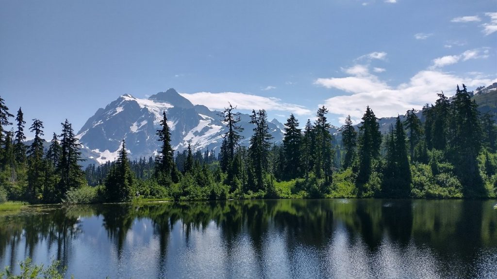
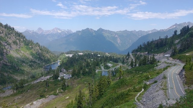
The highway walk went by very fast. Initially all the traffic was going up, so walking on the left side, I encountered almost no cars for over an hour. The road did get pretty narrow and snakey at the top, but I still found it pretty chill. On a weekend, probably not so much. As promised, there were great views of Mt Shuksan (which I originally thought was Mt Baker until Peakfinder set me straight). It had some nice hanging glaciers that looked like they were ready to calve. The cafe at the top was closed, so I blasted past the ski resort to a trailhead. There were a number of nice trails emanating from the large parking lot. I used the privy and talked to 2 Forest Service folks. They told me a crew had been working on the Swift creek trail, which was music to my ears. It was notorious for being overgrown and rough, but maybe I would have it easy.
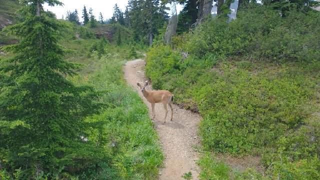
The alpine area was very nice and scenic, with friendly deer. Quite a few people were about on short day hikes. I crested a ridge and began descending for the rest of the day. I signed a trail register, noting only 3 other PNT hikers signed in before me (Captain Jack, Costanza, and Karaoke). I knew there were an additional 3 ahead (Salty, Shaggy and Goofy). The trail shared a path to Lake Ann and was very popular. Once I turned off to Swift Creek, I didn’t see anyone else. The trail was pleasantly cleared but still a bit uneven and with some rocky tread. It was actually a joy, considering how much chopped vegetation was laid to waste on the side. The trail crew had done a ton of work, which thankfully continued all the way to the bottom. Thanks trail crew!
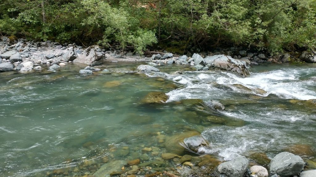
There were a few views of deep scars and slips along the way. This valley had seen some trauma over the years! As an active volcanic area, this made sense. It felt very wild and rugged. My anticipation grew as I neared Swift creek, widely proclaimed to be the worst ford of the entire route. I still wasn’t sure about it when I first saw it. It was indeed swift and had some deep pools. I studied various crossings for a bit, deciding not to change into my camp shoes but just get my runners wet. They needed a rise anyway and would give me better traction. I also packed electronics in water resistant packages, just in case. The crossing was very anticlimactic. I spent way more time planning and preparing, all for what amounted to an easy, everyday and multiple-times-a-day crossing in NZ. The water came up to mid-thigh and I was across in seconds. But it’s always better to be prepared than not. Salmon berries rewarded me on the other side. Later there were many huckleberries, raspberries and blackberries.
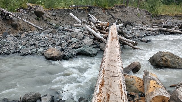
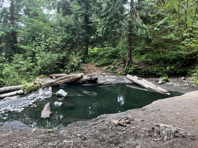
I came to a second crossing of silty rainbow creek, which was gushing stronger than Swift. A felled log had been improved with a flat cut surface, so was easy to use as a bridge. I was glad not to have to ford this creek, since the silty water made it hard to tell the depth. The trail was really nice after this, as the crew had smoothed the tread significantly. Flat and wide. I rolled into the hot springs around 5 pm, finding Karaoke and a nice Seattle man enjoying the pool. I cooked my dinner and did some soaking. There were mixed reviews about this springs but I found it to be pretty enjoyable. It wasn’t very hot, so I don’t think a winter visit would be ideal. Wolverine also arrived in time for a soak, so it was just 4 of us there. It had been threatening to rain all afternoon and finally did mist for about an hour. It actually felt really nice, perfect timing. And we did finally get a bath after 9 days, but I doubt we were very clean. The nearby campsites were pretty small, uneven and trashy, so the 3 of us opted to go down the trail to a site that would fit all our tents along the old roadbed. It all worked out really well.
You were e.coli clean, hahaha