Tuesday July 19th, 2022, 0600-2030
Bussard Mountain to Rock Candy Mountain, WEBO mm 211.6, Segment 2 Purcell Mountains
26.8 miles, Gain 6900′, Loss 6100′, elevation 6755
It was a nice sunrise but not as good as the sunset the night before. The wind howled all night but our campsite was well protected. It didn’t even get too cold. I was glad we stopped to enjoy the mountain. A quick series of switchbacks over 6 miles quickly brought us down 3,500 feet. My ears were popping. We hiked fast because we were looking forward to seeing what the resort, said to be hiker-friendly, was all about. We knew their hours meant the restaurant wouldn’t be open but we hoped to at least use the bathroom.
The manager and a few locals greeted me as I walked in. She immediately gave me coffee and water, inviting me to take my pack off. So welcoming! Her partner showed me the Hiker box and I had a field day! It was the best one I’d seen in a long time, full of vacuum-packed mystery meals that appeared to have lots of veggies. I love the homemade dehydrated meals…made with care and love by some stranger. I could have made a full resupply from this box. As it was, I took too much and made my pack even heavier. But that’s ok since I was short on food on this stretch anyway. Not anymore.
(Update: months later, we learned that a number of hikers had become ill around Bonners Ferry. The main suspect was the resort. It was so bad that a health department investigation was initiated. They found that the resort’s well had become contaminated with E.coli…which had nothing to do with anything the resort had control of or were doing wrong, it just happened. So in essence, I drank a bunch of this water…coffee, filled water bottles, and used to make a meal…but luckily never got sick.)
I cooked one of the meals right there, enjoying enchilada soup with chicken. The resort also had an adorable dog to play with, that is until he got skunked right as we were getting ready to leave. Dogs, you know? Then we ran into 3 WEBO PNT hikers on the way out of the valley. We didn’t chat for long. They seemed a little unenthusiastic… probably just eager to get to the lodge.
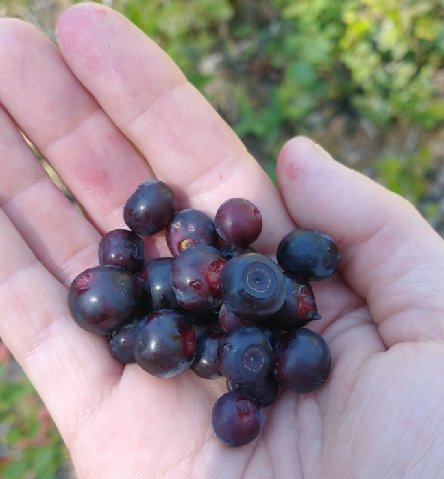
The profile out of the valley looked like the mountain we’d just come down. What goes down must go back up. It was a tough 5 mile climb, which really took the steam out of me for the rest of the day. The trail was made harder by the deep ruts carved by motorcycle tires (they’re allowed on singletrack trailer through much of Idaho). The one consolation was the giant huckleberries that I found intermittently. I’ve never seen such fat and juicy hucks! They were more like blueberries. They provided a nice distraction for awhile, helping me forget the climb.
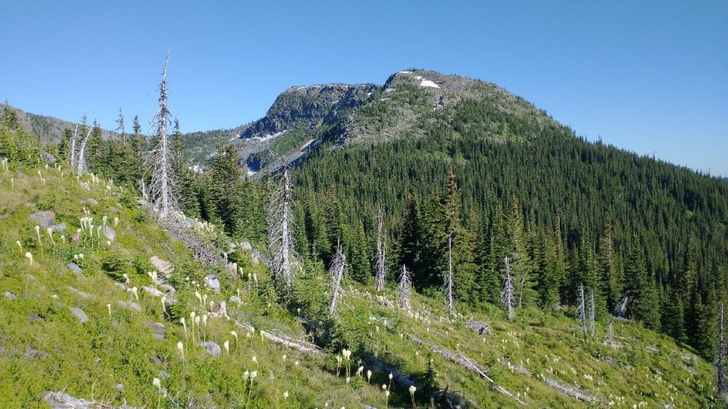
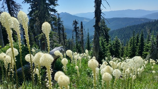
By the time I reached the ridge, I was so tired. And of course there I realized that there wasn’t water for another 6 miles. I wanted to take another break but had effectively already had lunch at the lodge. So I just walked. Up and down the ridge, all day. Through forest and meadow. There were fields of beargrass with the stalks as high as my head. Seriously, the bear grass has been crazy beautiful and so plentiful this year. It amazes me. But otherwise, it was pretty mellow. Just before a water source, I ran into another WEBO hiker. He wasn’t too hyped about the trail. Wolverine and I later remarked how a lot of these hikers seemed a little down-trodden. We surmised that they’d been through a rough few weeks of snow to get to this point.
We stopped for a long time at the water. It was already late in the day but we hoped to go another 11 miles. Given the ridge’s rough terrain, this seemed unlikely. The trail had gone from ORV roads and motorbike-chewed single track in Idaho, to barely discernible and unbanked turf tread as we crossed into Montana. Like the border with WA and Idaho, we missed the actual delineation. Generally I’d heard it said that Idaho is the least favored state given the poor shape of the trails. But so far, the Montana trails were worse.
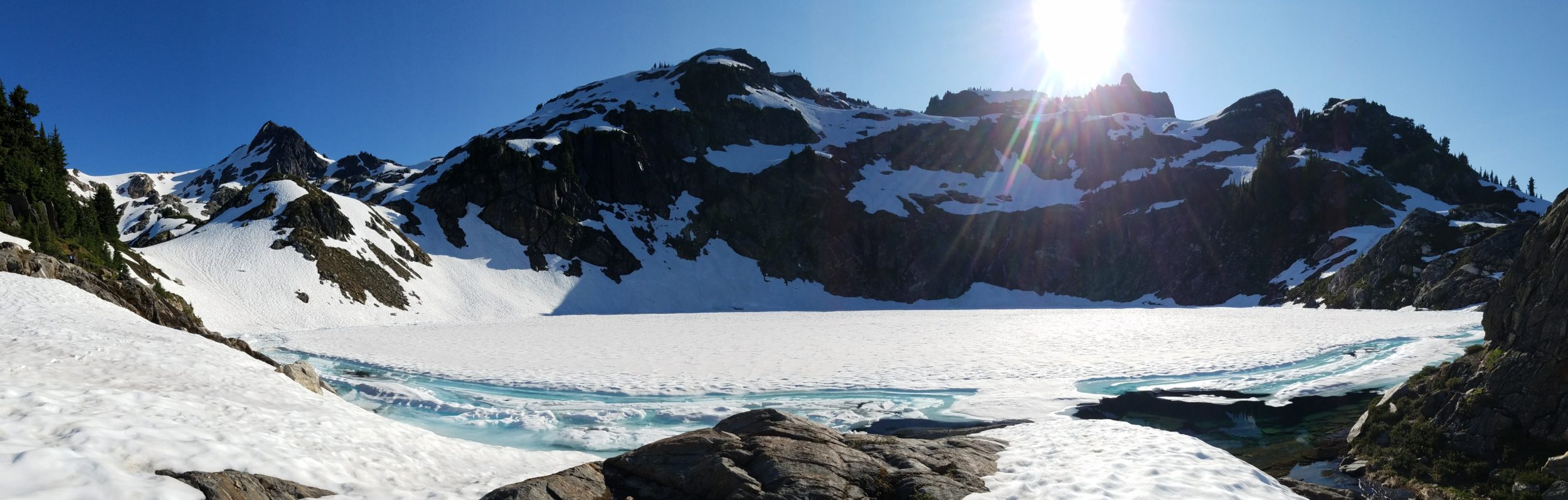
Another few climbs of 500 to 1000 feet followed. We stopped at what we thought was the last water source for the day to have dinner. This is a strategy to minimize water carried and reduce food smells near camp while in grizzly country. A WEBO had told us that he’d seen a momma with 2 cubs just a few days earlier in this area but we’d seen not even a sign. After dinner, we climbed to near the top of Rock Candy Mountain. There was water all the way up and on the backside too. A lot of snow was still melting and we walked through some more patches. I got off track going too far down a basin. The trail was marked with cairns but somehow I missed one. I had to climb steeply up to gain the trail. Wolverine had gotten ahead and I began to regret that we’d agreed on a campsite that was still 3 miles away. It was already past 8 pm.
The trail passed through nice forest with lots of flat spots. Then I spied her pulled over and knew we were on the same page about stopping short of our goal. It had been a tough day with lots of elevation change. The distance we’d walked was good enough in this type of terrain. The wind was blowing strong but we were well protected in the trees. Plus, I like to avoid established campsites when I can. Dry and high on a ridge is best for avoiding critters.