Tuesday July 12th, 2022, 0620-1930
Flume Creek Rd to Sullivan Creek, WEBO mm 350.5 Segment 3 Selkirk Mountains
9.7 miles, Gain 1000′, Loss 1200′, elevation 2450
I really had to convince myself to get out of my tent in the morning. The 100 some mosquitoes outside my door were slowing me down. I packed everything I could inside, then braved the music. I neglected to attach my gaiter over my shoe and in the short time it took me to fold my tent, they found that one vulnerability…like Russian hackers. They were even biting through my R1 fleece. I thought once I was moving fast on the road they would drop off, but no. They followed me the full 5 miles into town and even into the cafe where I had breakfast! They like to land on my pack, hitching a ride until it’s time to bite again. What horrible creatures.
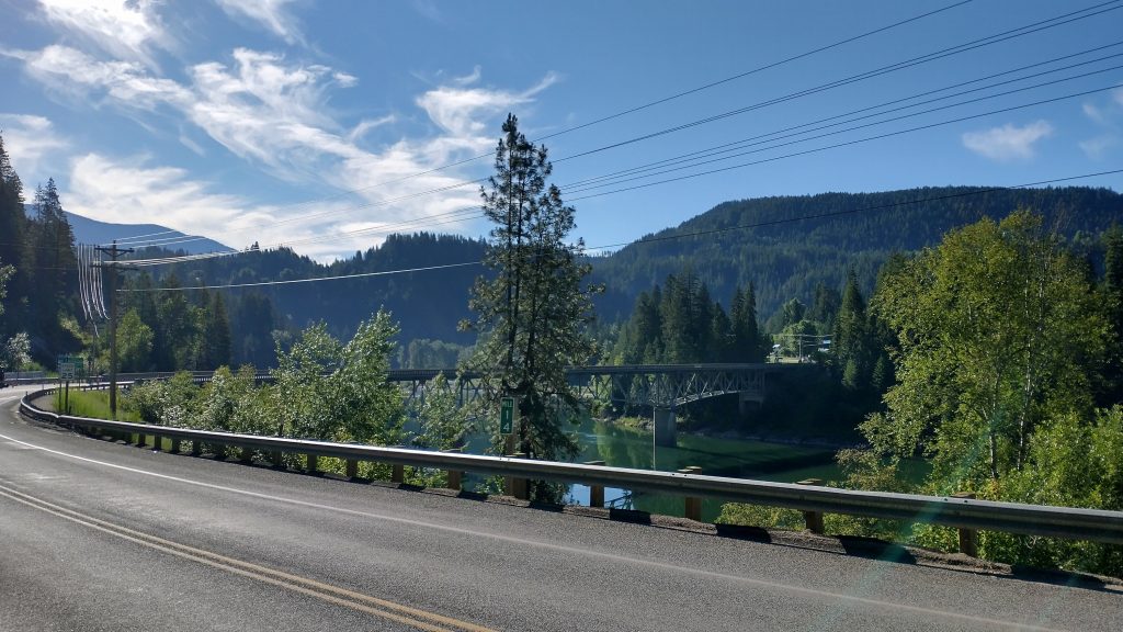
Other than the persistent insects, the walk was great. There remained hardly any traffic both in and later out of town. This was a highway described as one of the most dangerous road walks along the PNT. On a Tuesday morning there were a fair number of logging and chip trucks but the shoulder was wide and it’s not like I didn’t hear them coming. Super chill compared to the traffic in Miami…now that’s death defying!
I considered a shortcut that Buck30 had described in his journal from 2012. A power line ran straight down the hill towards town and would have shorted the road walk by about 2 miles. I walked to the edge of the corridor and looked down. While clear of big trees and deadfall, the passage was chocked with alders and brambles. Plus it looked steep as! Like break-a-leg steep. I have no idea how he managed to scramble up that years ago but I simply chuckled to myself and kept walking. One of my favorite quotes is from Pippin of the LOTR trilogy: “Shortcuts make for delays!” It’s so true sometimes.
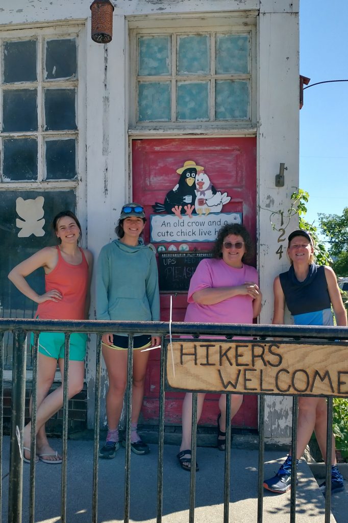
After a nice glide into town, across the river whose name I can’t pronounce or spell (Pend Oreille), I was at a loss with where to begin my chores. So I went to the cafe to think on it. Several plates later, I had more of a plan. A trail angel, Mary, offered her yard to hikers in need. She had a lovely set up, with chairs, a fire pit, grassy tent sites, a hiker box, and port-a-potty. My main objective was to wash the dog smell off my tent and any other offending gear. She provided a bucket and soap, and even had an enzyme treatment specifically for dog piss (she had an older incontinent dog herself). I tried just soap and water and that seemed to do the trick. I washed some clothing items and my pack as well. I was feeling much better after this.
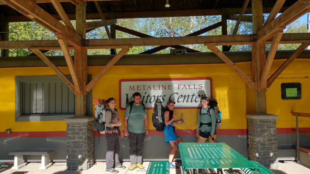
My other 3 hiker friends arrived and we spent the day chilling in the backyard. Mary’s family runs the small theater in town, so we got the low down on the movie showing business. Mary’s a tour-de-force and if not for that, this tiny town, like so many others, would be without its classic movie theater. They barely managed to make it work as it is, considering the astronomical prices big corporations like Disney charge for each showing of their products. Marvel movies cost as much as $1500 a showing. I had no idea.
We were on the fence about staying in town or hiking out a few more miles. Wolverine and I wanted to be staged well for the upcoming bushwhack section, so it made more sense to hike another 5 miles rather than doing 2 days of back to back 30s. We stayed in town as long as we could muster, relaxing in the park. We didn’t depart until after 6 pm but lucky for us, it was an easy road walk. As I mentioned before, the road had been described as one of the most dangerous but it was a breeze. Maybe 6 vehicles passed in 5 miles. I really don’t mind walking roads when there’s no traffic.
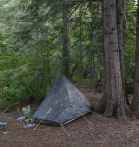
We arrived at a really nice forest service campground just in time. No one was there so we had our pick of sites. I found an amazing spot under a cedar and near the river. I still love ponderosas but cedars are a close runner up for best tree to camp under. Their duff is amazing…I barely needed my pad. There was also a primo long drop (tons of TP and spotlessly clean!) as well as stacks of firewood. The four of us could have had a fire if we hadn’t arrived so late. The bugs were pretty annoying too. Sashay found a tick on his tent mesh. Still, what a great campground! It would be a real destination spot for a family but for us it was just something that worked out great last minute. It wasn’t even listed as a camping spot on our Far Out guide\app.
On that side note, I have to say, the Far Out guide for this trail is really poor. It’s lacking any information about towns or even descriptions about parts of the trail. Following the red (or blue) line with GPS is obviously useful but the next best attribute are the comments…which we users provide for free! The company basically did little to no work but sells it as a stand-alone product, when it’s not. There are some politics going on I suspect, namely competing guide books for the trail and town stops. I wish there were a way for the app to incorporate the guidebook info and then give kickbacks to the authors for providing and keeping up with the info. This trail needs a lot of work in general but the resources could also be greatly improved.
Pend oreille! Pronounced pond..,