Thursday Apr 14th 2022, 0600-1800
Fivemile Pass Tank #2 to Corduroy Wash, EABO mm 126.5, Segment 2 mm 76.5.
25 miles.
It was another diverse day in terms of temperature and terrain. I recorded a low of 26 inside my tent, waking to sparkling ice crystals lining my walls. I slept cold towards dawn but considering that my quilt is only rated to 22 degrees, I think I did good. I could have still put on my puffy, which I instead had stuffed in my footbox to keep things warm.
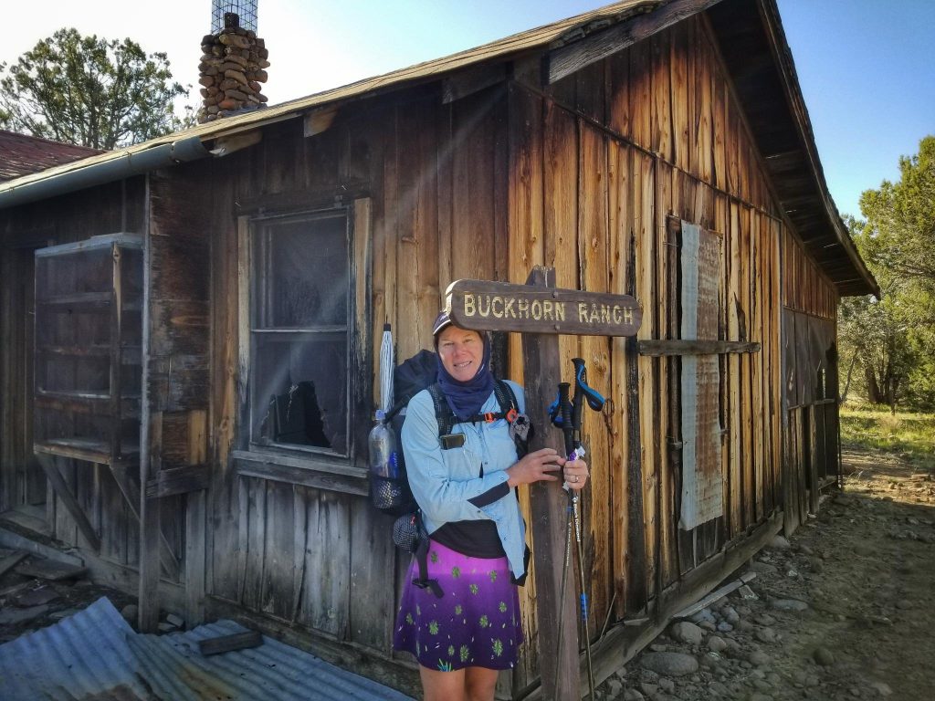
The morning took us through a maze of jeep track. Some intersections were marked, most not. It would be very hard to do this route without GPS. We stopped to check out an old ranch. The cabin was pretty cool and largely intact. Some hunters had recently signed the logbook. We promptly started following the wrong road leaving the ranch, realizing our mistake about half a mile in. We cut cross-country back to the correct road without much time lost. Morning water was found at a creek crossing. We were happy for the abundance of natural water sources throughout this section, saving us from having to get it from man-made stock ponds.
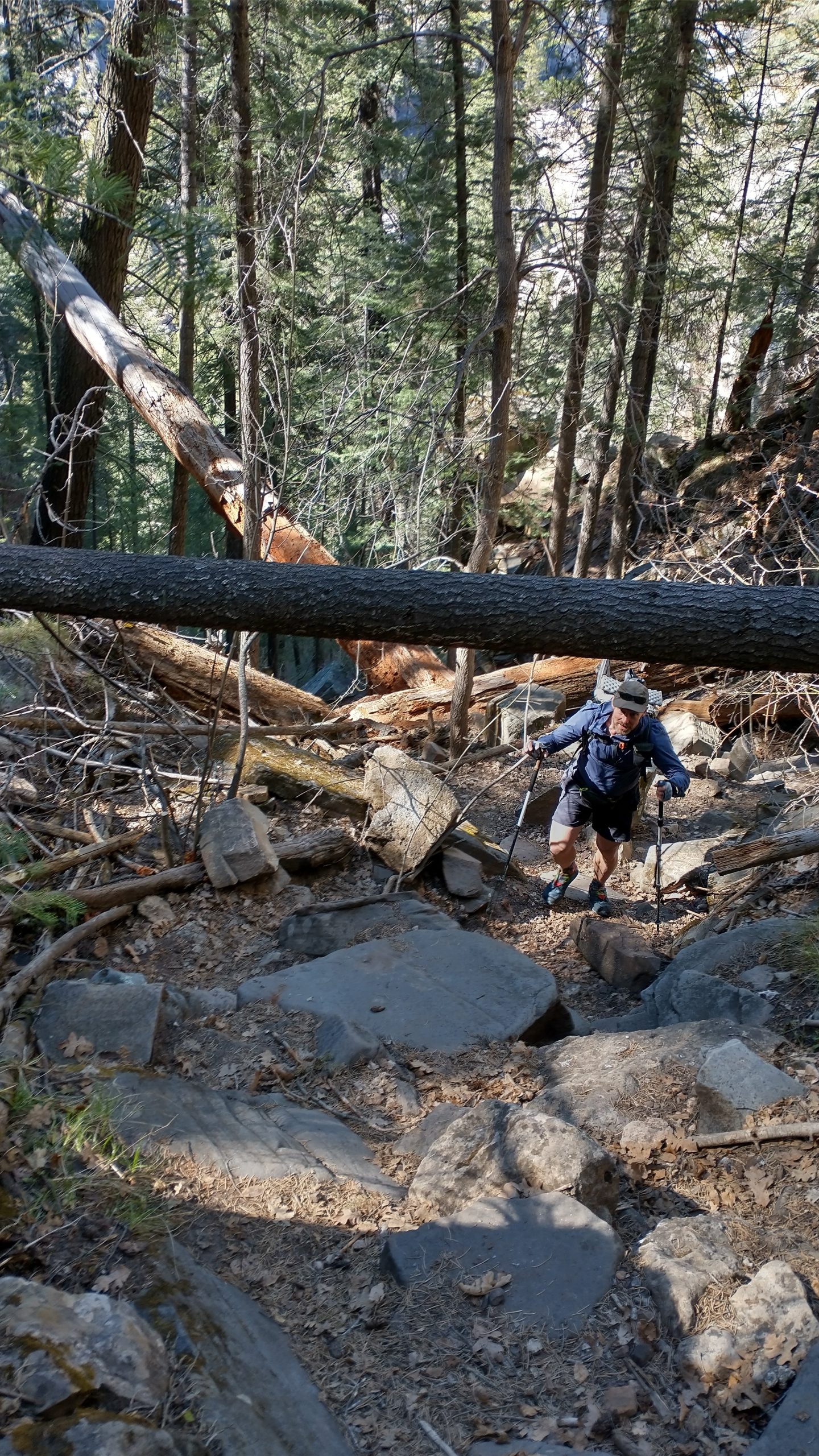
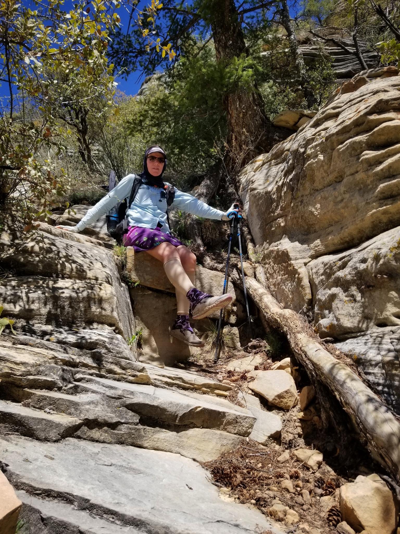
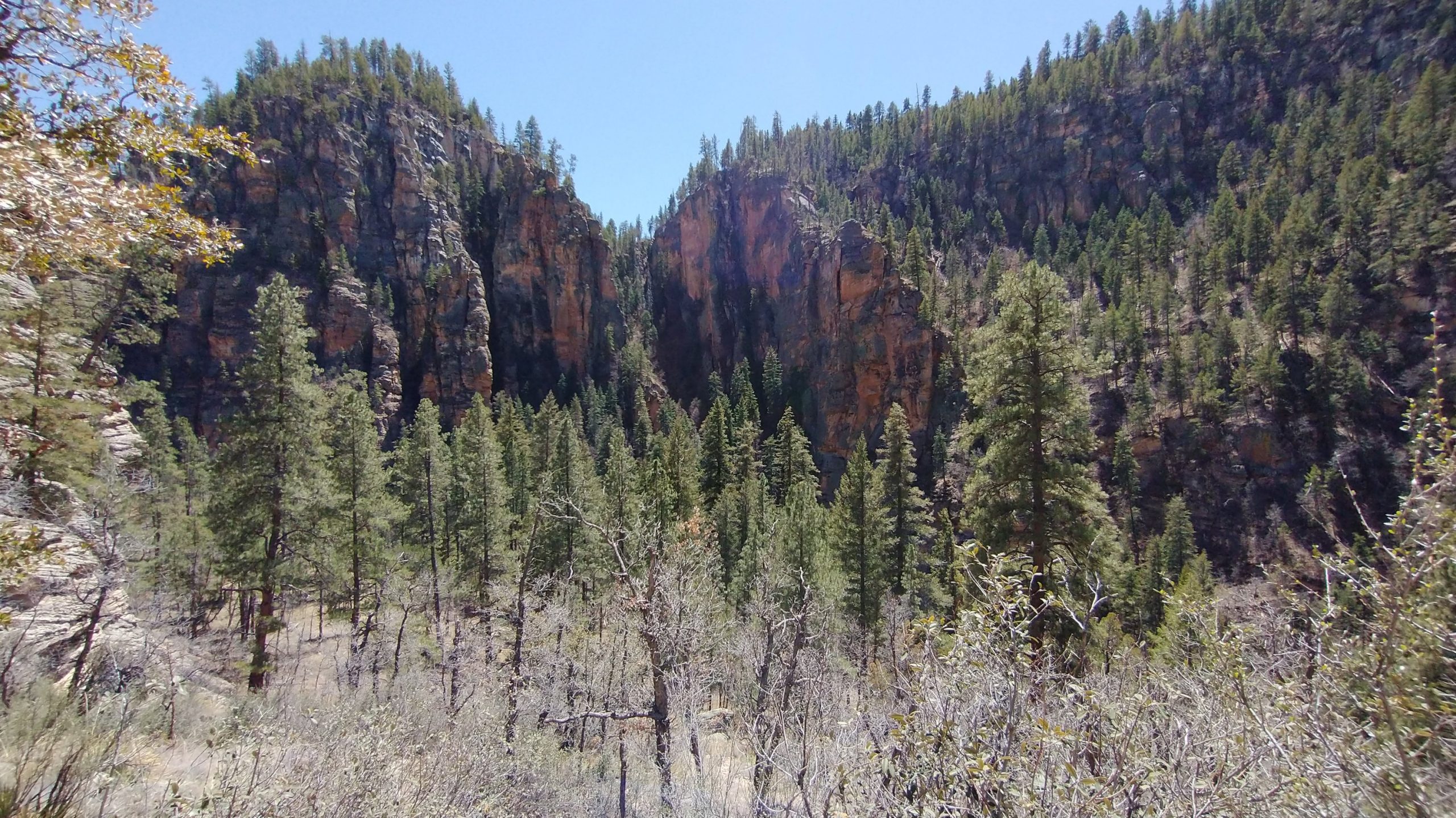
Around noon, we dropped off a high plateau to descend into a crack in the earth that is West Clear Creek Canyon. The drop was only half a mile in length but steep. It inspired me to sing the call of a canyon wren…the constantly falling notes that so match the image of a hiker tumbling down the rocks. The trail was cut nicely through the cliffs but required concentration. A wrong turn would lead the user to a cliff in seconds. Even when on trail, we found it necessary to downclimb several rock slabs. It was no worse than sections of the AT in Maine and New Hampshire and I enjoyed the challenge. The possibility of snakes being in the cracks did make me more cautious.
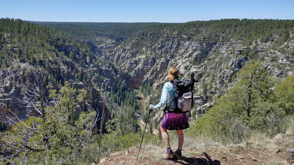
This being a much higher elevation canyon, there were giant conifers growing throughout. I had to hug one for a bit, relishing in its energy and longevity. The things these trees have endured. Flood, fire, rock falls… hopefully we would survive our very brief foray into their cataclysmic realm. To do so, we had to make our way about 2 miles down the canyon. I found this to be easier than had been described. There were pretty well defined social trails cutting along the banks, al la Gila river style.
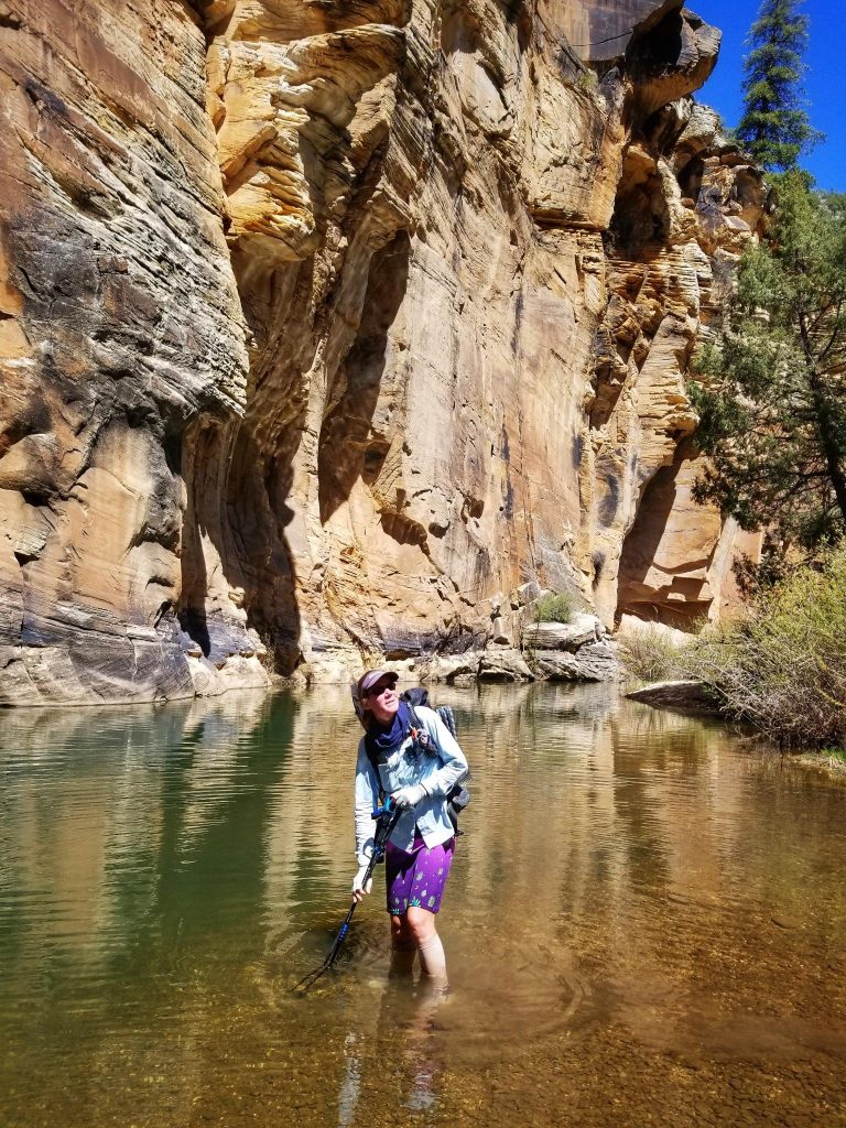
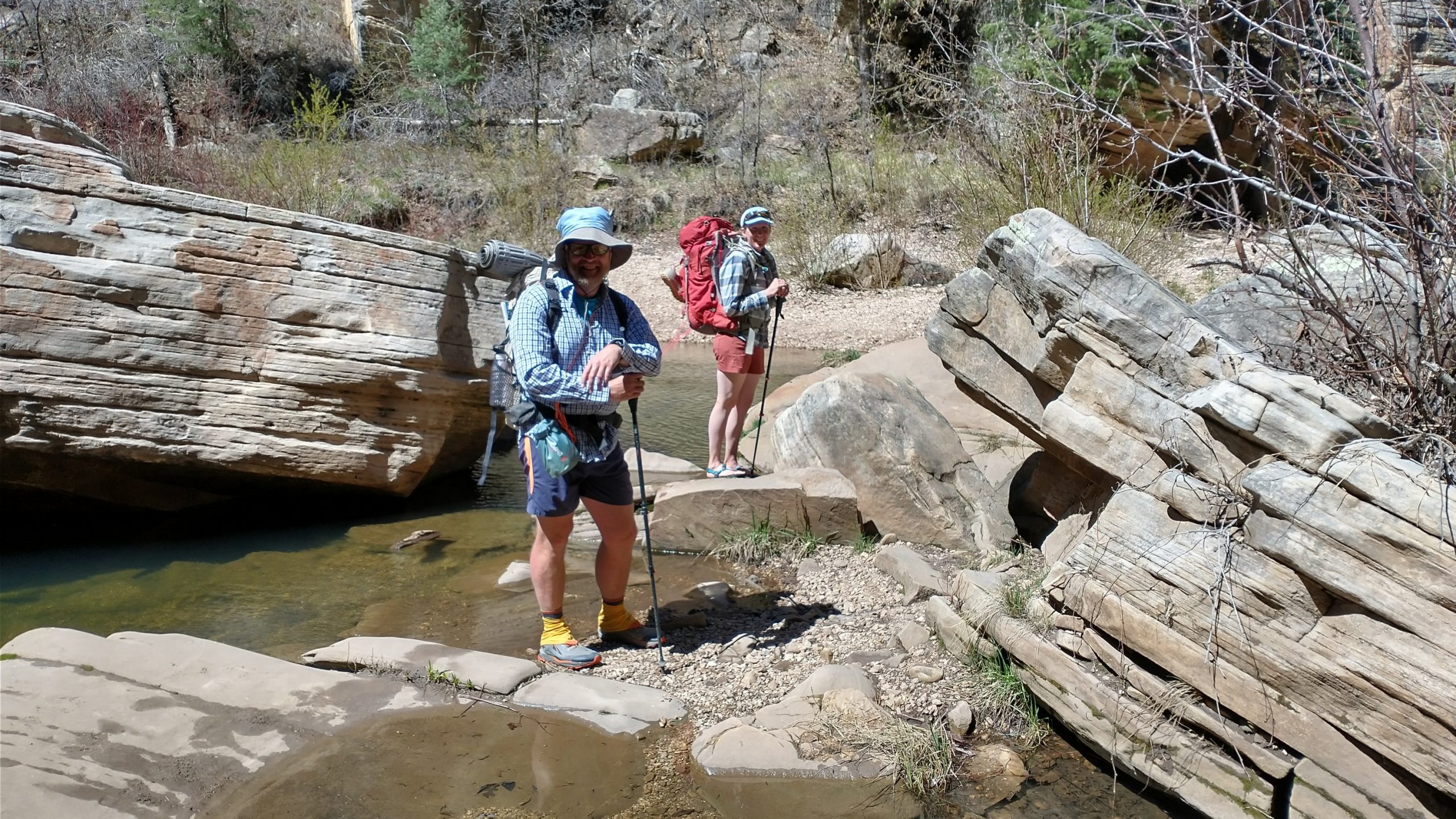
We waded through some thigh-high pools, pushed through brush, and climbed over some boulders, but made it just fine. The scenery was beautiful all the way. This was a very special canyon and we didn’t see a soul until we got to the exit point. There we found 2 backpackers, Pajamas and Cherry Tomato, from Fraser Colorado doing a loop hike out of Pine. They were as surprised to see us as we them. We gave them useful info on their route forward, ending their fears over reports of having to swim across the creek pools. Good thing, because the water was so cold. It was hard enough just walking through it. I could not bring myself to go for a dunk this day.
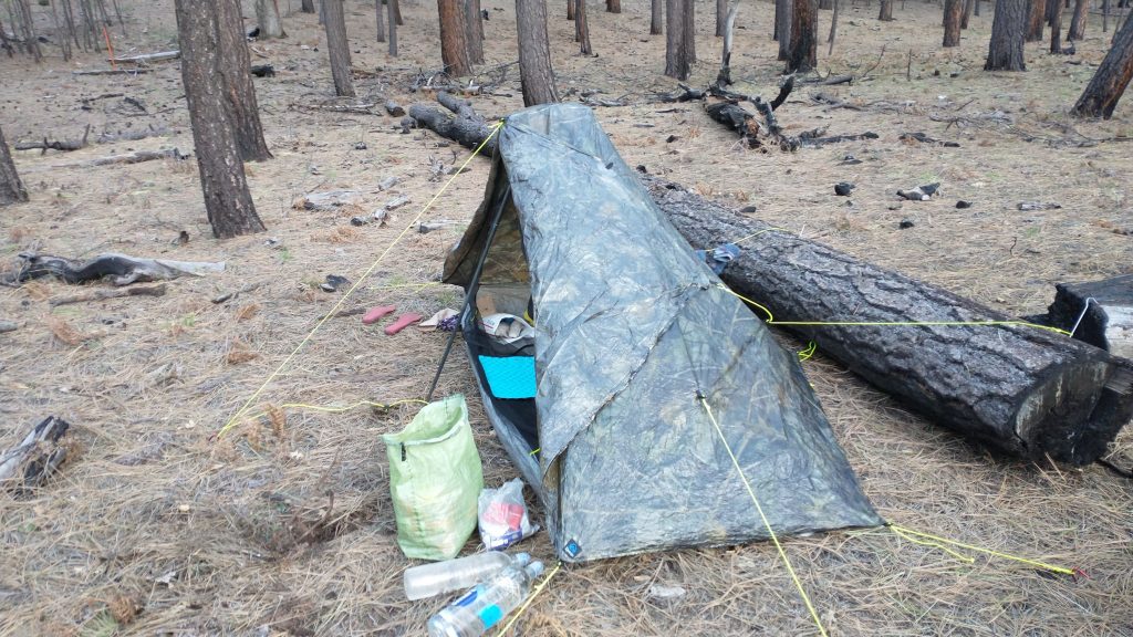
After a long break to dry our shoes, collect water, and eat a late lunch, we climbed steeply out of the canyon. The trail went up a gully full of boulders and giant logs. It was chaotic and fun, lasting less than half an hour to get back to the top. The rest of the day was on easy forest roads and then a 4wd track through a shallow canyon. We stopped early when I found a nice downed log to block the wind, situated in soft pine duff. I wanted to try for a warmer night and was very proud of my pitch.