Saturday Apr 9th 2022, 1300-1900
MRT Western Terminus at Parsons Trail 144 to Taylor Cabin-Sycamore Creek, EABO mm 14.3
14.3 miles
Well, it was finally back to the trail, which felt like a long time coming. Two weeks of travel preceded this start (as opposed to my AT start, where I hit the trail less than 24 hours after leaving my house). My hiking cohort for this trail, TS, was driving from the east, so I decided to fly to Denver in order to visit family beforehand. He picked me up along the way and we did a marathon drive from Canon City, CO all the way to my friends’ place outside of Phoenix. I dropped 3 food supply boxes along the way and spent a few days catching up with Jon and Laurel.
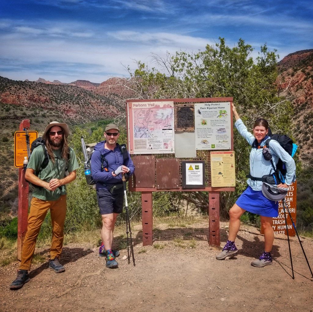
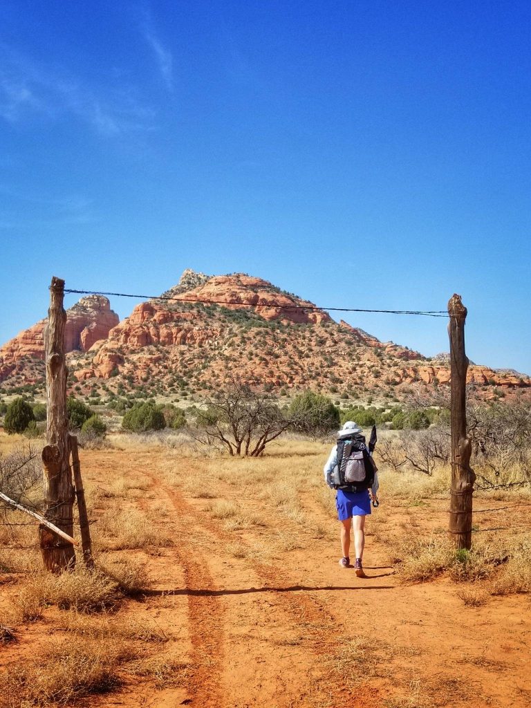
They were such a hoot to hang out with. Being local Arizonians, they always offered a wealth of insight and knowledge Jon had been my number one best Trail Angel for so many of my past hikes (PCT, AZT, GET). He’d graciously offered to drive us to the trailhead outside of Cottonwood. After a 2.5 hr drive from Phoenix, it was high noon by the time we got to the trailhead. Just before, we saw a hiker navigating the dusty road in-between cars. It was easy to deduce that it was 925, a thru-hiker that I just learned about the day before through another hiker, Coyote (who hiked the MRT in fall 2020 and was based in Sedona).
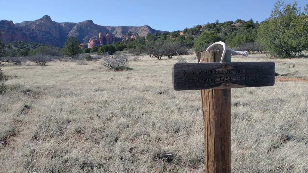
In perusing the FB pages and other sources, we had yet to learn of any other MRT hikers…until now. It was ironic that the 3 of us happened to be starting on the same day, same time. 925 actually began his hike from Cottonwood… 14 additional miles on dry trail and road. Had we realized that our schedules so perfectly matched, we could have offered him a ride. As such, he was tired and required a break at the creek. We gave him some water from the car and Jon took pictures of us at the trailhead sign. There’s no official MRT marker anywhere along the route. I should have printed my own. After all, Brett designed a very attractive emblem. Oh well.
We set off for a brief hike down to the creek, where I stopped to take my first desert dunking of the trip. I brought a mini digital thermometer for this journey. It read 90 degrees in the sun and 86 in the shade by the creek. Later I saw that it recorded a max temp of 98. Woof. But the cool water saturated into my clothes made it bearable. We bid goodby to 925 there, as we were both anxious to get some miles under our feet. It was 50 miles to our next stop in Sedona and I had (perhaps unwisely) only brought 2 days worth of food. With our half-day start, we needed to get something done this day.
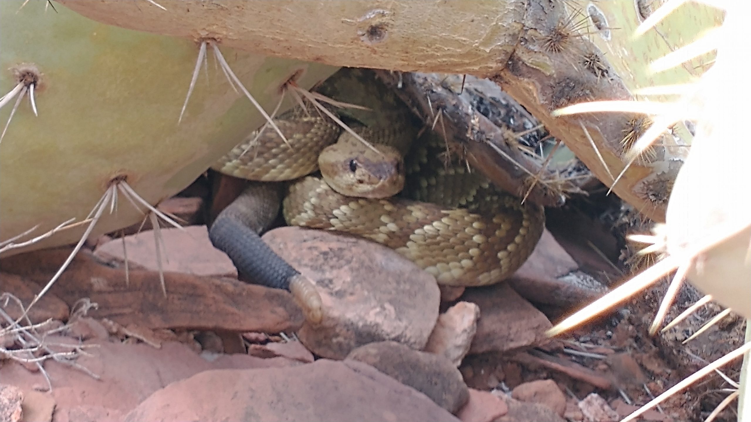
The trail immediately climbed out of the creek bed and gradually beneath the rim of the canyon. It was pretty good, with switchbacks and the usually rocky terrain that I’ve become so used to in Arizona. Within a mile, I heard my first buzzing alarm…the notorious signature of a rattlesnake. It was a beautiful green snake, which I mistook for the aggressive mojave species. In retrospect, the picture clearly shows that it was a black tailed rattlesnake. duh. According to Wikipdedia: Crotalus molossus is considered to be one of the most docile rattlesnakes because of its calm demeanor and curious nature. Bites are accordingly fairly rare. The snake relies mostly on camouflage to avoid discovery. It normally tries to slither away when confronted, but will rattle when cornered. This was exactly on par with my experience…it backed away under a prickly pear and reserved its rattling for the protection of the cactus spines. I got down low and zoomed in for some good pictures. What a nice snake.
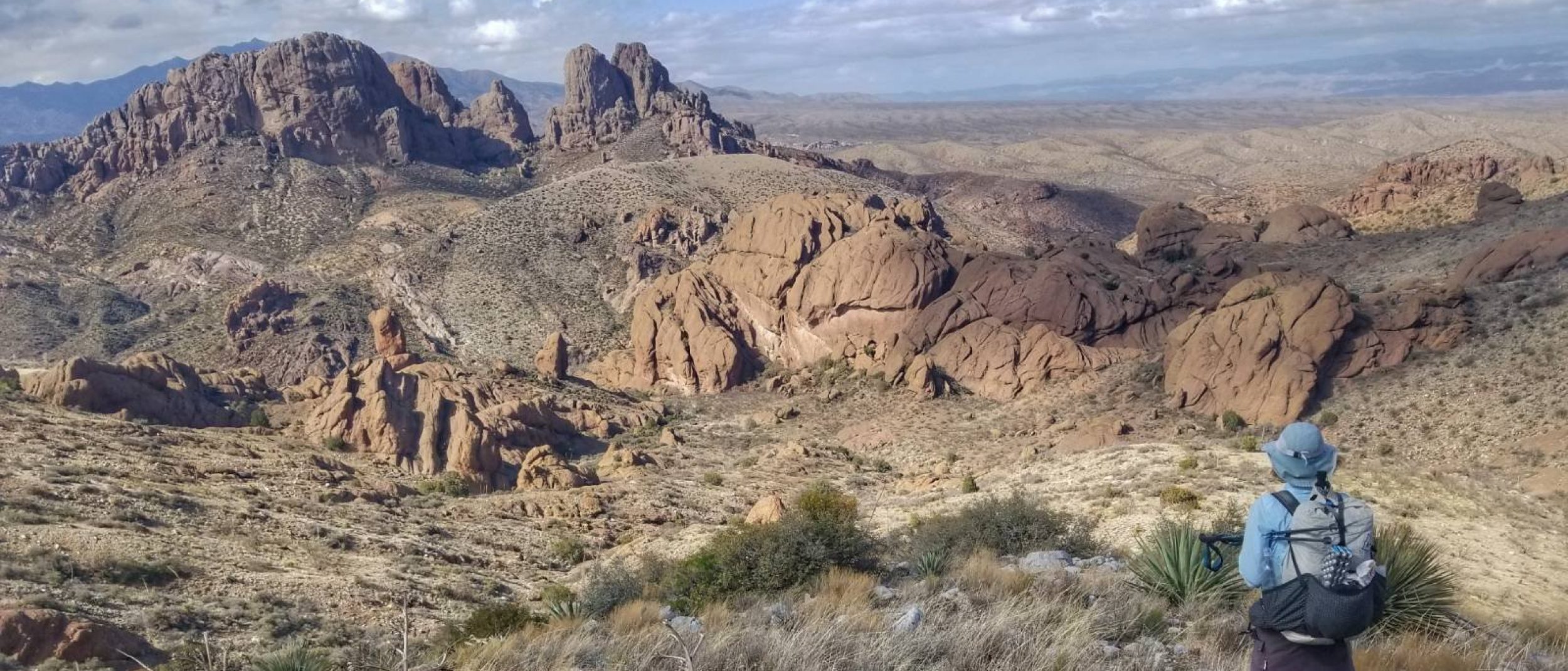
We continued traversing the red canyon rim, finally exiting through a small gully atop a large mesa. Red formations popped out along the horizon in front of us. I also caught glimpses of the San Francisco range to the NE, near Flagstaff. There lies the highest mountain in AZ: Humphreys Peak 12,633′. It was easy to pick out, having lots of snow on top still. We meandered through the juniper, finding faint trail here and there. Old footprints were barely discernible and we saw no other hikers all day. I flushed 2 jackrabbits and later a few cottontails. Those were the only other mammals I saw all day.
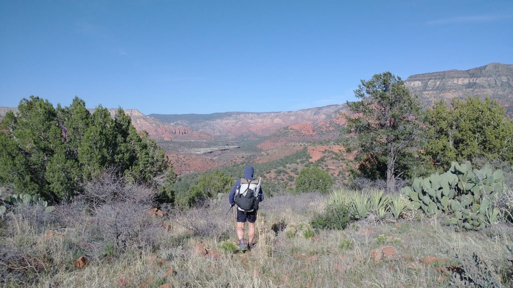
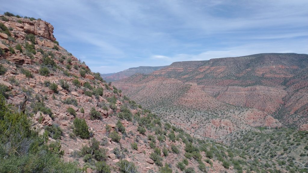
We passed a red silt cow pond…the only water in many miles. I had carried 2.5 liters from the start, barely drinking any of it since I had cooled my body temperature in the creek. Water weight carried in my clothes, until it quickly evaporated. The trail was mercifully flat and easy up top, gently dipping in and out of a few minor valleys. Then we descended back into Sycamore valley proper and journeyed along a bench high above the streambed. The trail was sometimes hard to follow as we entered a burn area that seemed fairly recent. I lost the trail as it crossed a large drainage and began to go the wrong way down the drainage. Luckily my spidy-trail-sense quickly kicked in and I only had to backtrack 50 meters or so. I have to pay close attention on these unmarked routes, which I find fun…I like such challenges.
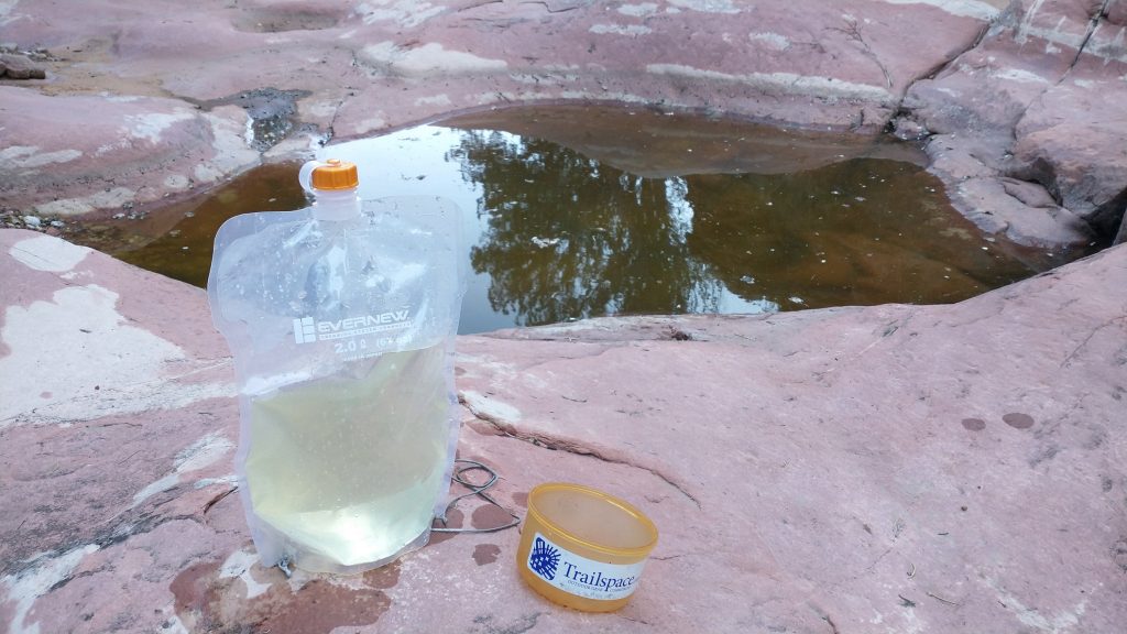
The bench brought us up and down through many side drainages, one of which was reported to sometimes have pools of water, called tinajas. I could use some extra water in this heat so we wondered down a ways to find a single algae-clogged pool. But the water scooped out pretty clear and was cold. I dunked my feet, which was enough to snap me out of the heat daze I was in. We’d gone 11.6 miles by 5 pm…not bad. It was tempting to cowboy camp right on the red slick rock next to the pool, but we figured we could go another few miles to where there was a cabin.
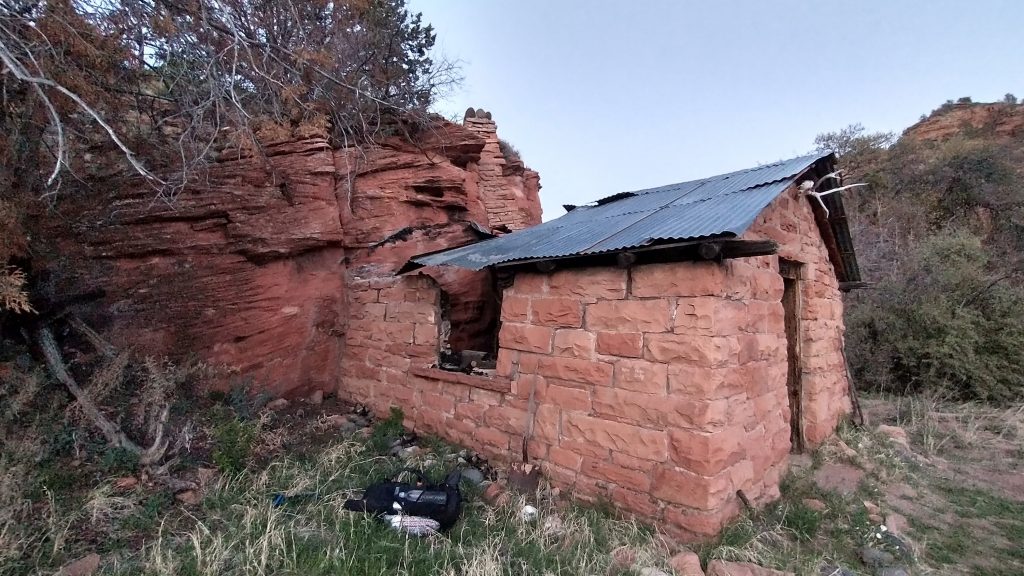
We found the cabin near the main wash, built into a rock face and providing a nice block from the wind. It made for the perfect setting for our first night. What a great day! The surrounding rock formations and canyons in this area are spectacular!
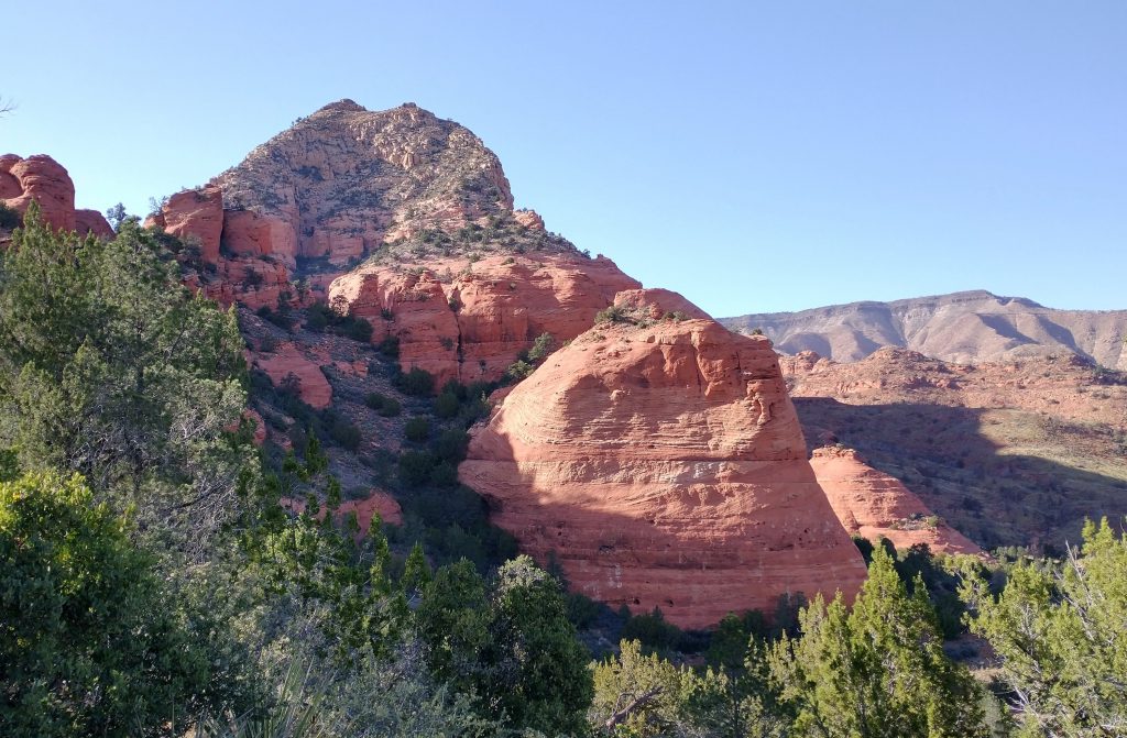
The Mogollon Rim is an escarpment ( long cliff) that marks the edge of the Colorado Plateau in Northern Arizona, running for a couple of hundred miles in a SE/NW direction. Blisterfree, creator of the Grand Enchantment Trail and Northern New Mexico Loop, and his partner Tree stitched together existing trails and roads into this roughly 500 mile route. I am grateful to them for their extensive efforts and for sharing!