Friday, April 21st, 2023, 0640-1830
Right Hand Collet Canyon to Grosvenor arch
25 miles, elevation 6230′
It was 25 degrees under the trees and 23 degrees in the wash in the morning. Three nights prior, the low had been 60 something. I’d never been on hike with such temperature swings, except maybe the GET and MRT. There was one benefit to the freezing temps: the quick mud in the creek was quite firm to walk over, making for easy travel for a few miles. But I still wished it would warm up some. It was supposed to be back in the 60s by the end of the day.
I thought we only had a few miles left before beginning an easy road walk up the canyon. But I read the map wrong and the ‘road’ was actually just an old pack and mining trail. There was almost no remnant of it left, but we were still able to follow it here and there. Mostly we continued in the wash, gradually having more near-misses with quick mud as it began to thaw. Finally I sunk a foot in… it was kind of like walking over snow and then postholing. We came to a spring where it looked like the sidewall of the canyon was pissing water…that’s because it was. There were stains of dark red and one sniff of the water revealed the high iron content. It reminded me of the disgusting water from pitcher pumps along the Florida Trail. No thanks, I passed. Besides, there was still plenty of water in the creek.
The wash became very tedious because of all the thawing quick mud, but then so too was trying to find the old road. After nearly 20 miles of walking in this canyon, I thought I’d be better at spotting the most problematic mud, but nope, it still surprised me now and again. TS went higher on the canyon bank at one point and I stayed in the wash, finally resigned to having wet and muddy feet. Within minutes, he disappeared entirely. I wasn’t sure where he was intending to go, since he never communicated with me about his diversion. But I assumed he was trying to keep his feet dry and find the old road again. I checked the map to see that it eventually came back to the wash about a mile and half up. Rather than backtracking to try to follow him (which would have put me further behind and out of sight), I just stuck with the plan, which was to simply follow that canyon until we hit a forest service road.
This was the most solo time I’d had on the Hayduke and it was certainly a change in pace. We’d previously made an agreement to stay in sight of one another along the cross-country portions of the route, but I wasn’t too worried about his deviation. That is until I looked again at the map to see that the topo lines got pretty tight in the wash. I suddenly became concerned about being delayed or stopped by a large pour off. After all, I had no beta about this canyon, so I fretted as the walls became higher and the stream bed very narrow.
Fortunately, there was nothing more than some rockfall, creating a small waterfall that I was able to climb up the middle of. My shoes were thoroughly soaked by now, so I began making a point of walking directly in the stream. Finally I learned the secret of the canyon: embrace the wet feet! Wherever there was water running, the bottom was firm. Sloshing through the ankle-deep stream but not sinking to my ankles in mud was wonderful. I’d discovered the zen of hiking Right Hand Collet Canyon…about 20 miles too late. I also got to witness a really cool phenomenon. By 10 am, things had warmed up quite a bit and the snow had started melting. Suddenly, the stream turned muddy brown and rose by a few inches. I was standing in it when the surge rolled over my feet. This is how flash floods appear, but this surge was more subtle and harmless. The remnant patchy snow melt wouldn’t rise to dangerous levels in this smaller canyon. It was just fun to see the change.
I met up with TS just as he arrived back at the canyon. We were lucky that our paces and routes had been similar, but I briefly pondered what might have happened if one of us had been delayed by an obstacle. Unfortunately it was one of several such events I’d ponder more in the days to come. I continued my path of enlightenment in the creek bed, while he continued to try to dodge the water, but at least we remained in sight of each other. Eventually we came to a left turn in the canyon where the creek bed was dry. I named it Left Hand Collet Canyon. Just half a mile later, there was another surge of melt water. Then another left turn (lefter Left Hand Collet Canyon) and again from dry to snowmelt surge. I was really enjoying the end of the canyon, even as it got more tedious. Eventually there was no way of avoiding wet feet, so I was glad I’d given in early on. I thought it was very cool that I’d followed the entire canyon to the headwaters …a day and a half of hiking. The spirit of the Hayduke was in exploring out-of-the-way canyons that few had seen, so this alternate felt in following with that.
We celebrated coming to the forest service road, which we thought we’d be on for most of the rest of the day. We took a long lunch break, drying our shoes and socks a bit. We were pretty high in elevation, with spots of lingering snow all around. The road walk was a welcomed respite from having to navigate, scramble over rocks and jump across mud. We put in headphones and zoned out. We collected some more water running from a culvert, which was good since it became very dry after that. At the top of a long hill, we noted that we needed to go cross country again for nearly 5 miles. I was grumpy that my perceived road walk had just turned back into slow, meticulous travel. But at least we didn’t overshoot the transition and do extra miles.
Fortunately the cross country was pretty easy, once we found the right ridge to walk down. Then came a pretty straight-line wash. It had hard-packed sand and just small rocks and stones to step around. It was amazing the variety in wash consistency and quality. I gave this one high marks for being fast and easy, not too side-windy. Pretty soon we were back on another road, rejoining the red line at mile 73. Our alternate, which had taken us less than 1.5 days of hiking, significantly cut short the official route by about 36 miles, almost exactly half the distance. But I really enjoyed it, so that’s what matters. It was unique and different.
We had only 5 more miles to knock out to get to our desired destination. Grosvenor Arch was a pretty remote attraction but one that came with a pit toilet and picnic tables. Those are 2 things that make a thru-hiker pick up the pace to make it to a campsite…if the miles work out. They’re not necessary but a nice treat. Only problem was, we needed water. One of the washes we crossed (Wahweap) was flowing but had terribly brown silty water. We’d noted this was the problem with snow melt. In a big enough drainage, it was too silty.
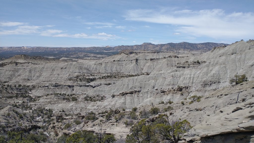
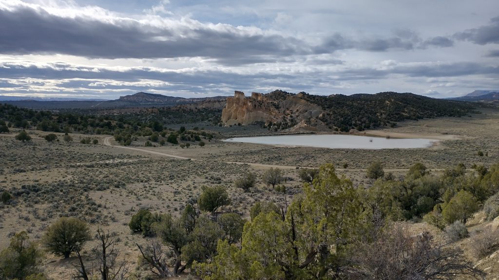
We hoped to find more water but if not, I knew I had just enough for the night. Plus our 3 gallon cache was only 3 more miles the next morning. We climbed into a geologic fortress called the Coxcombs, which reminded me of the hogbacks around Boulder CO. We had great views back across the terrain we’d walked all day. As we came around a bend just before the arch, we spotted a huge reservoir. It was usually reported to be bone dry, but in this very wet year it was filled to the brim with pretty clear water. It had been nice not to really have to worry about finding drinking water on this notoriously dry hike.
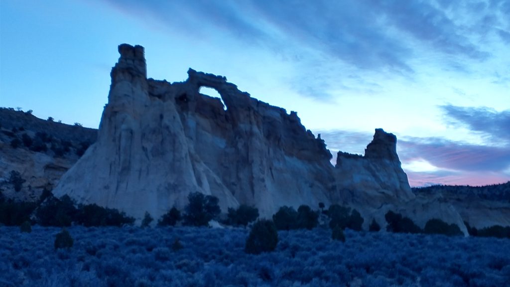
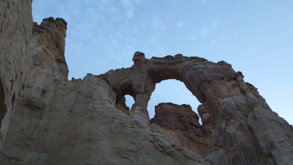
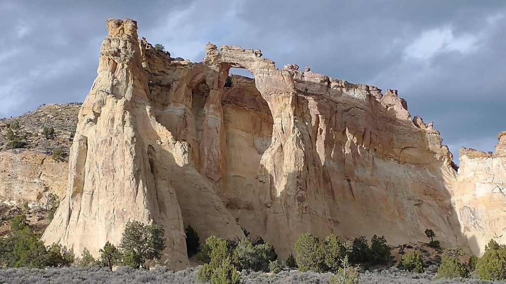
We were also hoping for another kind of beverage, often associated with vanlifers and rednecks parked at out-of-the-way places. It was not to be, though. There were about 4 or 5 vehicles that came and went as we got to the arch. People were only parked long enough to snap a few photos and jump back in their cars. A couple of guys with fancy cameras stayed for awhile, capturing the arch in the best light. They asked me what I was doing (how far I’d hiked) but clearly didn’t believe me when I told them I’d walked from Moab. That’s either a conversation starter or ender… definitely the latter in this case. Oh well, they didn’t appear to have beer to yogi anyway. I was just happy to have a place to sit that wasn’t on the ground, covered in cow shit. Plus it had a view!
We cooked our dinners in style at the picnic tables, visited the privy, then found some sites away from the parking area. As usual, I settled into a small wash under a juniper for my camp. It had been another long and hard day, but fun. At least I was plenty tired and slept well at the end of each day. We were the only ones left and the night was dead quiet.