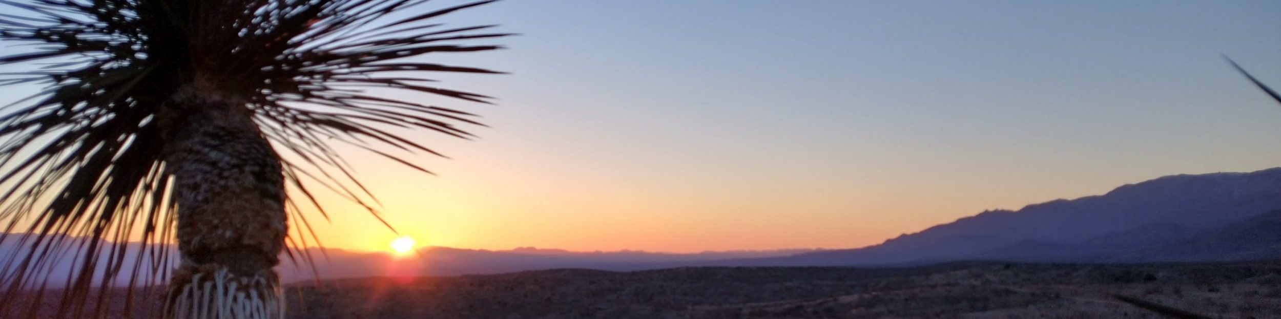
Saturday, April 22nd, 2023, 0640-1800
Grosvenor Arch S8 to Round Valley Draw and Hackberry Canyon confluence.
21.5 miles (but only 9 official trail miles), elevation 5750′
I got an early start so I could take more pictures of the nearby arch. The light wasn’t as good as the night before but I did manage to catch some of the sunrise. We walked a little ways down the road to our cache, which we’d originally intended to leave by the arch, but couldn’t make it all the way due to the road being muddy, icy, and covered in snow. In retrospect, this was a good thing, since I’ve learned that burying food in the vicinity of people and picnic tables is a recipe for rodent encounters. Things had changed greatly in 3 weeks. The snow was gone and the road dry and grated. It was passable by about any type of vehicle.
We dug up our bag of food, thankfully undisturbed, and located our water from behind some rocks. We moved down the road a ways so we could repack in the sun. The wind was blustery, with the temps starting in the low 30s. At least it was considerably warmer than the morning before. We hoped to meet a car on the road to take our trash and jugs but had no luck, so we just strapped them empty on our packs.
We came to Round Valley Draw trailhead and signed the register. Only 7 Haydukers were listed before us and of those, I knew 2 were no longer on the trail. We continued down the wash, coming to a large crack in the earth after a mile. This was when our roundabout of the day began. I’d read that the initial drop into this legendary slot canyon was now a lot harder due to 100 year flood conditions the fall before. A log jam that provided a ramp as well as rocks and sand had been washed away, making the drops deeper and harder. The first was about 10 feet and didn’t look too bad. But right after that was another, dark and deep and very difficult to tell just how bad from where we were standing. I figured I could make it down the first drop, but maybe not back up if I couldn’t get down the second drop.
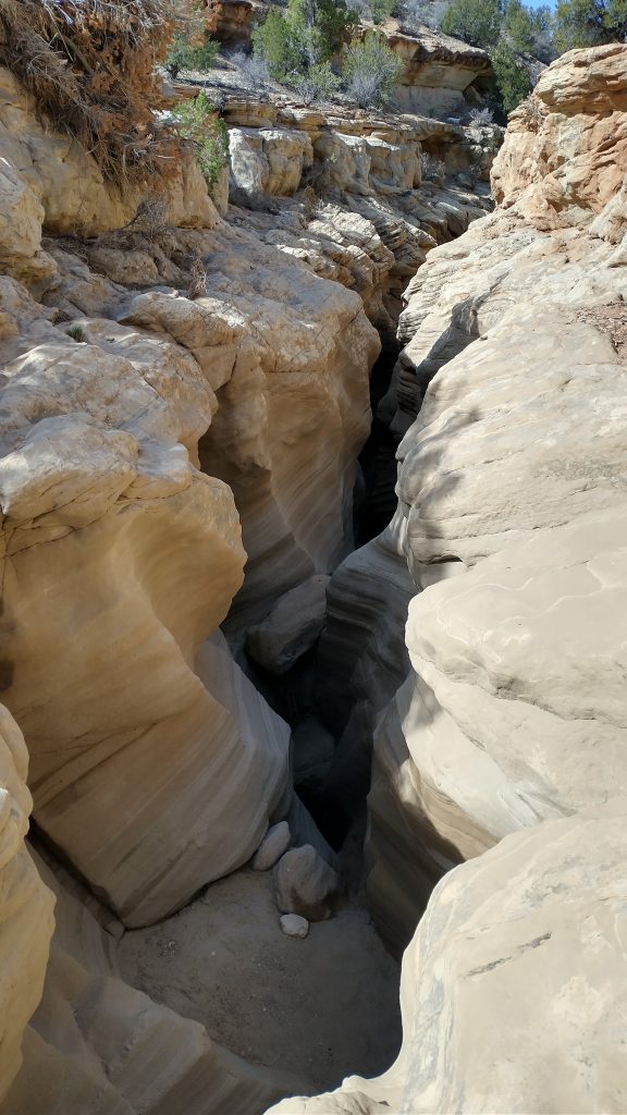
With my knee a little tweaked from a weird move I’d made 2 days before, I decided not to risk it. Trailcrew (another Hayduker and very competent thru-hiker of other trails) had reported a side entrance farther down, but I couldn’t remember if he’d noted the left or right side. The left seemed the most logical, so we began following along the top of the rent in the earth, as it silently pulled us towards it. Such gaping holes created their own special gravity. The crack became bigger and bigger and we had to climb ever higher to escape its orbit. I spied a side canyon on the map that might go all the way down, just past the confluence with Hackberry Canyon, coming in from the north.
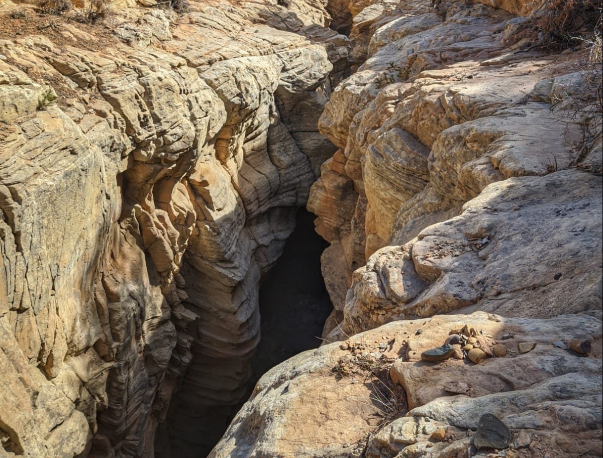
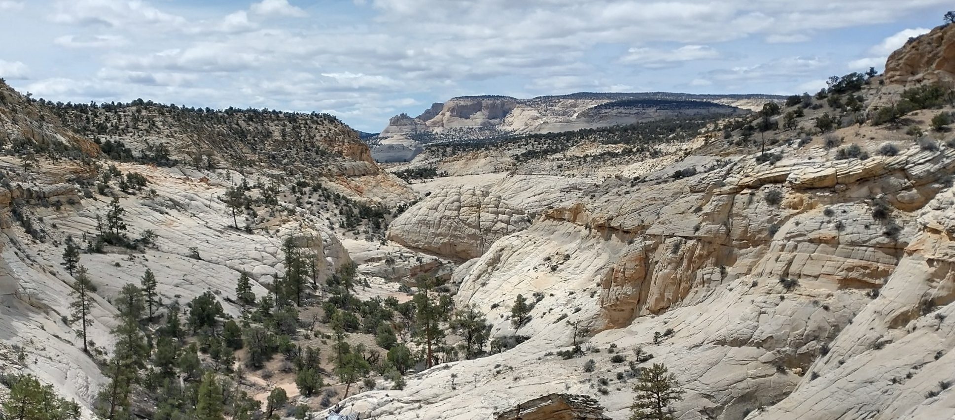
It sure did go down, just not at any angle we could contend with. Unfortunately this wasn’t revealed until nearly the bottom. We pretty easily went down through an area of tight topo lines at the head of the side canyon. The top rock was crumbly so there were some scree fields we could descend. But at the very bottom were giant, rounded sandstone mounds…sheer cliffs. Oh well, we tried and got to see a really beautiful side canyon as a result. We had lunch there, feeling somewhat defeated but at least having a nice view. The climb out was taxing but luckily nothing we couldn’t easily do in reverse.
From there, we decided to cut our losses and go back, figuring all the further side canyons were probably cliffed-out (they most definitely were). It was a good call, but still a long ways to backtrack through the convoluted topography. We briefly discussed either heading in a straight line towards the trailhead or contouring along the canyon rim, the way we’d come. We agreed that retracing our steps was probably best, and so I proceeded as such. I was moving a little slow, trying to avoid cryptobiotic soils, and noticed TS getting farther ahead and off to the right, seemingly having changed his mind to head in a straight line. I was confused and having a hard time keeping up, so I figured it was best to stick to our original plan. “Go the way you know” is a mantra I often fall back on, and which seemed especially pertinent upon finding myself unexpectedly alone in the desert for a second day in a row.
Except I really wasn’t clear when and where we’d meet up again. At lunch, we’d discussed going back to the drop into the slot canyon to give it a second look. Retracing our steps would have led us past the mouth, about a mile before arriving at the trailhead, so this all jived with our plans. But now I had no idea if he still intended to give it a second look or go straight to the trailhead? The ambiguity in these ever-changing plans this day had me worried.
Retracing my steps along the canyon rim was a good call. The terrain and landmarks were all familiar and easy to navigate. On the way, I hoped to find other hikers near the slot opening so I could ask them for beta on the drops. Perhaps someone might have even set up a rope. Unfortunately the place was dead quiet, even on a Saturday. I didn’t run into anyone else all the way back to the trailhead. I was then surprised to find it empty, with no signs of recent activity. I wondered how I could have arrived before TS when I was moving so much slower and had taken the longer way back. In my mistrust of the situation and our breakdown in communication, I went so far as checking for his footsteps leading away down the road, but found none.
I sat in the shade to wait, but our split had me pretty rattled. It really struck me that I couldn’t even trust that my hiking partner had waited for me at the trailhead. Why shouldn’t I think that he might have just continued on, as he’d just done earlier this day and the day before? It had suddenly become a really troubling pattern, one that made me doubt our cohesiveness for the rest of the hike. They day went from being a pretty nice, typical one to one of a lot of uncertainty and stress. I felt a lot of guilt and ownership of the situation, since I was the one most reluctant to downclimb the drop into the slot and had also steered us wrong when it came to finding the side canyon entrance (I re-read Trailcrew’s notes later and it was on the right side…oops). But this still didn’t warrant being left behind.
After a few minutes, TS arrived, obviously surprised to see me there. We didn’t speak further about our agreement to stick together, but we should have. Fortunately we had another option, which we should have considered from the get-go. If we went further down the road to the beginning of Hackberry Canyon, ultimately our goal anyway, the upper canyon was reported to be very easy and non-technical. So we walked the 1.5 mile road from the trailhead back to the main road, arriving at the same point we’d been some 7 hours before. All told, it was about an 11 mile round trip going nowhere. But you can’t say I didn’t try! Well, I did feel rather defeated that I didn’t investigate the drops further, but they did look a bit sketch. This was the first instance where my skills really weren’t up to par for this route, and it shook my confidence quite a bit. But another lesson I should have learned from this situation was that there were other options, and success was all about being prepared and knowing what the other options were.
We walked the main road for another few miles and at least were able to flag down a nice couple from Oregon to take our jugs and trash. They also offered us a ride to Tropic, but I was pretty hellbent on finally getting into the canyon and back on track at that point. We turned off on a jeep road which brought us all the way to the mouth of Hackberry. I didn’t have much beta on this alt and so I didn’t know what to expect. Thankfully, the wash into the canyon was a cakewalk! The sand was very compact and flat and the canyon walls just tight enough to be pretty awe-inspiring. I was very pleased with the final result of the day, making it easy to forget our earlier struggles…at least for the time being.
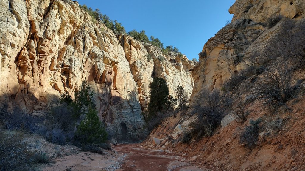
We made camp right at the confluence of Hackberry and Round Valley Draw. This way we could go on a side trip up RVD in the morning, to cover what we’d missed. It was a very nice campsite…no water but flat and scenic. We didn’t get very far down the official trail this day…just 9 miles, but I guess we made up for the time ‘wasted’ by taking the alternate out of Escalante. We still had plenty of food and water and were in no rush.