Monday, April 24th, 2023, 0650-1945
Lower Hackberry Trailhead \ Yellow Rock alt. to Paria River 0.5 mile south of Sheep River
20.5 miles, elevation 5230′
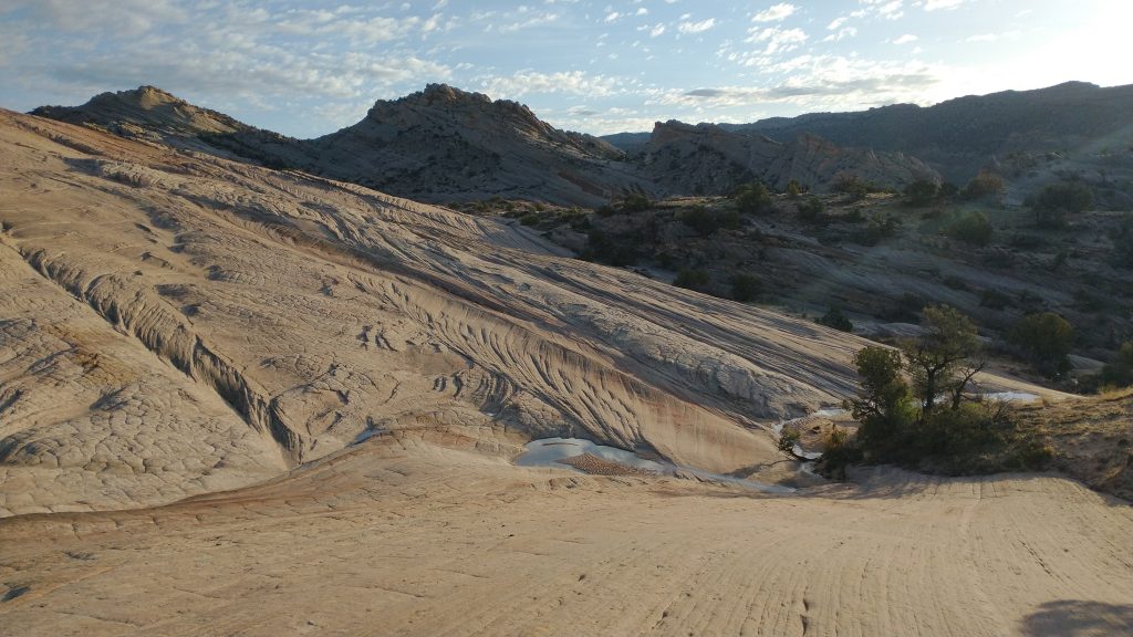
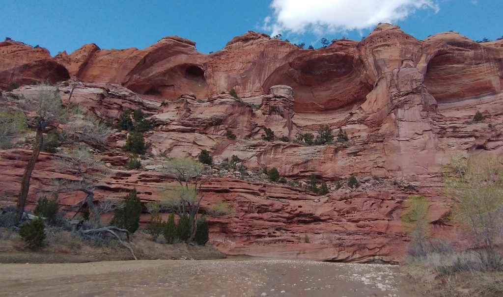
It rained for awhile overnight, but only lightly. The wind really picked up several times but luckily the trees kept me sheltered. Everything was pretty damp and covered in sand in the morning. Still, I felt like I’d been extremely fortunate with hardly any precipitation during the journey, mostly just a few nights when I was already in my tent. I couldn’t complain. We got ready early and immediately started up the alternate trail to Yellow Rock. This was one of many alternate attractions suggested by Jamal Green on his page Across Utah, and as usual, it did not disappoint. It was a giant dome of yellowish and orange sandstone, with a rise was gentle enough that I could easily walk to the top. I reached it under perfect light conditions, with the sun just warming the brilliant colors…yellows, oranges, reds, pinks, and whites. It was a beautiful slab of sandstone.
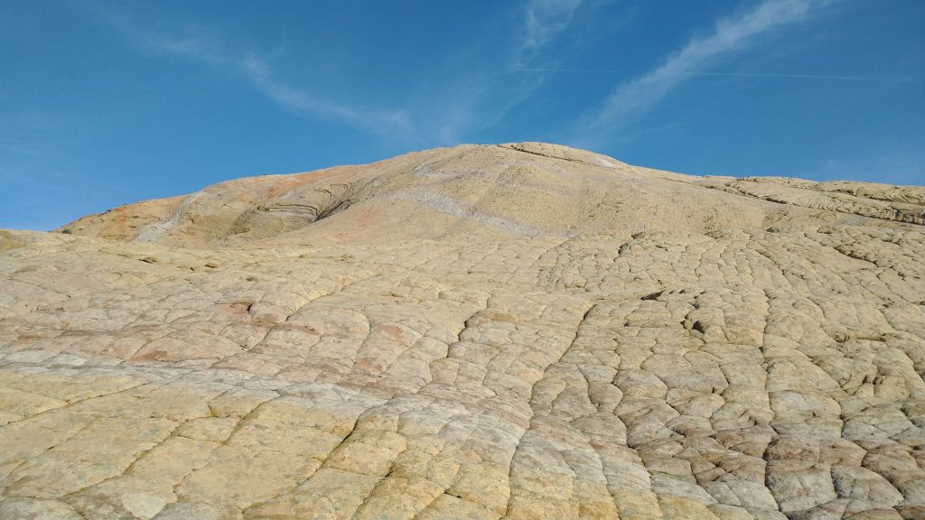
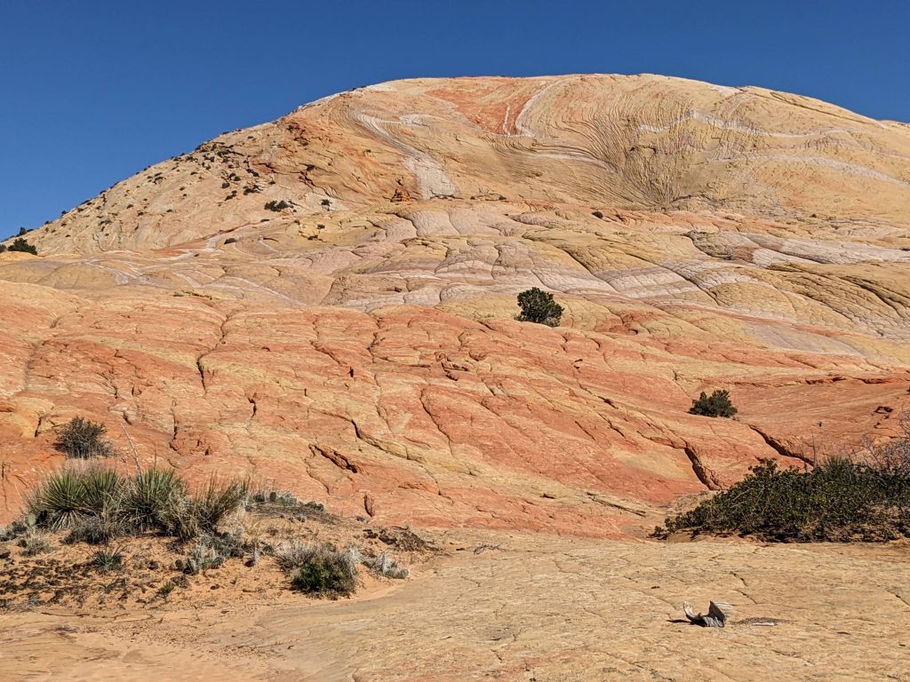
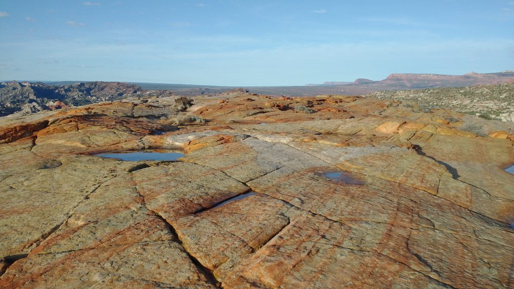
All the colors, textures and wavy lines were amazing. As a bonus, there were many potholes full with fresh water from the recent rains, reflecting the sunlight like so many mirrors. I was also very excited because I could see all the way into Arizona, including the Kaibab Plateau, still covered in snow. It seemed like it hadn’t been that long ago that we were in Moab and now I was looking at the outskirts of the Grand Canyon.
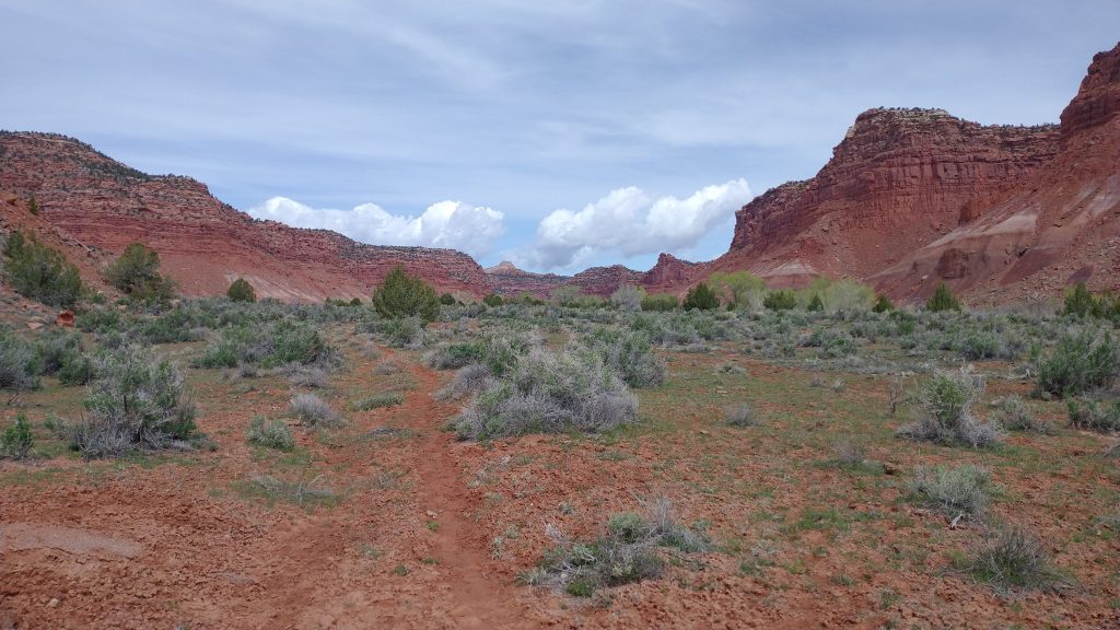
We stayed on top for awhile, playing with our phones (service!). I also looked at my peak finder app, trying to note significant points. There were a lot of “nipples” in Utah. We finally came down, going cross country across several drainages until we came to an old cattle trail leading to the Paria River. We’d followed Hackberry Canyon south for 20 some miles, now it was time to follow this river upstream for about the same distance. The Hayduke didn’t go in a direct manner but rather loved to follow canyons up and down, like in a V or W-pattern. We could have walked the road from Grosvenor Arch straight into the town of Tropic, bypassing all these beautiful canyons and saving 30 some miles, but we would have missed out on a lot.
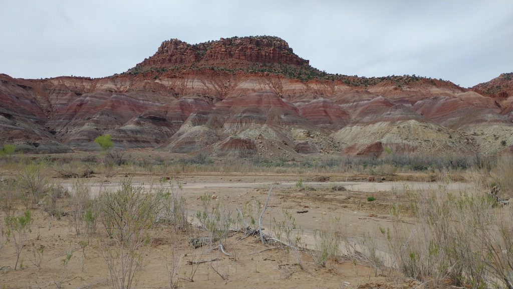
The Paria drained portions of Bryce and the mountains to the north, so I was afraid it might be running high from the snow melt. It sure was very silty, a light chocolate brown, much like the Dirty Devil. But the water was pretty shallow and the bottom firm. The river also was frequently braided, making the crossings even easier. We had to cross so many times, I didn’t bother keeping count. Probably something like 50 or 60 times. Even though there wasn’t much quick mud, I still managed to find a spot or two that got me worse than any canyon yet. I sunk almost up to my knees once but I just lunged forward and crawled out, laughing. It’s not like how it’s shown in the movies, where it sucks a whole body under in seconds. But it was fascinating, hard to tell where it was and once spotted, it reverberated like jello when tapped with a trekking pole. We encountered it so much, it just became another curiosity, not something to be feared.
We did a ton of side trips in the afternoon. First we searched for evidence of the old Paria town site, but found only a few traces. Nearby was also an old movie set location where they filmed tons of westerns, but the set was no longer there. We passed a hiker sitting near the river while we were walking up high on a bench. He looked like Mac but we didn’t see how it was possible that he caught up to us, given our shorter alternate days before. We waved and he waved back. We kept going since we planned to take a lunch break just around the bend, figuring whoever it was would come by us then. Of course it was Mac, hiking fast like a man possessed. It was funny that we pulled ahead so many times, yet he always came surging back. Our bubble had been keeping pretty much the same pace since Moab.
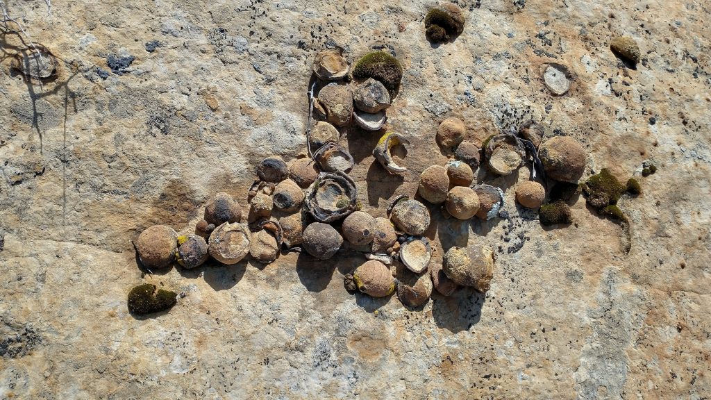
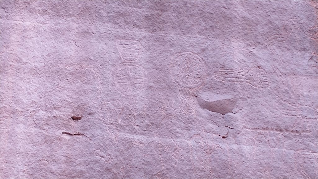
We took our lunch break at Hogeye creek, collecting clear water from a side stream. Mac continued on, hopeful to get to town by nightfall. We had more side trips planned. The first was a petroglyph panel at the mouth of Deer creek. They were really cool, with various intricate designs we could only guess at. They must have been spectacular 1000 years ago. These special places usually also came with cowboy-glyphs or graffiti: white male names and dates from the late 1800s and early 1900s. Depending on how old the native art was, it could often be out of reach as the cliff sides eroded away. But sadly some of the cowboy graffiti was carved right over the top of the ancient artwork, as if their egos needed to be reassured. Ergo, some Mormon dudes boring name was more important than a fantastical design of an eagle or snake by our early ancestors. I wondered how much of this beautiful artwork was lost due to such misguided mindsets? Dick swinging is what it was, as if the white colonizers hadn’t already taken enough and destroyed so many traces of Native American culture. I didn’t find the cowboy graffiti interesting, I just found it sad.
Our next stop was at Crack Pipe spring, whereby there was a crack in the canyon wall where water spurted out. Some genius stuck a PVC pipe a ways into the crack and voila, water spigot! It was absolutely gushing and since the area was miraculously also free of cow pies, we decided to have our dinners there. It was a really nice spot, long known by evidence of all the cowboy graffiti. We pushed on, still having 2 side trips on our agenda and it being nearly 7 pm. At Lone Rock (big isolated rock pillar in the river), we climbed the hill a ways to a balanced rock formation. It was cool but our late arrival didn’t allow for much time to be spent there. I noted more cowboy graffiti etched on the rock…of course.
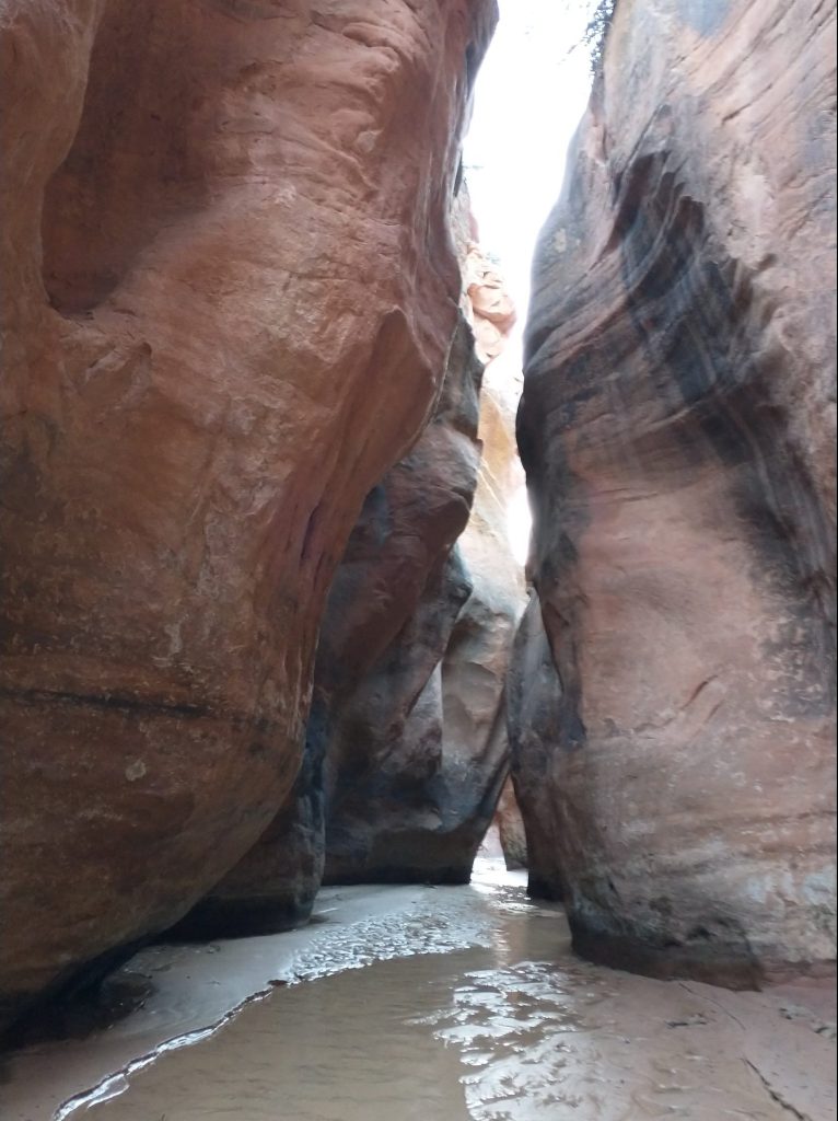
Our last stop was Asay (ACDC) canyon. We went a very quick distance up to see the slot portion. It was short and sweet, very fun and worth a side trip. But the quicksand in there was kind of crazy. I got into a few patches where I wondered if I might get stuck. It felt like I was walking on jello, then a foot would sink in, and it was time to start spinning to get free. At least it was all sand and not mud. I don’t know why that was better, it just was somehow.
Tourist Missions accomplished and sunset only half an hour away, we began an earnest search for a campsite. I found a nice place under some cottonwoods, sheltered well from the wind that had picked up. The frogs were really loud as I settled in for bed. A mosquito also came buzzing by but never even landed. They were such a joke in the desert…so far. Even in this wet year, I think the cold temps had kept them in check. It was nice to be able to keep my screen door open until I went to bed, but I made sure to zip and lock it soon after. For many miles I’d been pondering what kind of ROUS’s might lurk in these canyons. I’d imagined Hackberry Armadillos and Paria Meerkats. Yes, I know these things weren’t actually rodents but they were still quite dangerous to hikers. They had glowing red eyes and were just waiting to pull a hiker under water or swarm them next to a side gully. One always had to be on the lookout and hope their tent held them off at night. Maybe that’s what happened to those dead cows…
Sky’s dad here, really enjoying this blog, completely caught up now. Thanks for doing it…it helps me ‘see’ what Sky and Leah have been doing.
Sky’s Dad! Thank you! I feel so honored. They have spoken so highly of you 🙂 Parents are probably 90% of my followers, ????