Thursday, April 13th, 2023, 1030-1915
Hanksville\UT 95 Little Egypt to Under The Horn S5
21.5 miles, elevation 7700′
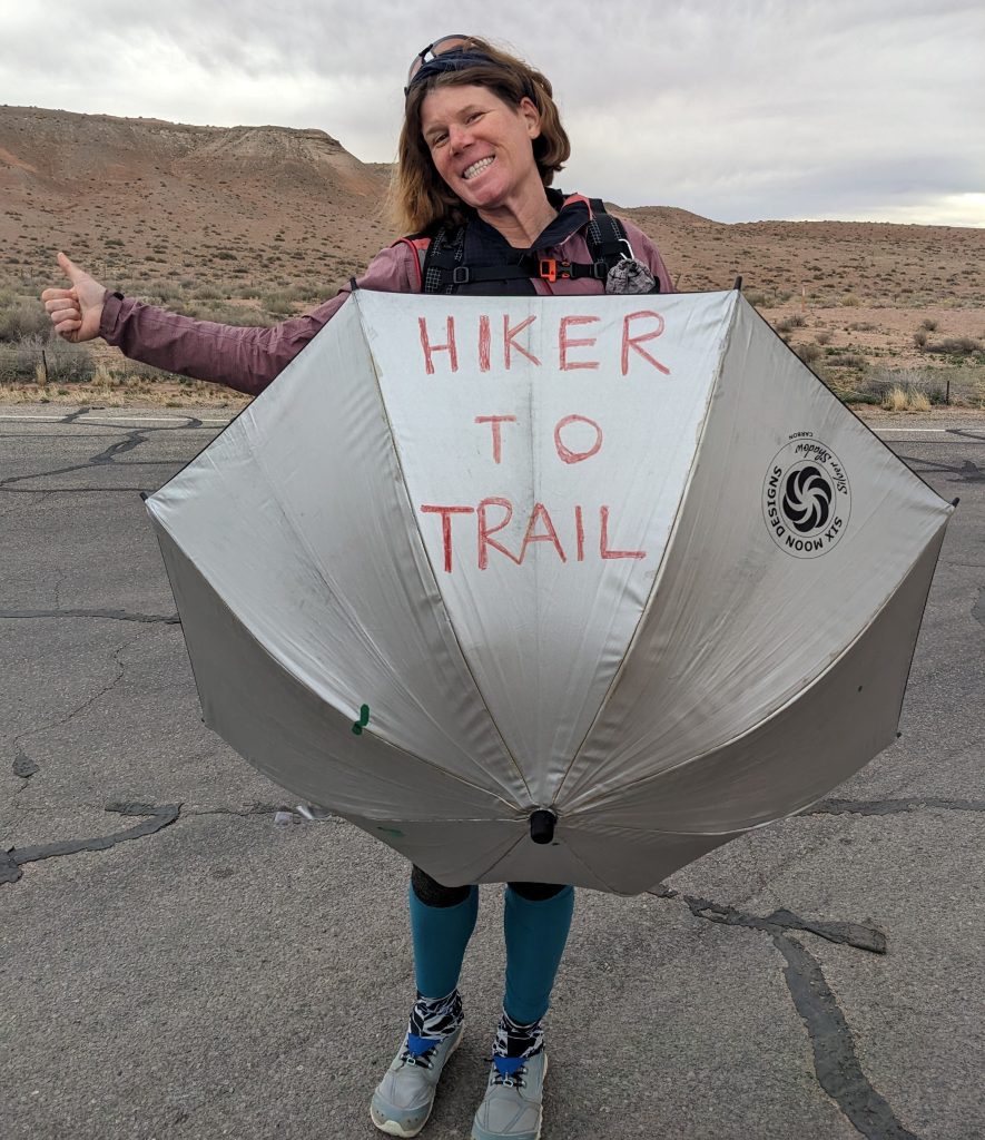
I was still trying to get so much online work done in the morning that we got a pretty late start. I intended to be hitching by 8 am but it turned into 10 am. We also hoped to get to the road before Sky and Leah, so that there weren’t 4 of us trying to get a ride. But of course we were all ready to leave at the exact same time. Lucky for us, a local with a pickup stopped. Connie was driving south on her route to clean all the federal land privies on the way to Hite…which included the same privy we’d used to store the boxes in our vehicle so that we could sleep in the back, the week we were setting our caches. Thanks to Connie, it was a very clean privy, so much so that we’d considered sleeping inside. She told us some horror stories about the messes she’d had to clean, though. Not an easy job!
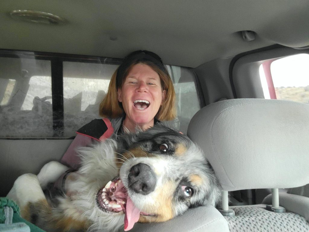
I sat with her dog Captain in the back, one very attention-loving Australian Shepard, who was adorable but didn’t smell great and was shedding like crazy. Connie confided that he’d been rolling in sheep dung all morning. The other Leah also sat in the back, but only one of us liked dogs (bad encounter growing up). Captain sensed this and tried so hard to win her affection, pawing and snuggling. I had to keep pulling him towards me and he ended up on my lap, snuggling turned into smothering. I was so covered in hair…and probably sheep shit.
Connie dropped us off at the road that goes to Little Egypt, a cool rock feature. This was an alternate start for us. We’d been considering a route up Ragged canyon but Connie warned us that there might be a lot of snow and we didn’t want to do any more canyon scrambling in snow after Fable Valley. We considered following Sky and Leah up to the Copper Ridge road that went around the east facing side of Mt Ellen and south to Pennellan pass. But the elevation profile showed that route going over 9k’, which didn’t sound like a good idea to me. The snow had been over the top of our vehicle when we’d been at that elevation a few weeks prior. Plus the sky had really gotten cloudy and it looked like it could rain or snow.
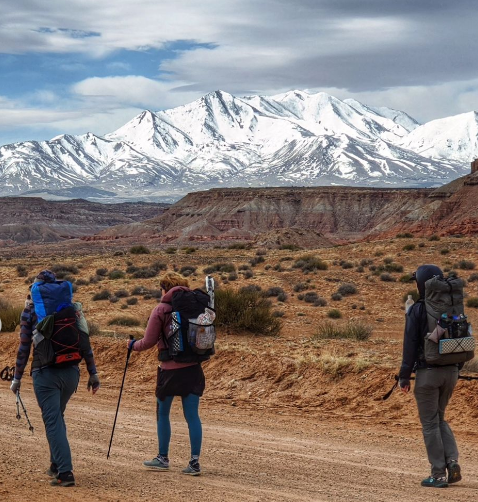
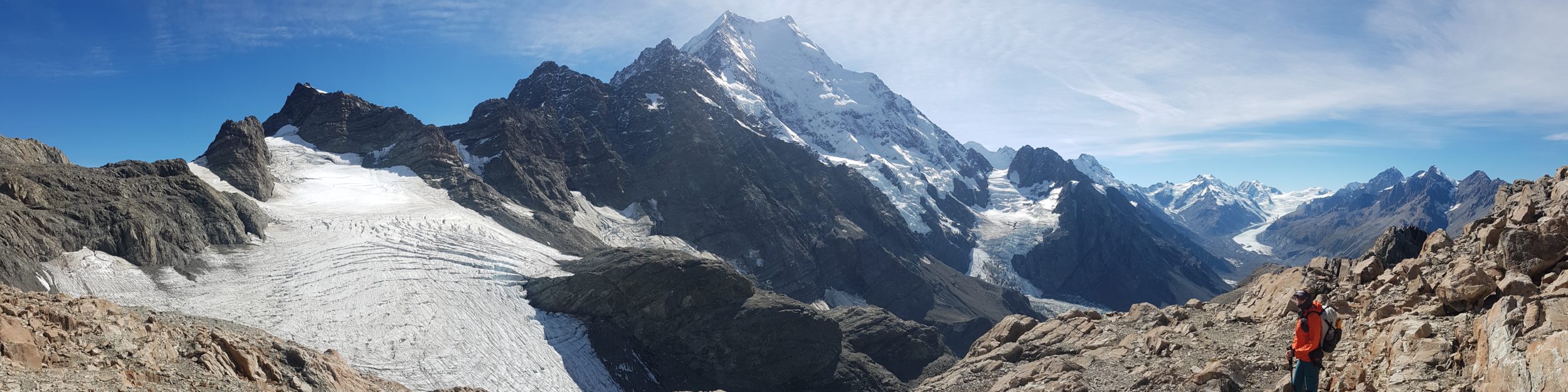
We’d devised another road route that was almost 6 miles longer but only went as high as 8100′. I voted for the extra miles but hopefully easier road walk. After all, it was merely a choice between road walks at this point. It was pretty dull for about the first 8 miles. We walked really far south, almost past Mt Pennell. And of course we walked straight into the wind, which was strong enough to almost double our effort. We passed some interesting chinle red rock mounds but that was about it. The snowy Henry mountains were stunning to look at as they loomed closer, if not a bit daunting. We climbed for hours on the 4wd road, not stopping for a break because we hoped to get over the pass by the end of the day.
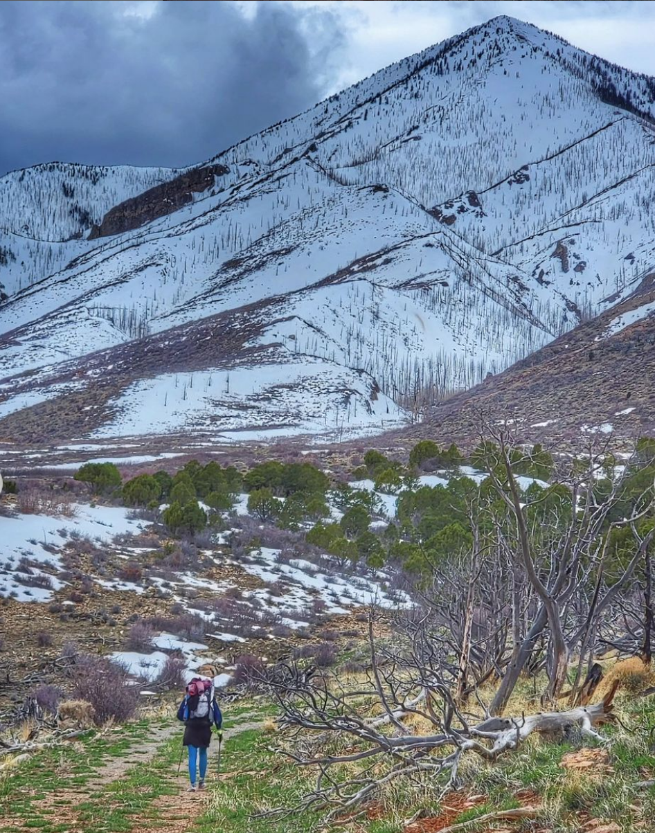
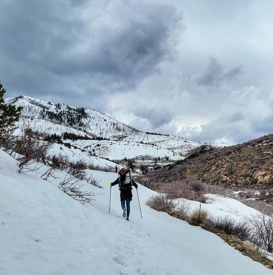
We hit snow on the road at 7300′. I started up about 10 feet and postholed every step. I felt exhausted after just that short distance. TS suggested we just walk cross-country up a south-facing ridge, which was a much better idea since the snow was mostly melted. Plus, it cut off some distance from the switchbacking road. But I was still tired and realized I must be bonking a little since we hadn’t stopped for a break all day. I chugged some electrolytes and recovered pretty quickly. We eventually had no choice but to walk the snowy road, but at least I was able to do some stretches without postholing. We took some more cross country shortcuts where we could, too. I cut across a steep ravine, which was fun to foot-ski in the snow and then mud. But the snow came up to my waist when I sunk in.
We found a great stand of ponderosas near Gibbon springs, with plenty of snow-free campsites. But it was only 5 pm and if we continued on, we’d at least go down a few hundred feet in elevation. We collected some water coming from the snow melt…it was so cold it turned my fingers numb. Travel got a little easier as we approached a peak called The Horn, but it was clear we couldn’t make it all the way to Pennellan pass in one day. We’d have to camp up high, so we started searching for a strand of trees.
Most of the east-facing side of Mt Pennel was burned, so live trees were scarce. But we found a few junipers and pinon pine to fit the bill and settled in. I had to do a lot of excavating to remove rocks from my semi flat spot…I even used my trowel. But I ended up with a pretty good site…so many of my campsites had been what I term “creative pitches.” I liked the challenge of a creative pitch but this night, I just wanted to burrow in my quilt as fast as I could. A few days ago I was melting from the heat and now I was back to freezing. There were seemingly no ‘Goldilocks conditions’ on the Hayduke.