Saturday, April 1st, 2023, 0630-1800
Arches National Park: Devils Garden to S1 mm 11.7 BLM land.
17 miles, elevation 4,300′
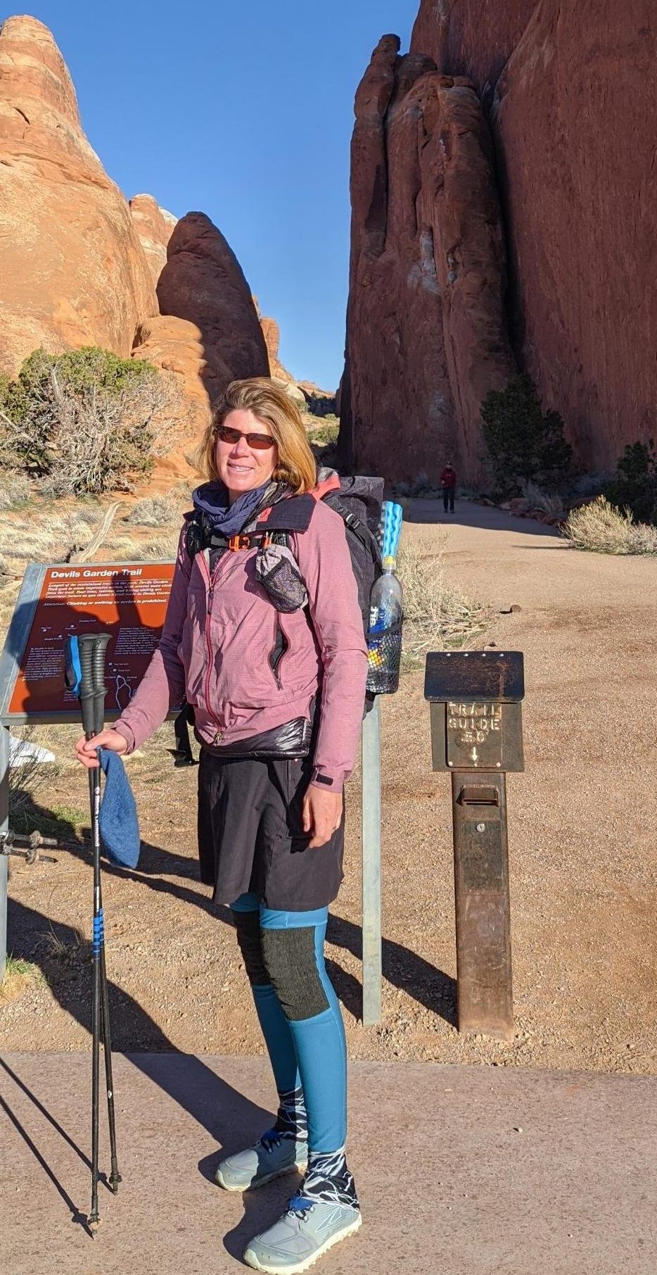
After all the planning, running around, and fretting, it was finally time to start hiking this trail, er, I mean route! It wasn’t too cold overnight and I slept really well…with earplugs to drown out the highway noise. We were up and moving before it was barely light. We walked 2 miles on a bike path to get to the park entrance. A nice lady picked us up just beforehand but her timed entry permit wasn’t until 9 am. Just our luck, the timed entry requirement had just gone into effect this day…go figure. The ranger asked her to turn around and wait but let us go in, since we were on foot. But now we needed another ride, as it was 18 miles on the road to our starting point. We stood at a pull-out for a few minutes until a LE ranger came and told us we couldn’t hitch in the park. I tried the excuse that we were just trying to be carbon neutral, but that didn’t fly. So back out we went. I was feeling grumpy having to walk half a mile back to where we’d just gotten a ride. I saw a Tesla approaching and figured we didn’t have a chance. I’d dreamed of getting a ride from a Tesla for years but it seemed to be one of those cars\drivers that never picks up hitch hikers. Perhaps my carbon neutral argument rang true, because wouldn’t you know it, the Tesla stopped! Then equally perplexing for me was how to open the door, since I didn’t know how to work the flush handles.
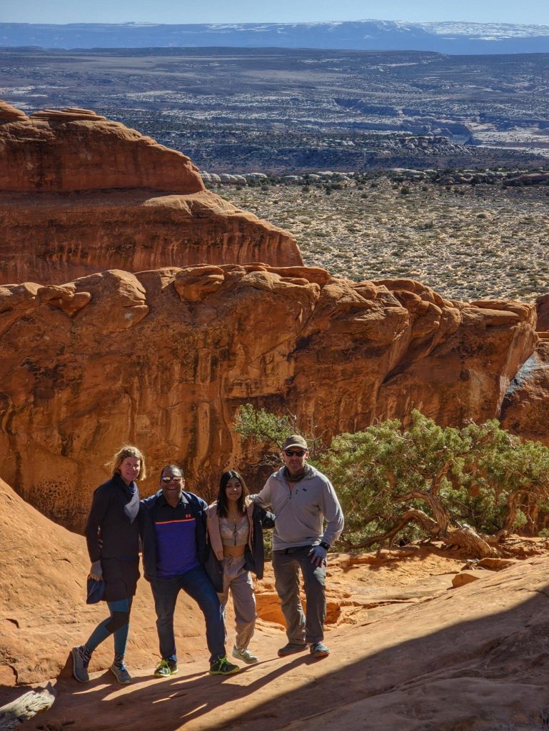
The 2 Tesla drivers were a father and daughter, Mangesh and Sanjana, from Pittsburgh. They were so friendly, we quickly all became buddies. At the entrance once again, the ranger asked for their timed-entry permit, which they had, and also their park entrance proof of payment…apparently these are both separate fees??? Mangesh was struggling to find the correct documents on his phone, since his wife had made all the arrangements. No bother, I flashed my veteran’s lifetime park pass and we were easily in (once again). So hopefully I saved them some money and\or time in exchange for picking us up. We did some tourist stops at all the pull outs and were entertained by the Tesla’s self driving feature on the twisty road (yikes!). We made it to the Devil’s Garden trailhead by 9 am for the start of the Hayduke.
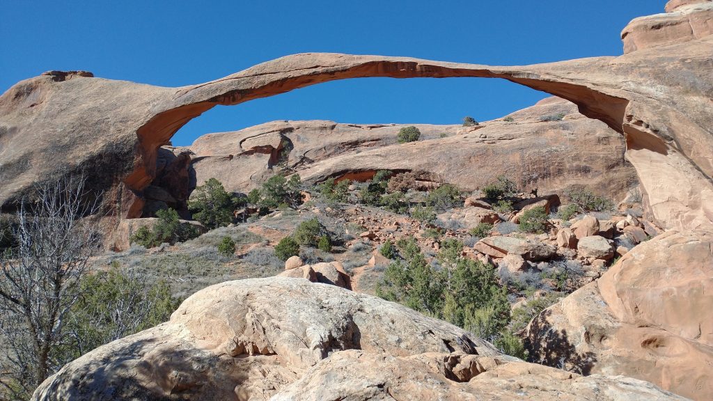
True to the nature of many of my hikes, but especially the Hayduke, we started on an alternate trail. The Devils Garden loop is by far the most popular trail in all the park, but for some reason, it’s not even a part of the Hayduke route. The official terminus is off a remote and hard-to-get-to 4wd road in the middle of nowhere. I suppose that’s fitting for the Hayduke, but we chose to go for the more popular and easier-to-get-to destination. For good reason, the touristy loop takes in most of the famous arches and has spectacular scenery. We passed so many arches: Pine Tree, Tunnel, Landscape, Navajo, Black and Double O, plus one or 2 I forgot. I thought all arches were pretty much the same but there were some pretty cool and unique ones, included several that people can walk under. The park no longer allows arches to be walked across on top and access to Landscape arch is completely closed due to a rockfall years ago. It’s the longest arch and also the thinnest.
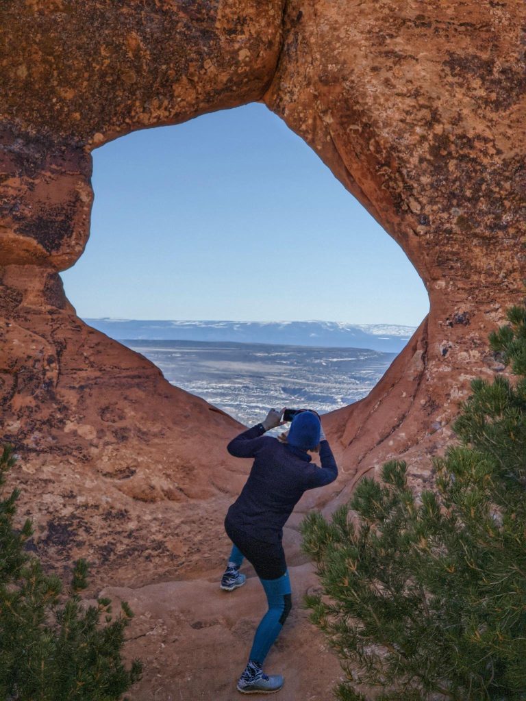
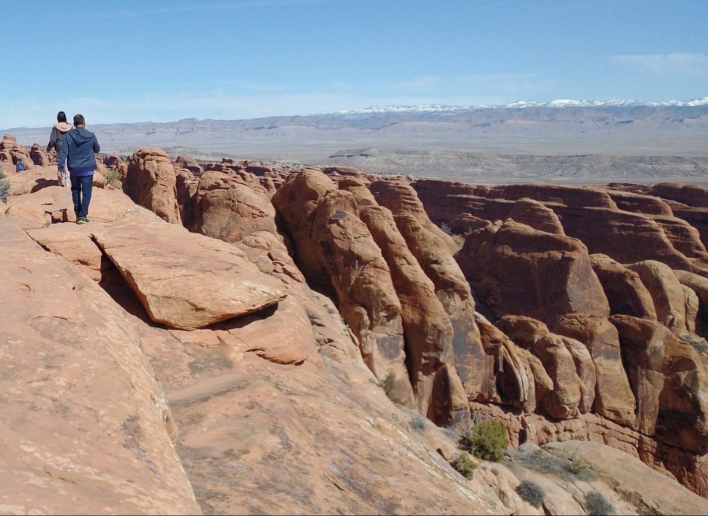
We spent much of the 3 mile walk with our new friends, Mangesh and Sanjana. They loved to take pictures and we got some good ones of us together. We took our time, exploring all the side trips and probably adding almost a mile. It was really nice just being a tourist. Mangesh was especially awestruck by all the natural beauty and it was kind of refreshing to get to see things from his perspective. I’ve been blessed in encountering so many incredible landscapes, as I’ve made it almost my job. But it’s good to reflect on just how special and unique Arches is, even beyond anything I’ve seen before.
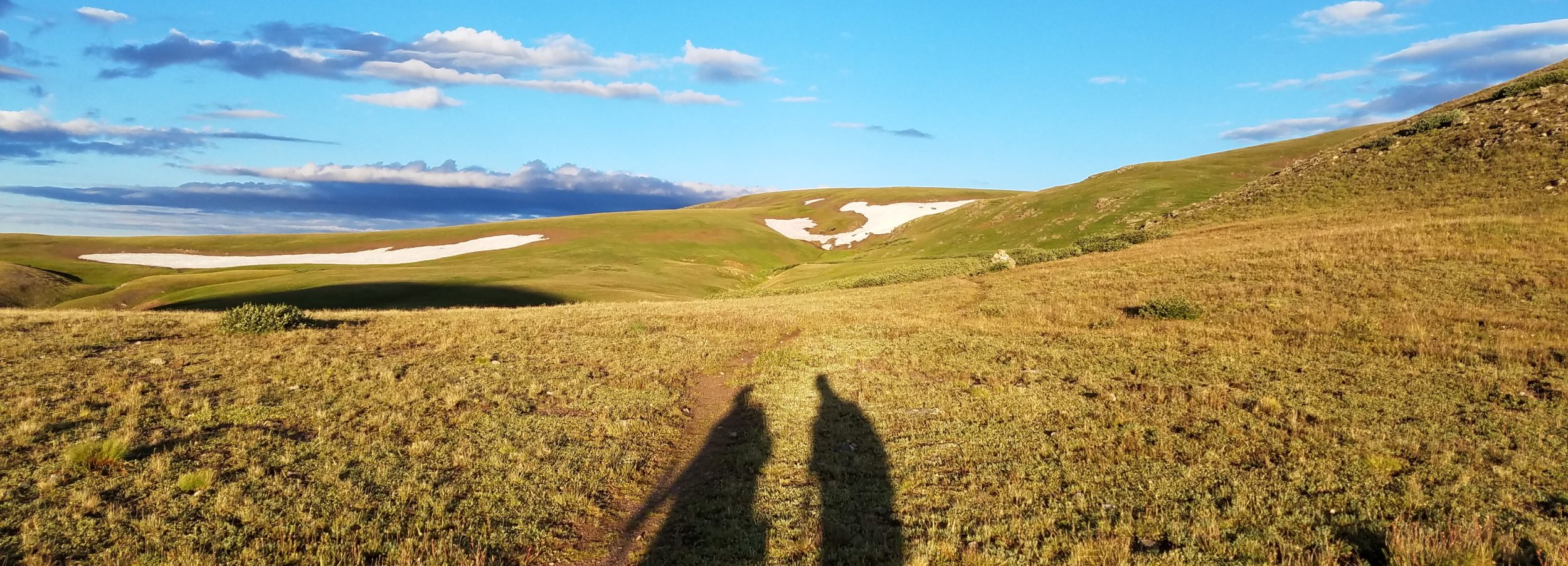
I was even surprised by the relative difficulty of the trail. There were some steeper scrambles up some of the fins and then a super awesome section walking on top a fin with 360 views. I could see the Henry mountains far to the southwest, the Colorado Rockies northeast of Grand Junction, the Colorado river canyons of Ruby, Horsethief and Westwater to the east and southeast (ones I’d once rafted), and I-70 stretching out in a line of trucks to the north. We pointed out the mountains where we were headed to Mangesh and he just shook his head in disbelief that we could walk so far.
We parted ways just before the last out and back feature, the Dark Angel pillar. It’s like a giant, isolated hoodoo with lots of varnish…dark stains on the red rock. It was a cool feature but my mind was already on the next challenge. A sign warned that it was the end of the trail, but not for us. We continued north on some social trails, dropping west towards a cliff band. The plateau we were on gave rise to all the amazing fins and arches but now we needed to drop into the valley below. As I read in Plants’ blog, the gpx line lead straight over a 40′ cliff. But we knew there was a way down, it was just a puzzle we had to solve by walking along the cliff band, looking for a weakness.
After searching for about 30 minutes, I finally spotted a series of ramped ledges leading to a gully of broken rock. It was a pretty easy descent, with only one ledge of about 5 feet that we needed to downclimb. We dropped packs and I simply jumped into the sand below. TS passed me the packs and then followed. That’s how it’s done with 2 people. It’s quite a bit harder alone. Also, 2 people can sometimes make better decisions because they can split up to see things from 2 different perspectives. TS at first wanted to descend in a spot that from my vantage point on the other side of the bend in the rim, had a very sheer drop-off. It’s good to have multiple eyes…and some good old ‘on second thoughts’.
We took a lunch break in the valley. We hadn’t even made it 4 miles all morning but we weren’t in a hurry. I did note that we still had 10 miles to go to a reliable water source and I was down to less than a liter, having only started with less than 2. This was par for the course for me and I knew I could easily make it. The temperatures were on the cool side. Still, we definitely needed to make it as far as Willow Springs before the end of the day. We pressed on through the expansive valley, with stunning views of the La Sal’s to the southeast. We did our best not to walk through thickets of cryptobiotic soil…a living organism than grows on top soil and rock. It takes years for it to grow but is easily trampled in a second. Avoiding the stuff would be a recurring theme for the whole hike but it was especially important not to leave a lasting impact in a national park (where there are no cows to destroy the crypto, as is usually the case elsewhere). We walked in a small wash for as long as we could.
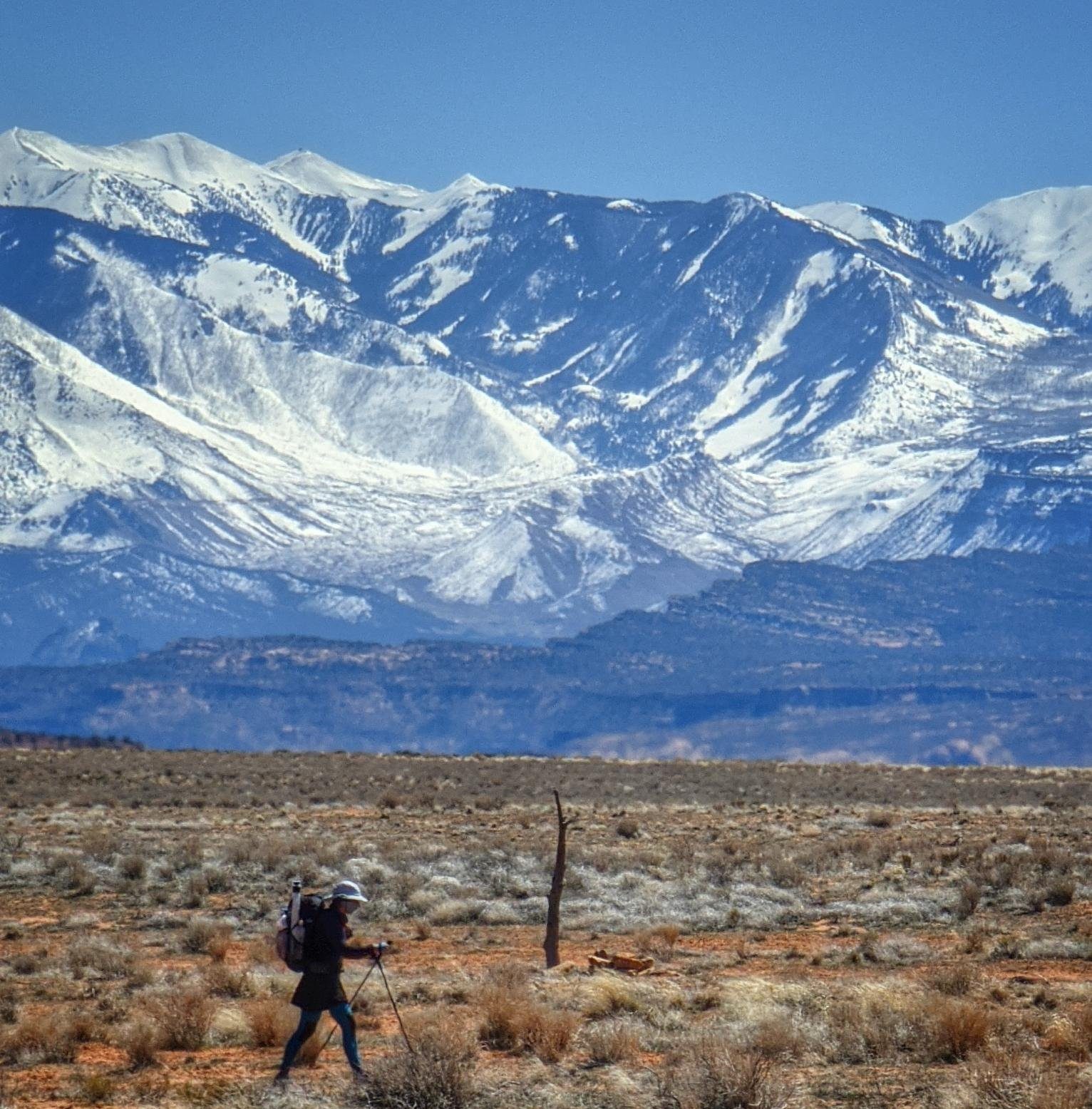
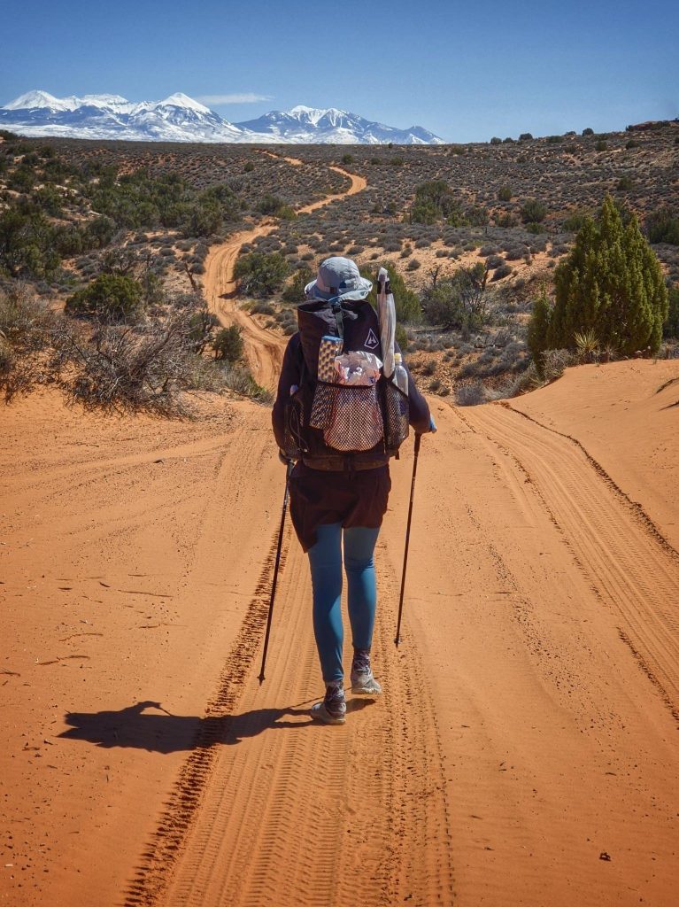
We came to an intersection of dirt roads and were finally on the official Hayduke route. A LE ranger was waiting there and asked us some questions about our route. He suspected that we had illegally camped along the Devil’s Garden trail…which thankfully we hadn’t. Once he learned that we didn’t plan to camp in the park this night, he wished us well on the rest of the journey. The Hayduke weaves to the west of the park and follows the border south. There are a few spots where it’s easy to ditch out onto BLM land, which doesn’t require a permit for camping. Of course that was exactly our plan. We followed jeep roads for most of the afternoon, enjoying easy travel and nice views of the Marching Men rocks. Only 9 jeeps passed us all day, 5 of which were in a caravan. I was surprised and relieved there weren’t more, given that it was Jeep Safari week, when tens of thousands of jeeples (jeep people) descend on the area.
We spent the later part of the afternoon traveling cross-county, first along a fence-line and then down Willow Springs wash. We found potholes full of water well before the spring but the spring had the cleanest and freshest water by far. It was the first water source of the trail and it was a great one (by desert standards anyway). Continuing down the wash required some bypasses of the many potholes and skinny slot-like sections. It was easy to climb above on the sandstone domes. In fact, other than the tougher descent from the bluff early in the day, I found the rest rather forgiving and very enjoyable. The navigation came easy for us, given our prior route finding experiences on Brett Tucker’s routes (GET/MRT). Even walking through all the sand didn’t bother me…section hikes on the Florida Trail and all the beach walking on the TA and PNT prepared me well.
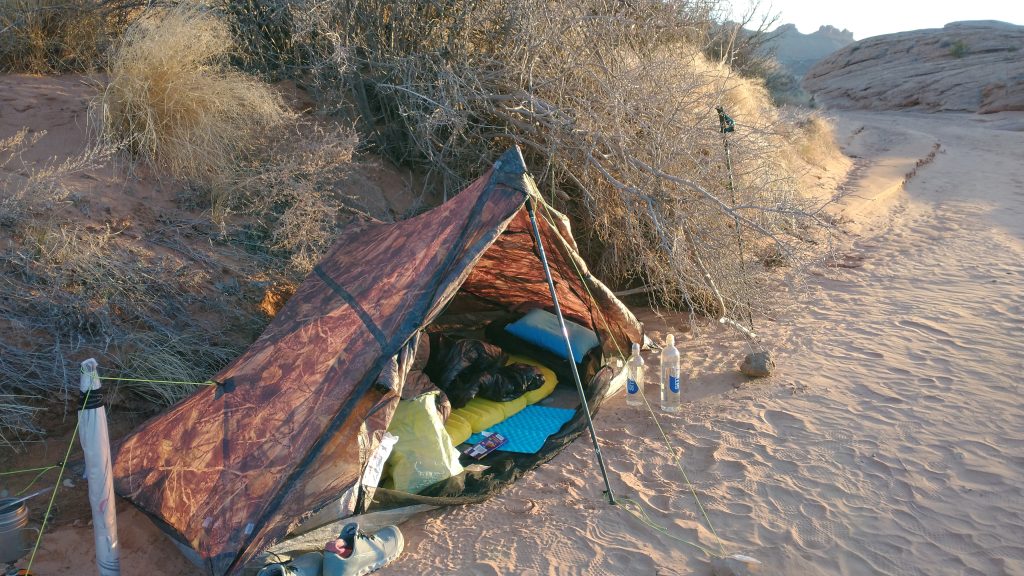
After loading up on water, we only needed to go a mile to reach BLM land. We started looking for spots in the sandstone dunes but everything was pretty exposed to the wind. Finally we settled on camping directly in the wash, up tight against the bank. The spot afforded protection from the wind, a perfectly flat and clean surface, and a nice view of the setting sun. I even found 2 huge potholes to rinse off some of the day’s grit. It was a perfect day, no fooling. I wondered if starting this hike on April 1st might be inauspicious but so far, everything seemed to be in tune.
(On a side note, I know camping in a wash is wildly controversial and sparks endless debates online. Spoiler alert, I’m going to make mention of my wash camping for the remainder of this hike and it’s been a feature of all my other desert hikes. I’m only going to say it this one time: I recognize the risk of flash floods and with probably over 100 data points of successfully assessing this risk beforehand, I feel very confident in making my decisions about wash camping. Anyone that’s vehemently opposed to it is free to just not ever do it and I will stick with the strategies that have worked so well for me all these years. BTW…a wash campsite is a great way to be LNT)
Very nicely written blog and it was fun to read about my husband Mangesh and daughter Sanjana ????. They truly enjoyed hiking with you, and learned many things. Me and our younger daughter joined them after 2 days, and he took us to all the beautiful trails and scenic views in Arches, we truly enjoyed the trip !
Thank you so much for reading! It was so great meeting a part of your family, wish we could have met you and your other daughter!