Thursday Apr 29th, 2021, 1000-1600
I 40/Tijeras to Sandia Peak Tram, Segment 38, mm 757
15 miles
I stuck this one out to the end and it was finally time to call it that…THE END. The past few weeks had certainly dragged on, first because of Norovirus and then so we could align our plans with good weather and a return ride. Jon, trail angel extraordinaire, was on his way from Phoenix to pick us up but wouldn’t be arriving until late afternoon. We had all day to walk the last 15 miles, which was a good thing since we had stayed up late with Blue and Twerk. We slept in a little, ate a small breakfast at Blue’s, then headed straight for the Roots Cafe when Blue dropped us off in Tijeras. Second breakfast was called for, plus we felt like we needed to support the cafe some more for letting us hang out and escape the rain for hours the day before. A lady that worked there told us her sister was currently hiking the AT, so she was very understanding and supportive of thru-hikers. The cafe had a really nice menu of healthy choices, plus excellent coffee. Pro-tip for any future GET hikers…spend your money and reward yourself here, not at the overly-expensive tram restaurant at the top!
By 10 am, we were finally ready to resume our hiking. The day was beautiful, with clear skies and perfect temperatures. A fresh layer of snow dusted the high peaks…right where we’d be walking. We knew the trail involved several more thousand feet of climbing, back to an elevation over 10,000′, but we weren’t worried. This close to a major city, the trails in the Sandia Mountains received lots of attention and were well maintained. Plus, we were feeling good from all the rest and food we’d had over the past 2 days. Going up over 10,000′ peaks had become a pretty standard thing on this hike…I think this was our 9th mountain range of such stature.
We started up the Crest Trail, enjoying easy switchbacks and nice views. We quickly met several trail runners, hikers, birders, and even a group that were “exercising” their remote controlled ORV’s. In all my time hiking, I’ve never met anyone out for a drive of their toy car on the trail, let alone a group of them. Technically we were in a wilderness area where such mechanical things are not allowed but the guys were all very polite and didn’t seem to be doing any harm. I guess as long as they had a passion for something that got them outside and enjoying nature, that’s what counted.
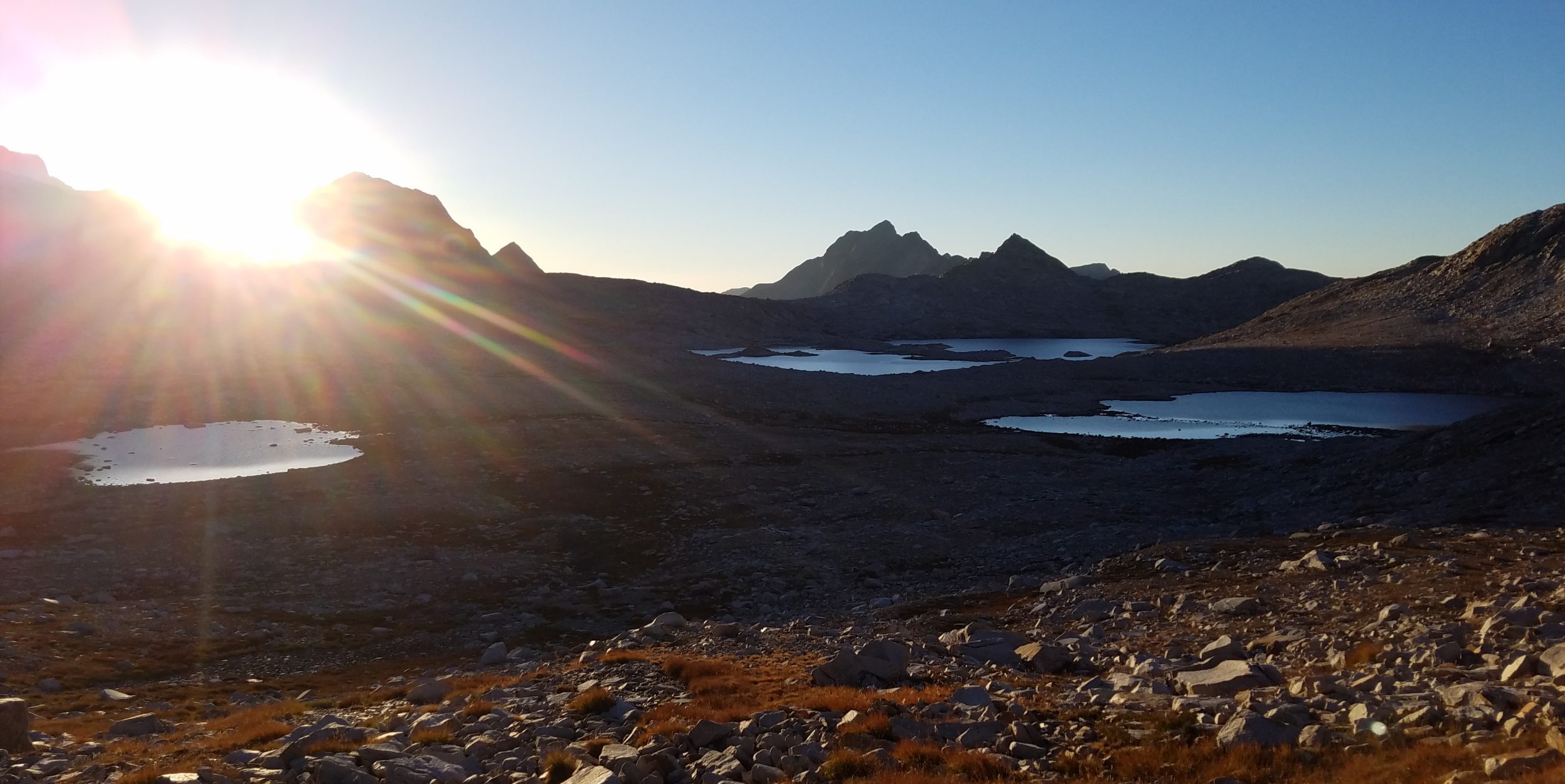
It didn’t take long for us to gain the ridge, where we then had about 7 miles of excellent scenic ridge walking. The trail and habitat was a lot like the crest trail in the Manzanos, only in better shape and less overgrown. We left all the day hikers and runners behind, as we didn’t see a single person on the ridge until we got to the tram. I guess it was still early in the season and with the fresh snow the night before, no one was up for getting wet feet and sliding around in the mud/snow. We enjoyed views south to the Manzanos, west to Mt. Taylor, and northeast to the southern Sangre De Cristo’s. My Peak Finder app even claimed that Mt. Blanca, 4th highest peak in Colorado, was visible but I couldn’t make it out. I was very happy to look around and see all these mountains that I had traveled through. On my flight from Miami to Phoenix, I’d even taken a picture of the Sandia mountains…a sneak peak of the finish line before I even started.
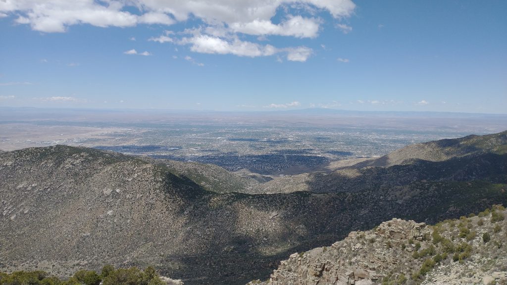
Looking west over Albuquerque and towards Mt. Taylor and the CDT.
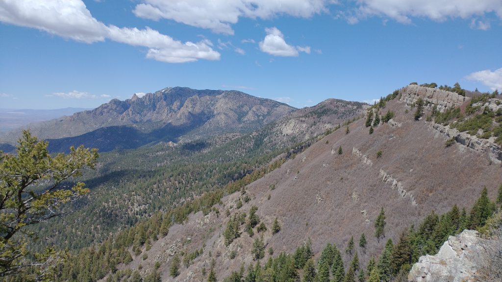
A view north towards Sandia Peak, where we’d finish the day and the GET.
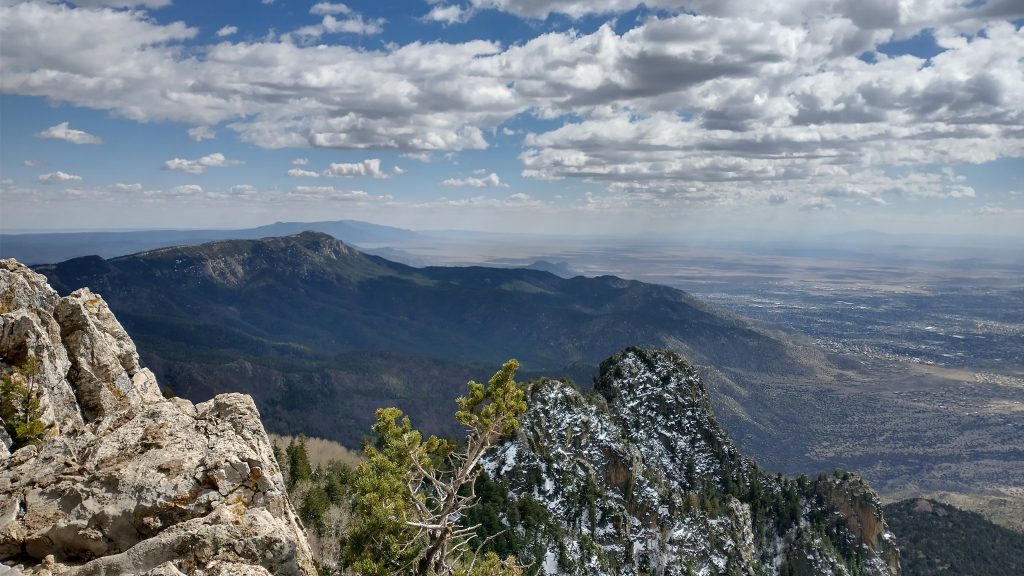
Back south towards the Manzanos and even the Magdalenas in the very far distance to the right.
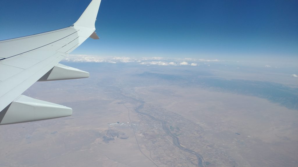
From the air, a look down on the Rio Grande and Sandia Mountains.
We took a nice lunch break, pretty much consuming all the food we had left. We were basically carrying no food or water weight at this point, so our packs felt great. This was good because for the last few miles, we encountered quite a bit of snow. The new snow on top of the old made for very slippery conditions and I actually fell pretty hard, tweaking my shoulder as I landed in an awkward position. For a second I thought I might have dislocated it. Just great, to have come this far and get injured on the last day. I struggled on, working through some pretty severe pain in my shoulder, radiating down into my arm. But my legs were fine and I was thankful for that, at least. It was certainly a much harder last few miles than what I’d bargained for, though.
We were a little concerned that we might not be able to buy one-way tickets for the tram going down, in which case, we’d have to walk 9 more miles to the bottom. We tried to buy the tickets online the day before, but the website only sold round-trip tickets. We budgeted some extra time for this, but we need not have worried, as there was plenty of space on the trams going down.
Technically the GET continued on with Segment 39, a steep trail leading down the mountain. But I reasoned that since I’d managed to survive the difficult route, I earned an easy ride down. Besides, what other thru-hike ends on top of a mountain with tram service? Even more special, it’s the longest tram in the US! It used to be the longest tram in the whole world, but of course China beat it a few years ago. It was $15 for a one-way ticket…a no-brainer in my book. Congrats, you just walked close to 800 miles through some seriously rugged, hot, dry, and desolate terrain. Enjoy a tram ride!
Having gotten our tickets, which entitled us to any tram before the last at 8 pm, we hung out at the top for awhile. Jon was still a few hours away, the views were awesome, and the weather was perfect. The only downside was that drinks and food were very expensive. I lived up to some proper hiker trash customs by making my own tea and coffee on my stove, right on the common balcony overlooking the city. I should have carried some celebratory drinks to the top but no big deal, I could wait until we got down.
This finish was without much fanfare. I didn’t feel a lot of emotion. I was happy, relaxed, and already thinking about the next hike. Later in the summer, I planned to be walking another couple thousand more miles on the Appalachian Trail to finish my Triple Crown. As my 7th thru-hike, it got less emotional each time. It was the act of walking that had become so important to my life, not the destinations.
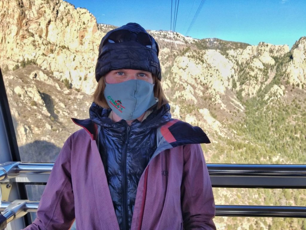
In our rush to board the tram, I completely forgot to take a finisher photo. Oh well. Since the GET was not a purposely-built, official trail, there weren’t any “GET” signs or memorials at either terminus, anyway. So here is my finisher photo on the tram ride down. It was pretty in-following with the a-la-carte, do what you like nature of the whole route.
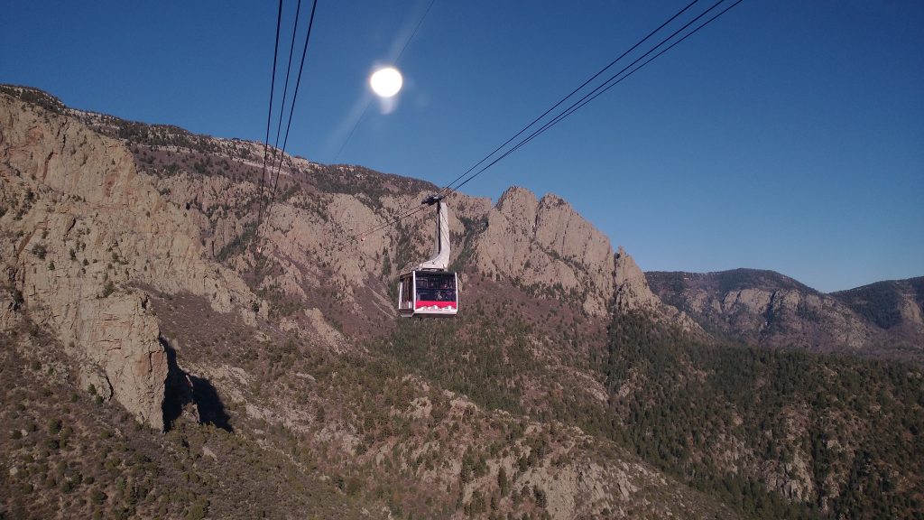
The tram ride was actually fantastic. The operator was very enthusiastic and had excellent eyesight…he pointed out a black BEAR far below! This was the only bear I saw the whole route, after a month and half of walking through the wilderness and despite seeing tons of bear poop. Pretty cool! The ride was also very exciting…as long as one wasn’t too afraid of heights! So much fun. I highly recommend a tram ride, either to start or finish the GET.
We made friends with a nice couple on the tram, who offered to deliver us to the nearest brewery so that we could finally have celebratory drinks. Jon met us shortly after and we spent the night in Albuquerque, celebrating over pizza and beers. The next day, we drove back to Phoenix via Socorro, Magdalena, and Pie Town, where we stopped to visit the Toaster House and drop off some beer for the CDT’ers. I finally met Nita, who was an amazing Trail Angel and owned the Toaster House. She was on vacation when I stayed at the Toaster House on my 2019 CDT hike. It was also great to see a fresh new batch of CDT hikers…close to 20 at the house in all! It was a reminder that just as our hike was coming to an end, thousands more were just beginning. And so too would I be hiking again…stay tuned for my final installment of the Triple Crown of thru-hiking…
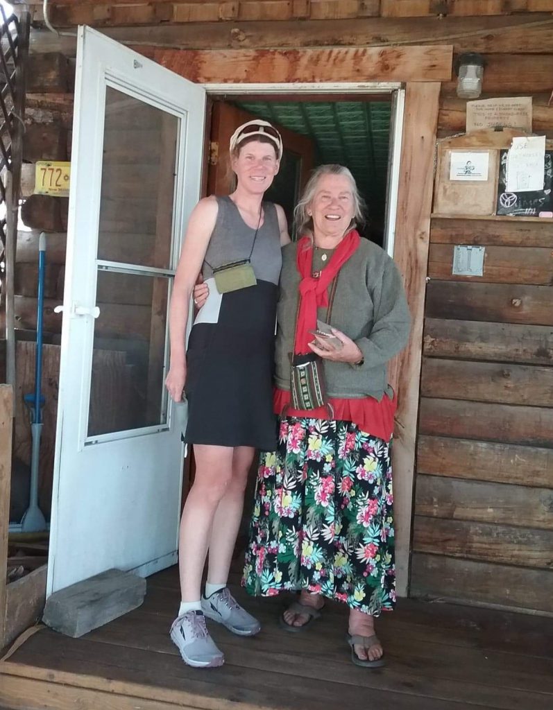
A flash-back to the CDT: Nita of the Toaster House in Pie Town, New Mexico.