Wednesday Apr 7th, 2021, 0700-1800
Mogollon Ghost Town to Mogollon Baldy, segment 20, mm 372
20 miles
I joked before we went to bed that the Mogollon town folks might come alive as vampires at dusk, preying on innocent hikers that had wondered into the area. Or maybe they were simply straight up ghosts that would haunt us. An axe murderer to boot? When you’re camped in the woods next to a ghost town, these things go through your mind. But there were zero disturbances overnight and I slept very soundly. Maybe the ghouls and vampires just couldn’t find me in my camo tent.
We hit the road and made 7.5 miles in just 2 hours. The road was dead quite and closed to traffic a few miles up. It was opened in the summer, usually around May. It went to a campground somewhere in the Gila Wilderness then continued on. Looking at my map later, I realized I’d walked a portion of it on the CDT alternate route, north of the headwaters of the Gila River… it’s a long road! The last few miles we walked had patches of snow, which didn’t bode well for us.
At a place called Sandy Point, we found the trailhead for the Mogollon Crest Trail and a privy. I have it on good authority that former GET hikers used the privy as an overnight shelter. I had yet to add a long-drop to my list of shelter options and prayed I’d never have to. But you never know. As we began the trail, an ominous sign warned “Trail not maintained, difficult to find.” We shrugged it off, since so many of the trails thus far met that definition.
Well, I can say now that unmaintained trails are on a spectrum and this one was definitely to the far end of bad. First some stats: we made it 12 miles to the top of Mogollon Baldy, which took us almost 9 hours (with a few breaks). We went from almost a 4 mph pace on the road to 1.5 mph pace, which is quite slow for us. And here’s the reason why:
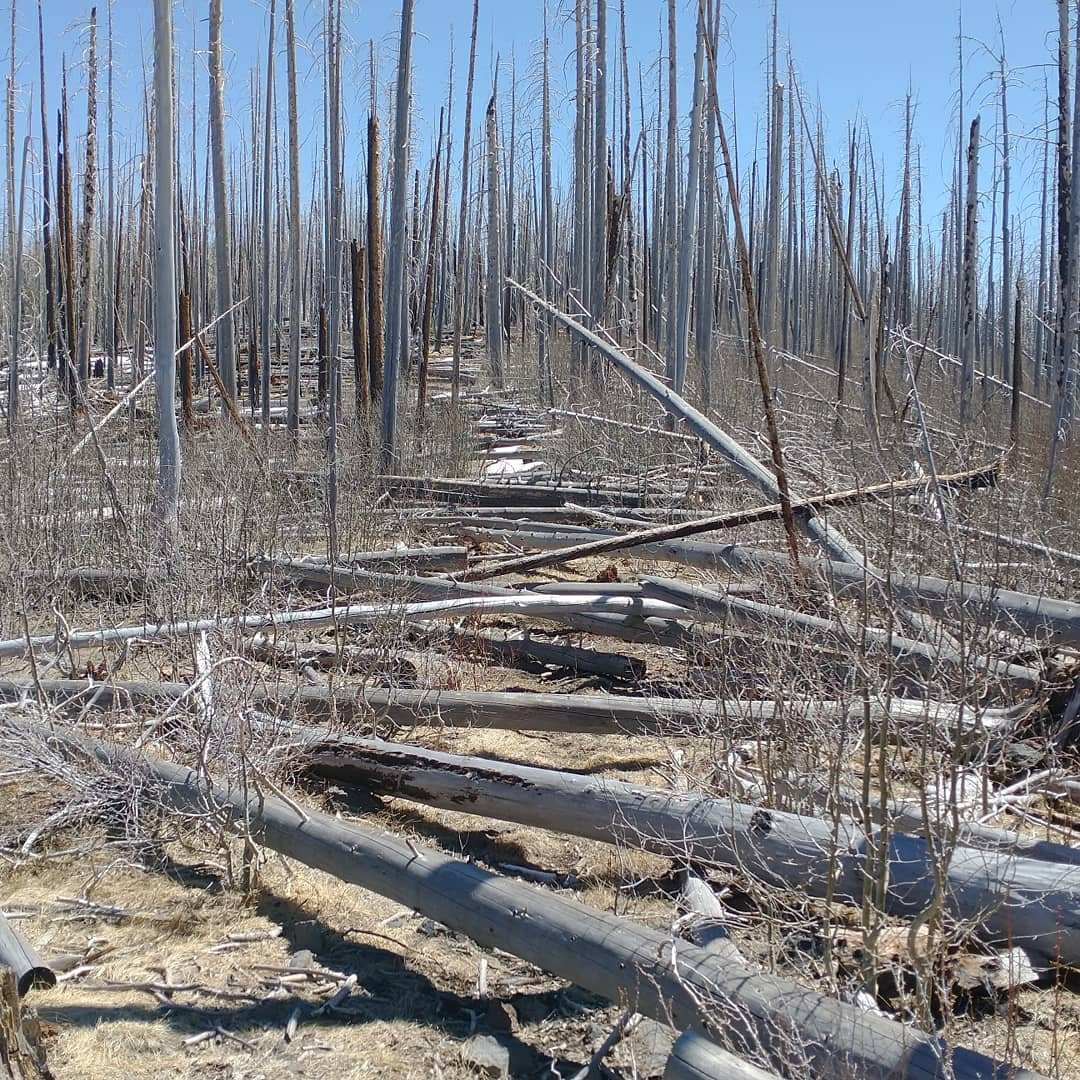
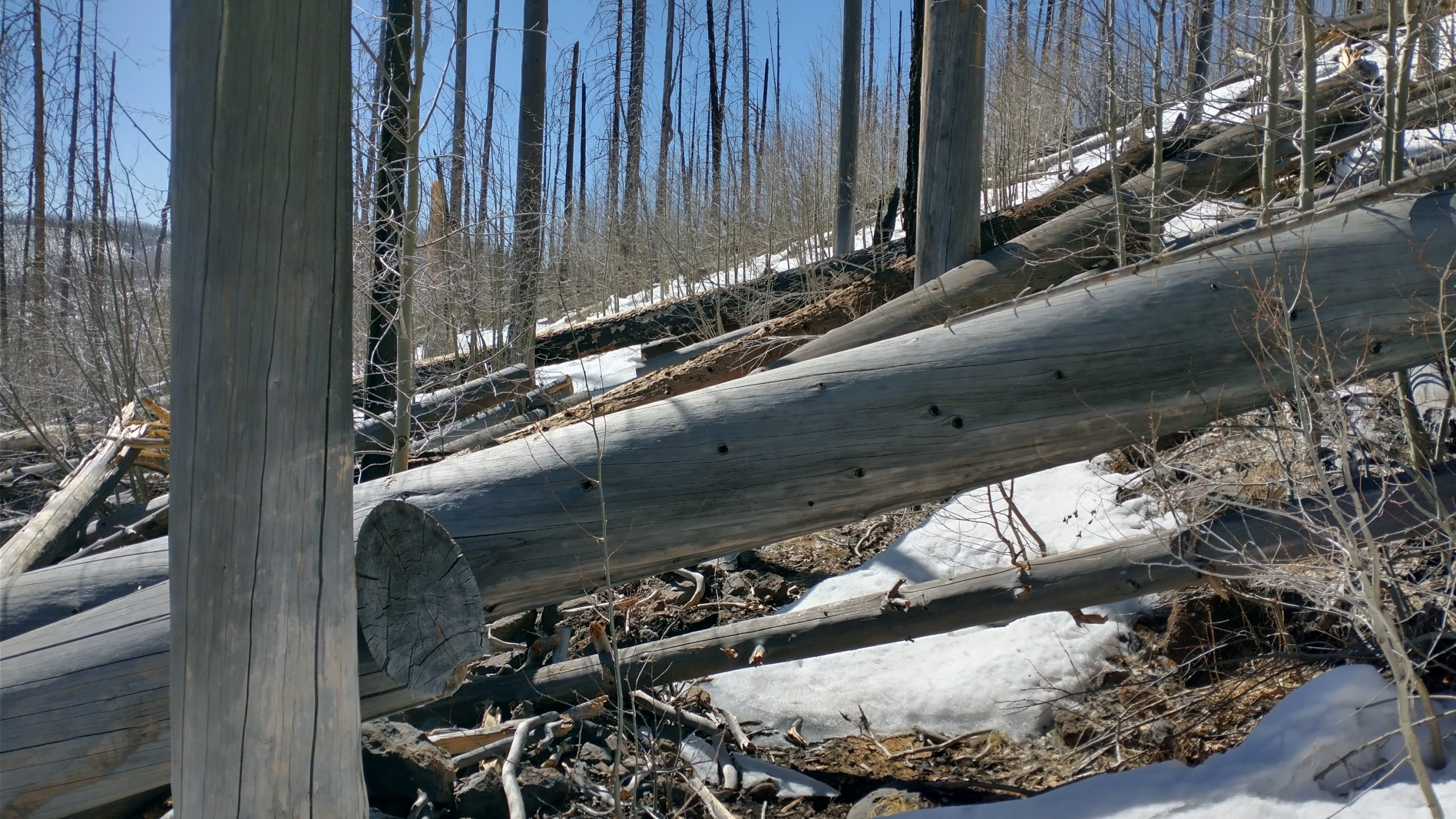
Miles of pick-up sticks on the trail. All the reports of downed trees from blogs I’d read and locals we met in Alma gave me the idea to start counting them when we started. By the time we’d gone 5 miles to Hummingbird Pass, I’d “logged” upwards of 600. At that point I got tired of counting and just started listening to podcasts. To the top of the mountain at 10,778′, we passed well over 1,000 downed trees. Throw in some lengthy stretches of snow on the north-facing slopes along with the elevation, and our 1.5 mph pace was actually quite commendable. There was one really bad half mile that took us over an hour, but we made up for it in the last 3 miles when the downfalls eased a bit.
There was never a point in the day where I was able to just walk unencumbered for more than 100 yards. Some logs required only a simple step over. Others I could just sit on and swing my legs over…though doing so repeatedly left my butt raw by the end of the day. Many required some sort of climbing via branches or other logs, which is always risky if the whole mess shifts or breaks. There were also many so high up that I had to go under, either by grabbing the log and swinging under limbo style, squatting, crawling on my hands and knees, or even taking my pack off to manipulate my body and pack into weird contortions. Several huge jumbles required all techniques at once. My favorite were when I could find a huge log running parallel to the trail and just balance-beam it for as long as it went.
I accomplished every gymnastic feat known to man throughout the day and estimate that my feet, or butt, were touching logs as much as they touched the trail. And then there was the snow. At first it was kind of fun and made the log crossings easier in some cases, as it elevated me above. That was until the afternoon when I started postholing. In the worst stretch, I knocked a hole in my knee from a branch and immediately postholed into another branch buried under the snow, further opening the wound. I left drops of blood all over the snow but luckily that was my worst injury all day. The risk from falling trees, shifting logs, broken limbs, or punctures from falling onto skewer-like branches was great. We were fortunate to make it through intact and with all our gear.
Why didn’t we just turn around? There was an alternate after all. Well, after going a certain distance, you become loathe to face all the obstacles you just went through again, always hoping it’s going to get better ahead. It eventually did, long after turning around seemed like an option. The massive fire that created all this mess was in 2012. For awhile it seems, the forest service kept up with the log cutting. This actually made it quite easy to follow the trail, even in the snow, because there were many cut logs indicating the path. But I guess at some point, they’d just given up. Budget cuts, covid, and massive wind storms had probably all contributed to the insurmountable task of forever clearing the trail. I think this was all part of a wilderness area, which would make it even more difficult since chainsaws can’t be used.
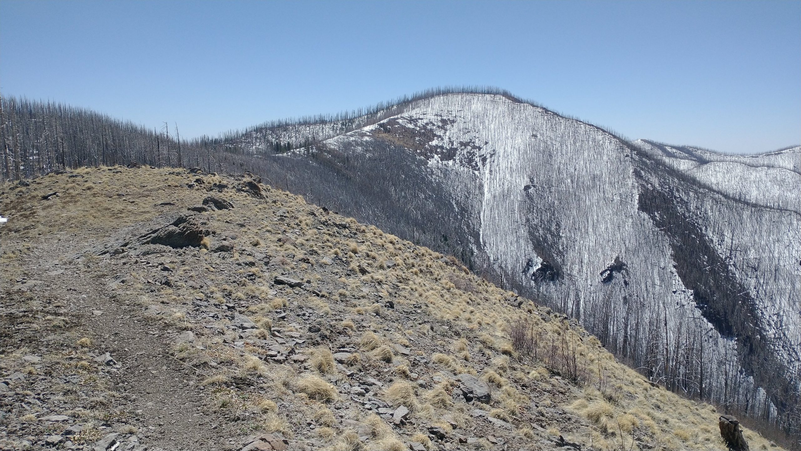
I really fear this will be the fate of large sections of our long trails like the PCT and CDT. Climate change is having so many ill effects on the forests, from beetle kill to severe droughts and wildfire. Once such massive fires occur, trail maintenance crews face decades of dead trees falling on the trail corridor and lots of erosion issues. Thorny, bushy plants are the first to grow back on the trail, adding to the increased effort. Not to mention just how sad and dreary it is to walk through such a landscape. We saw or heard almost nothing all day, save for a few birds. The wind howling through the dead trees was the main feature…the cries of so many deal souls.
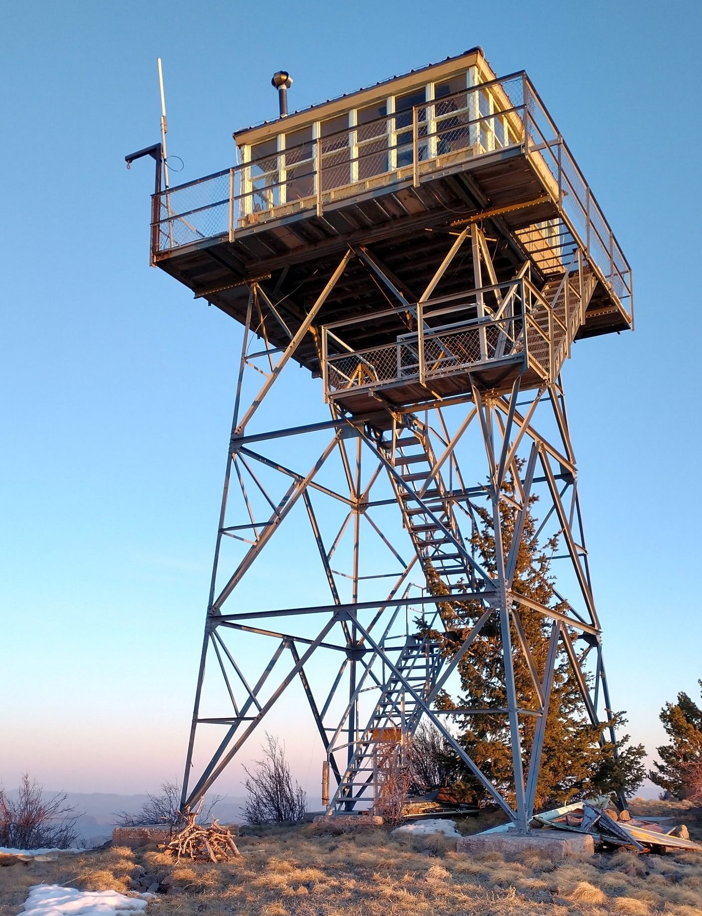
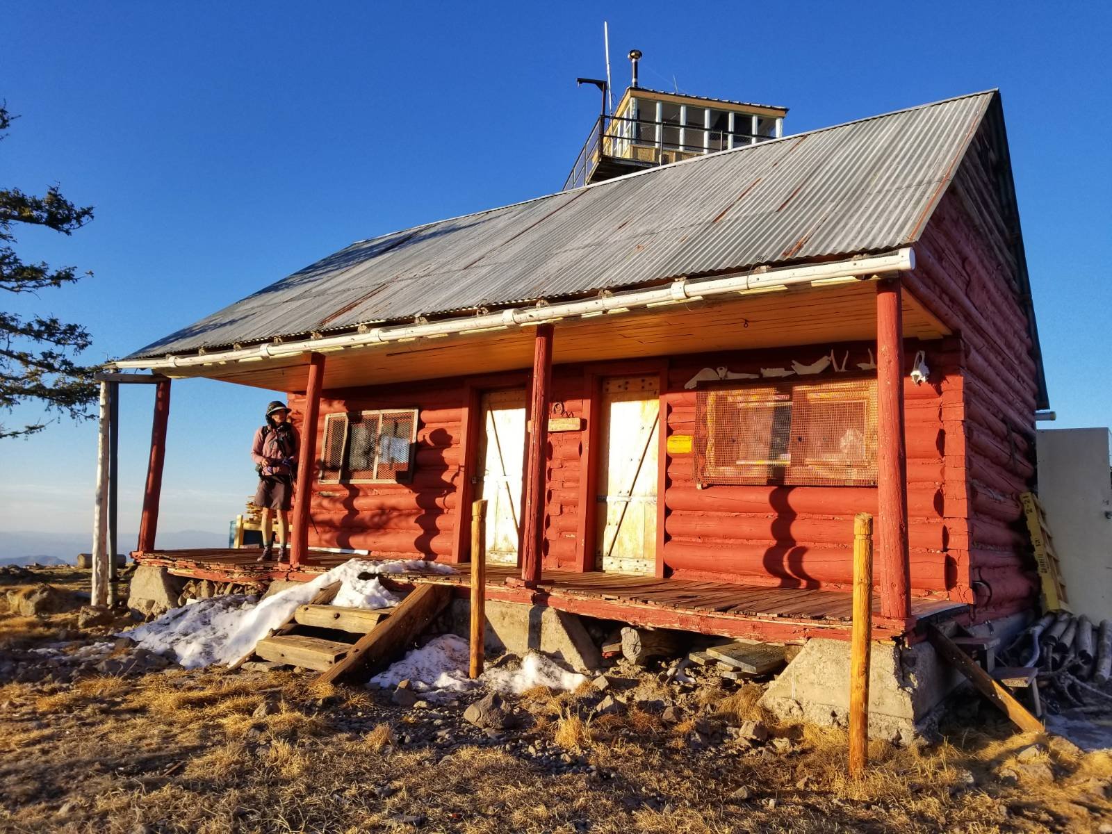
We also only found one water source all day, besides the snow. A tiny spring formed a murky puddle on a south facing slope. We stopped to collect enough water for the night, since it had become apparent that we would be spending it on top of Mogollon Baldy. It was the only flat spot not burned for miles. Plus we were extremely exhausted from all the acrobatics. Ironically, the forest service managed to save the fire tower and 1923 historic cabin at the top. But I didn’t see how they could get to the top now, other than by helicopter.
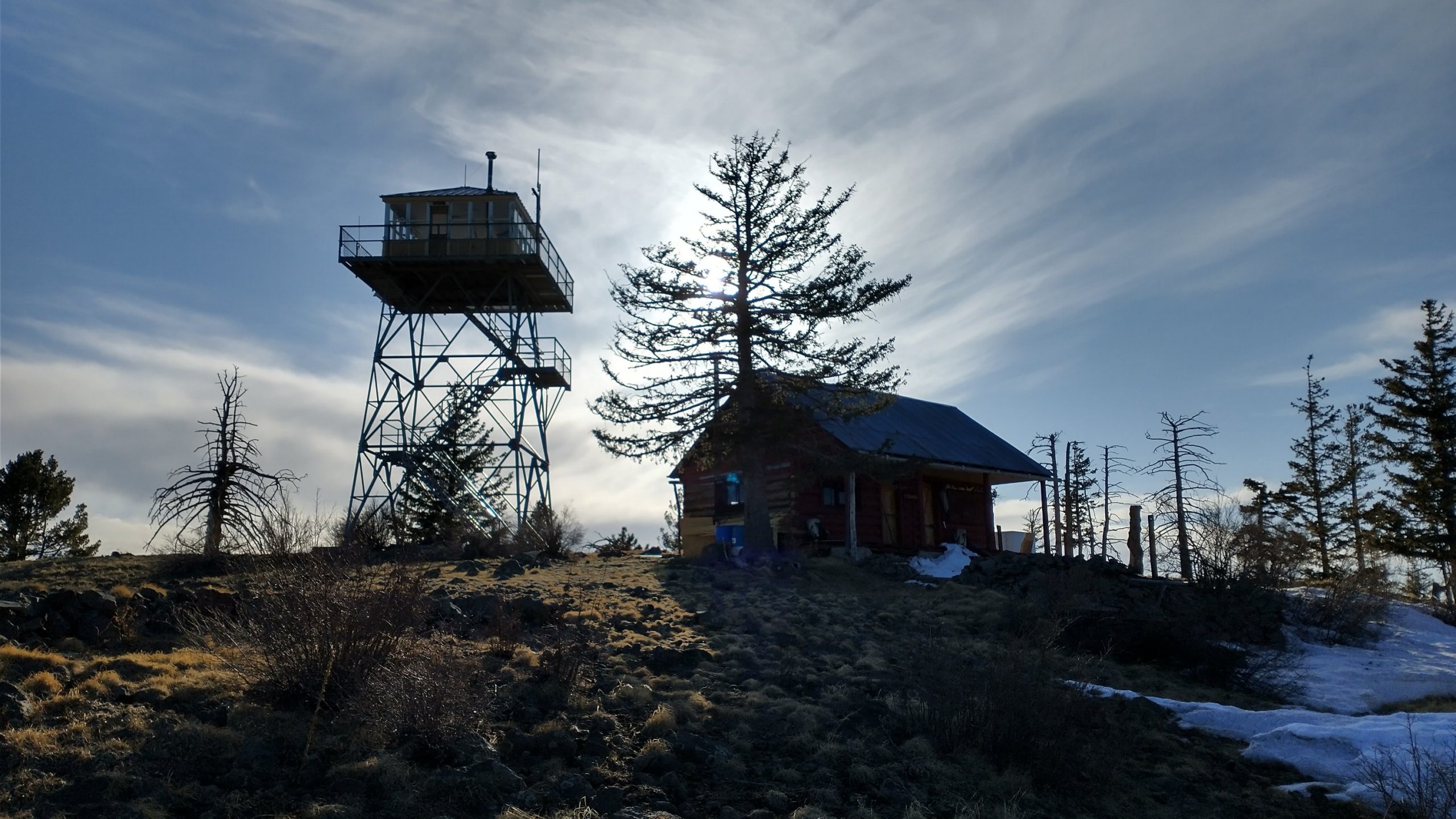
We arrived right around 6 pm. I immediately checked all the structures but everything appeared locked down tight. I’d resolved to pitch my tent on the front porch of the cabin, so as to get the best wind break. It was already getting very cold and I was expecting a pretty miserable night. TS did a sweep too, reporting that he found the storm shelter open. I was amazed, since this little container-like thing was the first place I checked, I just didn’t understand how to turn the door handle. I also thought it was nothing more than a storage bin, and must be full of supplies.
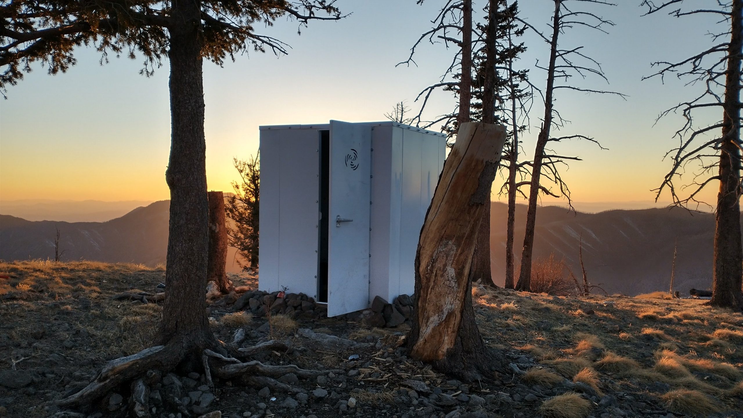
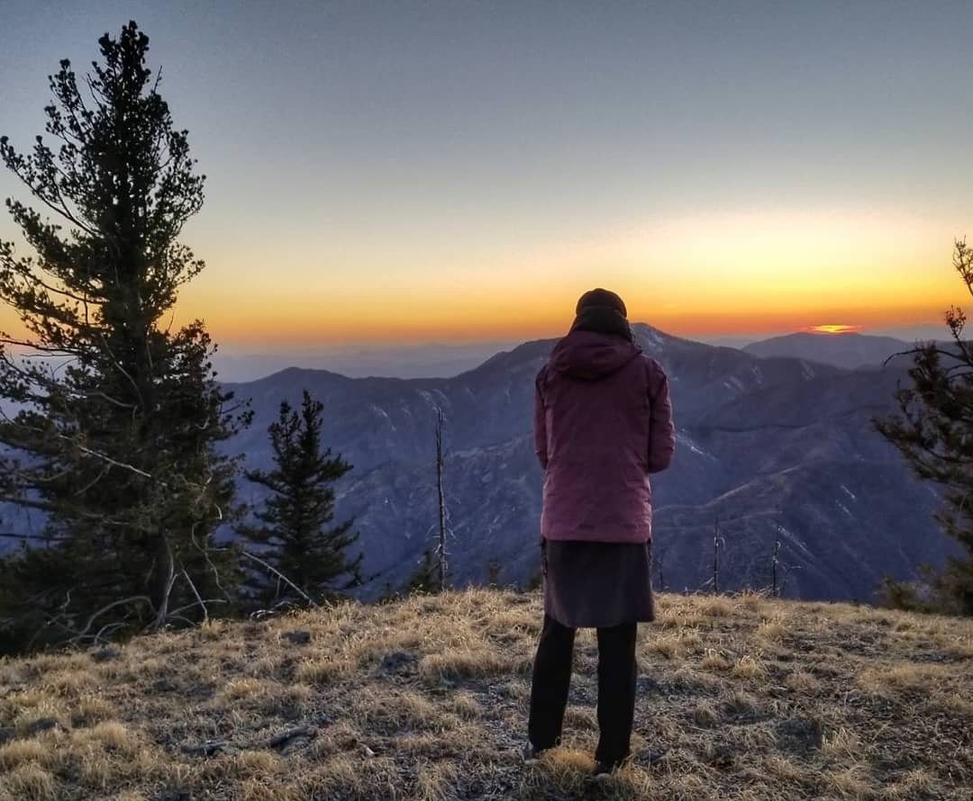
But it was indeed empty inside and labeled ‘storm shelter.’ There was even some carpet on the floor. It was just the perfect size for 2 tired and cold hikers unexpectedly spending a cold windy night at almost 11,000′. We settled in and enjoyed dinner on the cabin porch. We watched an amazing sunset and then locked ourselves into our metal box for the night. What a day. Lots of type 2 fun.
WOW
Great Pics Twig!
Your blog brings back wonderful memories of the GET.
Raven & I are in Grants right now and should be seeing ‘Doc Mack’ the trail angel tomorrow ?
The CDT NOBO is fun/different & I’m seeing parts of the official route that I’ve never seen before.
Got to have an amazing dinner (& two breakfasts) with NIta @ the Toaster House in Pie Town.
Hope you have a great rest of your hike.
Happy Trails,
Freebird
PS Did you see the graffiti on your box in Winston ?
I sure did get the graffitii! Supposed to be a blog I haven’t posted yet. Say hi to Mac…hope to see him when we drive back to Phoenix.