Wednesday, May 1st, 2024, 0740-1900
Springer Mountain Shelter to Wallalah Mt., mm 21
21 miles, Gain: 4400′, Loss: 5050′, elevation 3086′
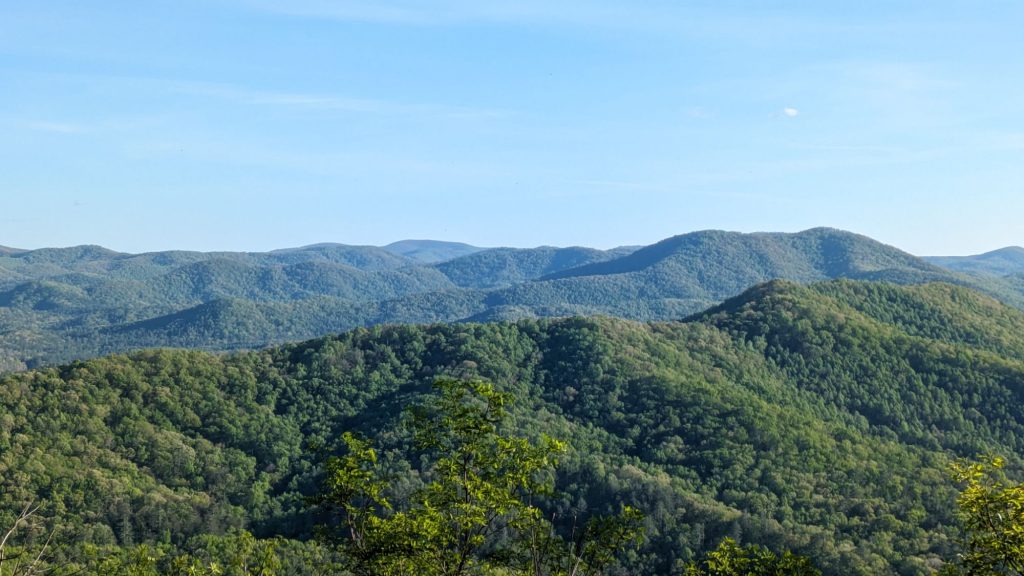
My goodness, what a beautiful trail the BMT was at the start! Green tunnels, waterfalls, swing bridges, rivers, creeks, and mountain top sunsets and sunrises. I didn’t set an alarm and woke with the dawn. The birds were in full swing with their songs, so lovely. The sun came up over the ridge and the rays penetrated brilliantly through the trees. While having breakfast at the shelter, RocknRoll asked if I’d screamed in the middle of the night and if I was ok. It was such a peaceful night, but perhaps I had a night terror. Or maybe it was one of those elusive mountain lions of the southern Appalachia that everyone insisted existed, except for wildlife biologists. I’d heard nothing and it remained a mystery.
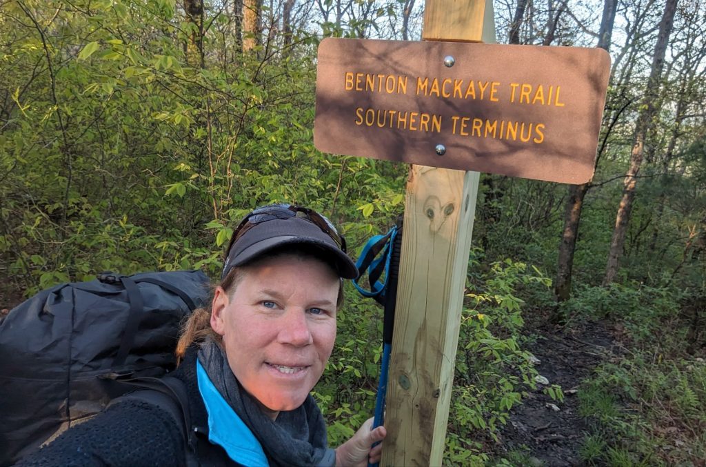
I walked with the other two for a few minutes until I came to the BMT terminus. We said goodbye since I wasn’t sure I’d see them again. The first 6 miles of the BMT intersected with the AT 4 times and then followed along for a mile until Long Creek falls. There the trails split for good until the Smokies. But the BMT was several miles longer than the AT, before it joined for the 1 mile at Long Creek. That’s because it dove due east to visit Ball Mountain, a sister peak of Springer, before heading down.
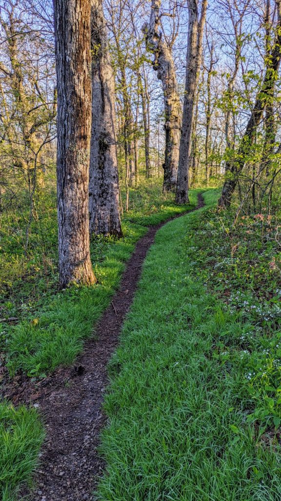
A minute after setting off on my own, I came to a plaque honoring Benton MacKaye. It mentioned that a part of the BMT was one he proposed for the AT. It was nice to hike over to Ball mountain because I was able to catch more glances of Springer and there was a nice viewpoint of the valleys below at Owen Vista. I heard turkeys gobbling in the far distance there. The trail was also so beautiful…a thin line through the grass between the newly-leafed trees. Spring on Springer.
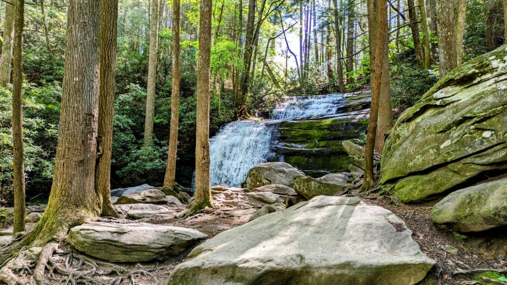
I wound down the ridges in a giant S curve. I saw no one else on the BMT but could see and hear other hikers whenever I was in the vicinity of the AT. There were about 10 hikers around in that first 7 miles and not another the rest of the day. I did get to see Mockingbird and RocknRoll one last time, just as I got to Long Creek falls. They were just leaving, so I ended up being the only one at the falls for a while. I hadn’t made it very far because of my late start and taking it slow, but decided to have an early lunch there anyway. I didn’t visit these falls on either of my previous passes, in too much of a hurry I guess. So it was nice to take my time and enjoy the beauty of the cascading water.
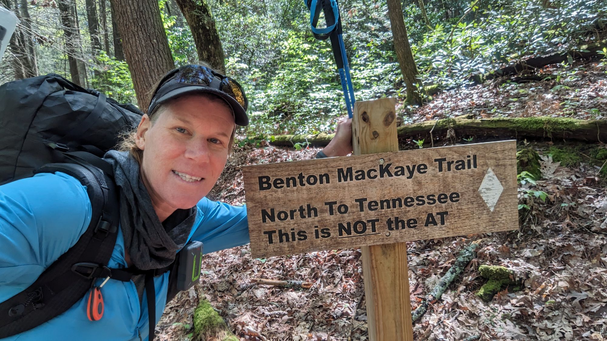
Leaving the falls, there was a funny sign marking the BMT and warning that this trail was NOT the AT. The BMT was marked by white diamonds, not blazes. I couldn’t imagine someone accidentally taking it instead of the AT. The trail followed the creek for a bit then climbed back up to a ridge and stayed there most of the rest of the day. Along the creek, I found a garter snake…one the few snakes I saw on the whole BMT. I also passed through a nice bald, which was also one of the few on the BMT. There were the typical gaps with funny names like No-Name and Bryson (after the Walk in the Woods author, I wondered?). It was very pleasant trail, well groomed and with switchbacks. I expected it to get a lot harder, so was grateful for this easy start. The weather was perfect, sunny but not too hot.
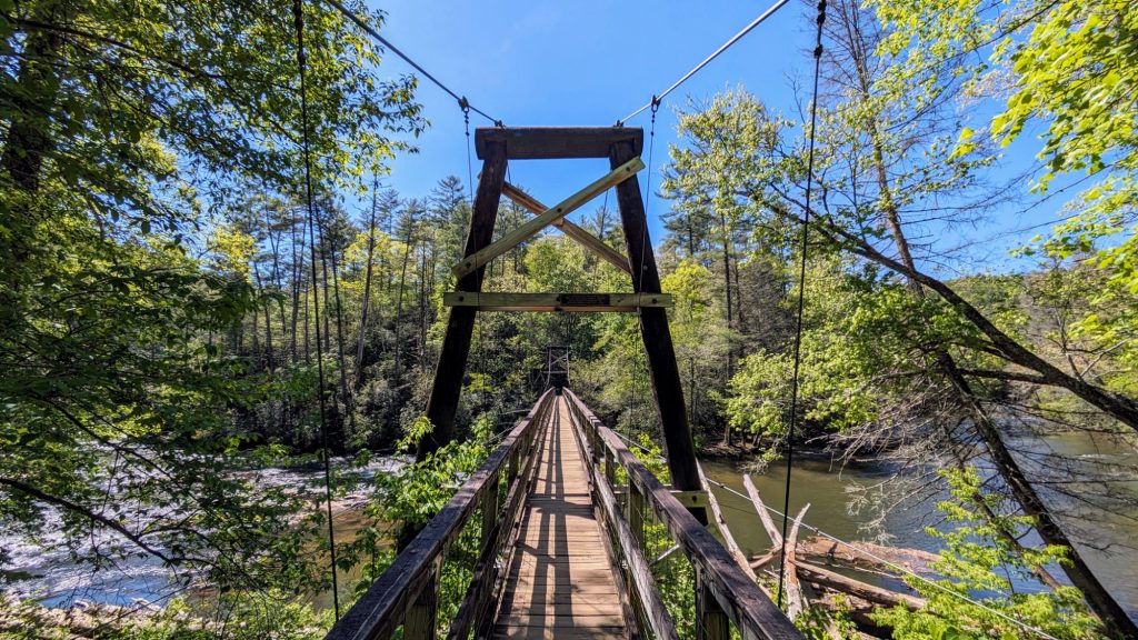
Late in the afternoon, I came to my first of 3 crossings of the Toccoa River (it became the Ocoee later in Tennessee). I was hot so I took a swim break. Then I walked across the cool swing bridge, an iconic sight along the BMT. A couple of day visitors asked me something about another parking lot, which was funny because in another BMT blog I’d been reading by Longstride, he’d been asked nearly the same thing at the bridge. Thru-hikers are the worst people to ask about roads or parking lots surrounding a long trail, but these people obviously didn’t know about thru-hiking, either.
Invigorated by my swim, I went up over another hill then back down to a crossing of hwy GA 60. In my planning for the hike, I’d expected to finish the day around here. But it was still early and I didn’t want to camp so close to the road. There was a campground nearby to the west, but it was too early in the hike and the weather too nice to spend money on luxury accommodation. I found a piped spring and decided to make dinner there, so I didn’t have to carry as much water up the hill.
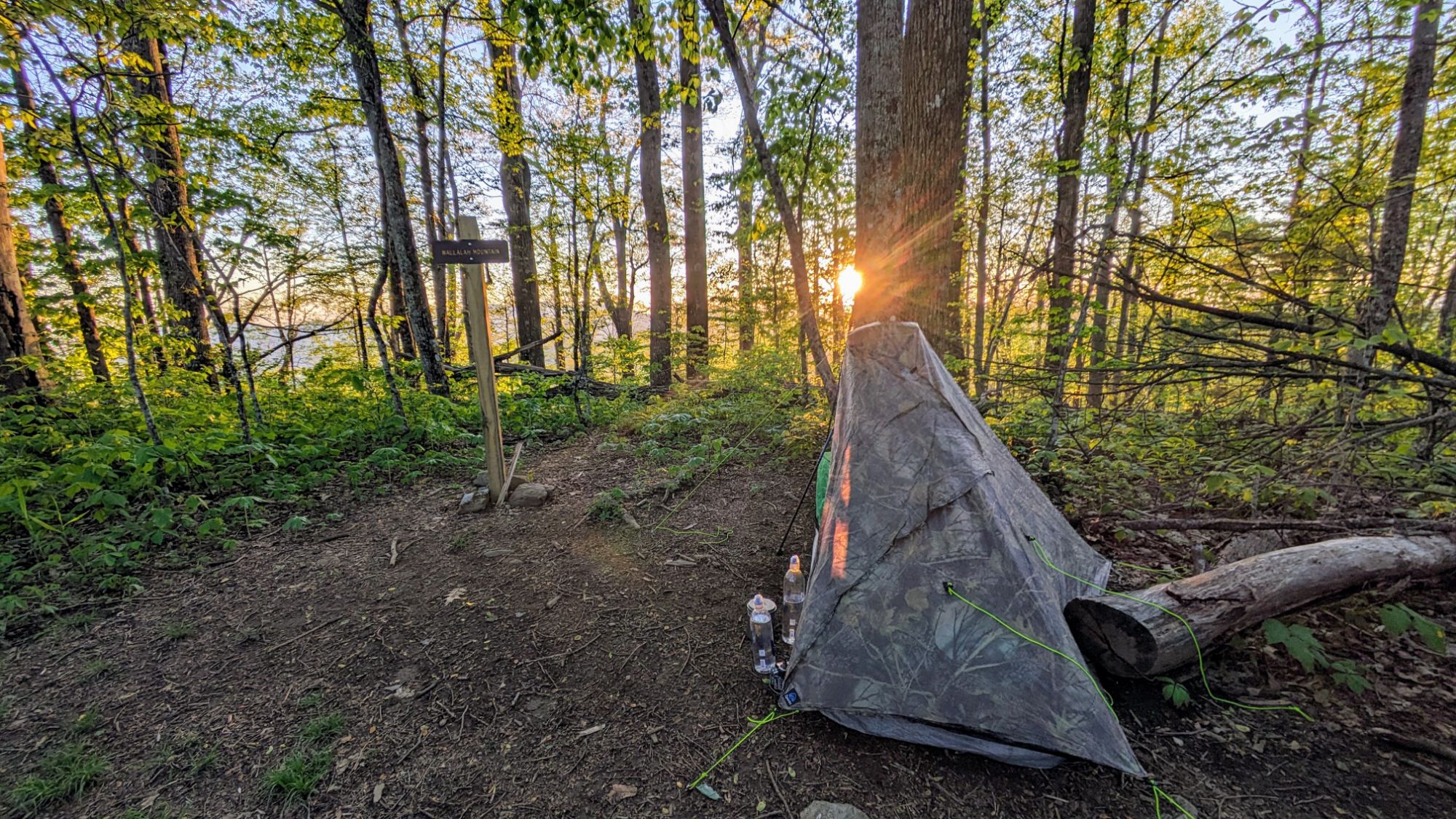
The last climb was a bit of a grind but had a nice view of Springer to the south, so I could mark my progress for the day. Thanks Peakfinder! The round top of Wallalah mountain was perfect for just one tent. I set up carefully among all the poison ivy and enjoyed a partial view of the sunset. What a great first day!