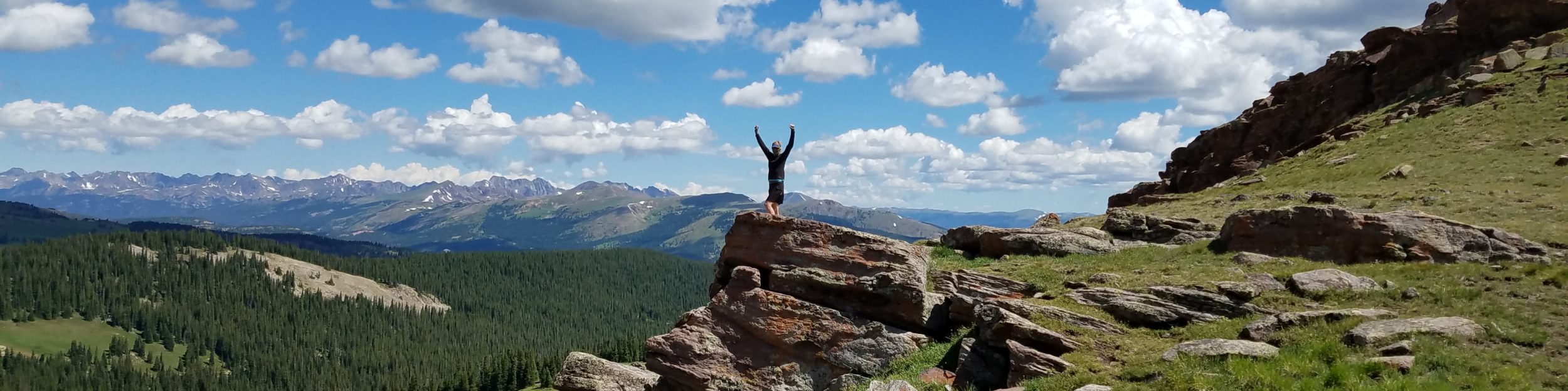
I wanted to post in more detail about this beautiful and fun loop hike I did as the finale of my 2026 AZT hike. Since the North Rim of the Grand Canyon was still closed due to the 2025 Dragon-Bravo fire, I decided to end my AZT hike at the Colorado River. This made the logistics of getting back to Flagstaff and Phoenix (for a flight home) much easier and freed up a few days to do even more! hiking in the Big Ditch. So following my overnight down the South Kaibab Trail to Phantom Ranch, then halfway back up the Bright Angel Trail, I went straight to the backcountry office to see if I could get another overnight permit to camp along the river. It would have been more efficient, cheaper, and less elevation gain/loss to combine the 2 overnights into one trip via the West Tonto Trail, but then I would have missed portions of the other trails. I’d never hiked any sections of the Bright Angel, Hermit or Boucher Trails before this trip.
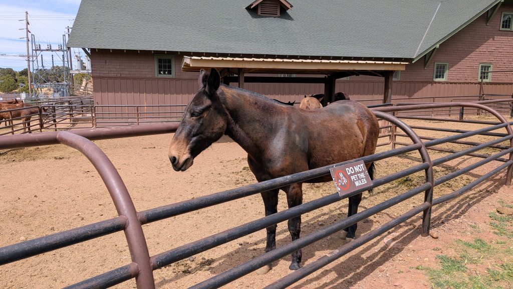
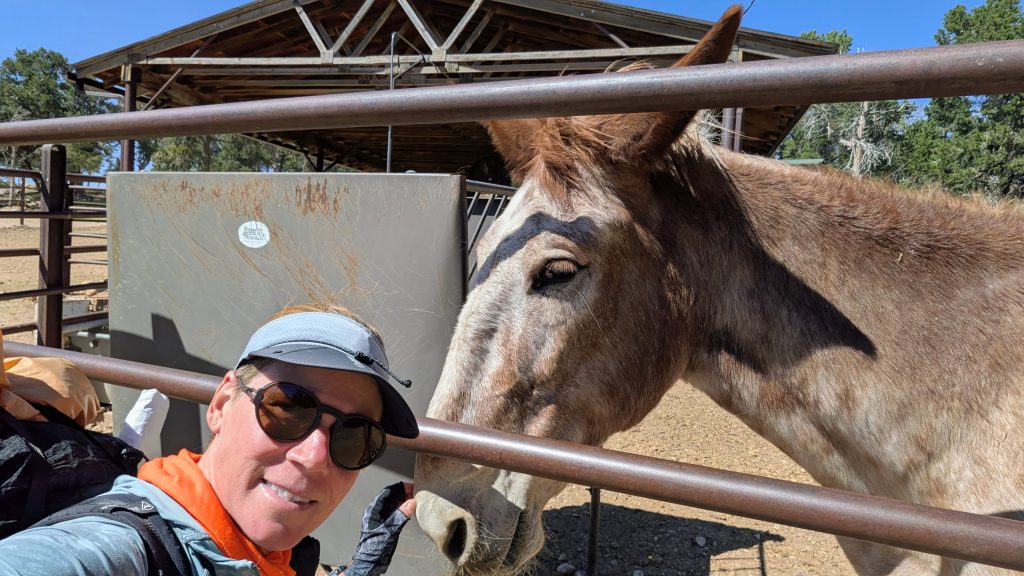
Leading up to this, I spent my first night in the park at the AZT thru-hiker site near Phantom Ranch. While it was fun for the novelty of staying near the historic ranch (I got to enjoy an expensive beer at the store), the settings left a bit to be desired, being so far away from the river. In fact, the entire Bright Angel Campground, as well as the ranch, are situated up the creek about 1/2 mile from the Colorado River. Also, the sites are right on top one another and perpetually packed full of campers. Ironically, the AZT site is one of the more secluded locations, albeit right next to the compost pile, mule stable and staff tent housing. I was fortunate to have it to myself the night I stayed, but the vibe just wasn’t the same as I enjoyed camping alongside the river during my Hayduke hike and Grand Canyon rafting trip. I was yearning for a more intimate experience with the river once again, so I was most pleased to be able to snag a permit for Hermit Rapids only one day in advance.
It’s worth noting here that a single backcountry site for 1 person now costs $25 a pop. $15 of that is the per person/per night permit itself (which I’m absolutely fine with, if only it were all going towards sustaining the park), but the remaining $10 is the administration fee charged by wREC.gov, which I find outrageous. A fee that’s 2/3rds the cost of the permit is criminal! (albeit less of a ripoff if you string multiple nights and people together into one permit). There’s no longer any way to avoid this fee, as even going to the backcountry office in person means that the rangers simply enter your info into the website, as opposed to you doing it yourself online. It makes me so mad that this private, for-profit company gets away with selling our public land back to us, like a bunch of suckers! But I guess it’s not surprising, given the amount of grift and corruption our government seems to fully endorse these days.
On the other hand, NPS Ranger David at the backcountry office was phenomenally professional, helpful and informative; just a real pleasure to talk to both times I went to get my permits. We chatted for a bit about horned lizards and snakes, as he was a herp fan like me. And he gave me lots of insight on the trails I was planning to hike, along with the printed route descriptions. These Park Service personnel are my heroes, especially after all the crap they’ve had to put up with recently. I hope the Park Service manages to survive the historic budget cuts, firings and outright disregard and disrespect the administration has bombarded it with. National parks are our nation’s greatest legacy and treasure. A lot of damage has been done in 2 years, but a lot still remains intact. The Grand Canyon is still quite GRAND, after all.


Here are maps of the Hermit-Boucher loop that I found on the internet (not my own creation). Note that most treat this loop as a multi-night trip, which is good since the goal is to enjoy as much time as possible in the Grand Canyon and stay at several of the lovely campsites near the river (Boucher, Hermit and Granite Rapids). I only had a night to spare and was in really good shape after hiking most of the AZT, thus I squeezed it into a 2 day trip. There is camping at large along the Boucher Trail (details about good locations provided in the NPS pamphlet), but the only sites permitted along the Hermit Trail are Hermit Creek and Hermit Rapids.
Day 1 (35 of AZT trip): Thursday, April 23. 1320’/5600′ gain/loss.
10 miles, starting from Hermit’s Rest Trailhead down the Hermit Trail to Hermit Rapids campsite.
I camped in the hike-in-bike-in site at Mather Campground, South Rim, the night before. No reservations are needed and it only costs $6 per person / per night…best deal in the park! I shared the site with several AZT hikers, as well as 2 Hayduke hikers, so I had some experienced and interesting company. Everybody was packed and gone by the time I rolled out the next morning, off to tackle their much more ambitious adventures. I had to wait until the 8 am shuttle to Hermit’s Rest, so a super early start wasn’t an option for me.
I didn’t envy the Haydukers, who were facing at least a 10 day food carry, due to the North Rim closure. They planned to take the Bright Angel down to the West Tonto Trail, connecting all the way to the South Bass Trail, cross the river on a raft (assuming one came by in a reasonable amount of time), go up the North Bass Trail, back down Saddle Canyon and Tapeats creek, along the Colorado riverside for 8 miles, up Kanab Canyon and out Hack Canyon. From there, they’d still have several long and hot days crossing the Arizona Strip before arriving Colorado City. I don’t recall if they’d placed a cache in Hack Canyon, which at least cuts the food carry down by a few days. But I knew the difficulty of the route all too well (minus the West Tonto and Bass portions).
On the Hayduke in 2023, I’d faced a similar North Rim closure and record high snow and flood conditions. Hiking down Tapeats creek wasn’t even an option that year, which is why I stopped at the south rim and postponed the last couple hundred miles until the fall. Then I started from the North Rim, negating the several days it would have taken to hike the West Tonto and Bass Trails. It was still the wildest hiking I’d done yet in the Grand Canyon, an experience for which I was most grateful. But I was looking forward to something a little more tame this time around.
As for the AZT hikers, a really nice guy named Logan, who I’d met before all the way back in Patagonia, was taking a shuttle around the North Rim closure. He hiked to the Utah border to finish his AZT hike days later. I wasn’t interested in paying $150 for the shuttle and re-hiking the AZ strip, especially when I could be exploring more of the canyon, instead. The other 2 AZT hikers planned to connect their steps by hiking the East Tonto to the Escalante route to the Beamer Trail, ford the Little Colorado River, cross the main river on a raft hitch (hopefully), then hike riverside to pick up the Nankoweap Trail and out. I hiked that whole route in reverse, also as part of the Hayduke in 2023. It too was an incredible 5 days in the canyon, leaving me pretty satisfied in having seen much of the eastern side. Now I was excited to see more of the middle part of the GC, via the Hermit-Boucher loop.
Originally I was planning to hike only the Hermit Trail down and back, but thoughts of tackling the longer loop crept into my brain overnight and I couldn’t shake the appeal of it. I always prefer seeing something a little different on the return and getting the most bang for my buck while I’m already there. But the trail description for the Boucher Trail was pretty intimidating. It colorfully noted “brutal, knee-wrecking” descents on ball-bearing surfaces, along with long water-less stretches and disintegrating trail. It was labeled as being for “experienced canyon hikers.” I was that, wasn’t I? After all, the Nankoweap Trail was said to be the most difficult named trail in the park and I hadn’t thought twice about doing it at the time. In fact, after all the craziness the Hayduke threw at me, I was just happy to have a trail to follow.


I was first in line for the 8 am shuttle, which was thankfully right on time. But by the time it arrived the end of the red line, I figured I might as well wait for the store to open at 9 am, so I could buy an expensive ham sandwich. I didn’t start hiking until 9:30 am, but at least I didn’t have all that far to go…or did I? I was still wavering about hiking the longer Boucher Trail down while I was fresh, plus had lots of water and gravity on my side. But it felt late in the day to be committing to 16 miles of canyon hiking. Also, the NPS pamphlet made it sound like it would be better to go up the Boucher Trail. At that point, I decided it was probably best to hike down the Hermit Trail, saving the decision about the Boucher Trail until the next morning.
Only a few minutes into the hike, I met an experienced solo hiker finishing his trip and polled him on his thoughts about the Boucher Trail. I loved how he mostly discretely looked me up and down and concluded that it was indeed a pretty challenging trail. I specifically asked him about the part of the description that read: “A break in the upper cliff requires an incredibly steep, risky hand and toe climb.” Was this really a class 3 or 4 climb? He agreed that it was a challenging part of the trail and that it would be easier to go up, rather than down. Then I name-dropped the Hayduke, listing a few sections of the canyon I’d already hiked, and he was immediately like, Oh yeah, you’ll have no problem then! Perspective always helps.
A different guy also gave me good advice about leaving 1 liter of water in Waldron basin at the junction of the Dripping Springs and Hermit Trails, as insurance in case I ran low on water coming up the Boucher the next day. I had 2 one liter smartwater bottles, plus a 2 liter Evernew bladder, so figured I could easily made due without the storage capacity of one of my bottles. Luckily I’d just filled both at the store, and so after the first few miles, I found a spot under a rock to hide a bottle, hoping it would only need be there for about a day. I also saw where another group had a cached a few bottles. I would have been nervous about leaving mine so visible. In the past, I’ve always been pretty meticulous in hiding my caches, especially during the Hayduke and Desert Winter Thru hikes, where I buried multiple gallons of water and bags of food. I’d had only one mishap in that time and had learned a lot in the process.
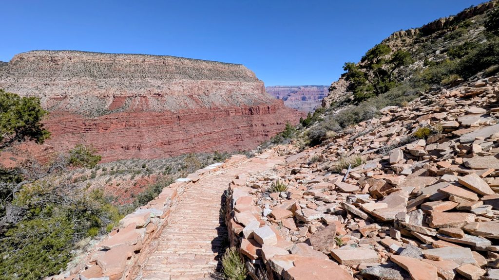
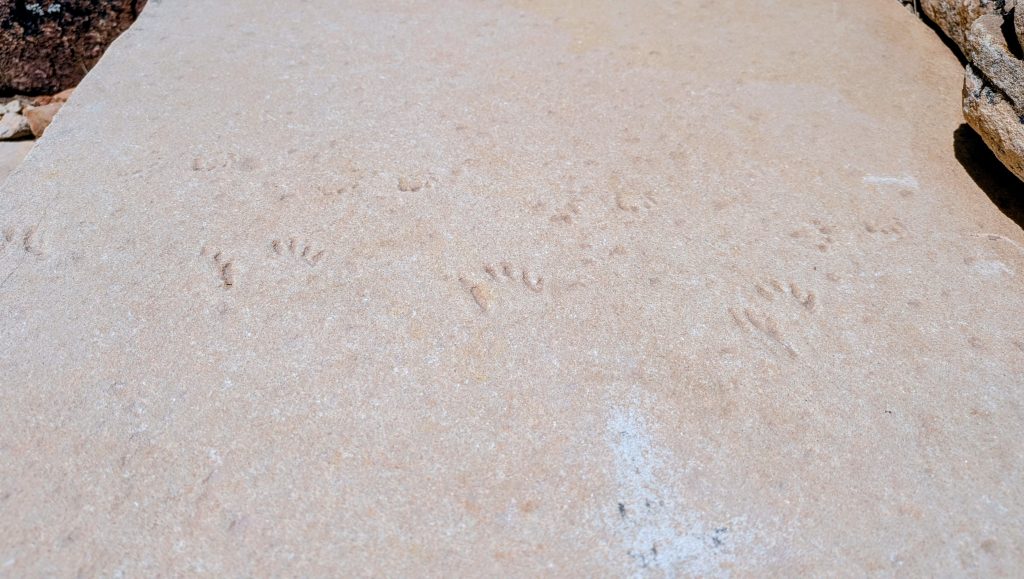
As for the Hermit Trail, it was a fabulous time. The first couple miles through the uppermost layers of the canyon were well-graded, easy and immensely enjoyable. Remnant stretches of the historic stone pavers and steps, so meticulously crafted out of the native rock, were a joy to behold. A few stone slabs even revealed ancient lizard footprints. Unlike the incredibly popular Bright Angel and Kaibab Trail corridors, which have to withstand the rigors of thousands of humans and mules every day, the Hermit Trail probably only sees a couple dozen hikers a week. The popular trails have deep gouges worn into the rock from all the traffic and have to be reinforced with rebar stakes and wood bars. On the contrary, the Hermit Trail felt both desolate and pristine, despite it’s hundred + years of history. Early on, I passed a large group of packers on a guided trip, a few solo packers and day hikers, but otherwise I had the trail to myself all day. By the time I reached Santa Maria spring, I’d dropped nearly 2000 feet in 2.5 miles, leaving almost all traces of civilization behind. The hiking felt effortless the weather was perfect.


I took an early lunch break at the spring, filtering water from the slowly-dripping pipe and eating while sitting in a rocking chair inside the old stone shelter. My expensive sandwich tasted really good, given the supreme setting! Plus, I found yet another great use for my friend Michelle’s Camel-Up device. I had the fortune of making her acquaintance when she hosted me in Flagstaff for 2 nights. It was then that she showed me all the benefits of her simple yet effective invention for collecting water. It attaches to a trekking pole to more efficiently and effectively reach into water sources, particularly nasty cow ponds. She came up with the idea while thru-hiking the AZT herself and I think it’s brilliant! It works with a CNOC bladder, a water bottle, and even a ziploc bag. It also rigged perfectly to the pipe so that I didn’t have to hold the bag in place myself. Additionally, I tested the claim that it floats (in case dropped in a lake or stream) and indeed it did. It attracted the attention of a tadpole, even. What a cool little device!


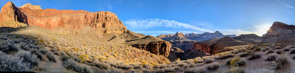
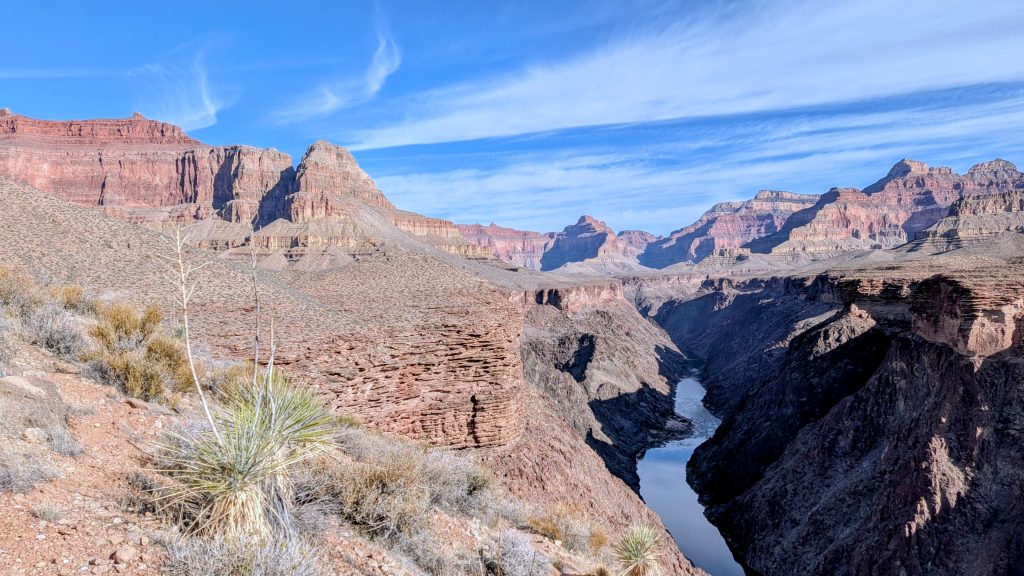
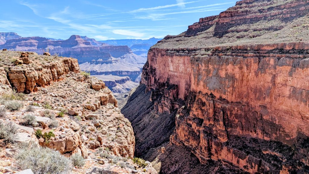
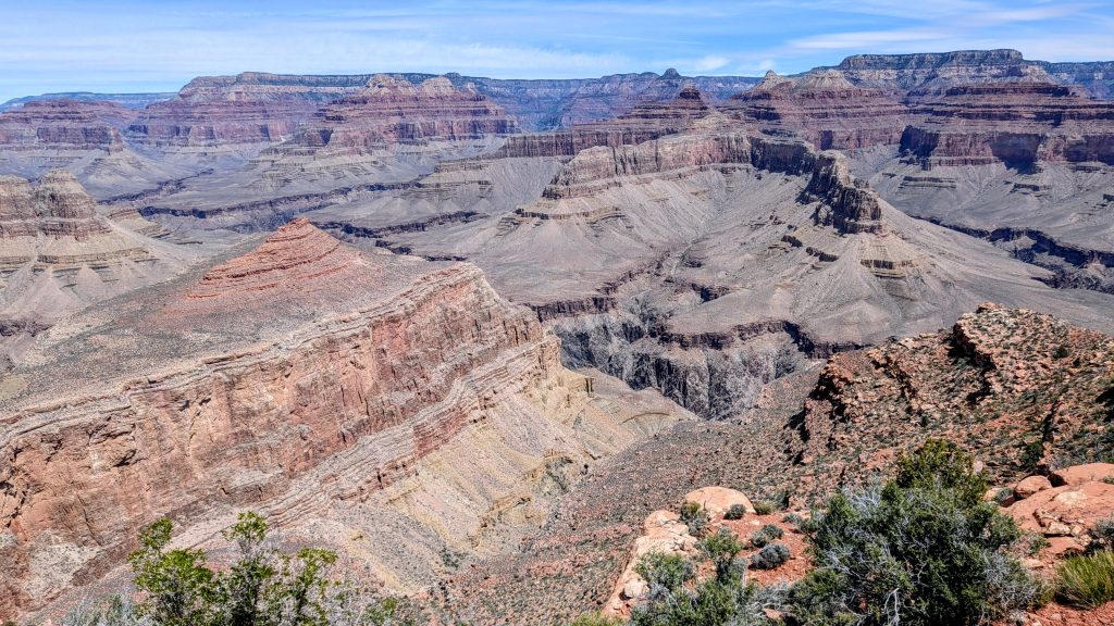
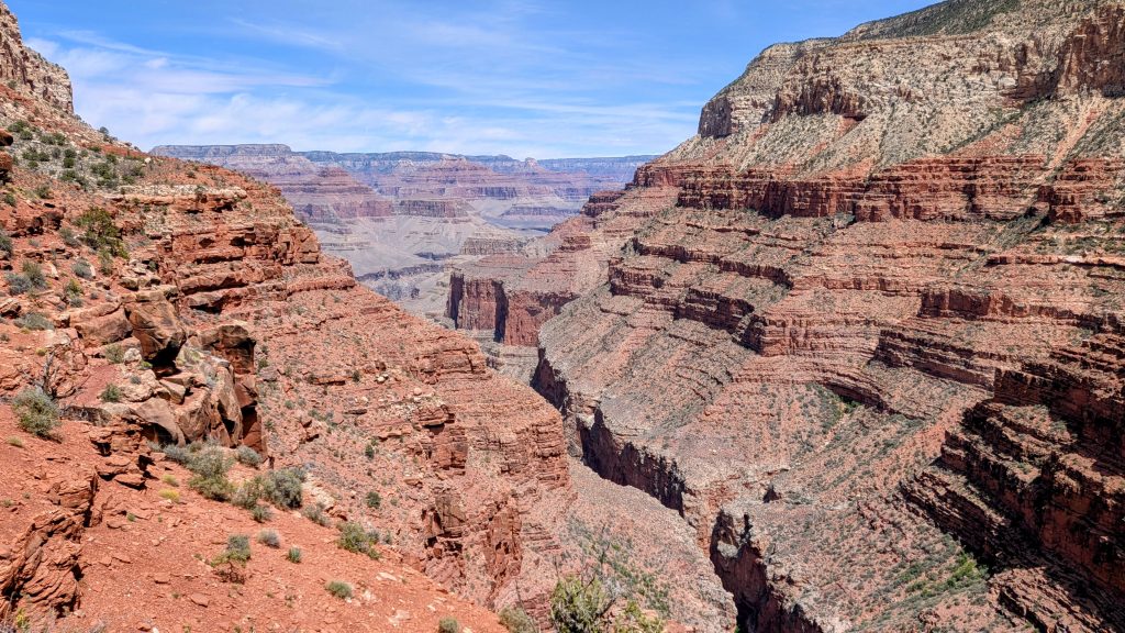
I continued on along a beautiful traverse of the Supai layers, slowly making my way down, both in elevation and progress northeast, towards the inner canyon. The traverse was several miles long and much slower going. All along this massive side canyon were breathtaking views. Giant boulders perched on the precipice, defying the will of time and gravity. Across the gaping canyon, I pondered the many layers of the exposed far side, wondering where and how the hell the Boucher Trail managed to navigate the vertical walls. The maps indicated that it delicately danced just above the blocky red Supai groups, finding a precarious purchase along the Esplanade bench. I could see no trace of it and shuddered to think that I planned to be picking my way along it the next morning. So many things look downright impossible in the Grand Canyon, at least from afar. Focus usually has to be given to the few feet ahead of you. The puzzle is slowly revealed, one step at a time.
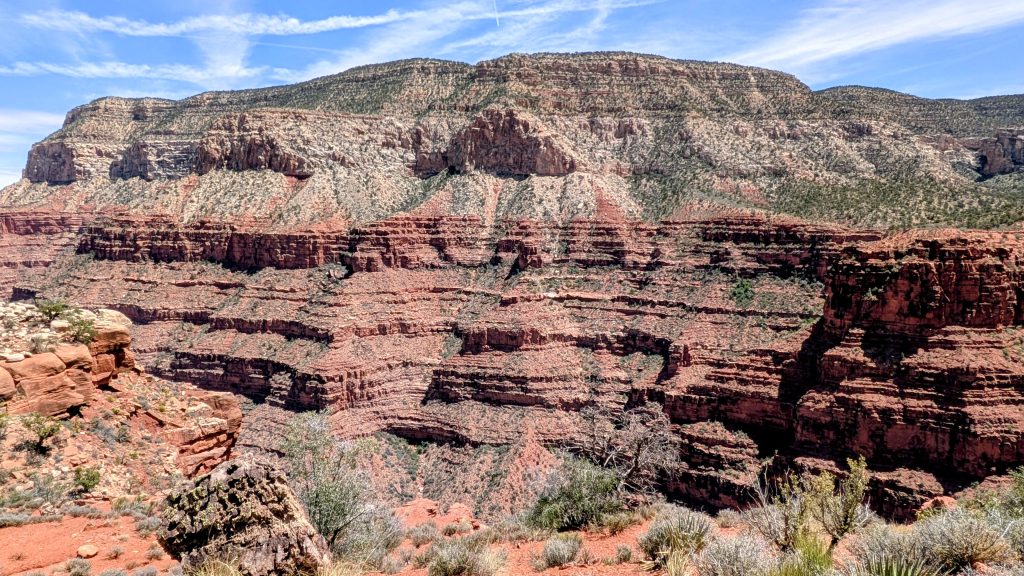
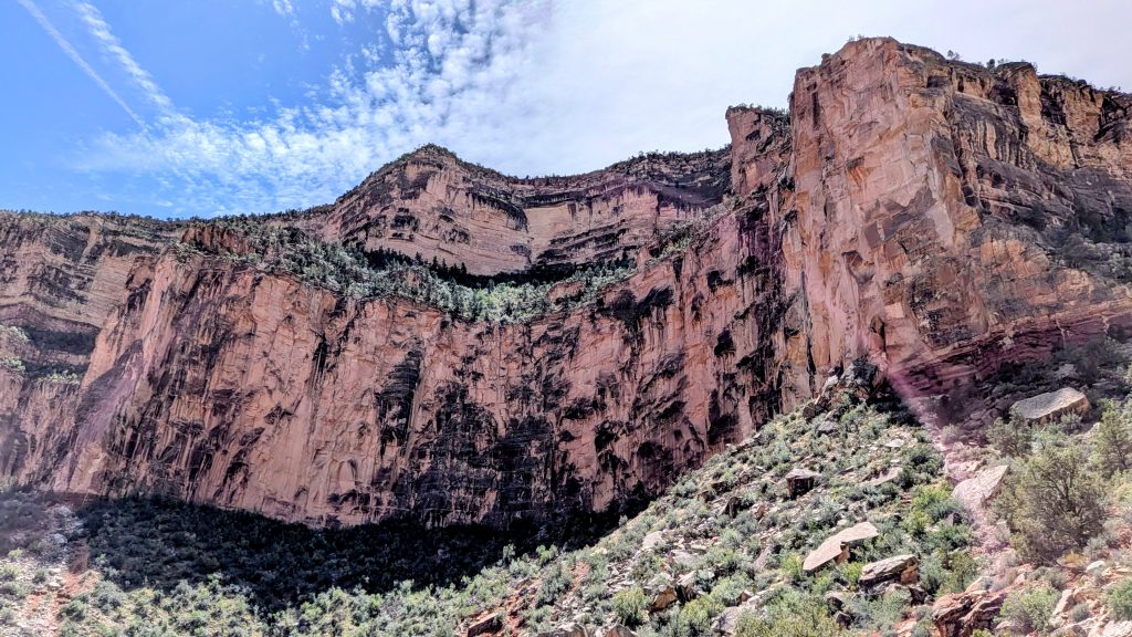
Just when it seemed as though the trail would run out of solid footing nearing the end of the long bench I was on, leaping into the abyss of the greater canyon itself, the trail plummeted through a weakness in the Redwall. It expertly made use of a series of short, well-crafted stone switchbacks (the Cathedral Stairs), built over a hundred years ago. There are a limited number of such weaknesses in the Redwall limestone, given it’s resistance to erosion, so this sheer layer is generally regarded as the crux of most Grand Canyon routes. Often where prominent trails do exist is because these weaknesses were discovered by the indigenous people centuries ago, then developed and improved over time. Animals like the desert bighorn sheep have also long been the champions of finding and following such natural paths. The more I learned about the geology and geography of the Grand Canyon, the more fascinating it became.
It took awhile longer to make my way down the steep shale and talus layers below the Redwall, a section where the gravelly nature of the substrate always make me feel like I’m one foot skid away from sliding to my death, or at least a very painful injury. Luckily my Salomon Speedcross srunners still had plenty of tread left to give me a confident purchase, despite me wearing them down over the course of 600 miles (Sierra High Route and part of the AZT). They started with such a generous amount of tread that I’d found them to be quite durable, plus also very suitable for scrambling and canyoning. Then I was momentarily distracted by the discovery of a delicate, tiny nest belonging to a pair of blue-grey gnat-catchers, a reminder that life somehow manages to exist and even renew in the harshest of environments.


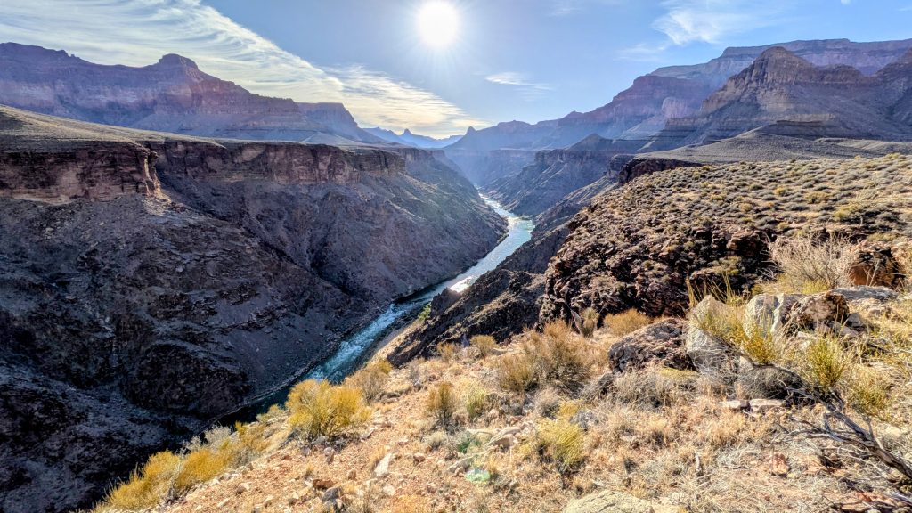
I breathed a huge sigh of relief upon reaching the Tonto Trail intersection, as I knew that my travel on it for the next mile would be relatively easy and that I didn’t have much farther to go after that. I’d spied the wide-open swath of the Tonto Trail several hours before, from hundreds of feet above, as the relatively flat and exposed characteristics of this massive bench layer make it quite visible. If one is patient, you can even watch tiny figures following this ant trail, sometimes at a distance of nearly a mile. I hadn’t seen anyone hiking near or far since leaving the spring, as much as I did pause now and again to look. I thought there was even a chance I might see the Hayduke hikers go by, but I never did. I was actually really surprised by how quiet the trail was all day.
Finally arriving the lower reaches of Hermit Creek canyon, I took a shortcut down and in, bypassing the toilets and campsite. Here I enjoyed the treat of dropping through my favorite layer, the Tapeats Sandstone. There are so many cool slot canyons that carve through this beautiful pancake-stacked layer, plus oftentimes crazy fossils in the form of worm burrows and trails. Perhaps I also love it because it usually signifies that I’m getting close to the river! My favorite passage is along Deer Creek narrows, a slot that culminates in the stunning Deer Creek Falls. This is a sight that usually only rafters are privy to, but can be reached (with difficulty) by Hayduke routes down Saddle Canyon and Tapeats Creek, or the Bill Hall Trail. Per usual, travel down Hermit Creek was phenomenal, but slow. Constantly hopping back and forth across the creek and battling with cattails and invasive tamarisks made the last half mile rather tedious. But my anticipation grew progressively with the rising hum of nearby Hermit rapids, spurring me on.


As a rafter, I knew the growing thrum all too well, a sound that had often struck fear deep in my soul (I could only imagine what Powell and his company must have felt—sheer terror I’d bet). But it’s funny how the change in my mode of travel meant that it was now a welcomed sound, no longer capable of affecting me. Perspective. Finally I broke through the vegetation to behold the swell of white energy bursting down the canyon. My heart-rate immediately spiked, but mostly out of joy. I recalled these rapids as a purely fun wave train and not ones that I’d fretted (like Hance, the Horns, House Rock, and Lava). Next my focus shifted to peering longingly upriver, hoping a rafting party would come along so I’d have some entertainment.


Well, apparently I might have waited a long time. In fact, I found it very odd, the entire time I spent around Phantom Ranch in the 2 days prior, plus the many views I had of the river this trip, plus all the time spent directly next to it, I never once saw a rafting party. On all my previous GC hiking trips, I’d always seen at least one or two. During the Hayduke, there were a plethora and I had no problem getting hitches as well as hooked up with meal leftovers. Now I wonder that I was extremely lucky back then, or just unlucky in not seeing anyone this time. A big difference was that I was hiking during the commercial rafting season on those previous trips. Yet it was all private party groups that had helped us. Again, I thought of the Hayduke and AZT hikers that were banking on being able to get a hitch across the river in the upcoming days and wondered if they’d have better luck. For their sake, I hope so!
I followed the use-trails over to the raft campsite, still wistful I’d find a party there. No dice and there wasn’t even evidence, like footprints, that there had been one recently. But the lovely beach with calm water beckoned me, so I went for a well-deserved dunk in the river. My thermometer read 80 degrees in the shade, so boy did that 50 degree water hit the spot! Then I lounged on the beach, drying my clothes and snacking. This was the clearest I’d ever seen the water, which reflected the most beautiful emerald green in all my pictures. A guy suddenly wondered by and I quickly deduced that he’d come from the Hermit Creek Campsite, a mile away. He was a backpacker like me, easily given away by the tread of his trail runners (which were huge compared to my bare feet!). We chatted briefly and he pointed out a cool snake, which I chased around for a bit trying to get good pictures. I looked it up later to find it was a Desert Striped Whipsnake, fast and beautiful! I also tried getting some expert wildlife photography of the charismatic spiny and collared lizards. They make it pretty easy with their large size and lounging about. Herps galore but alas I still have never seen one of the pink GC rattlesnakes! All the more reason to go back.


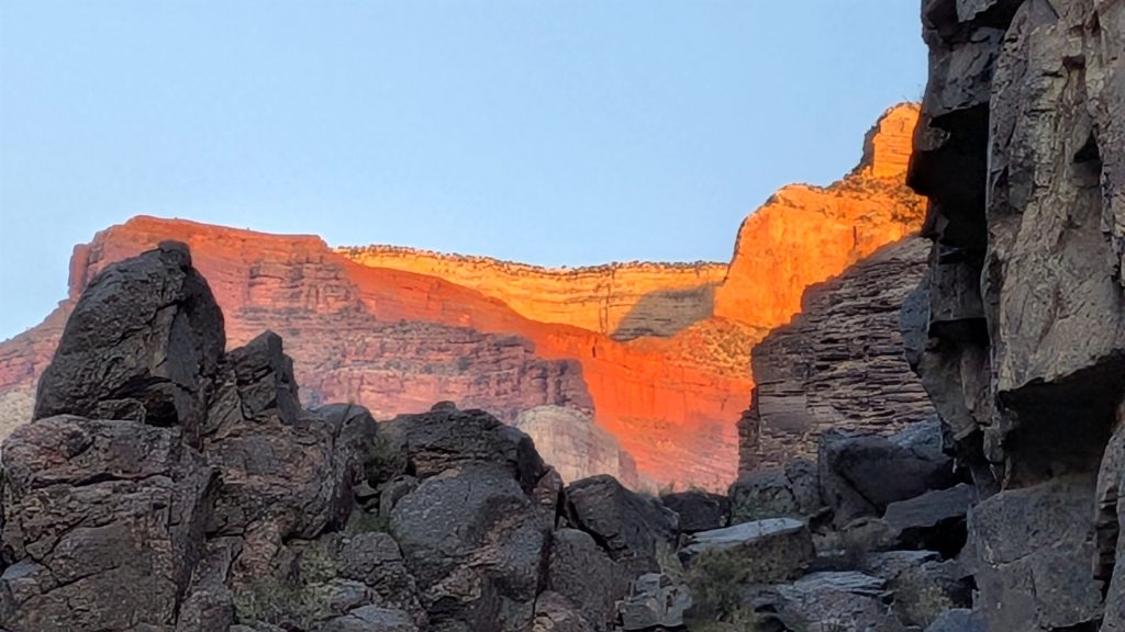
After playing around for several hours, a luxury I’m not often afforded on a thru-hike, I went back over by the rapids to claim a tent site. I couldn’t believe there were no other hikers. I took the primo spot with an elevated view up by the rocks, which another hiker had previously told me about. It was a nearly perfect site and my camo tent matched the surroundings so perfectly. It was exactly what I’d been hoping for on this last night of my hike. I enjoyed my simple dinner, basked in the evening evolution of light and space, then committed to a very early start the next morning. One hiker did finally come by, a late arrival who I welcomed to join me nearby. He was very friendly but understandably wanted to claim his own vast kingdom, so I assured him he’d most likely have luck staking out the large raft site. He never came back, which indicated that there were indeed no rafters visiting that night. Or he struck it rich by being invited to their feast of smoked salmon, steak, and all the fixings, I’ll never know which was the case but my imagination did run wild. At least I didn’t smell any indications of such activities, so I assume he was alone and stuck with the measly food he carried down in his pack, like me.


Just as I was retreating to my tent, I watched the headbeam of the red line shuttle skirt the edges of the south rim, some 5-10 miles to the east and 5k feet up above. It might as well have been a spaceship, relative to my circumstances. So I guess it’s possible to see both hikers on the Tonto Trail and rafters running Granite and Hermit rapids (maybe even Boucher) all the way from one of those touristy view points. Like the Gods of Mt Olympus peering down on the mere mortals, or in this case, those braving the depths and expanses of the canyon. I preferred to be a mere mortal, breathing the scents of the river and being lulled to sleep by the hum of the white water. Bliss!
Day 2 (36 of trip): Friday, April 24. 6860’/2550′ elevation gain/loss
16 miles starting from Hermit Rapids to Hermit Creek, Tonto to Boucher Trail up to the Hermit trail and Hermits Rest.
It was so warm overnight that I barely used my 50 degree quilt. Nevermind that I also had my 30 degree quilt plus all my useless layers. I’d wanted to leave half my stuff on the South Rim, but there was no safe place to store it. So I carried all that extra weight down to the bottom of the canyon and back up, twice! Well, at least I wasn’t carrying hardly any food weight.
I set my alarm for 4:30 am and was hiking at first light. I enjoyed the 1.5 miles up the creek, watching the increasing light change the colors and contours of the Tapeats sandstone. I found the cutest red-spotted toad, another herp to add to my list. At the campsite, I stopped to use the vault toilets and filter 3 liters of water from the creek. I was surprised to find nearly every campsite filled, with I’m guessing 12-15 hikers. Why had there been none at Hermit Rapids? I didn’t even know the quota for that site, nor how I’d been so lucky to score a spot the day before. Had Ranger David done something special to hook me up? Whatever the case, I was most grateful for my experience camping there. It had been exactly what I was seeking.


With a bounty of water in tow and the day still young, I turned west on the Tonto, committing to the much longer and harder way back. For the next few hours, I bounced along in true Tonto fashion to the intersection with the Boucher trail. Much of the experience of this very long, mid-level canyon trail is thus: hike for miles traversing up a side canyon, cross a dry (or if you’re lucky, slightly trickling) creek, hike for miles back towards the river, scale above some sheer and breathtaking cliffs while you glance longingly at the inaccessible water below, dodge a ton of cactus encroaching the trail the entire way, and repeat repeat repeat. And oh yeah, unless you’re lucky to have gotten a really early start, it’s going to feel like an inferno. There are no trees except for the occasional cottonwood in a side creek bed. The river views of the inner gorge bedrock are my favorite parts, but also it can be so frustrating seeing the river so close, yet having no way of ever reaching it alive. There I stood above a cliff-face, looking directly down on my campsite, but only after 2 intensive hours of hiking to get back to the exact spot, only several hundred feet higher. Travel on the Tonto is relatively fast and easy, yet it feels like you’re getting nowhere. But I’m not complaining, as it’s still one of the most incredible trails in the world!
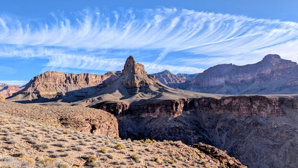
Luckily I did employ an early start this day, so I never had to suffer the heat. In fact, I had nothing but perfect conditions, enjoying stupendous and heartbreaking views. And once again, I had the trail all to myself. As I worked my around, I could also see Boucher and Granite rapids…yet still no rafts. Then there were some cool views of unique cascading formations in Travertine Canyon. The 5 flat miles went by very fast, and I barely touched my 3 liters of water. At the intersection, I could have gone down a ways to reach Boucher creek, but I didn’t need to. I was glad I carried the weight so that I at least didn’t have to add extra distance to my day.
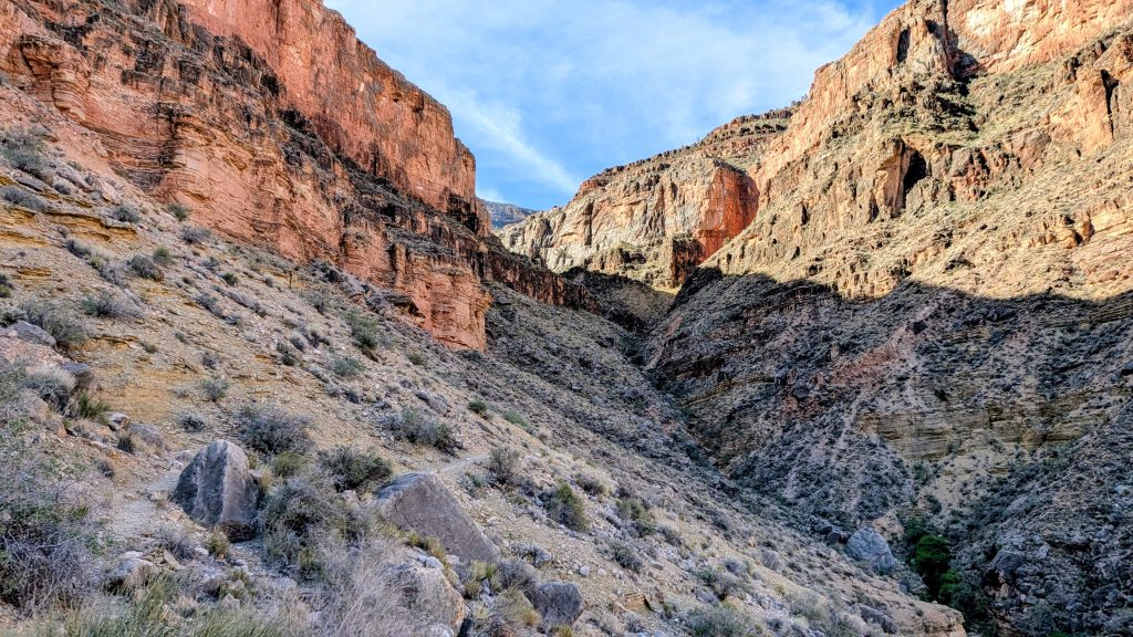
Then it was time to climb! The Boucher Trail immediately made its bid for a crack in the Redwall, which of course looked quite intimidating from below. It was one of the coolest passages yet, squeezing through a tiny ravine which got more and more narrow as I went up. Emerging from the tight and incredibly steep crevasse onto the broad bench above it felt like I’d been birthed out of a secret and special canyon portal. I crossed a wide saddle between Whites Butte and the outer rim formations, marveling at the views, cactus flowers and fossils. The scant trail made a really spectacular short traverse hovering above the Redwall cliff face, back to the head of Travertine canyon. Here I once again looked down on my position from hours before, now far below the impressive and imposing face of the massive Redwall. Then I began another steep climb, of note for its short section of hand and foot climbing through the uppermost Supai layer. Yes, I did have to briefly stow my trekking poles, resorting to some light scrambling. It got my heart rate up for sure, but wasn’t nearly as bad as I feared. Still, I could see how others might have difficulty with it.


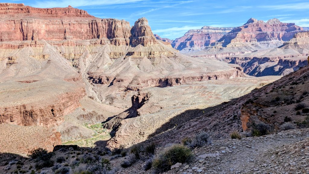
I took a short lunch break, then continued on. It seemed like I’d done so much already, and I had, but I had a lot more to go! There was a very long traverse of 4-5 miles working my way north, around Yuma point, then south again all the way up Hermit Canyon. Finally my route along the high Esplanade, which I’d pondered the day before, became clear to me. What had looked like sheer cliffs from across the canyon was revealed to be a pretty chill bench. Yet at times, I had to scramble through some large rockfalls that had been dropped from the Coconino above. Thinking too long about what it must be like to witness, or be a part of, such rockfalls put more pep in my steps. But I still paused to gaze across the canyon, picking out the faint trace of the Hermit Trail here and there. I finally spotted a tiny backpacker working their way along the cliffs. Having just hiked the trail the day before, I knew approximately where to look. But I wondered, could they see me? Did they even know a trail existed across the great chasm?
I finally reached the head of massive Hermit Canyon and the intersection with the Dripping Springs Trail. Don’t let the name fool you, there was still no water along my route, not since Hermit Creek. I would have needed to side track a ways up Dripping Springs Trail to find the actual spring, and I wasn’t sure if it was even dripping. Luckily I was doing fine on my water reserves and still had my extra liter cached less than a mile ahead. I shortly reached the intersection with Hermit Trail and retrieved my treasure. I didn’t really need it, but it was nice peace of mind. I hiked the final couple miles to the trailhead, catching up with the group of lady hikers that I met at Hermit Creek early in the morning. They couldn’t believe that I’d gone the longer route and still got back by 2 pm. Their guide offered me a selection of cold drinks from her car in the parking lot…I scored a cold coconut water! That was just the reward I needed for my big finale finish. Hooray, I was done!
In case you’re wondering how I made it back home, I took the shuttle to the GC village, scarfed down a microwaved Stoufers lasagna from the general store (which I’d been craving for 2 days), walked to the highway to hitch to Flagstaff and got ride within 5 minutes. The lady who picked me up was from Wisconsin and was on an Amtrak train adventure. She told me about the ins and outs of train travel, namely how she buys passes that allow her to get on and off for several days in interesting places like Flagstaff, then she rents a car to see more of the area. She was so sweet and just looking for some company for the 1.5 hr drive back…but only company from another woman. Luckily she’d noted my hair, which I always make sure to let down when I’m hitching. I prefer rides from women as well, just from a safety standpoint.
Back in Flagstaff, I stayed with friends, enjoyed a soak in a hot tub and ate all the food. Two days later, Kim, another Trail Angel that lives in the Sierra Vista but was visiting Flagstaff, gave me a ride to Phoenix. Otherwise, I could have taken the bus. There I stayed with my good friend and renowned Trail Angel Mamma Walker (Dime Bag), who I’d also reunited with earlier in the trip, when we met up for 1 night of camping near Mormon Lake. We had a blast visiting the Desert Botanical Gardens, then I few home. I’m so glad that the logistics of getting too and from the Grand Canyon are rather easy, as I hope to make many return visits to the area.