Day 17: Bishop Pass Again, Friday, Sep 19th, 2025, 1530-1920.
10 mi to Bishop Pass trail, elevation 9690′. 2320\2450.
I woke feeling very ready to get back on trail. The zero was good, especially since the mountains got hammered with rain during this time. The weather forecast still had flood warnings in effect for Yosemite through the end of the day. What a change from the week before, when the warnings were due to the fire, smoke and bad air quality. Some new hikers checked into the hostel mid-morning, telling very soggy, cold stories about their mis-adventures in the high country the past 2 days. Mt Whitney even got several inches of snow. There was a chance of rain for the late afternoon, but it was supposed to be clearing overnight and then be beautiful for the next 4 or 5 days. Time to go!
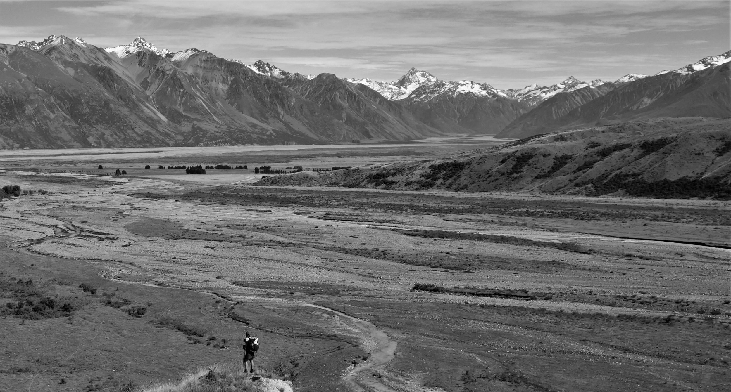
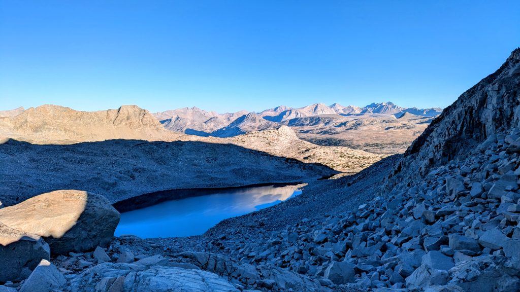
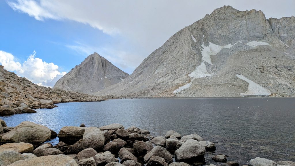
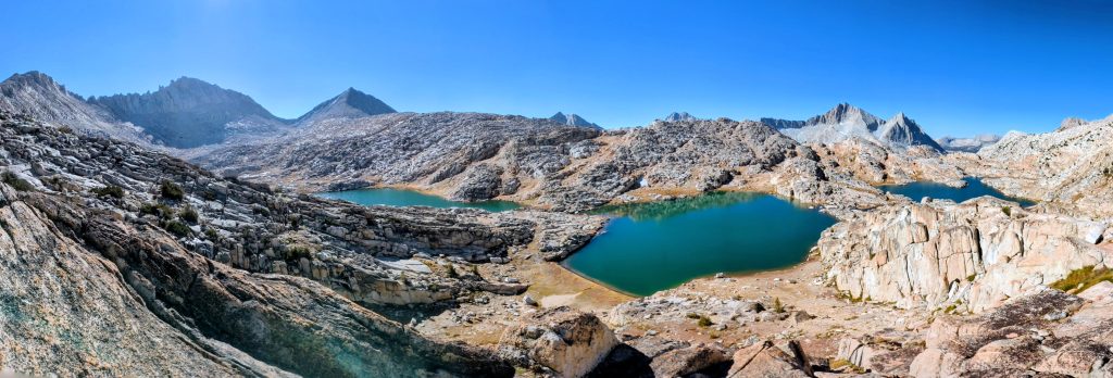
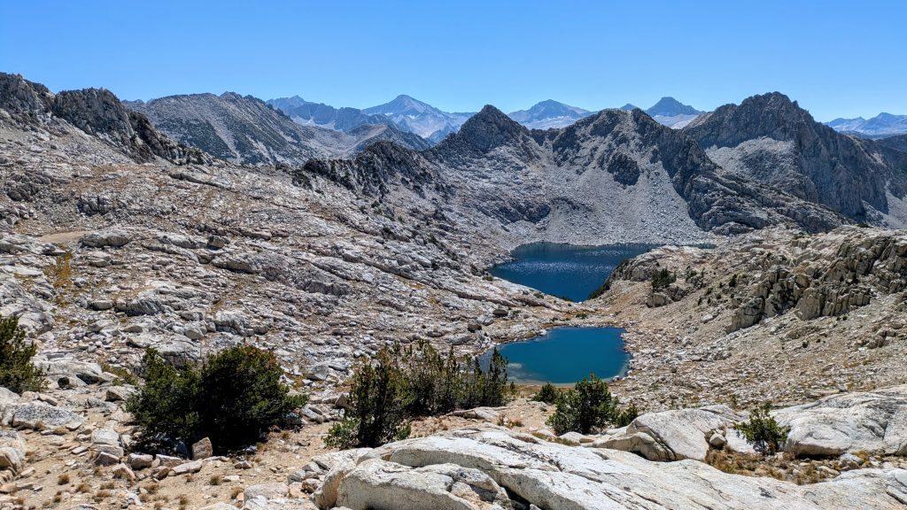
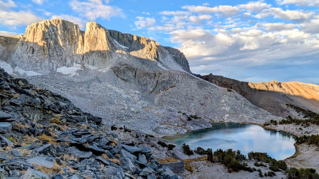
I got some more chores done, then met Purple and Willow around 2 pm. Not only did they give me a ride, they were great company all the way up and over Bishop Pass. It was so fun to hike with some fellow PCTers, too bad our schedules didn’t align more. They planned to go over either Knapsack or Thunderbolt pass, summit Mt Sill, then work back to their car. I bid them farewell in Dusy Basin and followed the Bishop Pass trail another 3 miles down, trying to get out of the clouds. The pass was pretty socked-in with some light drizzle, but I could tell the clouds were breaking, just as the forecast said. It got dark pretty fast, so I hiked in the mist and fog for about half an hour before finding a nice site with my headlamp. The trail had puddles everywhere, but at least the campsite had good duff under some big lodgepoles and was well-drained. I knew I’d get dripped on all night, waking up to a wet tent, but there would be time to dry stuff mid-day. The SHR follows the Bishop Pass Trail to the PCT / JMT, then over Muir Pass before breaking off-trail in the Darwin Basin. It’s the longest stretch that the SHR is on trail, so at least I was starting this section off pretty easy.
Day 18: Muir Pass, Saturday, Sep 20th, 2025, 0640-1710.
19 mi to lake just south of Alpine Col, elevation 11,930′. 3800\2570.
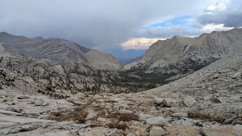
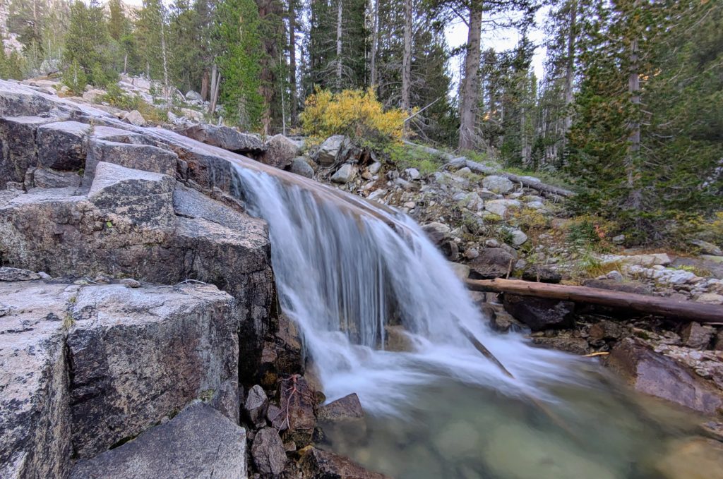
I woke to clear blue skies. Of course my tent was a bit wet, but it was a small price to pay for a nearly perfect weather window. Thanks to so much rain, I enjoyed beautiful cascading waterfalls along the granite slabs on the final mile down into LeConte Canyon, connecting to the PCT. Roper’s guidebook also pointed out some giant Sierra junipers in this area, “one of these, a trailside specimen with a circumference of nearly thirty feet, is possibly the single most impressive tree along the High Route.” It truly was a magnificent tree.


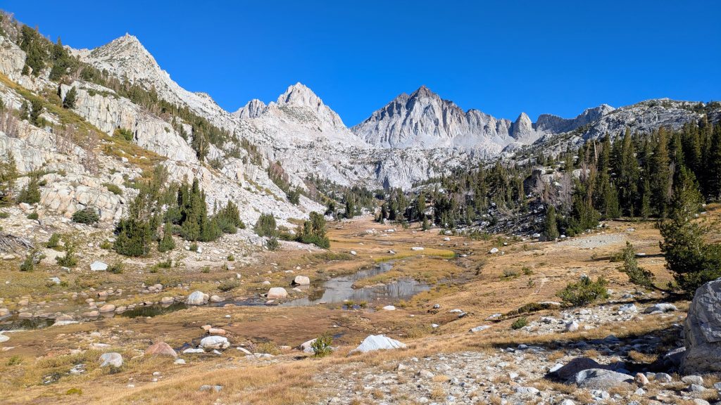
The hike up to Muir Pass was very chill and relaxing. I passed through a nice stand of white pines (with large slender cones) and also some Western hemlock…these IDs were again thanks to the guidebook. It’s cool that it was written almost 30 years ago, yet is still spot-on when it comes to these long-lived trees. It’s also very accurate about the route, as rock doesn’t change all the much, either. I easily made it to the top of Muir Pass, enjoying a change of scenery as I made my way northbound for the first time in the Sierra. Admittedly, I was a bit off-kilter with my permits (supposed to be going SOBO), but figured my flip-flopping wouldn’t matter too much this late in the season. If I did see a ranger (unlikely), I hoped they’d be understanding about the situation created by the smoke. I only passed a few southbounders, most I assume were hiking the JMT. I really hoped I might run into some people I knew while I was on trail. There was a 15 mile stretch this day and another 6 miles the 2nd to last day where the SHR aligned with the PCT, otherwise I was going to be off-trail and probably not seeing anyone, let alone PCT friends.


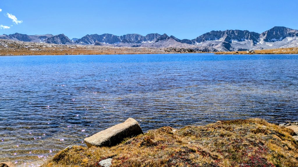
I signed the Muir Hut book and continued down a ways to have lunch next to Wanda Lake. I enjoyed some views of Mt Goddard from there. It was so quiet and peaceful by the lake, even though I was sitting right next to the most heavily traveled trail corridor in the Sierra. Then I ran into Sweetblood (Cory) @extremepedestrian, who I first met the year before in Pinedale while I was in the area doing the WRHR. He was hiking the CDT then, now finishing his Triple Crown on the PCT. What was I just saying about running into people I knew as I hiked north? Yep, that didn’t take long. I was happy to see him again and we chatted for a bit.


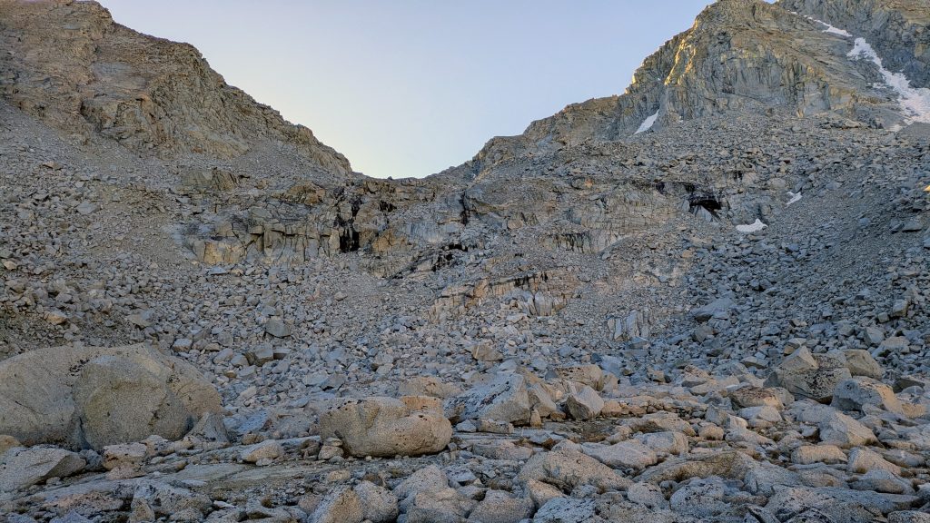
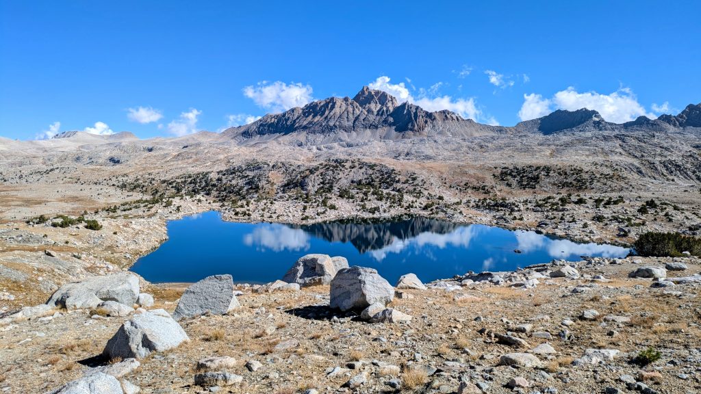
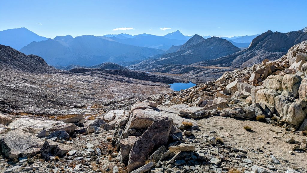
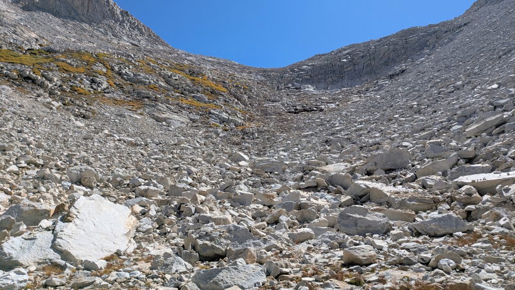
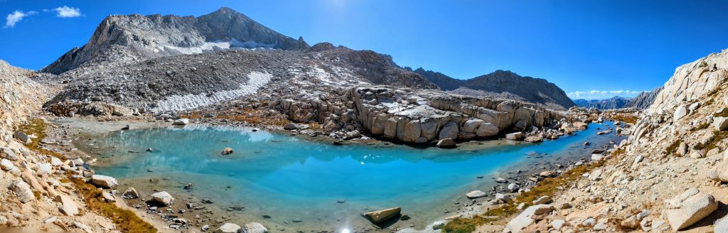
It was really quiet on the trail otherwise. Then surprisingly, just as I broke off to head cross-country up into the Darwin Bench, I ran into like 8 people! That’s as many as I saw on the JMT/PCT this day. A group of 3 were heading down along the creek and I caught up to 2 that were taking a break near a small lake, after unsuccessfully doing a rock climbing traverse. They said it was just too icy, given all the rain in the days before. I checked my maps to see that my route coincided with one that heads over Lamarck Col and down to the North Lake Trailhead, near to where the trailhead to Bishop Pass also starts. I think most of the hikers I saw were doing this route. I should also add that I was already deviating from the SHR again, as I’d decided to head over Alpine Col in lieu of Snow Tongue Pass. In doing my research, many had advised this, saying the latter pass was very steep and sketchy, with a scree chute that was “suicidal.” Alpine Col didn’t appear to be a cakewalk either, with lots of talus and a few cliff bands. But it seemed like the better of the 2 options. There’s also Keyhole Pass right next to Alpine Col, but I couldn’t find as much information about it.
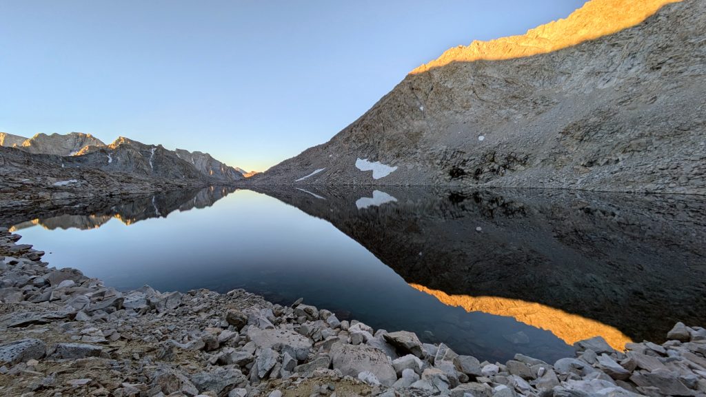
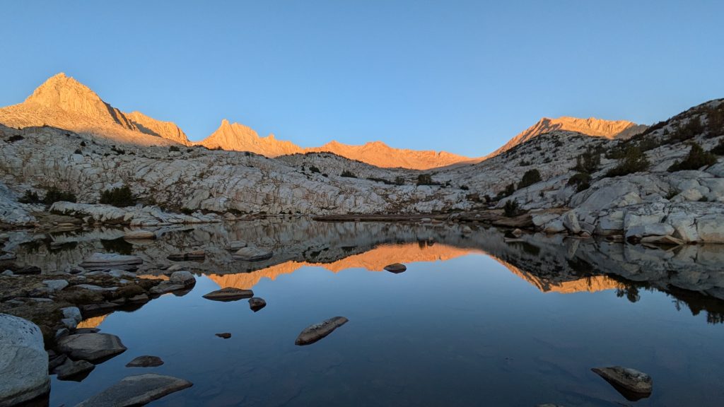
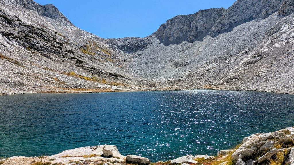
As I headed up a few miles towards Alpine Col, I passed one more hiker that was doing some version of the SHR. He gave me some good beta and sounded like he was pretty experienced in these high routes. I still felt like I was in the rookie phase, but getting better! It was cool to meet another solo adventurer, proving I wasn’t the only crazy person out here by myself. I worked my way slowly up past several lakes, aiming to camp at the highest one. I wished that I had just one more hour of daylight to get over Alpine Col, but stopping early at 5 p.m. was a good call. I clocked about 2.5 hours the next day before I made it to another decent campsite, and route-finding / moving over talus in the dark was a big no-no in my SHR playbook. I found a sandy flat spot, set off to the side a ways, but still completely exposed to the thin air. I wasn’t super excited about camping so high, as I knew it was going to be a cold and probably wet night. But I really wanted to be set up to tackle Alpine Col first thing in the morning. Besides, the views weren’t too shabby.
Day 19: Sierra Treats, Sunday, Sep 21st, 2025, 0640-1730.
16 mi to between Royce lakes and Italy Pass Trail, elevation 11,150′.
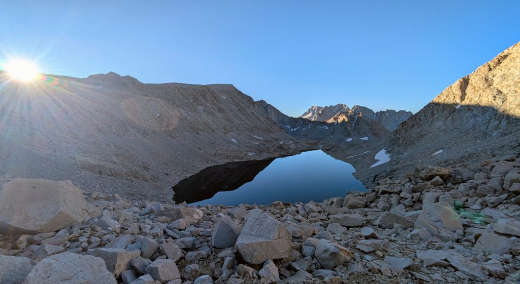
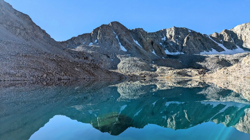
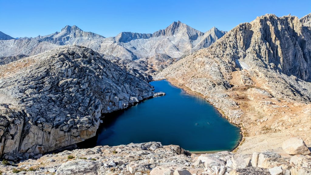
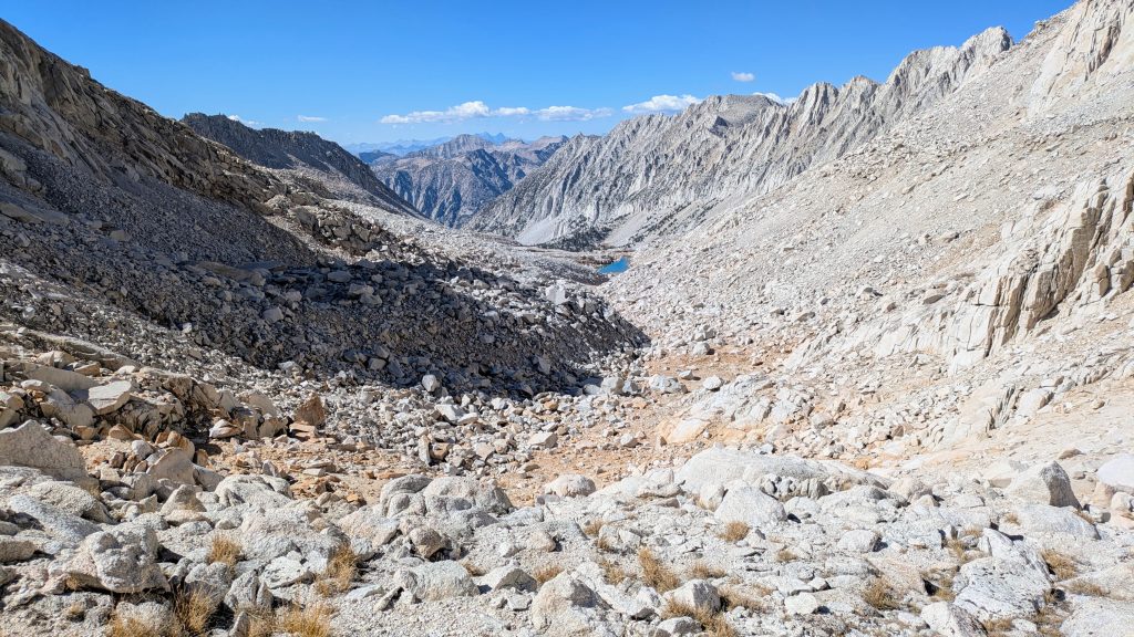
It was another phenomenal day, perhaps rivaling the one I spent in Crabtree Valley and Miter basin. I was up early to slide over Alpine Col, even though it was near freezing in the morning. It took a long time to work through talus along the lake, but getting up to the pass was pretty easy. Surprisingly, it wasn’t bad going down, either. There was one steep part where I had to step over some ice to reach a crack in the slab that I followed down. But the talus was just what I expected, slow but at least stable, way easier than Thunderbolt pass. I wasn’t in a hurry and was able to just enjoy the views across the Humphreys Basin. When I looked over my shoulder back towards the pass, the cliff bands in the middle looked pretty intimidating. I couldn’t initially see them from above (I knew they were there from my prior research), but somehow still managed to zig-zag my way down through them. As before, I just let gravity do a bit of the work in a few spots. I couldn’t even recall the line I took, but it worked!
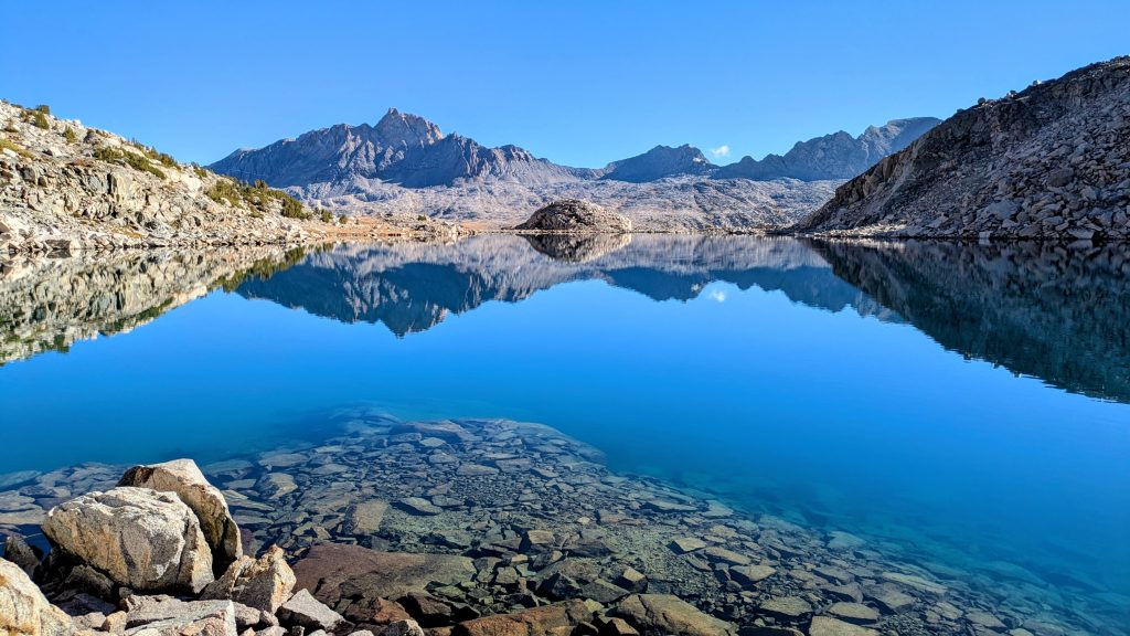
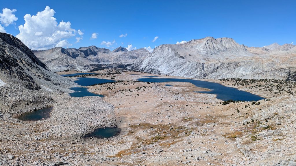
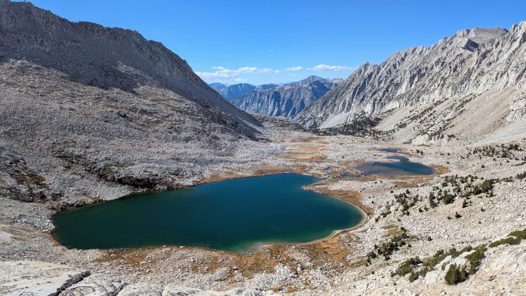
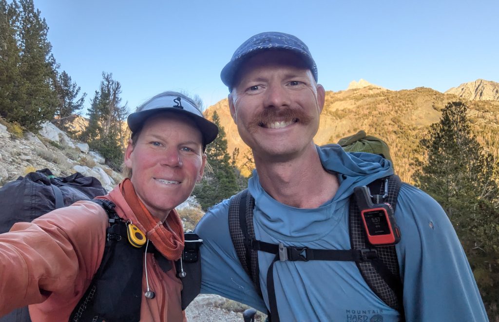
By the end of the second lake, the talus was over and I ran into 2 guys camping, Marc and Doug from Mammoth. Since I’d made good time over the pass, I sat down to chat with them for awhile and we had a nice discussion about these beautiful mountains. As an added incentive to finish this leg on time (I was already accountable to my airline ticket), they invited me to a Mexican restaurant Wednesday night…first margarita on them! I was pretty sure I could make it, averaging just 15 miles a day, so I filed the invite away in the back of my mind. They were the only people I saw all day. I set off across Humphrey’s Basin around 10 am, which was hours of walking bliss. The basin was wide open, almost like walking through high prairies in the Great Basin of Wyoming. I flushed a snowshoe hare, my first time seeing one in the Sierra. It was big, similar to a jackrabbit. I made it to Mesa Lake for a nice lunch, with some shade from a white bark pine next to a sparkling creek.
By this point, I was back on the main SHR. I climbed to Puppet Pass, which was very easy on the way up but steep with lots of big talus on the way down. I followed the talus fall line, which was most direct but stupid and probably a lot slower than if I’d simply traversed to a better line. There were a few drops / holes that were quite big, plus some huge boulders that felt pretty unstable. I had thoughts of falling into a hole, never to be seen again, and also of dislodging a large boulder, which might start a rock avalanche. Was such a thing possible? I’m sure it was, but thankfully I didn’t find out this day. When you’re free to go whatever way you want, there’s a lot that will work but isn’t necessarily the best or safest. I guess that’s the fun of a high route.
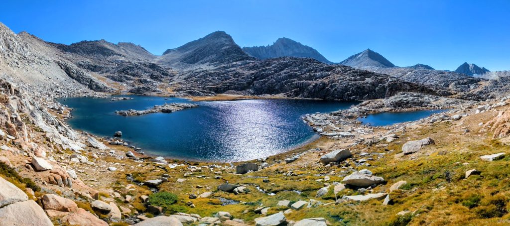
It was easy going down past large, boomerang-shapped Puppet Lake. Then on a whim, I decided to leave the SHR once again, in favor of following a GPX track from Eric Poulin (@seekinglost). I wanted to visit the Royce lakes and go over Italy Pass in lieu of Feather Pass. I don’t know why exactly, but this route just appealed to me more. Again, it’s part of the fun of a high route, going whatever way pleases you at the moment. I planned to reconnect to the SHR the next day, near the Bear Lakes. I cut to the east of Elba Lake and down into French Canyon, when I picked up the Pine Creek Pass trail. I followed it north about a mile, then broke west cross-country towards the Royce Lakes. By this time, the cumulonimbus clouds had gathering over Royce and Merriam Peaks. When I arrived at the first lake, it actually started to lightly snow, but at least there was no lightning, …yet. I was starting to get a little worried as I traversed along the completely rock-bound lakes, since there was no shelter anywhere for miles. It’s funny that Roper’s description of Puppet Pass entailed a detailed discussion of the Sierra’s afternoon thunderstorms, as if a precursor to what I might encounter this day. The last forecast I’d seen hadn’t included a chance of thunderstorms, but I guess this area is particularly prone to them. Meteorological wisdom from over 30 years ago.
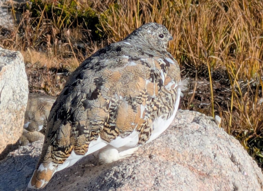
Then I found a flock of 9 ptarmigan causally pecking around and forgot all about the foreboding weather for a spell. This was yet another new animal sighting for the Sierra, plus one of my all-time favorite birds. I mean, who couldn’t love such beautifully camouflaged rock chickens? They let me get really close for some good videos and pictures. I assume they were a family unit of grown chicks and the parents, but I couldn’t tell which was whom. Some had big patches of white starting to come in, a sure sign of their annual transformation to all-white and the oncoming winter. They were so lovely to watch, completely oblivious to me and the dark clouds. I navigated the final talus field of the day around the 3rd and largest of the Royce Lakes while more snow fell. Thankfully it was just a sprinkling and added a sense of peacefulness along these rugged lakes, instead of impending doom.


I turned northeast to head down a canyon, with Treasure Benchmark peak looming high above me. Here I crossed the Sierra Crest, which is like the Continental Divided of the Sierra. Suddenly I could see east, down into the Owen valley once again. The decent was on beautiful slab, mixed with grassy ramps and white bark pines. I realized that I’d done zero research about this alternative route, so at least it was forgiving and so much fun! At the bottom, I found a small tarn with a beautiful flat spot in a knoll of whitebark pines. With the sky still threatening some thunderstorms overnight, it was the perfect place to stop. I had roughly 40 miles left for the next 3 days, no sweat. What an amazing day.
Day 20: Italy & Bears, Monday, Sep 22nd, 2025, 0640-1700.
13 mi to Lower Mills Creek, elevation 10,820′.
It was such a great night tucked into my little stand of trees, so warm and dry. There were no storms and it was clear in the morning. I quickly joined the Italy Pass Trail and worked my way up a few miles to the pass. All the meadows were frosted over, so I was glad I hadn’t proceeded farther the night before. I found another flock of 7 ptarmigan. They were still sleepy and all fluffed-up in their DIY down quilts, so cute. I wondered if I hadn’t taken this alternate, would I have seen any ptarmigan? They seemed to be quite common in this particular area. Though they are so cryptic, who’s to say I hadn’t already passed hundreds elsewhere?
Italy Pass was very easy and scenic, crossing to the west side of the Sierra Crest once again. I’d seen chatter proclaiming how terrible the trail was, but it was fine, just a little faint. From Italy pass, I could have proceeded down past Jumble Lake and straight on to Italy lake, connecting to the SHR there. But I was feeling good and saw that I could traverse southwest to Dancing Bear Pass, getting back on the SHR at White Bear Lake. This was a much longer way, but a very fun and mostly easy route. Importantly, it brought me into the not-to-be-missed Bear Lakes basin. All the lakes in this region have bear names, even though I couldn’t find a single sign of bears. I dropped my pack and backtracked the SHR south to Black Bear Lake, then onto an overlook of Ursa, Bearpaw and Big Bear Lakes, plus the north side of Feather Pass. In essence, I could see most of the SHR that I bypassed on my alternate. The views were certainly worth the extra mile or so.
Having satisfied my curiosity (though this spectacular area could be enjoyed for many days, no doubt), I retraced my steps back to my pack and promptly dropped down White Bear Pass. It was tricky navigation, with steep slab to one side and a ton of talus at the bottom. I should have stayed higher on the slope to the north, but instead I got sucked into the fall line once again. It took me forever to get through the fields of talus, ugh. But at least I got to enjoy the views of Brown Bear Lake for a long time. (As an aside for anyone doing the SHR down from Feather Pass, I think a better alternate would be to take broad and easy Dancing Bear Pass down to Jumble Lake and Lake Italy, skipping White Bear Pass.)
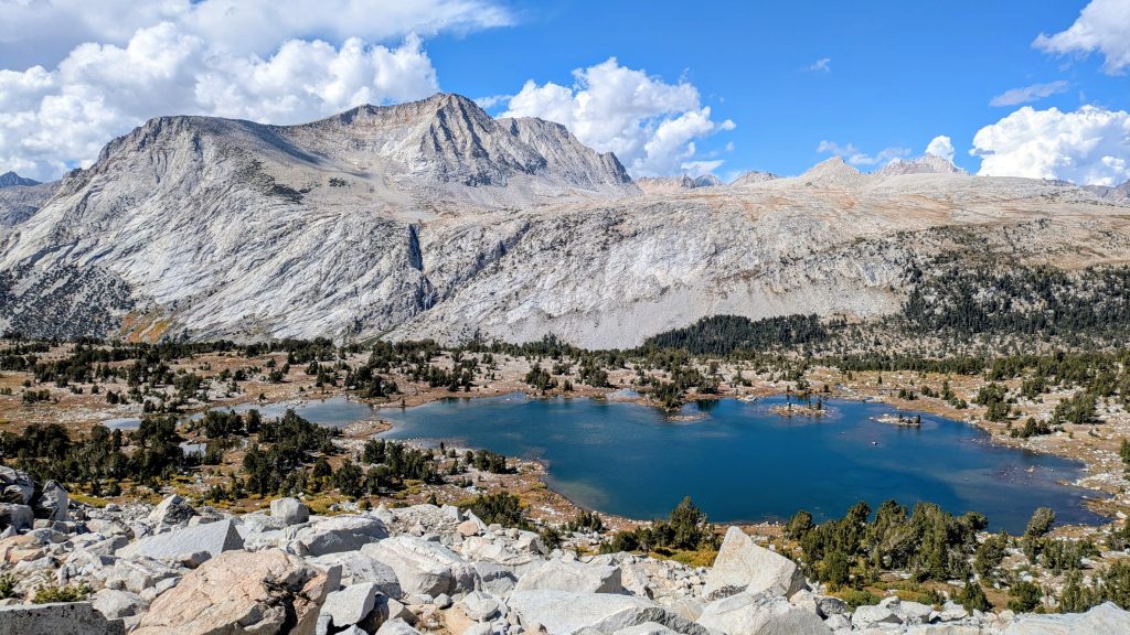
I finally left the Bear Lakes behind to reach the western end of huge and long Lake Italy…I guess it’s shaped like the country. I walked the full length, about 1.5 miles to Toe Lake, where I finally stopped to have a late lunch. Then I went up and over Gabbot pass (a combination of Mt Abbot and Mt Gabb, which it splits), which was similar to Italy pass in its ease going up the north side. Coming down the south side was a little more convoluted, mostly just trying to avoid talus, but still incredibly fun and scenic. I could see all the way north to Mt Ritter and Banner. It was a very long drop of several thousand feet to Upper Mills Lake. I made it to timberline at Lower Mills Lake and decided to stop early not long after, since there were so many nice spots among the pines. I set up my tent with a nice view of a meadow and creek. I figured that I had plenty of time to finish the miles over the next two days. It was another stunning day in the Sierra. Passing by so much incredible country, it’s kind of shocking that I didn’t see a single person all day. How blessed was I to have all of this to myself?
Day 21: Shout of Relief, Tuesday, Sep 23rd, 2025, 0630-1910.
19.5 mi to Duck Lake, elevation 10,440′.
It was a little windy overnight, so I put in ear plugs, which gave me a migraine in the morning. But I did sleep really well. The walk down the rest of the valley was more complicated than I anticipated. There was a very steep drop off where I had to bushwhack through willows and trees, negotiate wet slippery slab, and weave through some talus. It was tedious and slow, so I’m glad I didn’t continue farther the night before. Finally I made it to the lower valley, where there was an actual trail. Again, these trails have been described as not maintained, but I found this one to be in pretty great shape, except for a few blowdowns. I guess traveling so much off-trail makes any trail seem pretty awesome.
I came to the main valley and crossed Mono Creek, which was a simple rock hop. It can be a real challenge to SHR hikers earlier in the season. I proceeded uphill half a mile to pick up the Laurel Creek Trail. It climbed out of the canyon steeply to a bench, then was very pleasant up to Laurel Lake. A steep cross-country climb to Bighorn Pass followed, but it was straightforward on some grassy slopes. Looking across the basin to the next pass, the route looked pretty difficult. The guide said it should only take an hour traversing the slopes, going up and down here and there to avoid cliffs. I doubted this estimate, but followed this guidance as I saw fit and it only took me 40 minutes, ha! This pass was very aptly named Shout of Relief Pass, as in what you’ll do when you find the traverse you just took to be even easier than you thought it would be. It’s also the last significant obstacle of this section, meaning it was the last big challenge of my entire hike through the Sierra this year. From where I was standing, I could see the faint switchbacks of the PCT at the end of the valley.
I easily walked down from the pass to a creek for lunch, with a nice view of the meadows and lakes in the area. Just like Steve Roper mentioned in his guide, the area was filled with little birds flitting about, including mountain bluebirds. In my mind, the remaining 4 miles to connect to the PCT looked like they should be easy. But it was a long afternoon working my way down around a few lakes and a steep canyon to Tully hole. I dropped below timberline, so it was slow going through the trees and grass in places. I found some use trail here and there, which finally turned into continuous trail for the last mile. As much as I loved the off-trail hiking the past few days, it was nice to end this day by not having to use my brain as much. I got a little boost once I hit the PCT/JMT, anticipating the chance of running into people I knew. Admittedly this was a long shot, as a 6 mile stretch / 2 hour time frame didn’t allow for many chance meetings. In fact, I didn’t see anyone for the first 1.5 miles. Thus I went 2.5 days without seeing anyone at all. I finally passed some early campers near Lake Virginia, then a few solo hikers on trail, all heading north.
Just past Purple Lake, with only a mile left before I turned off the PCT for good, who should I run into but my WA/OR buddy Jockstrap! I suspected my timing might be good to see him or Meat Wagon, but I still couldn’t believe my luck. We chatted for a bit, but it was getting late and he still wanted to hike 10 miles south, while I wanted to make it another 2 miles north to Duck Lake. If only he’d been going a short ways, I might have turned around so I could at least hang out with him at camp. And if it weren’t for me having to catch a flight out on Friday, I might also have turned around to hike with him through the Sierra once again, perhaps even further. Why not? He updated me on the whereabouts of some of our other friends, and sadly Meat Wagon was about a day ahead and Foggy was still days behind. But still, it was incredible to see him again and I wished him and all my SOBO PCT friends the best in finishing strong through the desert. It was bittersweet that my long journey, started in the desert at the end of January this year, was only a day away from ending, while theirs would continue on for another month. But such is the world of thru-hiking. I marched on into the fading light to find a suitable tentsite behind some rocks and willows, hiding from the wind that had sprung up late in the day. Another front was coming through, so I was glad to be hiking out in the morning.
Day 22: The Final Finish in Mammoth, Wednesday, Sep 24th, 2025, 0630-1100.
9 mi to Horseshoe Lake, elevation 9000′. Then bus into Mammoth Lakes, Reno the next day, flight to Denver.
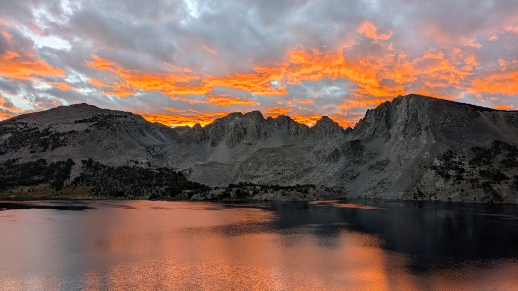
It was a lack-luster campsite for my last overnight, but I woke to one of the most brilliant sunrises over Duck Lake. At the north end, I contemplated taking a shorter trail down from Duck Pass, which would spit me out at Lake Mary, with access to Mammoth. But I stuck with the SHR and ridgeline for the views, following faint trail over Deer Pass and down to the Deer Lakes. I stopped to filter some water, enjoying the last little bit of alpine wilderness. Being so close to Mammoth, I was surprised no one was camping by these gorgeous lakes.
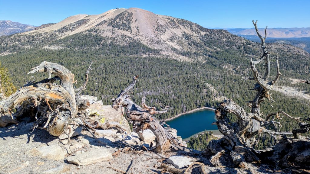
Speaking of lakes, on top of the ridge, while following the Sierra Crest Trail, I could see 25 miles NE to Mono Lake. I visited it for the first time back in May. To the NW were Banner and Ritter, with Reds Meadow below. Mammoth Mountain was obvious, with lifts and buildings at the top. I could see buildings and roads to the town below. This was also where I entered a region of high volcanic activity, as indicated by the grey and red hues of the surrounding terrain. The classic granite of the Sierra along with the volcanic rocks created quite a unique mosaic in this area. I followed the Sierra Crest Trail all the way along this scenic ridgeline, enjoying easy walking through the sandy pumice. I stopped periodically to search for good keeper specimens, adding to my collection of pumice stones. I actually use them on my hikes to keep my foot calluses under control, so I couldn’t pass up the opportunity to grab some free ones. I started to encounter several day hikers in the last few miles along the ridge, all beaming, as happy as I was to be out there. It was such a beautiful day and a lovely note to end on.
I followed the ridge down some steep slopes, having fun sliding in the pumice sand, happy I was going with the flow of gravity. I came to Mammoth Pass and took a right down past McCloud Lake and on to Horseshoe Lake. (If you’re curios why I didn’t retrace my steps to Reds Meadow, it’s because I would have needed to turn around and hike over Mammoth Pass to get back to town anyway…no shuttle, resort closed already, and road closed most of the day). So that was it, the finish line and end to my summer of hiking! As usual, there was no fanfare and I gave little thought to it. But I was really glad I capped things off with this final stretch north, as I got to see a ton of incredible landscapes that I would have missed otherwise. I also got to see a few familiar hikers. I think it was the best stretch of hiking I did in the Sierra, but also the whole month of September was fantastic.
As for my travels home, I caught a free local trolley from Horseshoe lake, which carried me downtown. I finished the day mailing Alan’s bear can back to him, eating pizza and thrift shopping for clean clothes and a duffel bag to check my backpack on the flight. I actually scored a brand new merino T-shirt from the Ridge Merino store for $20, plus steeply discounted underwear and a sports bra…nearly an entire new wardrobe! Then there was the small matter of where to stay in Mammoth for the night, given that the shuttle to Reno didn’t leave until 8:20 the next morning. I was just going to stealth camp somewhere on the outskirts of town. But recall my chance meeting of Marc and Doug 4 days prior near Alpine Col? And the offer of a margarita? Well you bet I went to the Mexican restaurant that night and true to their word, the guys were there, along with their lovely wives, Yvonne and Rebecca. They couldn’t believe that I actually showed up but even still, they’d given the hostess my description and asked her to keep an eye out for me, so they did expect me. I had dinner and drinks with them, which was so much fun. Of course the topic of where I was staying that night came up (picture my sad face saying “oh you know, just some spot down by the river that I read about on FarOut”), some glances were exchanged, and then I was offered a neighbor’s empty condo for the night. I got to take a shower, put on all my fresh new clothes, and sleep soundly on the sofa! I was so grateful for their generosity, thank you Marc, Doug, Yvonne, Rebecca and neighbors!


Doug drove me to the bus stop early the next morning, but not before making a swing by Schat’s Bakery (run by the ex-wife of the owner in Bishop) for some coffee and pastries. Doug again insisted on treating me, but I really wish he’d allowed me to buy him the donuts, after I learned that he was a retired police officer:) LOL. Everyone we met in town knew him and greeted him kindly, so I got the impression he was very well-liked and respected. Actually, everywhere I went in Mammoth, the people were so friendly…I really look forward to going back there again some day! I caught the Easter Sierra Transit shuttle to Reno for something like $36 (note: you can only use cash if you wait to pay the driver in person) and was surprised to see the same driver as before (Inyokern to Bishop). High praises for this service, which in my experience was clean, efficient, safe and on time. The Reno connections all the way south to Ridgecrest make it easy to get pretty much anywhere in the Sierra to begin or end a hike.
I arrived Reno around noon, leaving the rest of the day to explore the city. On a whim, I texted a couple that Alan and I had met back in May, while visiting a hot springs. Steph and Chris (Spreadsheet) live in Reno and Chris had also thru-hiked the PCT. They answered back right away and we met up downtown for dinner. They also offered for me to stay in their van, parked outside of their house, which was more than I could have hoped for that night, as I hate staying in casinos. I got to play fetch with their beautiful German Shepard and they were so kind to drive me to the airport the next day. In case you’re wondering, I like to add all these details about Trail Angels helping me for the simple reason of honoring them for their contributions. I don’t mean to sound like I’m gloating, I just want to highlight how generous and loving people are all around the country, and how tight-knit the hiking community is. Thank you to everyone that assisted me this year, as I simply could not have done all that I did without you! And thank you for reading about my adventures, I hope you enjoyed! I’ll follow up with a summary and year-in-review after this post. Happy Holidays and here’s wishing everyone the best for the New Year!


