Day 7: Thursday, July 17th, 2025, 0900-1900. Stehekin Bakery
21 miles to Miners Cabin trail junction, mm 101.6, 6050’up\2170’down, elevation 5500′. It was a peaceful night in the woods. I’m pretty sure no one ever knew I was there, just off the road in my camo tent. I love stealth camping, especially when it earns me such an advantage. Due to my strategic planning, I arrived at the bakery by 6 am. If you aren’t already in the know, the Stehekin bakery is one of the top 5 highlights of the entire PCT. The owner, Cragg Courtney, was already inside getting ready and invited me in to grab a coffee, use the bathroom and charge electronics. He was so kind and we chatted for a bit. It was really cool to learn some of the history of the valley. His grandfather was one of the original settlers and about half or more of the people in the valley are his direct family and close relatives. His dad was an outfitter and had 5 boys and 1 girl. The bus driver went into even more detail on their history, making the $10 one-way ride well-worth it for the experience. I got so much more out of my Stehekin stop than last time, including quality time at the bakery. I got to leisurely sip my coffee and eat a delicious breakfast cheese and bbq chicken hot pocket before the bus arrived at 8:15 am. I also got first dibs on the half-price day-old offerings and bought another Kuchen…cream cheese, crumble and berries, delicious! There were so many choices at the bakery that it was almost impossible to decide, but I think I sampled a fair amount this time around. The bakery had clearly expanded to offer sandwiches, soups and a huge variety of pastries. It was nice to see such a remote location prospering so well. I highly recommend an early and long visit, unrestrained by the bus schedule. It’s a few miles to walk from the ferry terminus, but so worth it!


Back on trail by 9 am, I said goodbye to Tony, who had also taken the first bus of the morning. I hoped to see him again, since he was hiking as far as Stevens Pass, then skipping down to Trout Lake, finishing all the sections he missed the year before due to fires. A few miles down trail, I ran into Geodude, my first verified NOBO. Apparently I’d already missed Cheswick, who was going for the Calendar Year Triple Crown FKT and nearing the border. I met Cheswick in Eureka in 2022, when he was trying to complete the Great Western Loop. Geodude was also going for the GWL this year, but having second thoughts about it. He figured he was about a week ahead of other NOBOs, but then I saw a second suspect NOBO only a few miles after him, but he didn’t stop to chat. I also ran into Dirty Bowl, who was doing a section with her partner and dog. I met her on the CDT and followed her blog when she hiked the Florida Trail. Then I ran into Skittles (Richard Larson), a guy I knew about from the Trail Show podcast, but had never met on trail before. I recognized him from pictures I’d seen online. He was admirably volunteering with the 2 Forest Service women I’d earlier seen doing trail maintenance. I gave the two women treats from my pack, including a raspberry twist pastry from the bakery. They were cross-cutting a huge log and it was the best way I knew how to say thank you for all their hard work. They seemed genuinely taken aback, grateful for the small gift and I was very happy to have something to repay the debt for all the trail maintenance. What a busy morning, filled with interesting people!


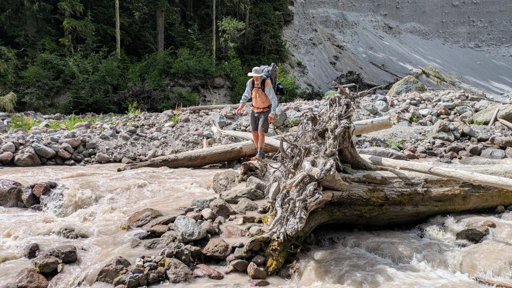
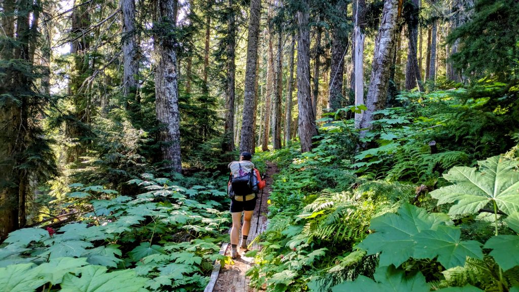
The trail through the forest was so lovely, going past magnificent old growth cedars. It was nice to be hiking a second time, present in the moment, noticing these majestic trees that I didn’t recall from my first time. I took a long lunch break at a stream crossing and continued through a very overgrown section, but I didn’t mind. Several of the section hikers that I’d passed had very negative comments about the trail conditions and were kind of trying to fear monger me, but after the PNT and other remote experiences, I find nothing as bad. When you’ve had to make due without a trail at all through these dense PNW forests, you greatly appreciate even an overgrown trail. I plugged away until early evening, knowing I wasn’t going to make it as far as Image Lake, like I’d hoped. But I was content to make it over Suiattle pass and to the trail junction…not bad miles considering my late start, many stops to chat with hikers and the elevation gain, uphill all the way. The junction had a small stream with 4 tents crammed into a few patches directly next to the stream. I was worried that these were the only tent sites that had been mentioned in the comments, all taken up by one large family, but I walked a little further down the side trail and found a large, flat dry area, completely empty. I was grateful for this, since where the family was pitched was slanty and not LNT, being so close to the stream. If they had just searched around a bit, they would have found the area where I was. The only problem with the campsite was a very bold deer that walked up to my tent and that I had to shoo away. She came back all night long, so I just had to make my peace with her.
Day 8, Friday, July 18th, 2025, 0610-1810. Image Lake
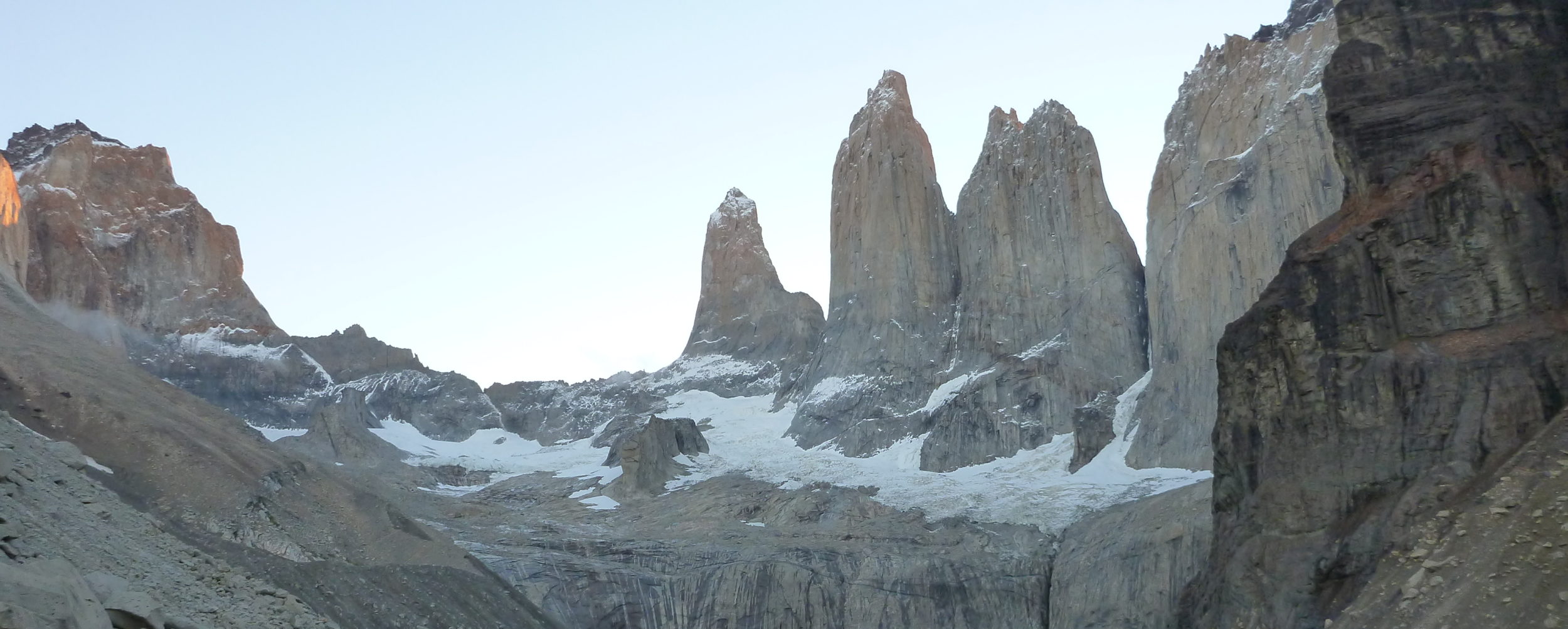
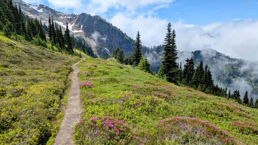
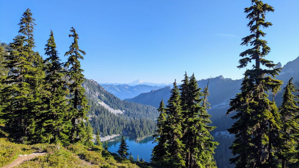
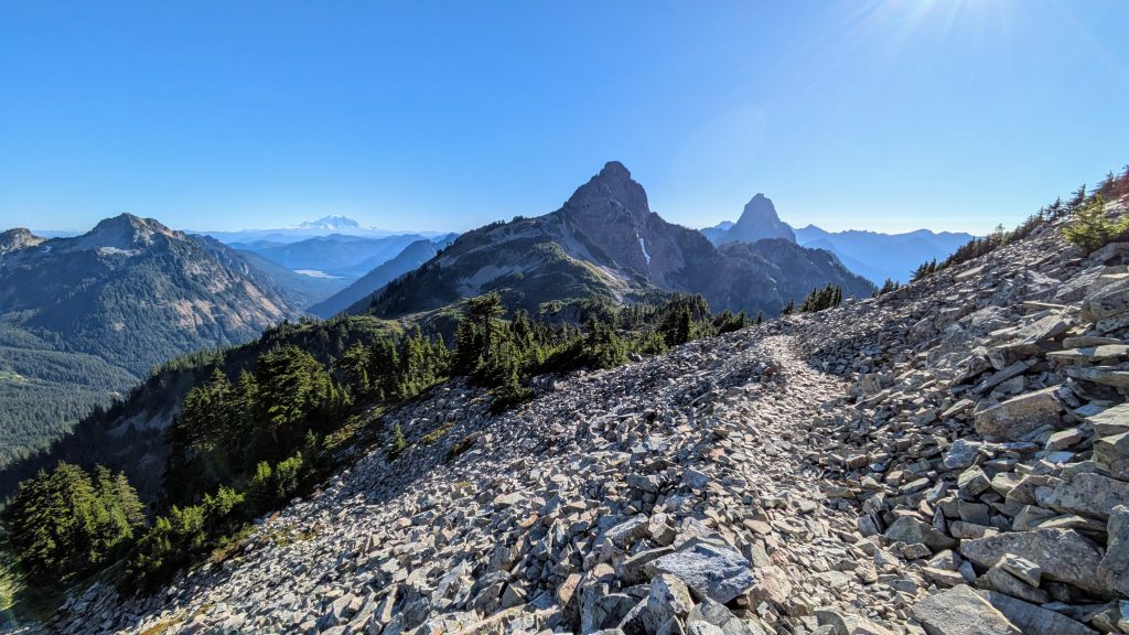
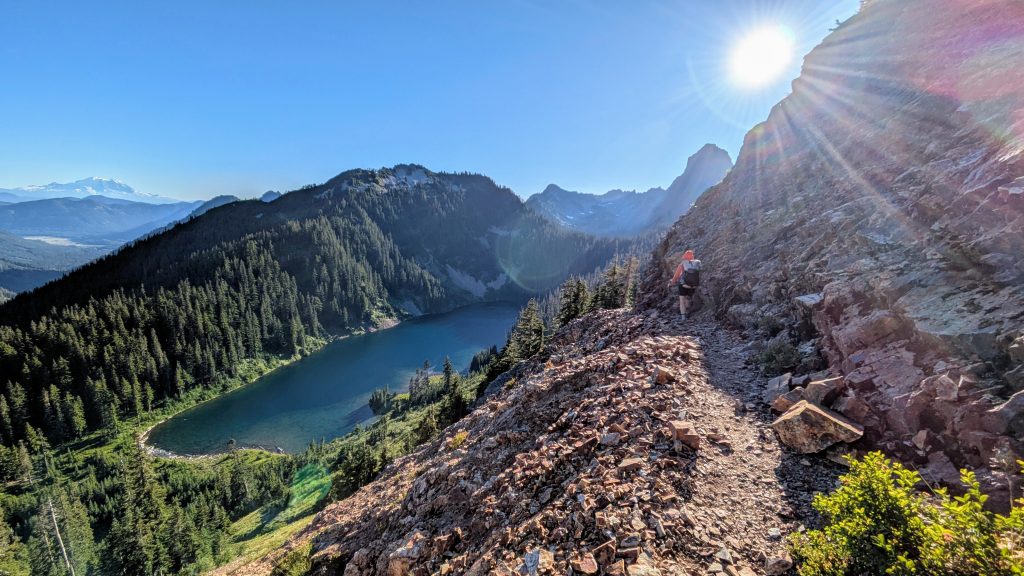
24.5 miles to ridge above Milk Creek, mm 124, 5300’up\5350’down, elevation 5574′. First thing in the morning, I took the Miners Cabin Trail to the Miners Ridge Trail, up to Image Lake. This alternate added 2 mi and 1,200 ft of gain over the PCT, but was so worth it for the beautiful views of Glacier Peak across the surface of Image Lake (hence the name). I didn’t linger because the mosquitoes were swarming next to the lake, so I guess it’s just as well that I didn’t camp nearby. I continued on up to the fire tower. No one was home and it was locked up tight. But still the views were superb! I dropped over 4,000 ft. in elevation on about 50 switchbacks coming down from the ridge. I saw only 3 other backpackers all morning on the alternate. The weather was so perfect for this side trip and I felt really blessed. Thanks to my friend Arrow, who I met near the border in 2018, for recommending it!


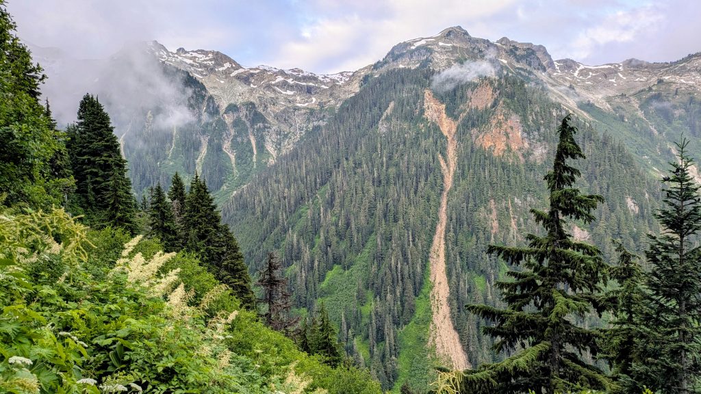
Back on the PCT, things were easy and quiet until after I had lunch, just past the Suiattle River. I met a 3 person trail crew that were doing repairs on the bridge and shared my candy with them. The rest of the afternoon was pretty taxing. There were a ton of blowdowns, some quite big given that the area is full of ginormous old growth trees. I also had to climb about 3,400 ft, as the trail ascending from the huge valley, back up to a ridge along the flanks of Glacier Peak. I felt so exhausted by the time I reached the top. I took a very refreshing dip in a snow-fed stream and collected water for camp. I passed a ton of backpackers in the afternoon, all heading north. A few were probably thru-hikers, but most were section hikers. Many had come back to finish this section, since it had been closed due to fires in previous years. I even saw a lady hiking with a tiny chihuahua, which she was having to pick up and place over all the blowdowns. It seemed like a bad idea to bring a small dog into such a rugged wilderness. On the other hand, at least he was easy to pick up and carry. I got to camp early, but I put in plenty of miles this day, especially considering how difficult the conditions were. If I’d gone any further, I would have landed in the middle of the infamous Milk creek basin, which I knew was very overgrown and likely limited on camping options.


Day 9, Saturday, July 19th, 2025, 0610-1920. Glacier Peak Wilderness is indeed Wild!
23.5 miles to 1.5mi north of Red Pass, mm 147.2, 6100’up\6150’down, elevation 5502′. First thing in the morning, I braved the overgrown trail through Milk Creek valley, said to be one of the poorest-maintained sections of the PCT. It was bad in 2018 and seemed to have only gotten worse. But again, it didn’t seem that bad, now that I had lots of experience. I counted 42 switchbacks down to Milk Creek, overgrown and sometimes tricky yes, but not terrible. The overgrowth got worse for a spell along the creek, but improved once I crossed the bridge and ascended a bit. I ran into group of 4 on the bridge, then a solo lady that was very friendly and had a ton of questions about conditions all the way to Stehekin. They had camped at the bottom near the creek, so there were spaces, unlike I previously thought. I began the long climb to Mica Lake and ran into 2 nice NOBO guys. Just before the lake, I also ran into Punisher, who was cracking away at his calendar year triple crown. I met him once while volunteering on the Florida Trail. I was surprised that he recognized me and spared some of his limited time to chat. It was fun to hear some of his story.
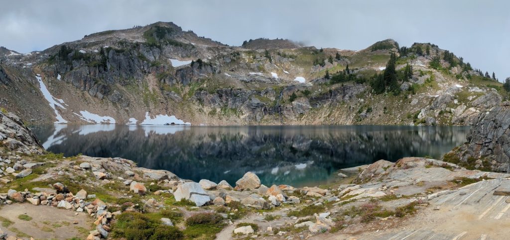
Mica Lake was beautiful as always, but I didn’t linger. It was overcast all morning, thus too chilly to go for a swim. In 2018, the lake had been surrounded by snow and almost completely iced over when we camped there…I didn’t go for a swim then, either! I continued on to Fire Pass, where there was no snow whatsoever along the way. What a contrast from before, when it was constant snow all the way from Mica Lake. I kind of missed the challenge of hiking through all that snow. For many miles after the pass, the trail was down in the forest and the hiking somewhat monotonous. As usual, there were a fair amount of blowdowns. Finally I caught up to Bad Sherpa and Last Nobo, both of whom I’d met in Stehekin. Thanks to them, the rest of afternoon went by fast. We took a lunch break together, then hiked some miles past Kennedy Creek and several other crossings. I was glad to have their company for the sketchy log crossing across Kennedy Creek. It was roaring from glacier melt in the late afternoon. The last few miles began to hurt again as the grades steepened before Red Pass. I found a nice campsite under some trees near a meadow, but not before being told to “go away!” by a really rude guy camping with a few others nearby. No one in the outdoors has ever been so openly hostile towards me and it really threw me for a loop. But it was easy to blow him off, since I never have a problem finding a campsite with my small tent.
Day 10, Sunday, July 20th, 2025, 0610-2010. Glacier Peak Climb, not to be.
28.5 miles to south of Grizzly Peak, mm 175.7, 6070’up\6530’down, elevation 5052. I had high hopes of climbing Glacier Peak while I was passing by this year, but unfortunately the weather wasn’t very good. I even shipped myself a pair of microspikes in Stehekin, anticipating walking on snow if I did go for the climb. I’d also packed an extra day of food to allow for the side-trip…all wasted weight, as it turns out. I woke to up to dense fog and cold wind, knowing that conditions a few thousand feet higher were probably much worse. There were at least some views at Red’s Pass, the earliest location where a SOBO can spot Mount Rainier. Sure enough, I could just make out the massive peak at nearly 100 miles away. I also got some cell reception, the first I’d had in 10 days, so I stopped to play with my phone. After just 20 minutes, my hands were so frozen that I had to keep moving. I saw a lot of peak-baggers around White Pass. Some were heading down, while a few were breaking camp and planning to head up to the summit the next morning. I felt really out of place compared to them, since they all had helmets, ropes, mountaineering boots, and crampons. I decided it was probably just as well that the weather wasn’t cooperative, since I didn’t really feel prepared. I’d researched the route quite a bit beforehand, reading that there was a way to climb the ridge to avoid glacier travel. But it might have been a little sketchy doing this alone. Maybe next time.


In the 2 pictures on the left, Glacier Peak is perfectly visible, then only hours later it’s swamped by clouds…such big peaks can be very finicky. GPW seems particularly prone to creating its own weather patterns.
Rather than peak bagging, I decided to get lots of miles done this day instead…something I’m much better at than peak-bagging. I caught up to Bad Sherpa and hiked with him briefly until he dropped off to get water. I spent the rest of the morning and all afternoon hiking alone. I only saw a handful of hikers going north and still didn’t catch up to anyone else going south. Throughout the day, I caught glimpses of Glacier Peak, which seemed to be taunting me over my change of mind. There had been a cloud inversion, so it actually was clear on top early on. However, by mid-afternoon, the cloud layer did a 180 and rose to cover the peak. Even if I’d started towards the top early in the morning, I don’t think I could have reached the summit before the clouds rolled in. They looked like heavy rain clouds too, so it didn’t look like fun up there. I did make one big blunder for the day by not picking up water before going up and over Grizzly Peak. I thought surely there would be a trickle somewhere, but found none for the next 4 miles. Luckily I’d eaten one of my meals for lunch, so I figured I’d just skip dinner. I was down to half a liter of water, so I either needed to go without or walk another hour past dark to make it to the next lake. I’d already done so many miles that I just needed to stop and go without. Not surprisingly, the mosquitos came out to play and I had to hurriedly set-up my tent, once again camping by myself. It was kind of a bummer of a day, but I did crush a lot of miles!
Day 11, Monday, July 21st, 2025, 0545-1030. Leavenworth.
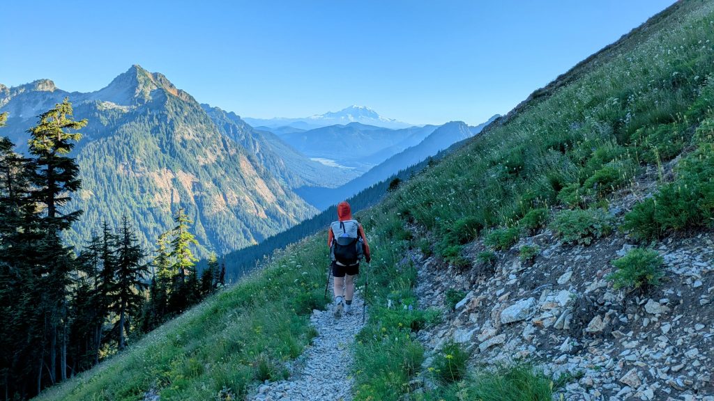
12.8 mi to Stevens pass, mm 188.5, 2180’up\3180’down, elevation 4050′. I walked a brisk pace all morning to get to Stevens pass early. I caught up to a trio of SOBOs, Gizmo, Ella and Haiti, then another lady within a mile of the pass. While chatting with her, a guy came screaming past the both of us. I thought I was moving fast, town-fever and all, but he absolutely blew us out of the water. Then I learned that he was shooting for an FKT, so that explained things. To my knowledge, he was the first person to overtake me, but I figured there would be a few more…usually the young guys. There were even more hikers at the lodge, but none that I recognized. Like the FKT guy, I was catching up to everyone else. Ella, Haiti, Bad Sherpa and I scored a quick hitch to Leavenworth with a local firefighter. He was great in telling us about some of the history of the town and all the best spots to visit. In 2018, I hitched west to the tiny town of Skykomish. So of course one of my goals on my second PCT hike was to do everything the opposite, at least when it came to opposing options in town stops. Besides, I’d heard that Leavenworth was not to be missed, so I was glad for opportunity to finally check it out. It’s a quirky ‘fake’ Bavarian town, where everything has to be in theme, and I mean EVERYTHING. The Starbucks, Safeway, and McDonald’s all had Bavarian facades and of course the hotels were done up to the hilt. Even a small mechanic’s garage had made an attempt at a Bavarian fresco over the hanger doors. It all made me chuckle as we passed through.


Our ride strategically and generously dropped us off at the far east end of town at the Safeway, which was in easy walking distance to the KOA. I wasn’t down with paying $200 or more for a hotel room in this very touristy town, so a $20 tent square, crammed in with 20 other PCT hikers, was just the ticket. Bad Sherpa also set up his tent there and it was cool having a camo tent buddy…there aren’t many of us left these days, since Zpacks stopped offering the color after 2020. Just as I got settled and made a beeline for the shower and laundry room, it began to rain and thunder. What lucky timing! In fact, weeks later, I talked to some guys that were a day behind me at the time, and they said it was a torrential downpour all day up on the crest. Bushwhacking through those overgrown sections and climbing over so many blowdowns in the pouring rain must have really sucked! It’s a very good thing I didn’t take an extra day to camp on the slopes of Glacier Peak, in an attempt to summit this morning, as I would have been badly rained-out! Instead, I was busy getting nice and clean under the spray of a hot shower. While the PCT tent lot was a bit lacking in size and amenities, the bath and laundry room at the KOA was the best I’ve ever seen: clean, functional, comfortable and convenient for hanging out!
It stopped raining by the time I finished my chorse, so I tried to walk to downtown to sight-see and get some food. I found out that it’s a bit of a walk, so I settled for an okay pre-made sandwich from the small deli at Dan’s grocery store. I stopped at the Safeway for a few items for my resupply, then back to the KOA to go to bed. As I was shining my headlamp around looking for something, I noticed a huge tear in the mesh of my tent. After further inspection, I found a total of 8 rips in the mesh, all at my head end between the floor and canopy. It almost looked like a bear had slashed it, or at least something with large claws. I’d left my food bag in a container at the site and nothing else in my tent seemed disturbed, so I still have no idea what it was, if it ever got in, or when exactly the damage occurred. But I spent almost an hour cutting small pieces of KT tape to serve as sandwich-patches over the cuts. I carry these tape pieces not for injuries but rather for repairs, since it’s very adhesive and also stretchy. Incredibly, the patches held up through the rest of my hike and so I guess are going to remain as a permanent reminder of Leavenworth.
Day 12, Tuesday, July 22nd, 2025, 1530-2010. Back on Trail.
11 mi to just north of Trapp Pass, mm 199.4, 3290’up\2080’down, elevation 5270′. I almost got peed on overnight, as a guy was pissing in the corner 2 ft from my head. I had to yell out that I was there, because of course he hadn’t seen my camo tent in the dark…which is why I set it up out of the way in the corner, so I didn’t get tripped over. Yes, it’s one of the pitfalls of being too stealthy sometimes. The same thing happened to me at PCT Days, almost getting pissed on and still being tripped over, even though I was in a far corner. It’s funny that on the list of rules the KOA handed out to each PCT hiker was 1. Please use the bathrooms and not the tent site to relieve yourself! It’s unsurprising that we hikers couldn’t follow even this simple rule. At least the offender quickly ceased his pissing and was very apologetic. I hung around the campground for awhile in the morning, chatting with many hikers. One of them was a familiar face, Denim Dan, who I met on the CDT in 2019! It was great to see him again, as he’s such a unique and interesting character. So interesting in fact that he even has his own brand stickers, and I got one! I also saw Foggy, the guy I last met at Hart Pass. I knew he was going to catch me quickly, and was glad he did, as I enjoyed talking to him again.


I packed my stuff and left to walk downtown for breakfast. I got a disappointing waffle at a tourist-trap restaurant, but had a nice conversation with Brian from Avon, Colorado. He’d camped next to me the night before Stehekin, but was reluctant to talk to me then because he thought I might feel awkward or nervous about a strange guy, the 2 of us being the only ones in camp. Funny, because the way I remembered it, I was hoping he’d join me for dinner in the cooking area, but he seemed like he just wanted to be quiet and keep to himself that night. So I’d resisted going over to chat him up. We’d both been in our heads about each other and it turns out that he was super friendly. He’d taken to calling me “the fast woman in a green skirt.” I was glad we finally knew each others names.
I mailed my microspikes home at the Bavarian post office, grabbed a Bavarian Subway to go, then got an awesome quick hitch with 3 other hikers from a couple driving a really cool converted bus. Classic! I lingered at Steven’s Pass for another few hours doing stupid phone stuff, then hiked out in the late afternoon. I caught up to Amber about a mile in and after talking with her for a bit, realized we had a very similar pace. We toyed with the idea of sticking together for the rest of the section, as I was in the mood for more consistent company after I’d been flying solo for nearly 2 weeks. She was also adapting to hiking solo, previously having hiked half the AT with her husky. He was safe and sound at home, since she’d simply decided that the PCT just wasn’t a good fit for him, at least not in the southern sections. We ended up at a campsite near a stream in meadow that promised to be very wet in the morning, but didn’t want to continue all the way up to the pass. Good thing since those campsites were full when we passed the next morning.
Day 13, Wednesday, July 23rd, 2025, 0620-1840. Waptus River For The Second Time.
25.5 mi to Waptus River, mm 224.8 4600’up\6830’down, elevation 3070′. This day passed very quickly with company. Amber and I both woke up at same time and hiked together all day. We shortly caught up to Andy and Lena at top of Trapp Pass, 2 of the hikers I got a hitch with to Stevens Pass. They were in the same campsite I stayed at in 2018. I hadn’t yet camped at too many of my previous campsites, but could at least remember where most of them were. I’d skimmed my blog from 2018, and it was remarkable how much some places looked different (all due to snow), but equally remarkable how little had changed in 7 years. The overwhelming theme of my previous hike through these sections had actually been about the mosquitos. This year, they were pretty much a non-factor. I’d also become a lot more tolerant of them, learning how to simply ignore and avoid them when they got bad. Additionally, I now had Permethrin in my bag of tricks. The PNT turned me into a pro in so many ways.
Speaking of interesting comparisons, despite having added 18 miles to my total itinerary this year (due to my start at Ross Lake), I was actually exactly 1 day ahead of my 2018 pace. Imagine that. Beating myself had become a fun challenge on this repeat hike, but I’d already failed miserably at it in the desert section earlier this year. I was too lean, fast and hungry for the end as a SOBO in 2018. I didn’t know it at the time, but I put in my fastest effort ever, knocking out 700 miles in just 3 weeks…incredible! I was a machine back then. I now knew that I’d never be able to match such a pace ever again, and I didn’t want to. Going NOBO through the desert this spring, even with nearly 1000 miles of trail legs under my belt, I’d intentionally set out to go slower. And so I did. The section had taken me nearly twice as long, as I’d had the luxury to enjoy many of the towns I missed before.
But resuming my SOBO ways this summer, with my hike so closely mirroring my previous start, I couldn’t help but feel the competitiveness rise again. Surely I could outpace myself, now that I had all the knowledge of a familiar trail, plus quite an experiential edge. I was even more fit, despite being well into my 40’s. Back then I had about 2800 miles under my belt, which at the time seemed like a pretty impressive number. Now I was over 21k. My wheels were either about to break down due to excessive mileage or keep chugging along like a dependable Toyota that never dies…I’d like to hope that I’m the later. Such musings were often on my mind while hiking alone, but at least this day, my conversations with Amber distracted me towards different topics.
We met some other hikers around lakes and on trail throughout the day, but it felt pretty quiet. We crossed Cascading stream pretty easily, even though it was gushing with snow melt. I sacrificed one foot to the wet, just to ensure a safe placement. We had lunch at a campsite just after that. Cathedral Rock was the nicest view all day…but not a very original name. Late in the afternoon, I went for a swim in Deep Lake and again for a cold dip in the Waptus river. I remember it being one of my favorite campsites and suggested we aim for it again. Thankfully it did not disappoint. I climbed up the nearby glacier-carved bluff and found the exact same spot I pitched in before, with nice views of the surrounding peaks. And this time I had a nice friend to share it with! After our cold plunges, we lounged on the hot rocks for dinner and watched nighthawks screeching through the air as they dove for their dinner. Bliss. Check out how closely my pictures match from 2018!


Day 14, Thursday, July 24th, 2025, 0620-1920. Beautiful Trail.
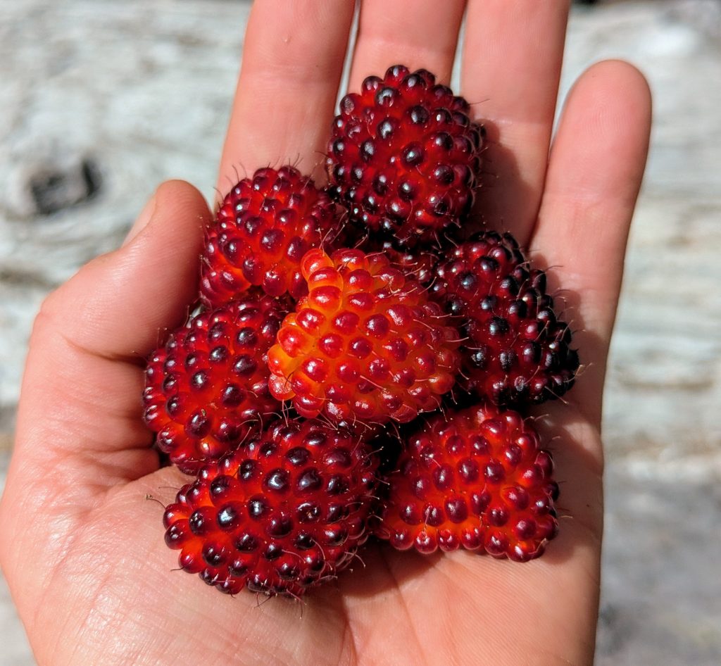
25.5 mi to west of Joe Lake, mm 250.2 6870’up\4820’down, elevation 5080′. It was another great night camping on the rocks. We climbed out of the valley in the morning, feeling good. We caught up to Foggy partway up. He was still camped, eating a tortilla with pb and sour patch kids. He cracks me up! We did a lot of big ups and downs this day, but they were all well-graded. But the rocks began hurting my feet before lunch. Thankfully we stopped at a nice stream with tons of yellow salmon berries, where I could take a dip to soak my hot feet. Foggy came hopping along and we showed him the ripe salmon berries. It was a very hot climb through a burn area, where I had to take another dip in a stream. After, I felt much better going up a tight staircase of switchbacks to the top of the ridge.


We wound past the Alpine lakes and then along the scenic basin traverse under the Four Brothers Peaks. The talus was a chore…I think this section was somewhat covered by snow last time, which is why I didn’t remember the rocks. What I did remember was this being one of my most magical moments on the trail. I camped up high and watched the most amazing sunset. This time around, we were aiming to go a little further, even though we were both very tired on the last small climb along the traverse. But the views were just as spectacular as I remembered them. I stopped several times to video the 360 degree surroundings, catching sightings of Glacier Peak (last time), Rainier, and even Mt Adams (first time). I just love marking my progress by the passing of volcanoes. It’s one of the highlights of the PCT! I could also just make out the Olympic Peninsula and Puget Sound, which is so incredible. It brought back many fond memories of my last days on the PNT…damn, I think I’m going to have to repeat that trail again too, even though it was so crushingly difficult much of the time. A repeat would really put my old Toyota to the test…


We gathered water in a melt pond, then proceeded down the trail to end up just west of Joe Lake, high on top a ridge. The two tent sites were nearly perfect, but without grand views. At least we got a spectacular show hiking the last few miles in the late afternoon. No wonder I remembered this section so well!
Day 15, Friday, July 25th, 2025, 0520-1920. Snoqualmie, Halfway through WA!
14.5 mi to Ollalie Meadow, mm 264.3, 2770’up\4150’down, elevation 3640′. We got a very early start to try to beat the crowds coming up from Seattle to hike to the Kendall Katwalk. The strategy mostly worked, as Amber and I only began to encounter day hikers a few miles from the trailhead. By the time it started to get crowded, we’d made it all the way down. I’d previously made the mistake of heading downhill mid-day on a Saturday, encountering a constant train of hikers to the tune of hundreds. It got so bad that I had to sprint during the few gaps, just to make any headway. It had sucked! At least I learned from my mistake…and another good reason I was ahead of my previous pace. Near the parking lot, we met Josh, Amber’s partner. He’d come prepared with bean dip and chips, which we devoured. Then he drove us to the Chevron to pick up our packages. I’d actually had mine delivered personally by Kelly, since she’d done a section hike nearby in the weeks before. I still had to pay $10 to the Chevron (a fair price), but at least I saved $20 on shipping! Thanks so much Kelly!


Josh kindly drove me back the way we’d just come to the Alpine Club cabin across the highway. There I said goodbye to Amber, as she was wisely taking a zero, after not even taking a day at Stevens Pass. She’d gone halfway through WA with only a brief stop in Stehekin, now that’s hardcore! No wonder she was moving so fast through this last section…she was desperate for a shower. I wished we could continue our streak together, but she’d previously hiked most of OR, and so would be skipping to NoCal at Cascade Locks. I’d be skipping all of NoCal once I finished OR, so our sections were all off. But maybe we’d line up in the Sierra, you never know?


I checked out the awesome Alpine Club cabin for the rest of the day, doing some chores and yakking with hikers. A steady-stream of NOBOs were starting to come through, but alas, I’d already somehow missed 3 of the ones I was looking forward to seeing the most. My desert section ‘trail kids, Samwise, GoodWill and Louise, had managed to stick together as a tramily from Kennedy Meadows South all the way to the end, and seemingly I passed them in this last section. I’d gotten texts that they were leaving Snoqualmie just as I was departing from Stevens, so I figured it was a given that we’d meet. I hate to think that they slid by while we were camped out of sight above the Waptus River, but that seems likely. Or maybe they were enjoying one of the many beautiful lakes that were just off-trail in this section, that would make sense too. Oh well. I’m still delighted and so proud of them that they made it all the way! It was an honor to get to hike with them through the desert.
Despite the heck-of-a-deal the Alpine club was offering to thru-hikers ($60 for a bunk, shower, laundry, dinner and breakfast!), I decided to get back on trail. This turned out to be a good plan, since the power went out in all of Snoqualmie in the afternoon. It didn’t make much sense to stay in a town with no power. I went to Lee’s market to get a slice of pizza and then was back on trail by 5:00 p.m. I made it a few miles to a really nice meadow surrounded by blueberries. I collected a bunch to have for breakfast. It was one of my best campsites yet, despite the fact that I was sleeping in a field of bear food. Does it matter if you sleep with your food when you’re already surrounded by food? I think not.


I will always remember eating Steheken cinnamon rolls for breakfast and carrying two for later. Nice summary, and lovely images.