Since I previously published daily blogs for my 2018 SOBO PCT thru-hike, I decided to take a bit of a break my second time around. Earlier in 2025, I posted weekly to bi-weekly summaries after my PCT desert section hike, and so I continued taking notes in this format over the summer. Here are my accounts, derived from those notes, plus pictures. I edited some of the days to be pretty detailed and lengthy for my own memories’ sake, while other days are more in note format…sorry for the inconsistency.
Additionally, just as I started the PCT southbound for the second time, my episode on Backpacker Radio (The Trek) came out. I did the interview with Chaunce and Zack in Golden Colorado back in May 2025, at the end of my Desert Winter Thru and PCT desert section hikes. You can listen to it here (and tell me if it’s good, cause I still haven’t listened to it myself!)
Days 0, Wednesday July 9th-Thursday July 10th. I flew from Miami to Seattle one-way direct on Delta for $120…it was an excellent flight and I got to sit in an exit row, plus was allowed a free carry-on. The flight even arrived 30 minutes early around 9 pm. At the airport, I easily walked past the Link light rail terminal and across the street to check in at the nearby Roadway Inn for the night. My plan was to meet Tony Lombardi in the morning, a contact I previously found on the PCT FB page. He was flying from Tampa same day, with similar plans to take the train north to Bellingham and a Trail Angel ride to Harts Pass the next day. My plan was to visit Mary Walker (a PNT trail angel just south of Bellingham), then take a bus/hitch east on HWY 20 to Ross lake to start from there. Tony generously offered to take my small resupply bag of food to Harts Pass, so I wouldn’t have to start off with a 6-7 day food carry (Ross lake to the border, then south on the PCT to Stehekin). Instead, I’d only have to carry about 4 days of food to get from Ross lake to the border, then back past Harts Pass.
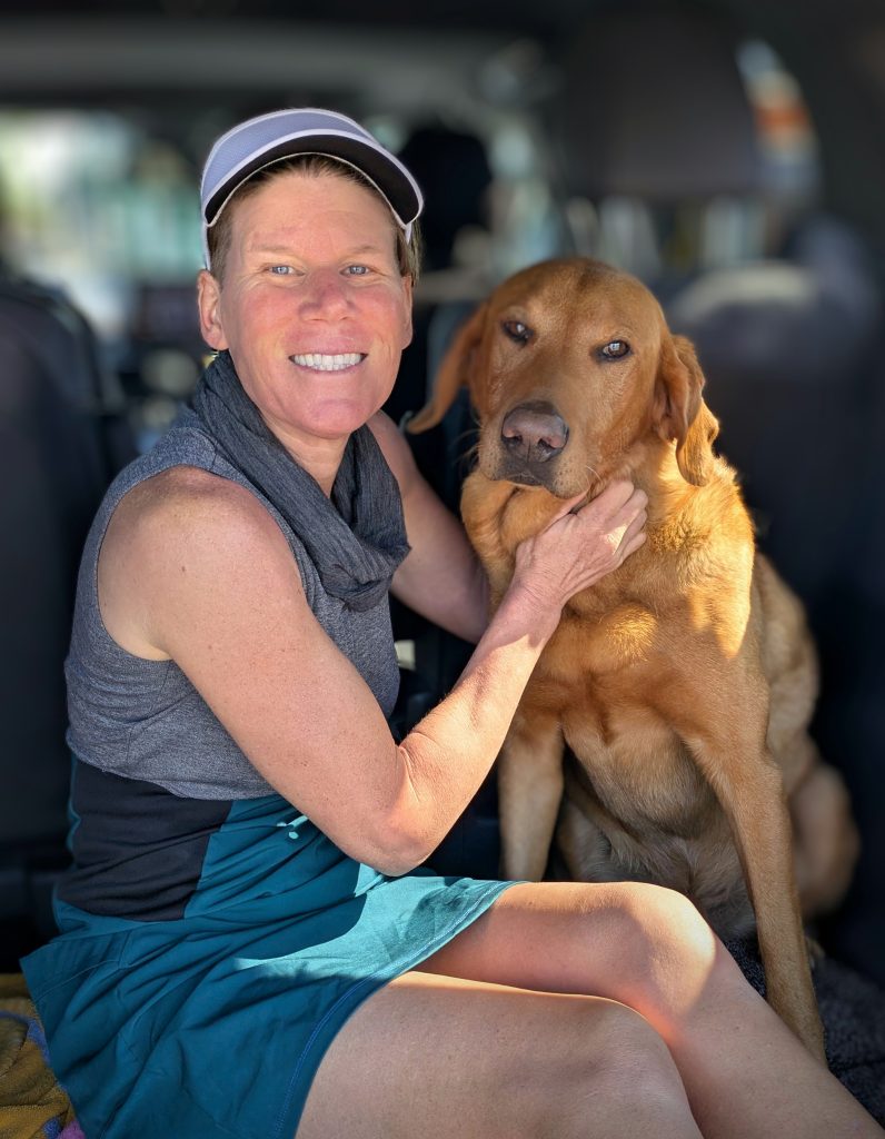
The next morning, I met with Tony and we took the Link to downtown Seattle, then caught the Amtrak bus that goes north to Bellingham. All went very smoothly and it was nice to have a travel companion to share hiking stories with. I got off at Mt Vernon, where I met up with Mary. It was so great to see her again! My first visit to her house was on my 2022 PNT thru-hike and I had the fortune to visit her again at her new place in AZ, after my trip on the Grand Canyon in 2024. I’d hoped to see her in AZ during my Winter Desert hike earlier in the year, but our plans hadn’t quite come together. She did help me big-time in receiving a package I sent from the trail and at least plans worked out perfectly to see her again this summer. And of course it was awesome to get some hugs with one of my favorite trail dogs, Boone! We did some shopping at Costo, then went back to her awesome lake home. I shipped a resupply box to her with things I couldn’t put in my carry on (trekking poles and stakes), and thank goodness I sent the priority mail box nearly 2 weeks in advance because it took 10 days! It arrived only the day before I flew in, just in time. The tracking said it sat in Miami for 4 days, then went to Cleveland???, then finally Seattle.
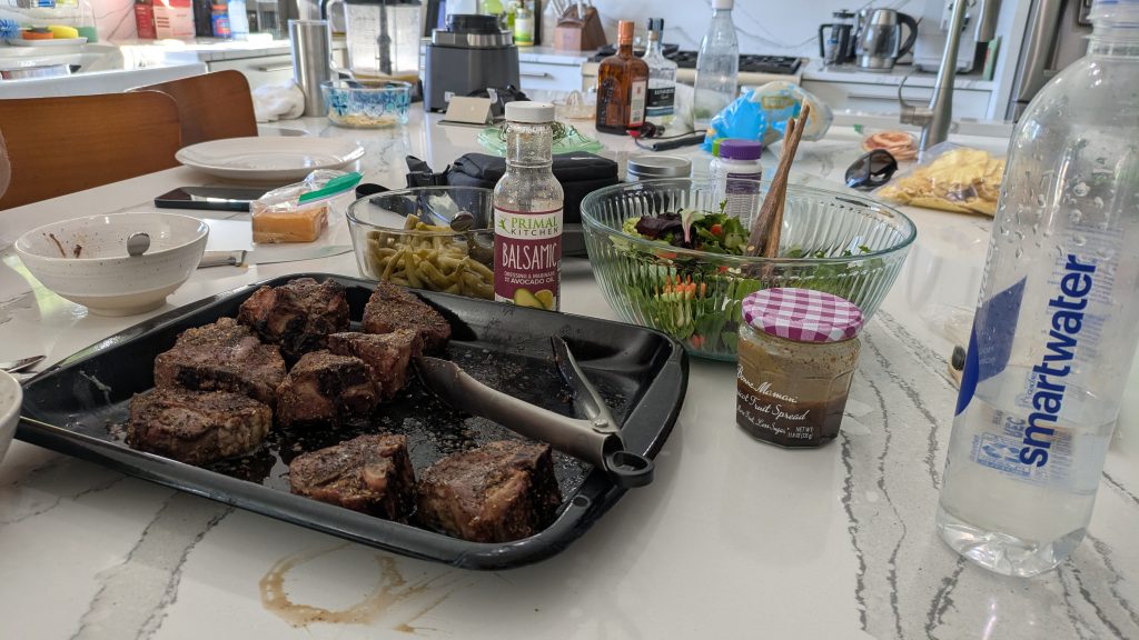
I had unrealistic hopes of maybe getting to Ross lake this same day but quickly realized I’d be staying the night with Mary. She planned a huge dinner and we kicked things off with Mango Margaritas…I supplied the mango from my own tree in Miami, of course. Best of all, Kelly, another friend and trail angel from the PNT, came over so we could all celebrate together. Mary went all out on a full course meal with lamb chops and we spent a lovely afternoon and evening enjoying the views of the lake from her porch and gossiping about hiking. I love these ladies so much:) The PNT is still my favorite trail angel trail of all time, thanks to now long-time friends like Mary and Kelly.

Day 1, Friday, July 11th, 2025, 1230-2100. Ross Lake.
17.3 miles from East Bank Trailhead (Ross Lake start) to Dry Creek Pass on the PNT, 1600’up\1390’down, elevation 5860′. Mary dropped me off at the bus terminal in Sedro-Woolley early in the morning and I rode the 70x to the end of the line in Concrete. From there, I posted up along HWY 20, but didn’t even manage to put my thumb out before 2 woman rolled down their window to ask if I needed a ride. I was flashing a sign that read “hiker to Ross Lake”, but other than that, basically made no effort at all and got a ride in less than 5 minutes. Nellie and Angela were on a vacation from AZ (bringing it back full circle to my winter desert hike earlier in the year) and quickly informed me that it was their first time picking up a hitch-hiker. In fact, they made me promise that I wasn’t a serial killer before getting in their car, LOL. I’m used to getting first-timers, especially other women…it’s one of my specialties in being a clean-cut woman in a dress and thus so lucky with hitches. They kindly gave me a ride from Concrete to the North Cascades NP visitors center, a distance of about 30 miles. I went inside to see if I might get a permit for a site along Ross lake, but as I expected, it wasn’t that easy. Like so many parks, backcountry permits aren’t actually issued at the visitors center…that would be too easy and make too much sense. I would have needed to go back 15 miles the way I’d just come to the office in Marblemount…and even then, it was likely there were no walk-up permits for a busy upcoming weekend. I walked back to the highway and got another quick hitch from a couple. I sat in the back with their car-ride-anxious pup, who adoringly cuddled me for comfort. I was glad to be of some service…an emotional support human.
After another 20 miles, they dropped me off at the East Bank trailhead, where I officially began my PCT southbound hike. This alternate start served several purposes. First, it closed a small gap of the official PNT for me, a section of about 20 miles I had yet to hike because I took the Jakita Ridge alternate in 2022. Since I’d already walked the PCT from Harts Pass to the Canadian Border twice (the only option SOBOs ever had and now the only option any PCT hiker has), I figured I might as well see some new trail while I had a chance. It also made the logistics of starting the PCT southbound much easier. Considering the simplicity of taking 2 buses to get from Seattle to Concrete, then easily hitching along busy HWY 20 to Ross Lake, as opposed to nearly 2 days of complicated bus transfers and hitches to get from Seattle to Hart’s Pass, I’d highly recommend this strategy. The downside is that it added nearly 18 miles to my round(ish) trip border bid, making for a total of 79 miles as opposed to 61 miles (the RT distance from Hart’s Pass to the border and back). It also added about 8000 feet of elevation gain…a big part of which I was having to tackle this first day. Ugh! Still, I was very thankful things worked out so well with Tony dropping off my food resupply at Hart’s Pass, because at least this saved me a pretty heavy food carry! I also got to take pictures with the NCNP signs along HWY 20!


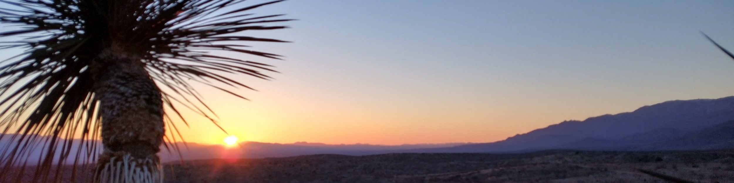
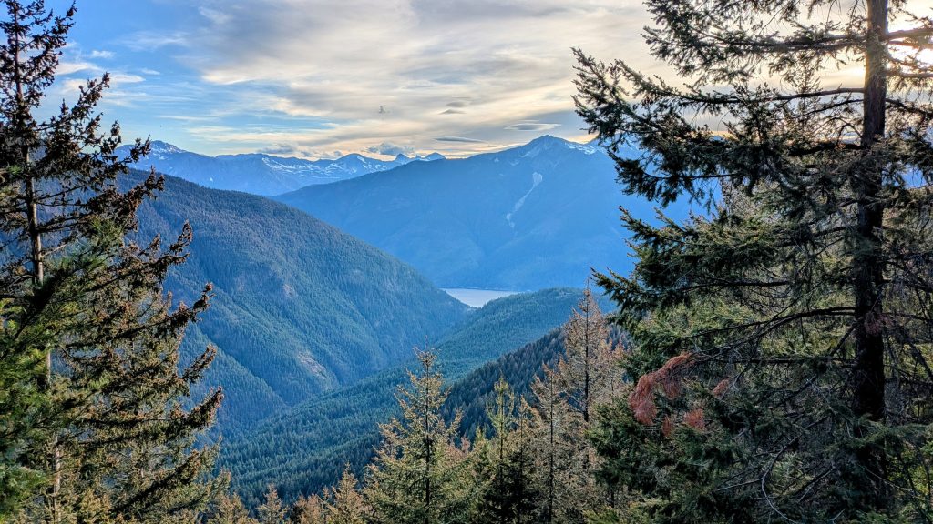
Starting so late in the day, I wasn’t sure how far I would make it. I needed to go at least as far as the National Park Boundary, about 15 miles, as I didn’t have a permit to stay at any of the official campsites along Ross lake. The very first person I met on trail was a NCNP Ranger, who of course asked me about my plans and/or to see my permit. I confidently told her I was hiking outside the boundary and she was super cool about my plan. They can usually tell if you’re a thru-hiker with some experience. The first 12 miles of trail along the lake were easy and cruisey, as I knew they would be. I felt good and able to do the miles. Around 5 pm, I stopped for water, dinner and a fabulous swim in the lake at the Devils Junction campsite. It was very tempting just to stay there, especially when one of the campers invited me to share his space and permit. But alas, the sun wasn’t setting for another 3 hours and I really wanted to eat into some of the hellacious climb up to the crest. Besides, I also felt obliged to play by the park rules, especially after promising the ranger. The swim and dinner really refreshed my energy levels, the cool of the evening beckoned me on. I turned east onto the Devils Junction trail and no more then 5 minutes from the campsite, I met another hiker. A small black bear was busy eating huckleberries along the trail and we stood staring at each other for a good 3 minutes before he kindly got off trail to let me go by. It was awesome to see a bear first day, especially so close and thankfully also peacefully. My heart rate doesn’t even go up when I see a bear anymore, it’s just become a normal thing. I think this made a total of 11 bears that I’d seen along the PNT. I also stole some of the bear’s huckleberries, but there were plenty to go around (both red and purple ones!).


The climb was pretty easy for the first few miles, not too steep. But once I hit the park boundary, BAM! The trail immediately turned into an overgrown mess, which feels like swimming against the current when you’re going uphill. Welcome back to the PNT, baby! The last few miles of my day were predictably steep and tedious, and I was so very tired. There was of course no place to camp on the steep hillside and it was getting dark. I made it to some flat spots on the ridge just in time. The mosquitoes came out briefly while I was setting up, but were easy to escape. I fell asleep as soon as my head hit my pillow. It was a beautiful first day!
Day 2, Saturday, July 12th, 2025, 0610-1830. Back on the PCT.
25 miles to Hopkins Lake on the PNT & PCT, 5800’up\5450’down, elevation 6250′.
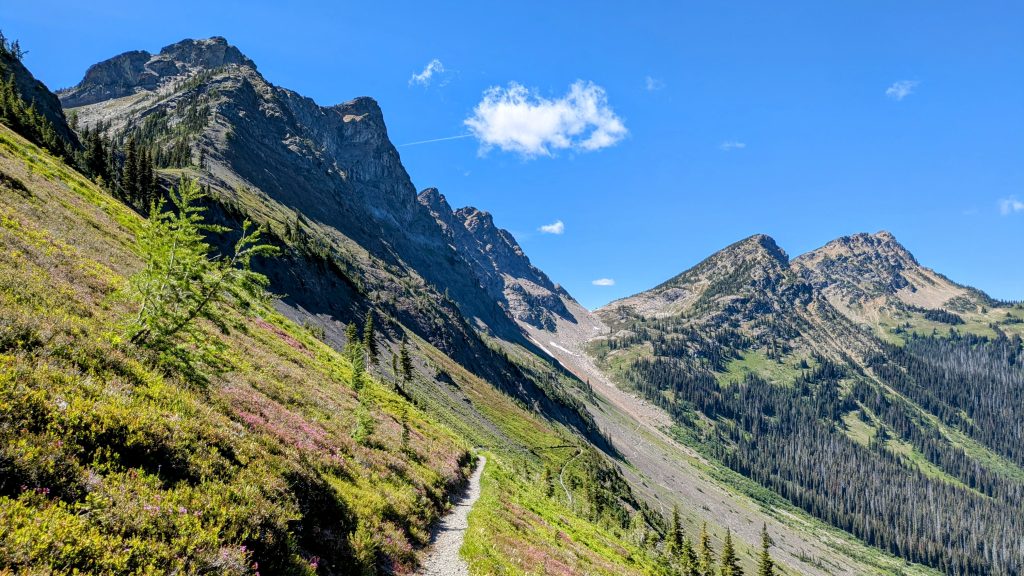
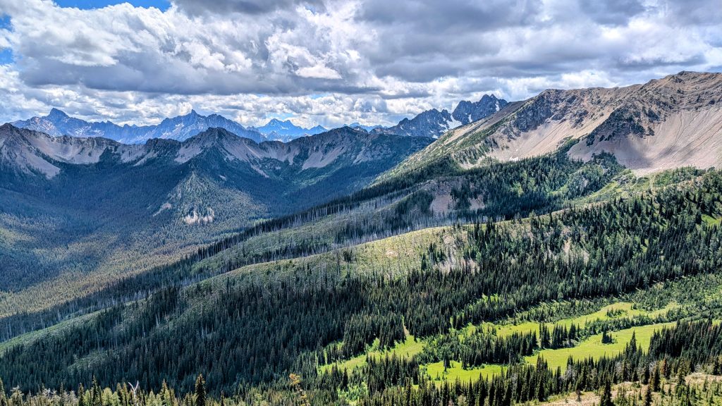
There was a deer searching for my pee (salt) overnight, making noise and waking me up. Ah, how great to be back on the trail with my all-too-familiar companions. I waited until it got very close, then let out a blood-curdling Sasquatch shriek to scare it away. To my satisfaction, it ran off crashing into the woods, which made me chuckle. When deer mess with me, I like to mess back. Thankfully it didn’t come back the rest of the night. I had a hard time waking up, even though it started to get light around 4:00 a.m. The morning greeted me with another thousand foot climb to the top of Devil’s Dome. At least there were great views of Jacks peak and Mt Shucksan. I saw one tent pitched on the dome and then passed a solo backpacker that was heading down from the dome. I saw no other people after this, until reaching the PCT in the afternoon. There was a rugged stretch just before meeting the Jakita ridge Trail, with lots of blowdowns and overgrowth. The remainder of miles to the PCT were also kind of tedious and somewhat boring in the trees, especially since it was now all ground I’d covered before.


I hiked 14 miles on the PNT to reach the PCT at Holman Pass this day, a combined total of 31 miles since I started from hwy 20 the day before. I was very happy to make it to the well-groomed PCT and also to start seeing other thru-hikers. It felt like I was finally on the right path, even though I still needed to go another 17 miles in the “wrong” direction to reach the border. Also considering that this made for my 4th time hiking through this section (2x on the PCT and 1x along the PNT), I was very familiar with the terrain. Thankfully these are some of the most scenic miles along the PCT, so I didn’t mind. The conditions have also been very different each time. This was ironically a dry year and stretch, with not much water running across the trail. What a contrast to 2018, when I was hiking through snow almost all the way to the border. As such, I met a hiker who was very insistent that I carry more water, stating that he’d already been to the border and back, so knew for certain there was no water the next 10 miles. I knew for certain that there was spring slightly off-trail, just north of Rock Pass, since I’d stopped to collect water there in August 2022. If there was water then, there would be water even earlier in the season. I told him so and he did not like my contradiction. Sure enough, the spring was running and I enjoyed a nice break there. I also counted at least 5 small sources a few feet off-trail along the way, mostly little trickles but would do in a pinch. So much for no water. Hope that guy never has to hike through the desert!
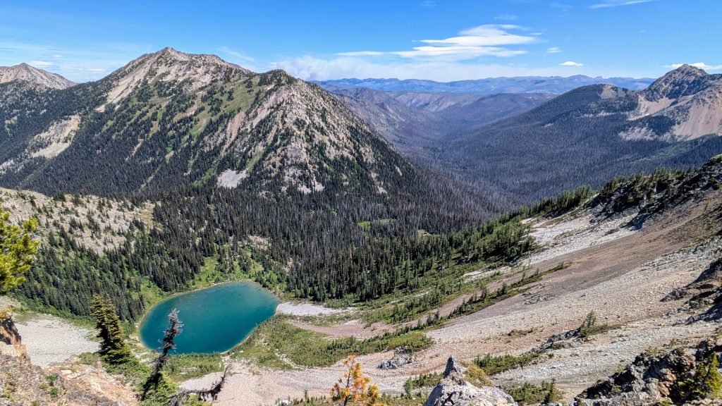
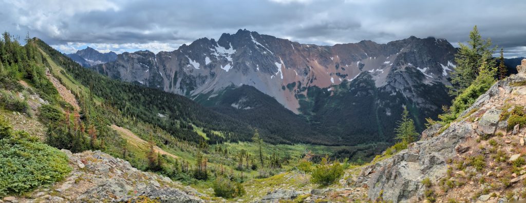
I hiked another 10 mi to make it to Hopkins lake by the end of the day. The last climb to Hopkins pass was very tiring and I began feeling that maybe it wasn’t worth it to hike all the way to the border. I also saw a large plume of smoke coming from the Pasayten river valley, near the border by Bunker Hill on the PNT. I couldn’t believe it, the Pasayten was already on fire at the beginning of July! I was lucky to just miss the fires when I hiked the PNT, but this seemed like an ominous sign. Maybe I wouldn’t be able to make it to the border by the following morning? I enjoyed views of Mount Baker to the west and Cathedral Peak to the east (the PNT passes close by). At the lake, I went for a short swim to rinse off all the sweat. I found a nice spot in a meadow with a good breeze to keep the mosquitoes away for a bit. Once the breeze died, they began swarming and I retreated into my sanctuary…nothing that a little permethrin and tent bug netting can’t fix.
Day 3, Sunday, July 13th, 2025, 0600-1900. The BORDER
27 miles to border and back (14 miles RT), then south to tentsite mm 19.6, 5030’up\5300’down, elevation 5940′. It was a great start to the day, as I made fast miles slack-packing 7 miles (one-way!) to the border, then back again. It was all downhill to the border…which meant it was all uphill on the return, but at least gradual and also without the full weight of my pack. I left everything but my food and safety items near the lake early in the morning, stashed behind a tree. I passed only 2 hikers as I was going north, then about 9 as I was going south. I was all alone at the border and didn’t linger long. I took my self-portraits, signed the registry, and then was officially on my way by 9 am. I felt like I was moving even faster going back, relieved to finally be heading south, making positive miles towards my final goal this year, the High Sierra.


I made it to the top of Hopkins mountain for lunch, where I had a nice chat with Sebastien, a fellow thru-hiker. We watched the fire plume by the Pasayten River get bigger and bigger. By the time I made it to Rock Pass, it was huge! Another reason I was glad to be heading south. I caught up to Sebastian and we hiked together a lot the rest of the day. It was nice to have company, but I didn’t expect it to last, given the fast pace I was determined to keep through WA. I stopped to chat with some campers at Holman pass who were really friendly. But the day was so nice and I was still feeling good, I figured I’d nab a few more miles. Incredibly, I ran into a woman that recognized me from the Big Sandy trailhead, when I was doing the Wind River High Route the year before. I can’t believe she recognized me and also remembered my hiking buddy Strider. What a small world. The next campsite wasn’t as nice and I ended up with a slightly slanty tent site. I think it was the same campsite I stayed at my very first night on the trail in 2018. Southward Ho!


Day 4, Monday, July 14th, 2025, 0630-1830. Harts Pass
26.5 miles to Methow River, mm 46.1, 3930’up\5500’down, elevation 4380′. It was a nice morning hiking 11 miles to Harts pass. I loved the really cool traverse for the last 5 miles, with great views down into the valley and glimpses of the fire lookout, which I hadn’t even noticed the time before. I also caught a glimpse of a yurt. I passed SOBO Ken, who I first saw the day before heading from the border. Then I passed a group of about 8 by Tamarack Peak. I met one day hiker with a cute dog. Finally, I chatted with SOBO thru-hiker Foggy, who was just leaving from the trailhead to tag the border. He said he was planning on doing 30s once he got going, so I figured I’d see him again (spoiler alert, I hopscotched with him all the way to Crater Lake!). There were no SOBOs taking a break at Harts pass while I was there, but I had a nice chat with the ranger. She told me due to the DOGE budget cuts, the PCTA was not handing out hang tags to SOBOs. What a bummer! I at least had mine that I’d received at the Mexican border. I grabbed my resupply bag from the bear box and sorted it inside a screened tent over a picnic table because the mosquitoes were terrible. I left just before noon and started another really cool traverse. It was foggy the last time I passed through the area and man did I miss out on some really amazing views! Not this time…I could see the trail stretching out for miles, which I always love. I was also surprised by how steep the drop-offs were along the sides of the trail, which I had no idea of before. I passed about five day hikers and one backpacker all heading back towards Harts Pass.

By mid-afternoon, it got pretty cloudy and was threatening to storm, so I hurried down the many switchbacks from Grasshopper pass. I was very tired by the time I got to some water at Bush Creek. After all, I’d been pushing big days since I started. I thought about stopping there but decided to push on to a better campsite at the Methow River. Glad I did because the campsite was very nice and the river had the perfect little pool to take a dip in. Boy was it cold! I was the only one there and I passed just two tents, no people, below Grasshopper pass, so it was a very quiet afternoon and evening. Wildlife: only 1 deer and a few large piles of bear scat. Lots of ripe huckleberries the Methow valley.
Day 5, Tuesday, July 15th, 2025, 0630-1800. Cutthroat & Rainy Pass.
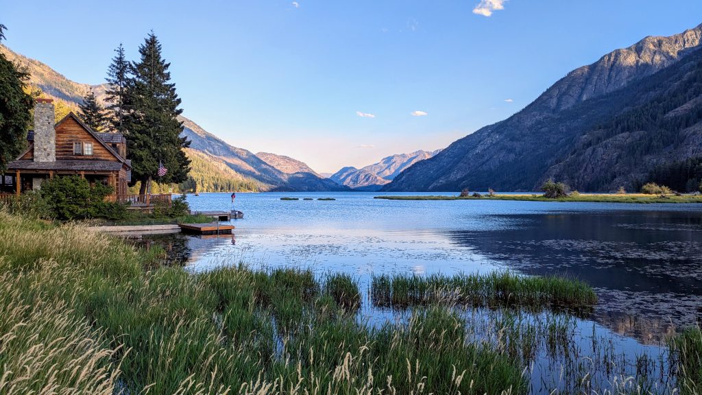
23.5 miles to Six Mile Campsite, mm 69.5, 3750’up\5070’down, elevation 3140′. It was a lovely camp along Methow river, with hardly any mosquitoes. The wind blew strong overnight, so I was glad I was down low. It was a peaceful walk early in the morning through big trees. Mid-morning, I caught up to Mary Badass, a hiker I knew of by name and reputation and had also chatted with online, but hadn’t yet met in person. We hiked together all the way up and down from Cutthroat pass. She was doing an alternate to get around the fire closure at Whatcom pass on the PNT…which started the year I hiked and still wasn’t reopened. It was very fun hiking with her. We saw lots of day hikers and backpackers around Cutthroat pass. There were no remnant snow fields this time, so the trail was very easy. It was one of my most treacherous snow traverses in 2018. After crossing Rainy Pass at HWY 20, it was a long afternoon. I was solo again and trying to make up some miles to get to 6 Mile Camp, allocating for camping restrictions in North Cascades National Park. I made it just in time to be the first to set up camp and go for a dip in the Stehekin River. I think this was my easiest day yet.


Day 6, Wednesday, July 16th, 2025, 0500-0830. Stehekin
11 miles to High Bridge, then bus to Stehekin, mm 80.7, 1590’up\3060’down, elevation 1680′. I got a very early start so I could make it for the 9 am shuttle. The hiking was mostly unremarkable but I made it with 30 minutes to spare! I might have taken a bit of a shortcut. There were only 3 others waiting for the bus and not too many hikers in town either. I didn’t even have to wait for the one shower in town. Doing laundry right next door was a breeze as well. Such easy logistics in this tiny town! I met some really nice folks. Tony, my friend from the Seattle airport, was there, also Bad Sherpa, Trinity, and a Belgium guy. I picked up my box from the PO…all was fine except my bar of Tonys chocolate was partially melted, but at least it was at the very bottom of the box. I ate an expensive sandwich from the lodge restaurant for dinner and walked a few miles along the lake and out of town to pop into the forest for the night, setting up to be close to the bakery when it opened in the morning at 07:30 am.


Great start.