Sunday, March 23rd, 2025, 0700-1840
San Vicente area to Penasquitos canyon open space, mm140.5, Elevation 380′
21 miles.
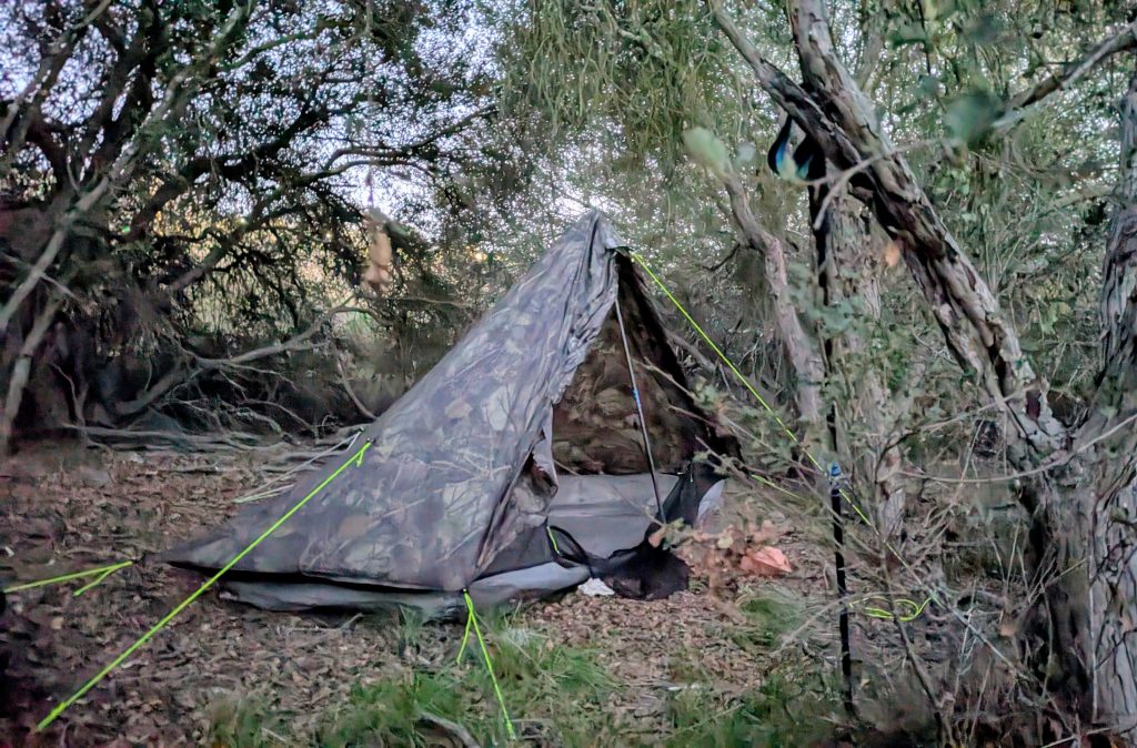
My semi-urban campsite was a little too wild, as some animals were fighting in the bushes overnight, probably racoons. Still, it was a great spot. I woke to a very foggy, wet morning. My tent was soaked, but at least I didn’t have to resort to cowboy camping, thus getting my quilt wet. I figure I’m more discreet inside my camo tent anyway, as long as there’s space enough to pitch it. It’s like a hunting blind. The fog also served to further conceal my escape from my site, not that anybody was around to see me go.
I followed the paved road a little further, then turned onto a dirt fire road leading steeply down into the valley. The road spit me out into a residential neighborhood that was a bit more run-down than the ones above it. But one kind resident had placed some tangerines in a free box, which was a nice little bonus for the morning. The scene quickly turned into an industrial area that was loud and kind of smelly. Thank goodness I stopped for my perfect camp spot when I did!
I briefly turned south on busy HWY 67, then promptly turned onto a small side road called Hi Hopes. No irony there. The road seemed to only service one house and the GPX track suggested a reroute through the bush to bypass it. Again, I decided to try my luck walking past on the road and did so without issue. Then the road split, and I was to follow the right fork heading directly behind the house, almost like I was walking up the driveway and into the backyard…hence the suggested reroute. I think there was also one of those pole gates blocking vehicle access, but it was easy to side-step on foot. There was a guy in the open garage, loading stuff into his vehicle, but he either didn’t see me or ignored me as a scuffled by. I guess I got lucky again. Maybe I’m just one of those people that hardly anyone else notices…I feel like that a lot, anyway. It can be an advantage, but also a pretty lonely experience. Sometimes I wonder if one day I’ll just disappear into the wilderness for good and no one will ever be the wiser.
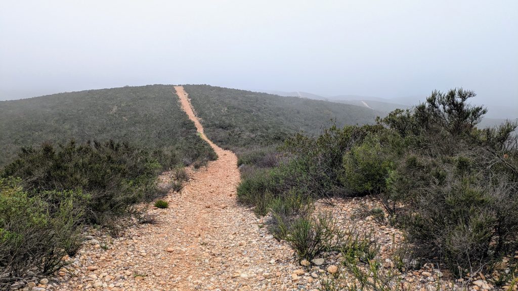
The road turned into another firebreak, leading up along the ridges. I followed a network of these through various stages, from pretty overgrown, then clear, then very rocky and slightly overgrown, to clear and well-graded. A number of roads bisected the one I was on, so I was glad for my GPS. I even got turned around once, heading the opposite direction that I thought I was. Because it was still so foggy, all I could see were the surrounding hills, which was kind of disorienting. I felt like I was in the middle of nowhere, among nothing but green, featureless ridges. I was surprised by the vastness of this undeveloped area, all part of the Sycamore Canyon/Gooden Ranch Preserve, owned by the county. It was hard to believe that San Diego was less than 20 miles to the south.
A SDTCT thru-hiker could probably camp easily enough in this area, but still on the DL. It would have been hard to find a spot that wasn’t too rocky and not right on one of the roads, though. After about an hour on the ridges, I started to encounter mountain bikers. They were all very friendly and courteous, but that would be another thing to watch out for, if camping in the area.
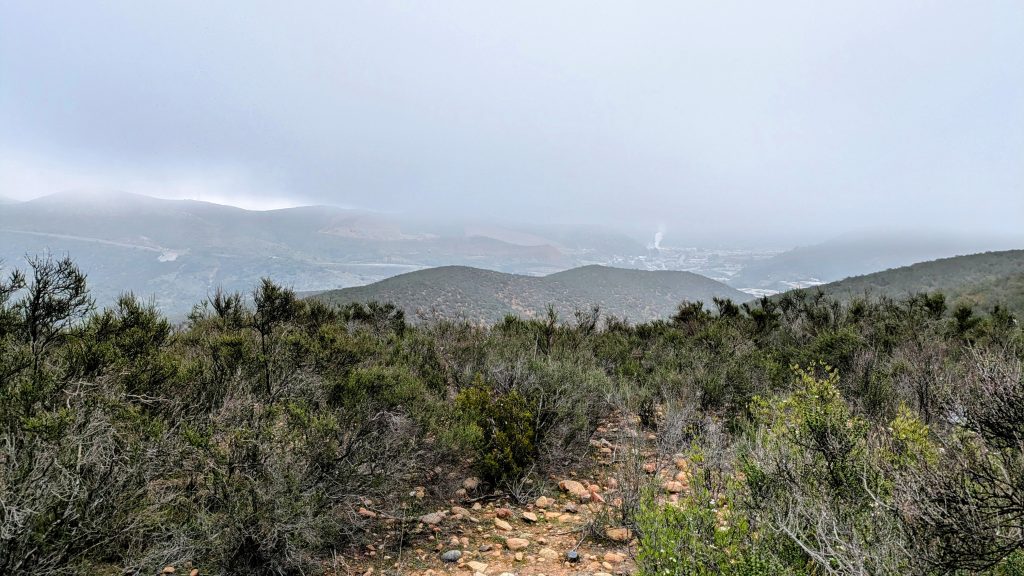
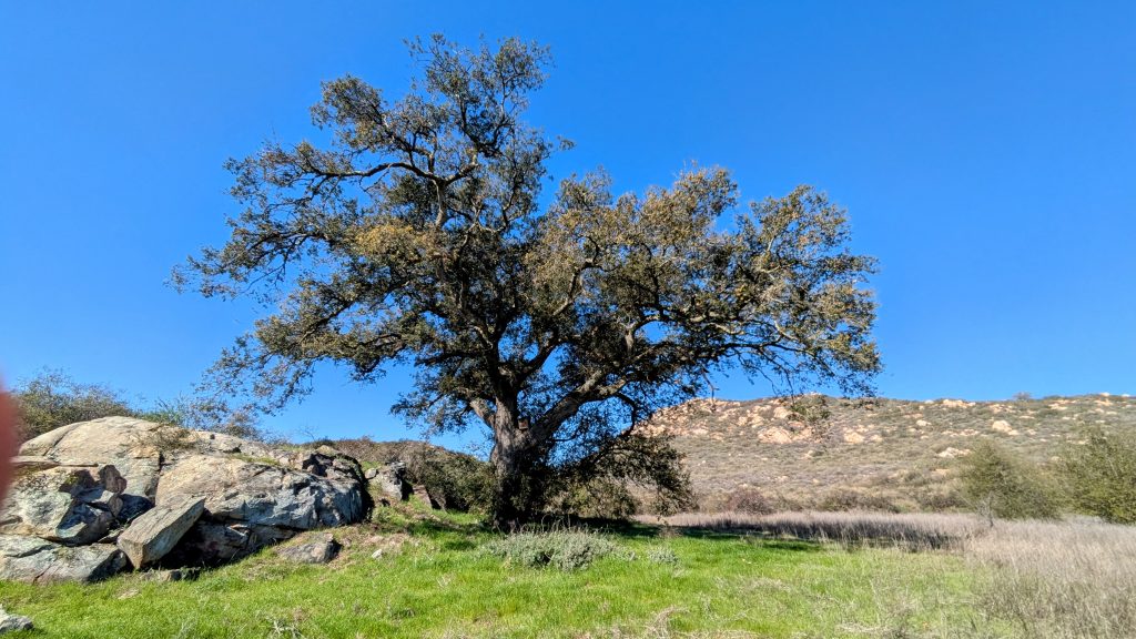
In total, I walked over 5 miles on the ridges. By the time I was nearing Poway, the fog had burned off and it was a brilliantly clear day. I pondered several lovely camp spots under giant oak trees…for another time. The route now followed a series of mountain bike trails, but thankfully I didn’t encounter anyone on these narrow and twisty trails. I walked through a giant culvert, passing under busy and wide Scripps rd, then started descending west towards Poway. Up ahead, the route went right past a business area with a Costco and several restaurants/fast food places. I was eager for lunch, but still decided to take a break under an oak so that I could dry my tent. While I was there, some women rode by on horses. The poor lead horse had to contend with my tent flapping in the breeze…a spooky prospect indeed. I stood up to let the horses see that I was a person and got a nice petting for my efforts. The women were very friendly and told me they helped maintain the local trails. Good on them!


As I continued, I found a cool alligator lizard that I wanted to move out of the trail, but apparently they can bite pretty hard, oops! This one continued to play ‘stick’ even when I picked it up, so no bite for me, fortunately. Somehow I ended up off-route, walking right through the horse boarding facility that the ladies had come from. I followed a road to get back on course, only to find a confusing network of bike trails and firebreak roads. With a lot of references to my GPS and Google Maps, eventually I found a way up to Poway’s industrial and office space park. Since it was Sunday, most everything was closed. Even still, there was a poke bowl place that hit the spot for lunch. I charged for a bit, used the bathroom, then continued on straight to an In and Out Burger for second lunch / early dinner. I was definitely dragging my feet this day, which was just fine. There were too many miles left to finish the route in one day and I’d spied some potential stealth camps spots on the map, just up ahead. There was a nearby Ramada Inn that past hikers had used, but I was too intent on the challenge of doing the entire route without the aid of urban lodging.
I took an alt to get back to the route, sticking with some side streets through the business park. All was calm and quiet, so it was a very pleasant walk. I crossed Pomerado Rd, went down a valley through some neighborhoods, passed a VFW (which given my veteran card, might have let me pitch my tent out behind, had someone been around to ask), crossed Beeler Creek, then up and over a small hill. Here I finally entered the Penasquitos valley proper, which I’d be following for the remaining 15 miles to the coast. I figured there had to be a concealed campsite somewhere along the way, but I had less than an hour of daylight left to find one. This was of course, just the right recipe, since the cover of darkness is key.
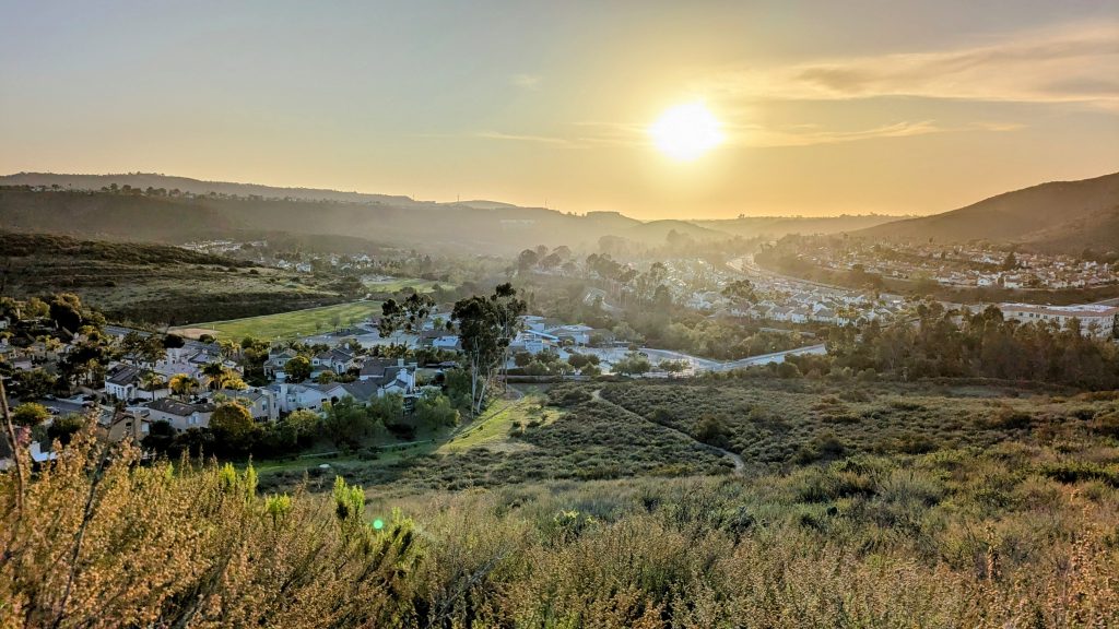
Walking the wide and well-traveled urban path next to the creek in the late afternoon was very nice. My belly was full and I was again on a high after a fun and relaxing day. But I’d be lying if I didn’t have some hard doubts about finding a camp spot. I’d entered the most urban setting yet and the rows of houses lining the valley would be hard to hide from. Several people passed me walking dogs and going for runs, just like you’d expect of such an area, especially on a weekend. Nice for them to have a good place to go for a stroll, but not good for me, in search of a quiet hiding place. Surprisingly, I came across another SDTCT sign…perhaps only the 5th I’d seen the whole route.


The trail got a little soggy as I entered a marshy area and there was a fun makeshift boardwalk…maybe the difficulty of this section would cut down on traffic, I thought. The valley had widened and sure enough, I found the perfect spot under some low oaks, just as the sun set. I was less than 20′ from the trail, but I made sure my tent was not visible in the slightest. My camo print even has oak leaves as part of the design, so it really blended in. I was careful to set up without my headlamp and used my lowest red light setting to make the last adjustments. I wasn’t in a spot that others would be attracted to (no view, no access to water, etc), so I felt very confident about going undiscovered and slept very soundly. Only half a day left and I’d be touching the ocean…what a way to finish the Desert Winter Thru Hike!