Sunday, March 16th, 2025, 0620-1800
Salton Sea, eastern terminus of the San Diego Trans County Trail, elevation -226′, to outskirts of Borrego Springs, mm30.5, elevation 500′
30.5 miles.
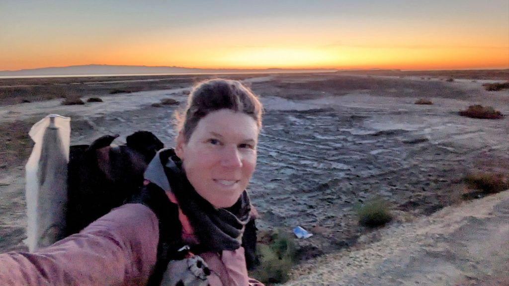
It felt great to be at the start of the SDTCT when I woke. I was moving before the sunrise, since I didn’t want to be discovered camping along the shore. I couldn’t see how far away the water was, but the flats made for a nice sunrise. I didn’t even realize that I was standing over 200 feet below sea level. The depression was formed by the San Andreas fault, which stretched the landscape as the plates slid past each other. I’m not sure I’ve ever been in a place so low, and especially not at the start of a thru-hike. I’d need to climb about 7000 feet before dropping back down to the ocean. But this day promised to be pretty mellow…mostly all wash walking.
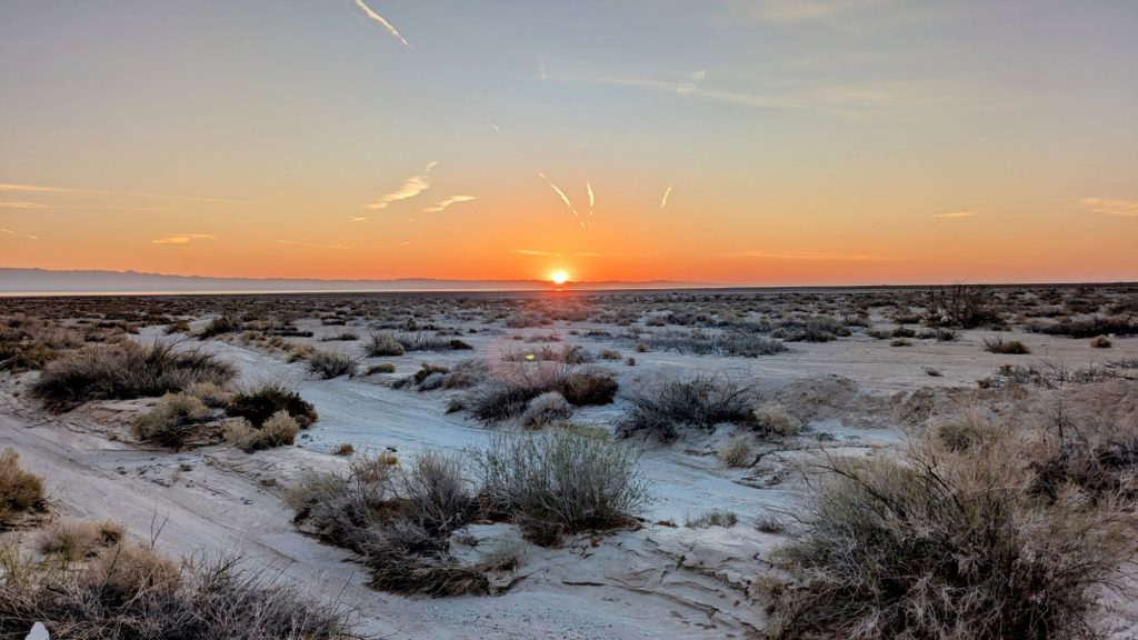
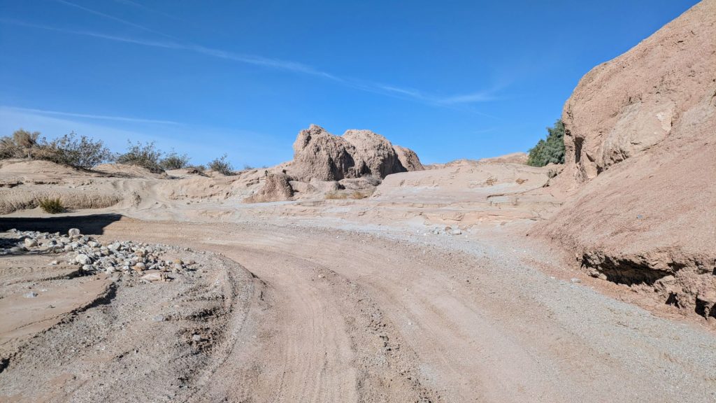
In fact, the route followed the same wash, Arroyo Salado, for almost 20 miles. But first I had to walk about half a mile across the flats to find it. The sun was just rising and once in the large wash, the navigation was quite easy. The sand was also pretty hard-packed, so the miles flew by throughout the morning. I passed a water treatment plant, went under CA 86, and entered an ORV playland. There were numerous signs and markers denoting the areas for the ORVs, plus tracks going everywhere. I immediately wanted to get through the area before they appeared, but thankfully all was still quiet on a Sunday morning. I knew from experience that I was lowest on the totem pole, obligated to stay out of the way or risk getting run over. I did not enjoy being part of Mad Max scenes in the desert.


I thought this was either a goat or desert bighorn skull
There were a few major splits in the wash that I had to pay attention to. Then I did take a wrong turn, but it was easy to get back in the main wash. It started to get a little warm so I put up my umbrella. If nothing else, it made me easier to see by the vehicles. I saw a few motorcycles in the distance, but that was it. Then I passed into another area that was part of the Anza-Borrego Desert State park, which was zoned for 4wd street-legal vehicles only. At this point, a few trucks passed me, but were moving slowly and courteously.
I was so thankful that I didn’t travel through the previous area when the speedy ORVs were active. This made me realize that I’d done very little research on this route and that maybe I should read up more on what to expect. I knew there were some private property issues closer to San Diego, as well as a bushwhack section going up El Cajon mountain. For sure, camping was going to be tricky once I passed over the crest. Perhaps I should have watched some videos and read more blogs.
Finally the wash ended and I reached a BLM campground just in time for a lunch break in the shade of the pit toilet…a tactic I’d already employed way back in AZ. A few cars passed by, so I could have begged for water, had I needed it. But I was doing just fine. This was also a suggested cache spot, but I was glad I hadn’t bothered with the hassle of renting a car and driving all over to bury water and food. I was down to just a few liters of water and my pack felt so great.
I briefly hit S22, then turned south to head down Ella Wash and again west to follow Short Wash. The views were really nice, since I’d gained about 1k feet in elevation. I could still see all the way back to the Salton Sea. There were also some trees and bushes along the wash. I learned a new one was called a smoke tree, which looked similar to Palo Verde. I’d been seeing them since the Mojave but hadn’t known their name. I also passed some clusters of California fan palms.
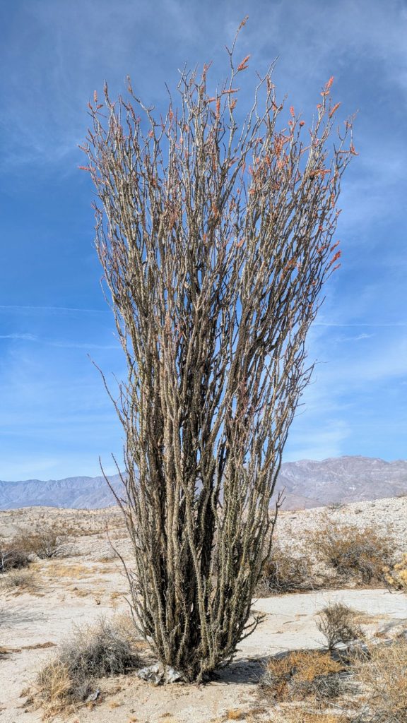
Most surprisingly, there were ocotillos. I thought they only grew in Arizona. It turns out, I passed them on the PCT in 2018 too, I just didn’t know their name then, nor was paying much attention. Later I learned that this variety is native to southern California. They looked different than the ones in AZ, bushier and with more strands. They had flowers already and I could see that their leaves were just starting to pop after the good rain days before. They are able to deploy their leaves in as little as one day after a hard rain.
I joined Fonts Wash, which was a dirt road, and started getting passed by vehicles going to Fonts Point Overlook. Luckily I was only on the road a short bit until I broke west to hike cross country to Inspiration Point. I reached a cliff, looking down on a valley with Borrego Springs in the distance. Directly before me was a convoluted landscape of sharply eroded hills…the malpais or badlands, as they were called. I was standing at almost 1200 feet and certainly wasn’t expecting such a view this day. It was really beautiful!
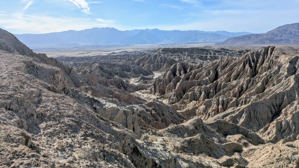
I also wasn’t expecting to have to scramble down a gully and begin weaving my way through such a landscape. It looked steep, but shortly I found that the gully made for an easy passage through the cliffs and then became a dirt road. I followed it for several twisty miles until it dumped me out on the flat plains. I also took a break in the shade of one of the cliffs, since the angle of the sun was low enough to cast a shadow.
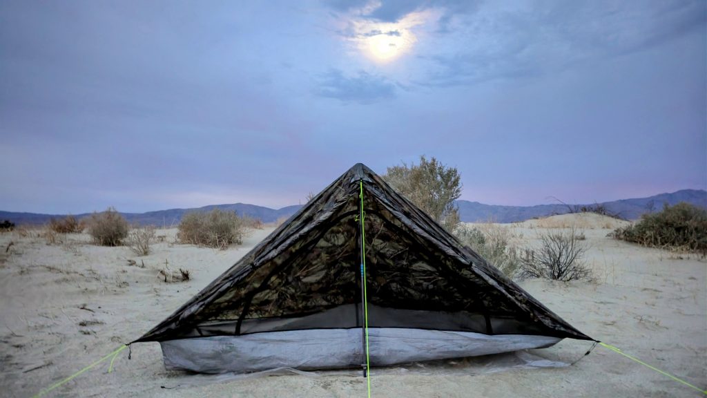
I probably could have pushed all the way to town this day, but had plenty of water for another peaceful night in the desert. Thirty miles was certainly enough, plus if I pushed any farther I would have ended up surrounded by private land. I found a nice creosote bush to pitch next to and watched the stars come out. It was very warm and there wasn’t a breath of wind…little did I know how rare this is and how lucky I was to camp here without getting blown away. What a great start to this hike!