Tuesday, March 11th, 2025, 0630-1900
JTNP mm 84 to near Black Rock Campground, mm 17, Section 8a, elevation 4030′
27 miles.
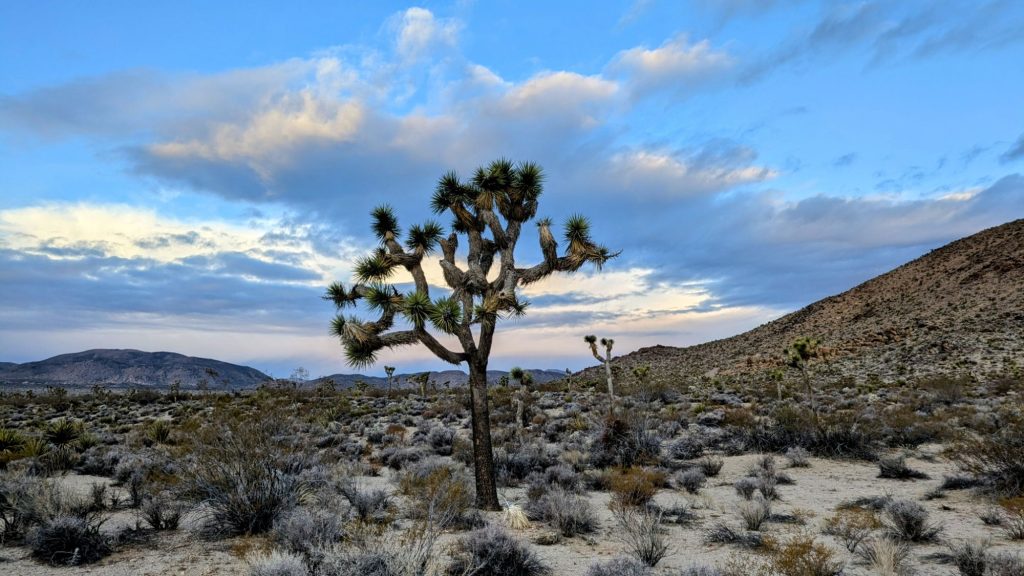
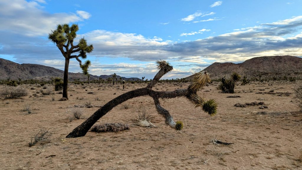
The morning was beautiful in the canyon. I heard a great horned owl and a canyon wren at the same time as I continued up. The canyon split and I decided to not follow the suggested route, but rather go for an easy dirt road walk across the Queen Valley. I picked up the Desert Queen Mine Trail and followed it to the road. It was early and a weekday, so I didn’t see a single car while walking several miles along it. What I did see were tons of Joshua Trees!
Plus there were many cactus and bushes planted and marked with tags along the road. The park service seemed to be trying to restore the area, covering old tracks of vehicles that illegally drove off limits. Why did we idiots try to drive everywhere when there was a perfectly good road to follow? I lamented that the restoration project would probably get cut in the effort to undermine science and conservation by the current administration, run by a circus of greedy billionaire clowns.
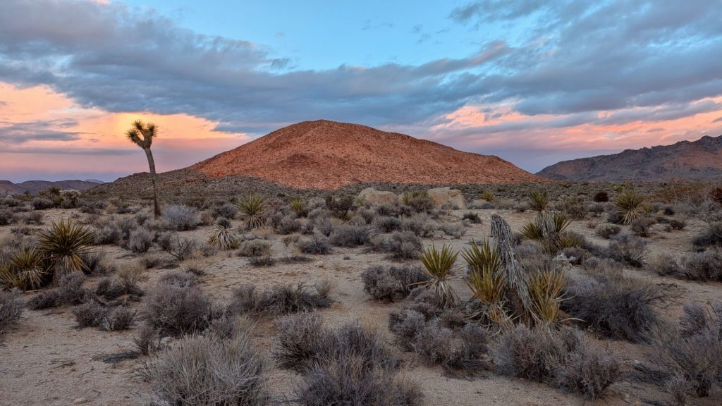
The valley was so beautiful, with the sunrise casting an Alpenglow on the hills. But I could imagine it quickly becoming spoiled by unchecked vehicle use. A similar thing happened when the parks were closed during covid. People came anyway, drove all over the land and left trash everywhere…as people do because we suck. Best case scenario, maybe the park service wouldn’t even have the resources to maintain the roads anymore and they’d just put up barricades to keep some, unfortunately not all, the vehicles out. I’d be perfectly fine having to walk all over the park…as I was already doing this day.
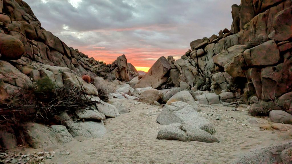
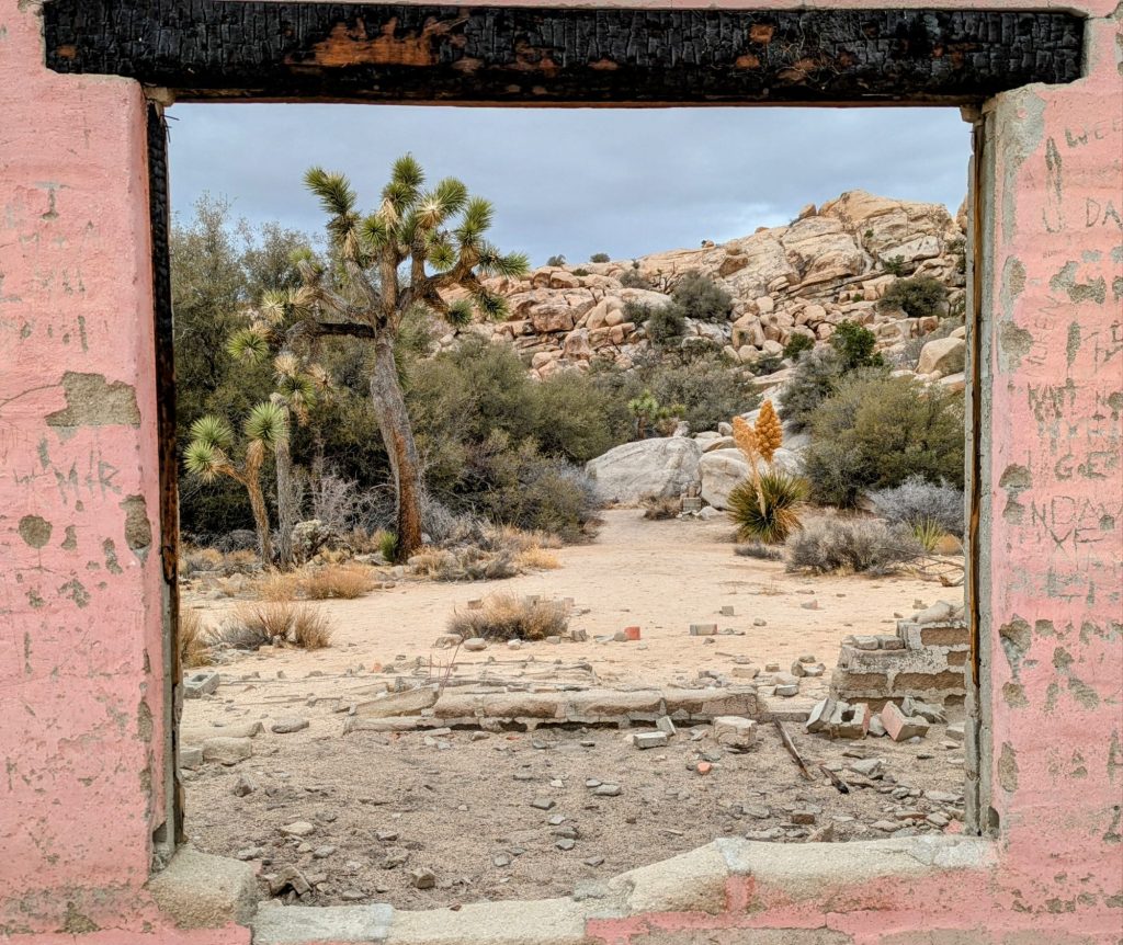
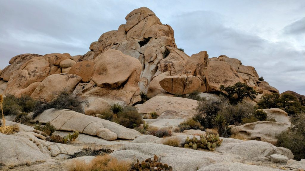
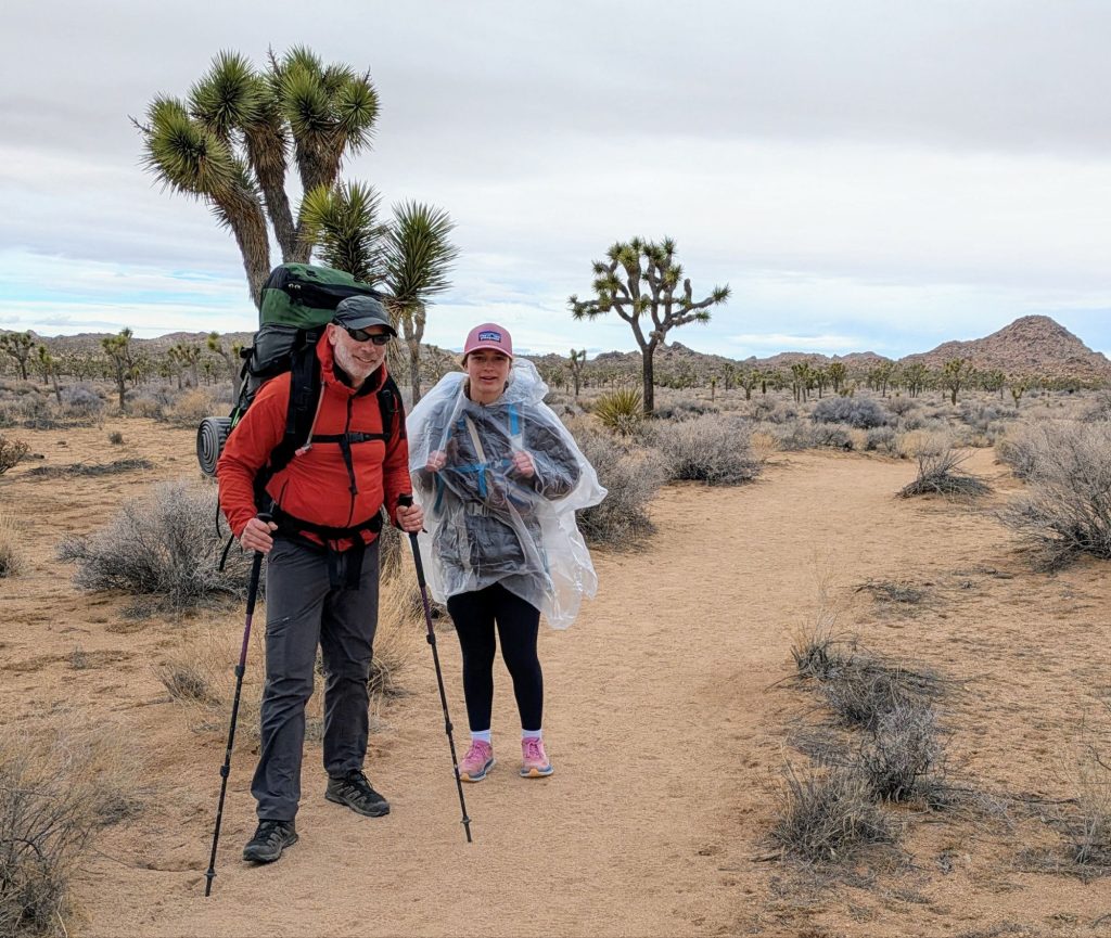
I took a break at the Wall Street Mill trailhead, where I saw the first people of the day. There were just a few day hikers and only 2 cars. I used the toilet, then chatted with a guy, standard trailhead stuff. He kindly offered me water, but I didn’t need any. I walked past an old homestead foundation, oddly painted pink. Then I entered an area called the Wonderland of Rocks, which was hands down the most incredible part of the whole park (that I saw). I followed a series of washes through the valleys of rock formations, many of which were popular with climbers. But I had the whole place to myself on this day and it was absolutely stunning.
The navigation of this area looked complicated on the map, but in practice, I found it to be pretty straightforward. There was a good use-trail most of the way and relatively non-technical small scrambling bits. I recalled a podcast about a woman who went hiking in JTNP, got lost and broke a joint falling off a rock. She laid out there for days in the sun before a rescue team finally found her. Even though the park was relatively small compared to the expansive wilderness areas I’d previously traversed, I could see how someone without route-finding experience might easily get into trouble in this jumble of rocks. But for me, it was just another day on the DWTH, albeit one of the most incredibly scenic ones!
About halfway through, the sky grew dark and a brief rain shower blew by. I put up my umbrella and paused for a bit. It only lasted a few minutes, but clearly the area had gotten some rain in previous days, as I came across numerous potholes of water in the rocks. It was the first natural water I’d seen in awhile.
I made it through the rock maze and popped out into another open valley. Shortly I stumbled across a rather foreign object…it was long and straight, about 5 feet wide and smoothed over so that the surface was delightfully easy to walk along. I believe it’s what the park service calls a ‘well-used trail’. There were even signs marking the way! It was the very popular Boy Scout Trail and within minutes, I saw another miraculous thing. There were 2 people carrying backpacks down the trail! Father \ daughter duo Chris and Tessa were the first backpackers I’d seen since I met the one guy on the Arizona Trail, Day 2. I only had to walk across 2 states and about 800 miles to finally see a fellow backpacker.
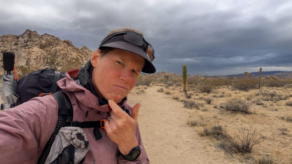
I eagerly chatted with them for awhile, so desperate for hiker interaction. Then I walked a few more miles on the BST and abruptly turned away from the official finish line of the DWTH, as I was set to continue my journey for a few more days (months really), all the way to the PCT. I followed a series of trails that Brett had skillfully woven together to make forward westerly progress. I stopped at a spot with good northerly views of the valley (hence the North view trail), where I had cell reception. I regretted my brief contact with the outside world, as I learned of the passing of a dear friend of mine, Rick Poston. I was shocked by the news and started sobbing under the rock I was borrowing for shade, right next to the trail. A few day hikers were probably alarmed by my distress, but didn’t stop to inquire. Rick was like my surrogate dad in Miami and a huge champion of my hiking adventures. He’d left numerous supportive comments on my blog on past hikes. I just couldn’t believe he was gone.
After awhile, I pulled myself together and stumbled on. It was so bittersweet to have basically finished the Desert hike this day, accomplishing such a feat, only to be shattered by the loss of my good friend. But Rick would have wanted me to always carry on, and so I did. As if the universe shared in my despair, the clouds returned and a cold wind began to blow. I crossed the west entrance park road and joined the Bigfoot Trail, which was, no surprise, just following a wash. I entered a burn area and my mood became even gloomier. It also started to rain again.
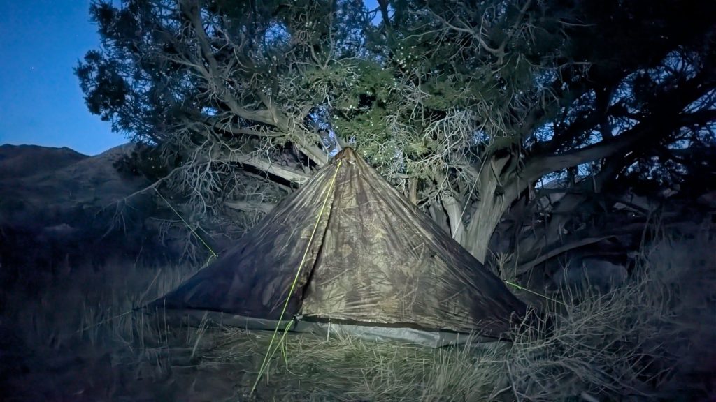
The rest of the day was pretty bland. I climbed out of the valley over a blustery pass, pushing fast to get low again, out of the wind and rain. My mind was only on finding a protected place to camp and to get dry and warm in my tent. The scenery turned familiar, as I entered the area Alan and I had previously hiked while setting my caches. There were nice juniper and pinyon pines lining the washes, and presently I found a protected spot under a juniper.
A developed campground wasn’t far away, but I suspected the sites would be more exposed to the wind, if there were any sites available at all. Also, probably the only way to make a reservation was through wRec.gov, and I wasn’t about to hassle with that given limited cell service and the terrible nature of that crappy website. God I hated it. Most all the fees charged went to the private company running the website and not to the National Parks, so F them anyway.
I was also technically supposed to get backcountry permits, which were free for non-quota areas like the one I was in. Back in the days, a hiker could fill out one of these free paper permits, carry one carbon copy and leave the other in the box. But for the convenience of doing this online, wRec.gov charged $6 (to add to their profits). Never mind if there was no cell service. Oh well. With all of the EviLordOfNazi’s federal hacks to the Park Service, it’s not like there would be any rangers out patrolling for non-permitted campers anyway. I was feeling VERY anti-goverment these days, and in protest, I was going to stick my camo tent under any juniper I pleased. The juniper didn’t mind, at least. In fact, it offered me quite a show of the full moon under the nearby Joshua Tree.
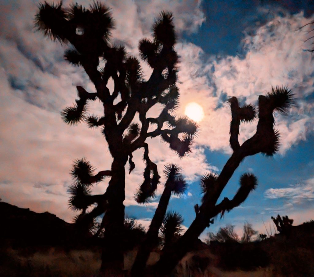
I had one shot of spiced rum that I’d added to my food cache, so I toasted Rick and howled at the moon. Freedom, loss, life and death. There were few but straightforward currencies in the desert, far removed from the bullshit going on thousands of miles to the east. The balance of these truths grounded me and I briefly felt at peace.