Tuesday, March 4th, 2025, 0530-1710
North Tower Mountain, mm35.5, to Hill Top House, mm 61, Elevation 3813′
25.5 miles.
The wind died a little overnight, or maybe I just did a good job of ignoring it. At some point, I could swear I heard a distant murmur from either a highway or a train track, maybe even a train whistle. But I have no idea where the noise could have come from because I was too far north of I-40 and even farther north of the BNSF railroad. The area felt extremely remote, so who knows what I actually heard. Maybe I dreamed it.
The wind picked up again just as I started packing in the morning, go figure. Plus it was quite cold. I had to go up and over a ridge, so I wasn’t looking forward to doing it in the wind. First I had a few easy miles on a dirt road. The road of course petered out at the base of the hills and I began the cross country climb. The sun was just peaking over the ridges and things started to warm quickly. Even the wind died again, so it was surprisingly very pleasant on the ridge.
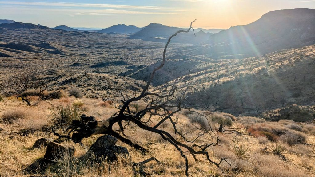
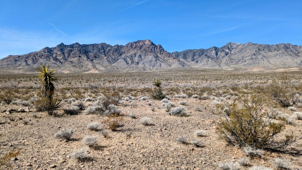
I was actually disappointed when I realized the route wasn’t going to the very top of the nearby peak. The ridge was still the second highest point along the whole official route at 5,500′. I was hoping to get one last view of the Whipples, but the view to the SE was blocked by the nearby peaks. This was important because the view to the SW was very exciting …I finally could see Mt Gorgonio! My finish line sat right at the base of that mountain! If I could have also seen the Whipples, I’d have 6 connecting viewpoints from my start to finish: Mt Lemmon to Table Top to Harquahala to Whipple Peak to the Providence Mtns to San Gorgonio. I thought I’d seen the Whipples the day before, so it was pretty close. I could also see the Kelso dunes, Telescope Peak (part of the Lowest to Highest route, another Brett Tucker special), and Charleston Peak, which was far north in Nevada and had snow on top.
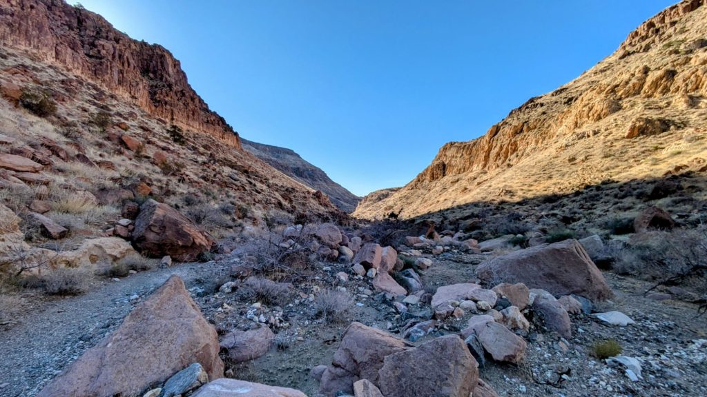
I followed a side ridge down into a drainage, which shortly became really large Beecher Canyon. The walls were quite impressive, rivaling some of the side canyons in the Grand Canyon. Unfortunately, this canyon was pretty worked-over by cattle. There was poop everywhere and really worn cow trails all throughout the wash. It reminded me of Upper Hackberry Canyon on the Hayduke.
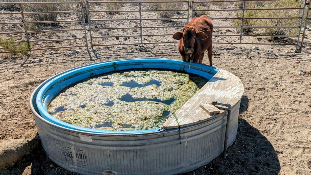
But where there’s cows, there’s water. The canyon spit me out just above a large cattle ranch, so I made use of one of the water troughs. There were a lot of brown cows nearby and these were not the skittish kind. I had to bulldoze my way into the corral and even then, a calf stood at the trough drinking and drooling while I collected from the float valve on the other side. I wasn’t worried about the calf, it was his mom that was giving me the evil eye. I talked gently to her and she decided to give me a pass. I grabbed just a liter and promptly mooved on, letting them be.
I had to take a detour around the private property lines of the ranch, then began a long traverse along the base of the Providence mountains. This was mostly via old dirt roads and made for an easy afternoon. I crossed a small paved road, the first since leaving Fenner a few days ago. It was leading to the Mitchell Caverns. I could see a van parked up a ways, but otherwise the valley was very quiet. I didn’t see any people all day, per usual. I passed 2 more cow waterholes in the afternoon. One was just a big tank that was half full. I didn’t bother to try to dip down into it, as I would have needed to use my pole. The 2nd was a solar well and trough with good water from the float valve. Section 7 thus far had tons of water compared to section 6.
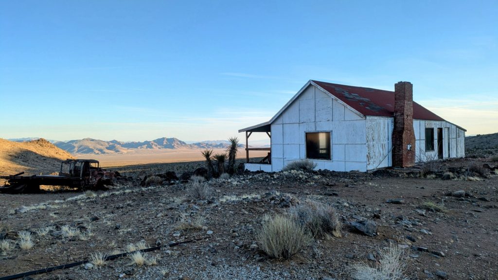
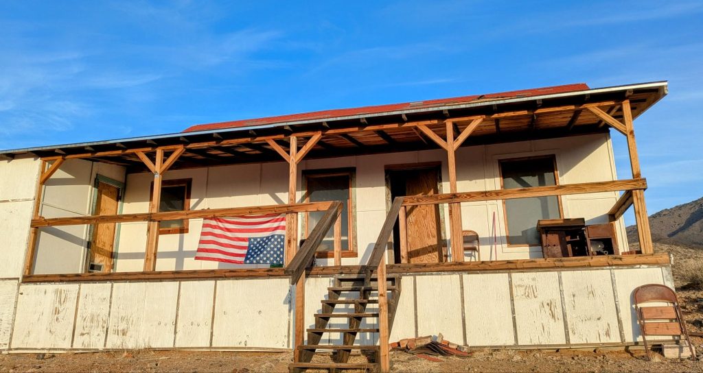
I had a short, late lunch at the well, grabbed a ton of water, then continued my march. The reason I was pushing so hard this day was that I was trying to get to an old mining cabin to spend the night there. It was the only such shelter along the route and the novelty of it sounded fun. Buck30 and others had reported that it was in pretty good shape, free of rat droppings and the like that normally make such places pretty inhabitable.
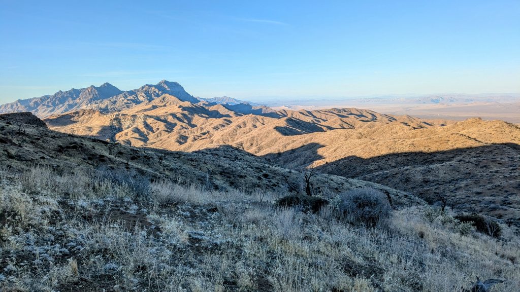
But first I had to get over one last cross country pass for the day, and it wasn’t easy. Fortunately, I found a bighorn sheep trail that traversed the steep hillside and brought me to the pass, with great views to boot. A lot of Brett’s notes reference these specific trails and they always were there, just waiting to be found. He and Tree (his partner) used some sort of wizardry to find the trails in the first place. I guess they have an innate animal sense, just like I think I have.
From the pass, I could see the distant Fenner hills that I walked past days before. The route made a huge horseshoe turn in this section, going far north, then swinging back south. I was really relieved to be going south again, as it felt like I was making progress towards my finish line. I could also see I-40, which I’d crossed at Fenner. The line of trucks was visible for many miles. Lastly, near in my sights, was the cabin. Home for the night!
I reached it just as the sun was setting. A preservation group had received a grant to restore the cabin from its dilapidated 1933 condition, but sadly it appeared that their efforts had waned in the past year. There seemed to be a lot more rat droppings everywhere, to the point I didn’t feel comfortable staying inside. So I elected to sleep on the front porch, instead. The views were better from there anyhow. There was even a beer waiting for me in the fridge…you bet I drank it! But at least I checked the expiration date first this time.
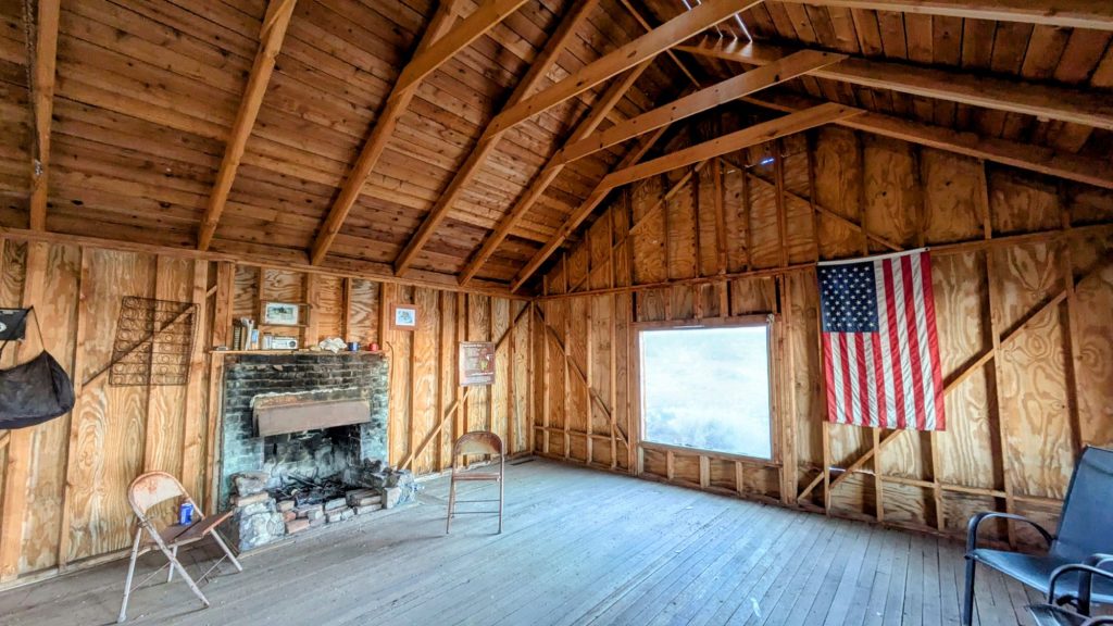


The wind had died completely and the temperature was quite comfortable. I hung out on the porch drinking my bonus beer, watching the light show from the distant interstate and marveling at the stars. This felt like such a magical moment, different from all my nights camping in a wash. I usually didn’t have such a great view and wide open space. Unfortunately, I also had a cell signal, so I was getting updates from the real world. I should have just stayed in airplane mode.