Wednesday, Jan 29th, 2025, 0750-1700
Catalina SP fee station to El Camino del Cerro (Sweetwater) TH SNP, Section 1A mm 8.5 to 27.5
19 miles
I stayed up way too late trying to sync all my last minute plans and then had a terrible time trying to sleep. For some reason, all the negative thoughts I sometimes get before a hike flooded my mind. It had been awhile since I struggled with so much anxiety. I barely got more than 2 hours of sleep before I had to get up. Josh generously offered to drive me to Catalina State Park before he had to go to work in the morning, so we left bright and early at 6 am. Once I got moving in the morning, at least all the anxiety melted away.
Josh dropped me off at the park entrance and I hung out at the ranger station for a bit until they opened at 8 am. I’d planned ahead and brought my 5 day food supply to see if I could stash it there. Already I was thinking 3 days in advance, which will become more clear as I explain things. Fortunately, the friendly staff agreed to hold my food for the 2 day time span.
While perhaps not the most exciting way to start a thru-hike, my plan was to walk through this low valley, urban connector section while the weather was iffy. I could care less if it rained while I was walking a bike path all day. There would be multiple points to take shelter, plus I had my umbrella. I’d stay with Josh for a second night, then start up Sabino Canyon the next day, hiking all the way back to Catalina SP by the 3rd day, via the AZT and Romero pass\canyon. This way, I’d already have the long urban walk done with and could just take an Uber back to wherever I left off this day. Plus, I wouldn’t have to carry my heavy food bag for Section 1 over Romero pass. Confusing? You bet! No wonder my mind was working hard all night long!
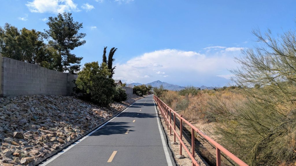
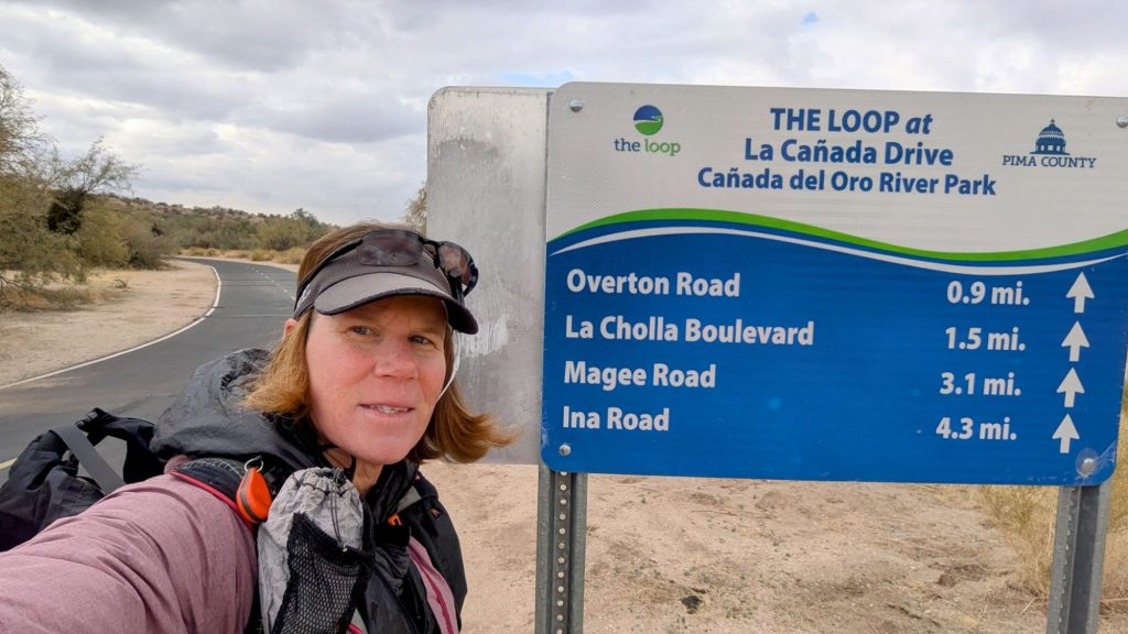
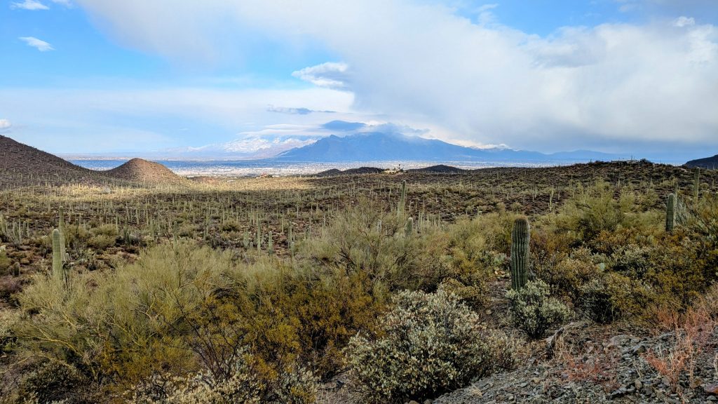
To start this section, I joined the nearby wash, crossed under the highway and jumped on The Loop path, part of an extensive set of Multi-use paths that went all over Tucson and the surrounding area. I’d be on it all the way past I-10, around 12 miles.
I didn’t make it more than a mile when I spotted a nearby coffee shop on the map. Bingo! It was 38 degrees when I started and I was eager for my morning cup. After some crafty route finding, I was sipping quality brew on a warm couch. What a way to start a thru-hike! After this stop, I was good to go for many miles. The bike path was exceedingly pleasant. It was wide and there were many different users: joggers, dog walkers and cyclists. But I was the only backpacker.
I saw a lot of my favorite desert birds along the way, since the path followed the large Canada Del Oro wash : a curved bill thrasher, a Ruby necked hummingbird, gila woodpeckers, quail, great egret, red-tailed hawks, and many more. I also spotted a rare Verizon / AT&T palm tree.


I made it all the way past Ina road before jumping off to grab some lunch and hitting a Sportsmans Warehouse to buy a fuel canister. I made such good time that I decided to go further along the route. The cool temps and my light pack (yes, I was slackpacking) had been conducive to a fast pace. I crossed under I-10 and started following along the Santa Cruz river. There was actually water flowing in the river bed, but it was more like a creek. I spied a potential short cut on the map and decided to cut straight across the river, shaving 2 miles.
Sometimes short cuts can prove to be disastrous, but I sniffed this one out perfectly. I found the narrowest point to jump across the river and did some very minimal bushwhacking to find a dirt road that led to the nearby paved road. The other side was fenced and I worried I was trespassing on private property, but I actually came out at a spot that was signed as a public green space and had a pedestrian gate in the fence. What luck!
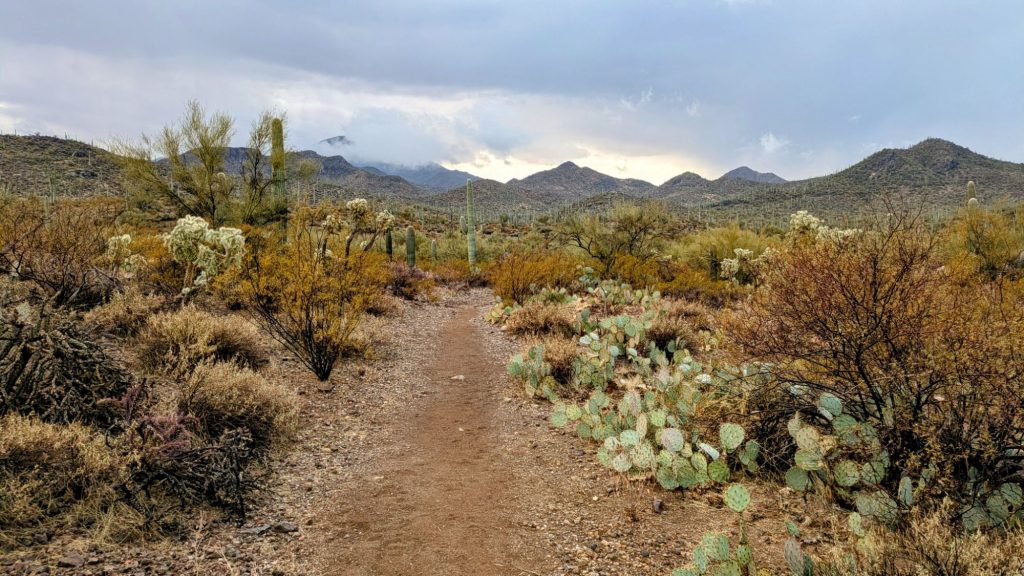
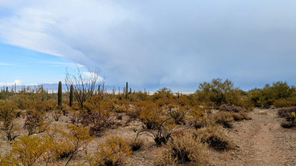
With this success, I started entertaining ideas about hiking even further than planned…typical Twig. Perhaps I could make it as far as the El Camino del Cerro trailhead, which was the the official start of the desert winter thru hike. It was another 5 miles, but I had 2 hours before Josh got off work. So of course I went for it! Only problem was, to the west was a dark squall, heading my way. Just before I reached the Belmont trailhead leading into Saguaro National Park, the squall hit me with strong gusts and pelting rain. I still put up the umbrella and marched into the sideways rain. I was screaming into the wind, not in anger, but with cries of encouragement. Hell yeah, bring it on! It seemed significant and special that it started storming just as I reached the outskirts of the desert.
The wind let up as I started on the trail and I rejoiced in the peace that settled over everything. I could feel the desert breathing a sigh of relief, feeling the rain grace its soul. Rain in the desert always feels like a miracle. The smell and sound of it are magical. Sadly, the rain let up too quickly, but the surroundings felt so refreshed from this little blessing. I hiked for some blissful miles and even found an old cement trough full of water. I didn’t need any, but it was a good sign.
Here’s some more history and info about the water sources along this route: Basically, if it weren’t for man-made sources, there wouldn’t be any. The cattle troughs that are scattered about are one thing, but the wildlife guzzlers (as they are called) are a specialty of the desert southwest. They were built by various organizations to collect water for wildlife, especially bighorn sheep and quail (game animals), which bring in revenue in the form of hunting permits. They vary somewhat by design and size, but generally have an underground cement trough or cistern that’s fed by a cement, plastic or metal apron, spread out flat over a large area to collect the sparse rainwater. They are incredibly effective and resilient, as all it takes is one good rain storm to top them off, yet they can last through months of drought. A recent fall 2024 DWTH hiker (Buck30, of course) found that even the small quail guzzlers in the Mojave desert still had some water left in them… that’s after essentially 8 months of no rain.
Yet the guzzlers have their limits. Obviously they could not sustain both the wildlife and a hoard of thru-hikers (think 50 per day like on the PCT) coming by to fill their bottles. This is a primary reason Brett has to limit the access to the route info and also why I’ll have to be intentionally non-descriptive in portraying these sources. Many are also quite old and fragile. The aprons can and have been damaged, while others have removable cement caps that are cracked and on the verge of collapsing. Such caps are vital to protecting the cistern from the ravages of evaporation and debris accumulation. They were designed to be removed only occasionally for servicing of the cisterns, and not for the frequent convenience of dipping a bottle, tempting as it may be. As such, the lucky users of this route must swear to only use crafty dipping techniques and apparatus to access the cisterns… namely an outstretched trekking pole with an attached bottle.
Lastly, these guzzlers both attract and sustain wildfire, but can also sometimes lead to their demise. For one, hunters may set up right by a guzzler to pick off animals as they come to drink. It’s common to find game cameras set up around the perimeters. Also, all sorts of critters have succumbed to them, either by getting trapped inside or dying of natural causes on the apron and getting washed down (likely the most probable cause, as the guzzlers usually have a ramp, allowing for things to escape). Previous hikers have found all manner of decomposing bodies in these sources…a fox, rodents, birds, frogs, etc. Just think what collection of things could be in stale and stagnant water that’s been sitting over 8 months since the last good flushing rain.
Brett designed his routes to have access to water sources at a fairly regular interval: 10 to 20 miles. Yet as I learned the hard way on the GET, climate change has made many of these sources unreliable. He also created a shared water report that provides invaluable recent information from other hikers. But if a source is dry and there’s no rain in the forecast, it doesn’t matter how often the water report is updated, it’s still dry. Even this route was designed to be done without the need for water caches or excessively long carries. However, with such deepening extreme conditions as the SW is likely to experience going forward, caching is now almost compulsory. That’s certainly the case this year, at least for several sections.
Thanks to the recently updated water report, I at least knew that I’d be good through the first section. I anticipated a few carries over 30 miles, which equates to about a gallon per day…8 lbs of water weight. I know I can get by on this because I’m a supreme hiking camel…but I still don’t like it. My pack is already heavy with all the extra layers I’ll need for potential winter conditions. Last minute, I decided to double my quilt power by stacking my new EE Apex 50 degree quilt over my Katabatic gear 22 degree quilt (which is decidedly very old and used by now…7 thru-hikes, and thus has lost some loft). The EE quilt is only 10.5 oz, but still is added weight and bulk over what I’m used to.
Anyway, back to this day. I made it to the trailhead just as Josh was on his way to pick me up, but mistakenly sent the wrong location. My map named the trailhead as “Sweetwater”, which was the name of the trail I was on but when I googled it to send a pin to Josh, the Sweetwater trailhead was actually in a different location, over 4 miles away. I didn’t realize my mistake until later, so Josh was waiting for me in the wrong place. I updated him and started walking down the road to meet him. I probably got 2 miles before we finally linked up. Oh well, lots of bonus miles to start this hike!
The rain started again just as I jumped in his car, so I was very relieved to have a warm, dry place to stay the night. It even hailed on the way home, blanketing the ground in white. Yay rain! Perfect timing on my part! We picked up pizza and enjoyed another night reminiscing. I got in one last shower and even the house cat tried to give me a bath. Or, perhaps she was just tasting my ear and contemplating eating me…foreshadowing the similarly-looking kitty I almost met the next morning…

