Sunday, May 12th, 2024, 0620-1920
Chambers creek to Newton Bald 52, mm 253.1
32.5 miles, Gain: 7550′, Loss: 4250′, elevation 4950′
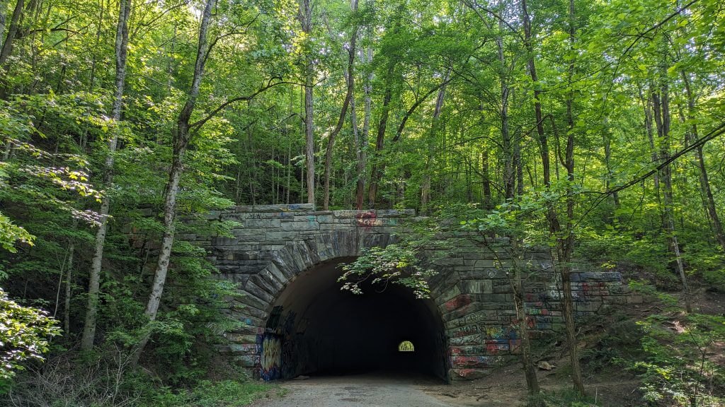
I woke to a clear morning for once in a long while. It was actually one of the driest and clearest days the whole trip, but still my tent was soaked with condensation, not surprisingly. About 5 miles into the beginning of this long day, I walked through the quarter mile ‘tunnel to nowhere’. It was was pretty creepy, with lots of dystopian-looking graffiti. This struck me as odd, being so far away from a city. In the middle of the tunnel, I couldn’t see my feet or the tread, so I was worried about stepping on a snake (or giant salamander). I could’ve just turned my phone’s flashlight on, but I was relishing in the novelty of the experience. I later went to the park’s website to read about the history of the tunnel but there was none listed, just a description of how to get there. I also found it interesting how elaborate the bridge was spanning a large gorge across Noland creek, only for the road to end half a mile later. I guess both the tunnel and bridge were built with the expectation that the road would one day continue further along the lake. Instead it ended and became the Lakeshore trail.
I left the short road walk at the other side of the bridge, following a side trail down to a dirt road that the large bridge just passed over. The Far Out Guide made no note or representation of this transition, but fortunately the user comments explained it in detail. I know I criticize the Far Out guide pretty often, but I did find it to be particularly poor for the BMT. User-supplied detail shouldn’t have to make up for the lack of detail in a guide that I paid for. The app was also acting very buggy when it came to rendering the elevation profile of my planned route. Additionally, it failed to mention the presence and location of bear cables for over half the campsites in the park. I had to again read user comments to discover these details…accordingly all designated campsites in the Smokies have bear cables installed.
I started up the Noland creek trail, which for many miles was a wide dirt road with elaborate bridges over the many crossings of Noland Creek. This was the first of many big climbs over the next 2 days, but at least it started out at a very gentle grade. I needed to go over 30 miles (according to FarOut) to make it to a campsite and meet my average of 28 miles over 3 days. Despite the cooler and breezy conditions, the elevation gain smacked me…over 7500′ for the whole day. I also tracked my route with my Garmin watch and found the route to be over 32 miles by the end. Again, the distances in FarOut had been consistently off since the beginning, but I expected things to be a little more accurate in the park. It seemed no one had measured with GPS in awhile. Or was it my watch that was off? I actually timed quite a few of my miles, keeping my normal and well-known 3 mph pace, and many of the miles were taking significantly longer than 20 minutes. So no, I don’t think it was both my watch AND my pace that were off.
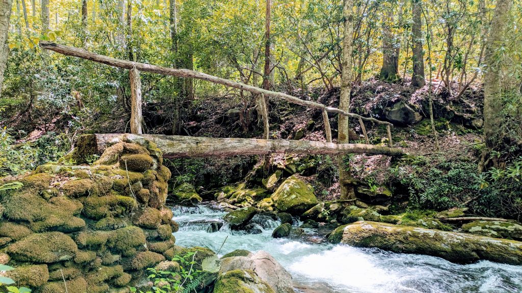
Early on, I passed a father with his daughter going down the road. These were the only other backpackers I saw until the end of the day. I had lunch at the campsite I was supposed to stay at this night, so I was very ahead of schedule. The trail had many more cool log bridge crossings, including some fun single-log ones, but near the top I had to ford Noland creek (river) several times. I was able to keep dry socks and trail runners by changing into my beloved vivobarefoot ultra camp shoes…I used them a lot on the BMT.
The trail finally left the creek and did some switchbacks up to a ridge. This was the point where the Mountains to Sea Trail coincided for a bit with the BMT. There I ran into about 10 riders and horses. We chatted for a bit and they were blown away when I told them the distance I was hiking (they asked me). I perhaps too over-confidently proclaimed that a person could out-hike a horse any day and got some dirty looks….but hey, it’s true. If someone wants to pay me to go head to head in out-hiking a horse, I’d gladly take up the challenge. I was felling upbeat as I incorrectly assumed the trail down Pole Road Creek would be nice, since it had just been traveled by so many horses. Certainly there were no large blowdowns but it was actually the most overgrown and tedious trail I encountered in the park. All the vegetation was pushed the wrong way by the horse train, so I felt like I was going against the current of green. I also had to navigate some pretty muddy pits that were torn up by the horse hooves. But at least I was going downhill.
No sooner had I reached the bottom, that I found myself climbing again…6 miles of 2.5k’ up. While the AT followed the spine of the Smokies, this was the part where the BMT went over every finger coming off the spine. It was a tough way to end such a long day. But there weren’t any campsites between 24 and 30 miles, so I needed to push on to meet my average. Otherwise I would have had an even bigger 3rd day, which was when the rain was supposed to start again. Normally I wouldn’t have let the rain dictate my hike so much, but my leaky tent had really let me down and jacked up my plans. Plus I knew I was capable of doing such miles and elevation gains, and so I did.
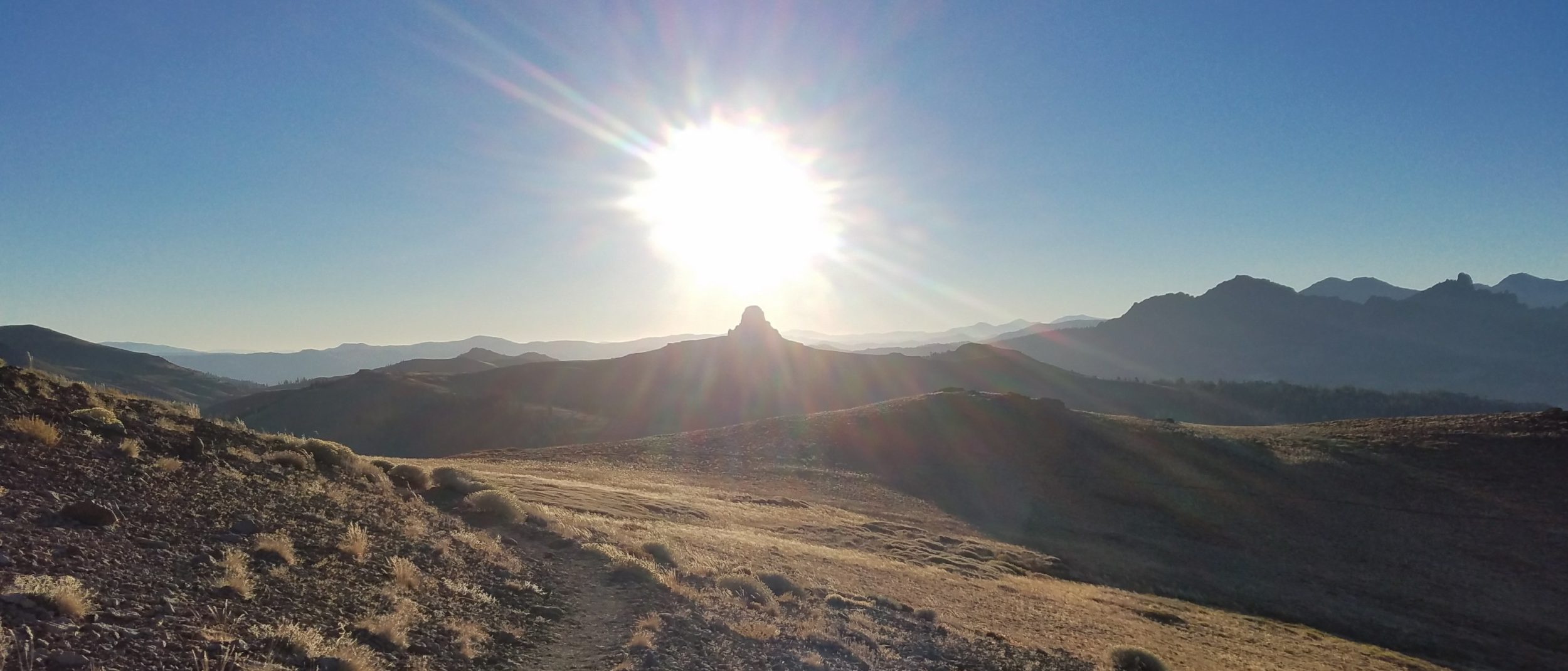
I was really dragging my feet for the last few miles, but the trail was in great shape, the weather was gorgeous and there were a few partial views of Clingmans Dome. The campsite was also nice, complete with companions and a blazing fire! It was my first and only campfire on the BMT, thanks to the 4 guys that got it going. They were all sleeping in hammocks and set up at the saddle. The campsite also had sites at the top of a hill, so I set up there to give them some privacy. After all, I technically wasn’t supposed to be staying at this spot but there was room for maybe a dozen more. I had just enough time to gather water and set up my tent before the sunset over Clingmans dome. I hung out with the guys at their campfire, having my dinner and telling stories. After a bit, they left to go look for the aurora borealis (sadly I’d missed the best night when I stayed at the hostel) and I went to bed, since it was already after 10 pm. What a day!