Day 10: Back in the swing of things over Bishop Pass, Thursday, Sep 11th, 2025, 1400-1700.
7 mi over Bishop Pass and into Dusy Basin, elevation 11,320′.
It was a slow start to the day, as I was dragging my feet in town. I planned to hitch to the Bishop Pass trailhead, then hike south following parts of the SHR, the PCT and Southern Sierra High Route, eventually ending in Kennedy Meadows South. On a positive note, the smoke did diminish overnight, so it seemed like I could proceed. But the forecast called for some more thunderstorms over the next few days…always a worry when I’m hiking almost entirely above treeline. I busied myself with chores all morning, as I’d done some late night grocery shopping and still needed to sort and repackage items. Of course, after visiting the Grocery Outlet, I’d bought far too much. Luckily I planned to pass through Bishop on my way home and the hostel agreed to letting me leave a few items to pick up later. I also still needed to claim a package I’d mailed from Tuolumne Meadows. Due to my earlier-than-expected arrival in Bishop, the package was still en-route and I didn’t want to wait on it. Unfortunately it contained my Southern Sierra High Route mapset, so I’d have to decide if I felt comfortable traveling off-trail without paper maps. I had the option of simply following the PCT, instead.
I finally started walking out of town just after noon. I passed the stoplight near the PO and started to stick out my thumb when the very first vehicle, a van, stopped. Once again, my ridiculous hitching luck came through for me! The couple, Deuces and Holiday, were very awesome and had hiked most of the PCT the year before. Deuces was on his way to work at the lodge, so Holiday drove me the rest of the way to the trailhead…what service! I was telling her about all the routes I’d done and she asked if I might be interested in hiking across Iceland with her, maybe next summer? Of course I was like hell yeah! I would love it if that actually worked out, so we’ll see. All these interesting connections are why I love this lifestyle so much. Holiday also had her own van and was a traveling nurse, which is an awesome profession for allowing time off for thru-hiking. Thanks for the ride Deuces and Holiday!
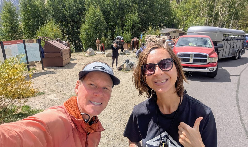
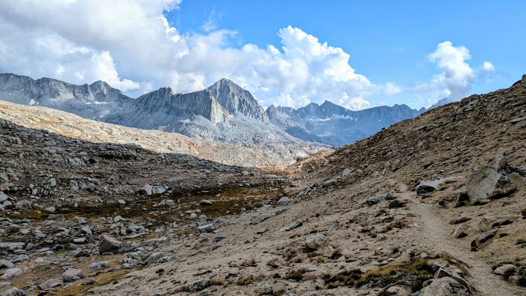
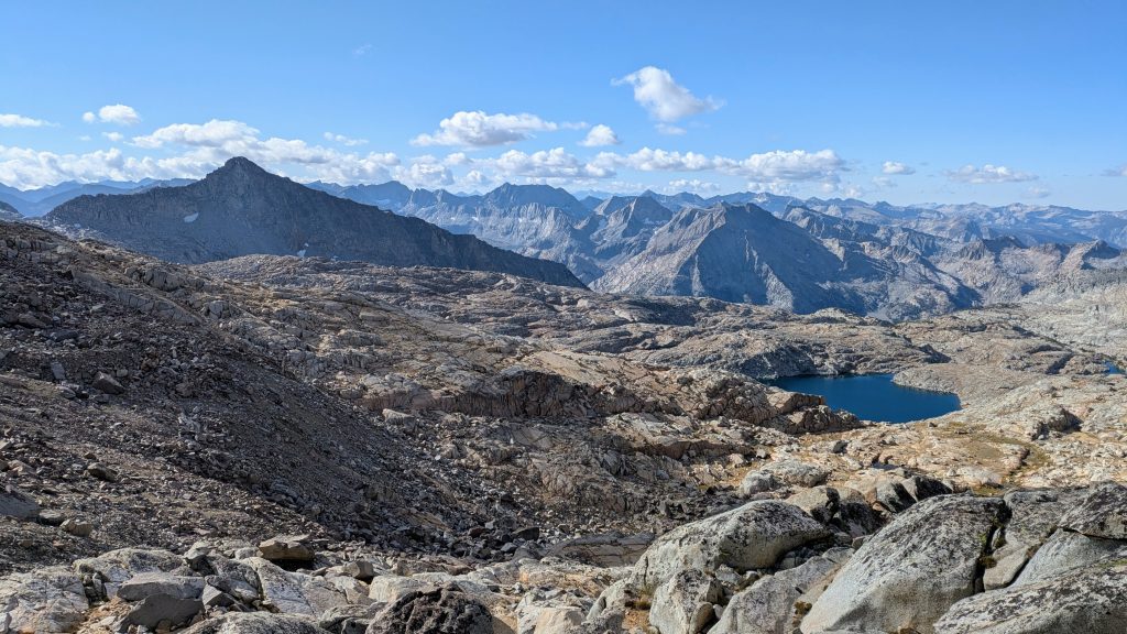
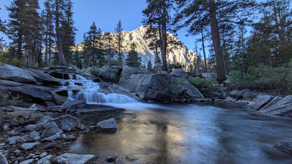
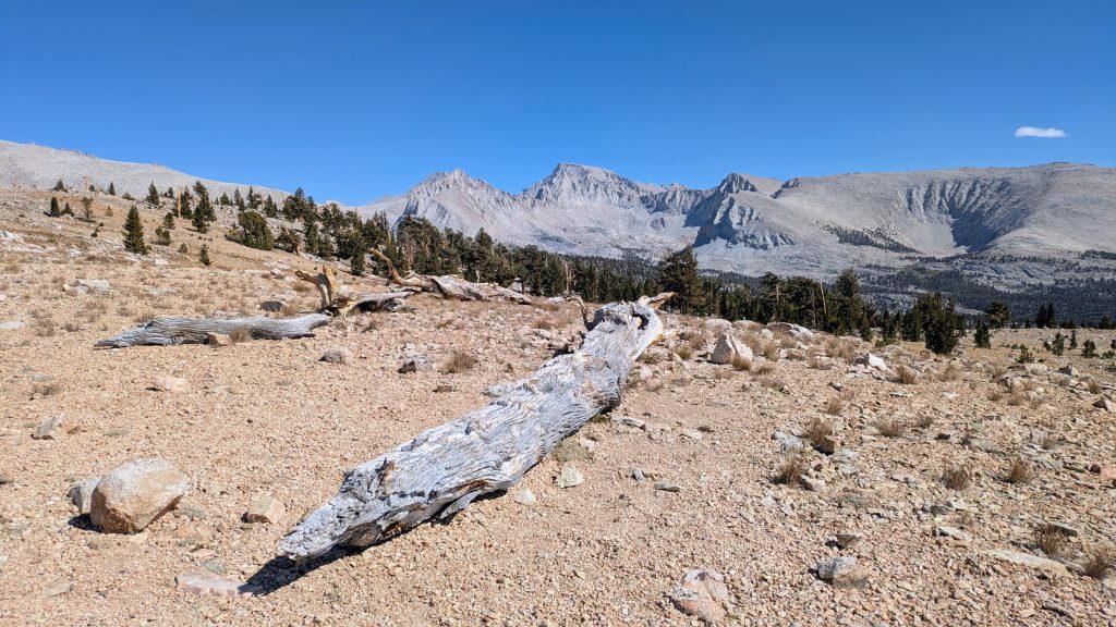
There was a mule and horse expedition just finishing at the trailhead, so I got to pet some equines. I felt pretty crappy starting out, a little dizzy and winded, with an upset stomach, and achy chest. The burrito I ate from the hole-in-the-wall across from the hostel was pretty gross, so I wondered if I might have food poisoning. But after a few miles and a pit stop, I felt a lot better. The trail went up and up and up, starting at 9800′ and climbing to nearly 12k’. No wonder I felt it! This was the highest I’d been yet this year. The clouds were gathering by the end of the day, but fortunately the rain and thunder held off until I found a nice campsite in Dusy Basin, on the other side of the pass. I debated pushing on another mile, but the spot was so perfect, nicely sheltered by some white bark pines. Around 7 pm, it started to hail and snow ever so slightly, so I was glad I was settled in my tent. I’d be picking up the SHR again first thing in the morning.
Day 11: Mix of everything, Friday, Sep 12th, 2025, 0640-1820.
15 mi to South Fork Kings River, elevation 10,190′.
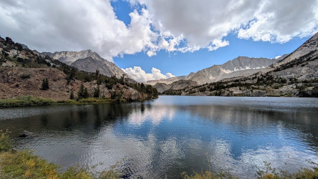
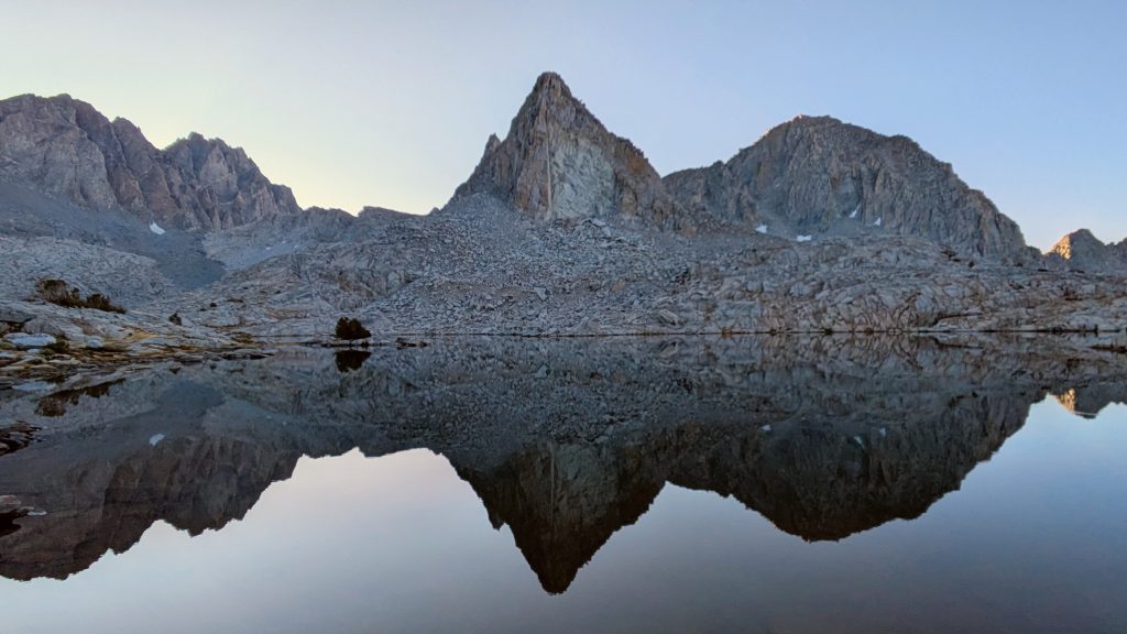
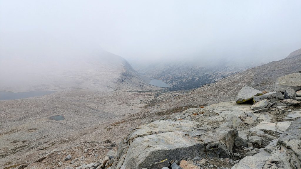
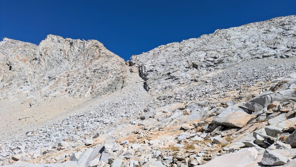
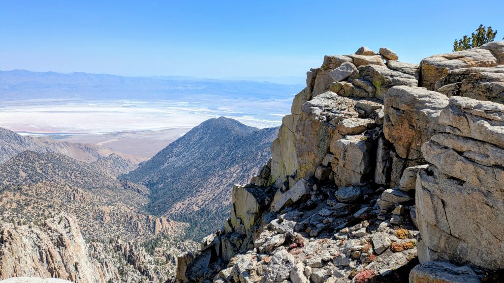
Not surprisingly, there was a pretty hard freeze overnight, leaving frost on my tent and my water bottles partly frozen. Thank goodness for my top quilt…I stayed warm, dry and happy! To resume the SHR, I decided to take the Thunderbolt pass alternate (as opposed to Knapsack Pass), because it was said to be more scenic and looked a bit shorter from where I camped. This might have been a mistake. It was a slow start route-finding along the Dusy Lakes, then incredibly tedious moving through giant talus on the east side of the upper lake. In retrospect, I should have gone around the west side. In fact, if I’d just traversed straight from Bishop Pass, it looked like it would have been much faster, as there was a band of stable slab rock most of the way.
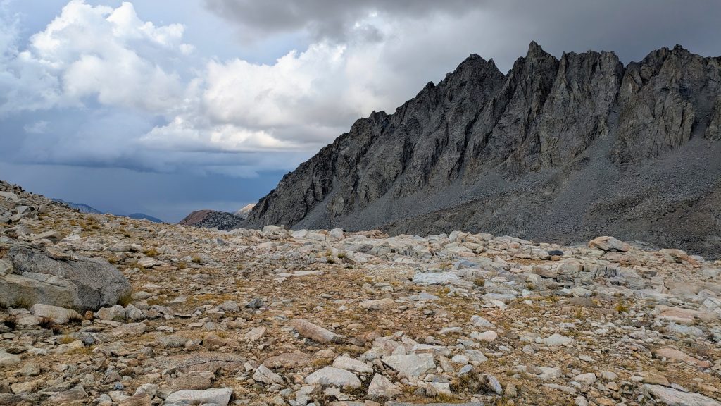
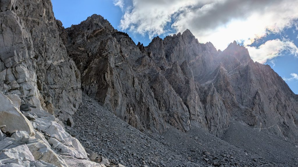
Instead, I followed a continuous line of broken talus, by far the worst I’ve ever encountered. It easily took me over an hour and a half to go 1 mile. There were some really huge boulders, with giant crevasses, and just endless sharp and unstable rock, tilted at bad angles. I negotiated this mess all the way to the top of the pass at 12,350′. There I paused to pay my respect to Thor. With such a name as Thunderbolt Pass, I was glad I got an early start, topping out by 9 am. Already I was a little nervous about the cumulus clouds that had formed in the vicinity. I also learned a valuable lesson in how advantageous it can be to plan a route ahead of time. It’s worth it to follow stable rock, even if that path isn’t as direct, it will likely be much faster.
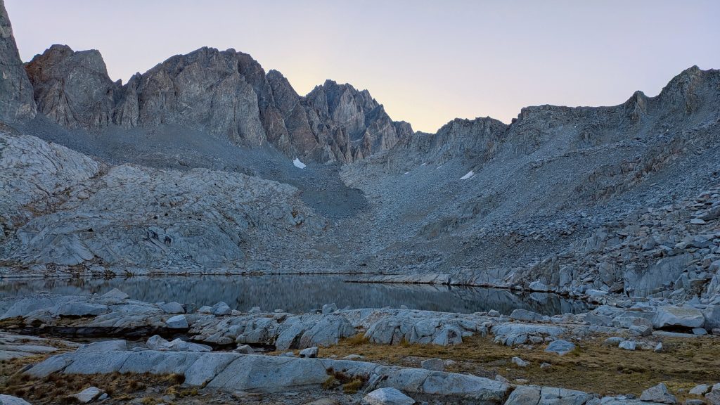
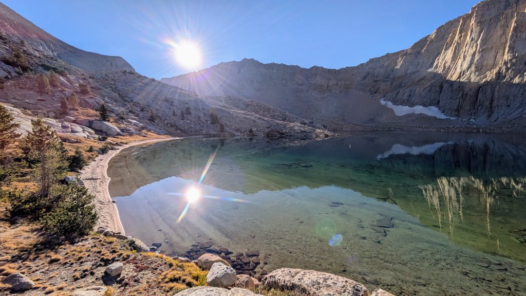
Coming down the south side of the pass was mercifully easier and I quickly rejoined the main SHR at Barrett Lake. I stopped to filter water, since the water I had from the night before tasted terrible, probably because I gathered it near the lake’s outlet. I guessed that some ash from the fire landed on the surface and condensed near the outlet, that or maybe my new CNOC water container also sucked (it did indeed impart a terrible plastic taste on my water, something I never encountered in all the years I used an Evernew water container).
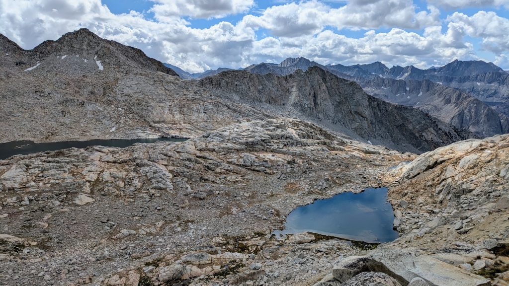
It was more slow going up to Potluck Pass, with lots of ledges and slabs to negotiate. It was the same on the way down, only much steeper. Getting to the top of Cirque pass was the chillest effort all morning, following some easy slab ramps. I thought I had it made by that point, as I was only a mile and half shy of reconnecting to the PCT. The SHR follows it for about 6 miles over Mather pass, so I’d be ending the day on trail. But the cross country drop into the valley was still quite a challenge, especially towards the bottom, just before meeting the PCT near Palisade Lake. There was just a lot of tricky micro-navigation, having to backtrack numerous times after I’d get cliffed-out along a ledge. All the while I was trying to move fast, as I could see the thunderstorms forming. I pushed well past lunch to make it down to the cover of some trees, not stopping for even a short break. There’s no time to rest in the high country when lightning’s on the way.
This was a good call, because just as I reached the bottom, I heard thunder and it started to hail. My timing couldn’t have been better. I popped my umbrella up and hurried along the easy trail to a stand of white bark trees. I took shelter under them and my brella as best I could, enjoying my well-earned late lunch. It was nearly 2 pm at this point. My break, coinciding with the rain and hail, worked out perfect because it kind of cleared up just 40 minutes later. After hemming and hawing a bit, I decided to make a break for 12k’ Mather pass. On the way up, I passed several hikers and tents that had already called it a day by 4 pm. I made it over the pass just before it started to snow, but thankfully there was no more lightning. It was kind of fun seeing the flakes because it wasn’t even that cold. There was no wind and the snow instilled a calming silence. It was just me and the trail, a nice and easy reward for the end of a tough day. Oh, and I finally saw some of my first Sierra marmots (for this trip) this day!
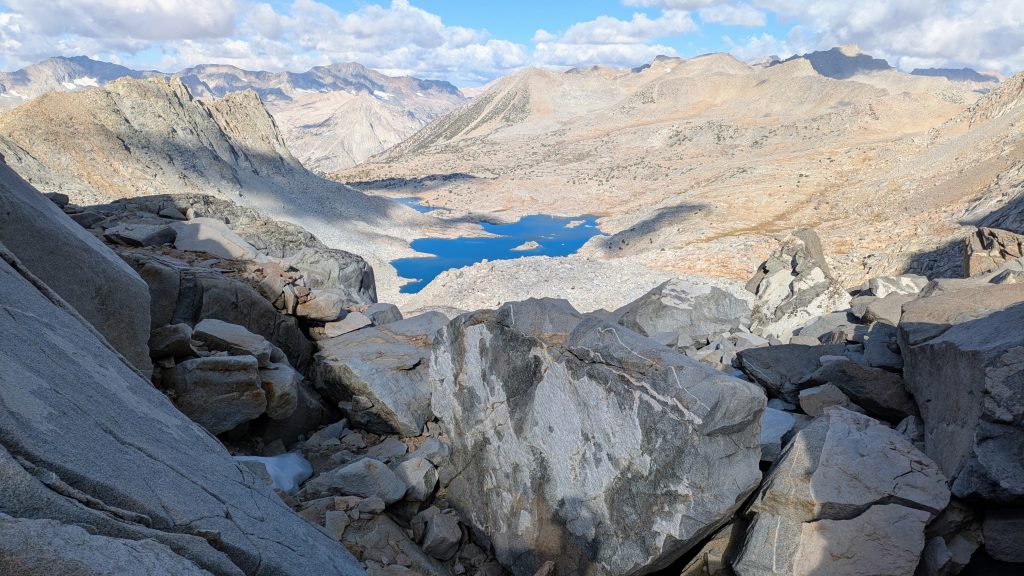
In the wide basin at the bottom of Mather Pass, I left the SHR behind, as it dove west over Frozen Lake Pass to head to the terminus at Roads End. I’d always planned to skip the last 26 miles of the SHR in order to hike the Southern Sierra High Route and PCT all the way to Kennedy Meadows South. But now with the Garnet fire threatening to close the road to Road’s End, my plan made even more sense. I hiked down the PCT for many miles as the early evening set in. Going 9 miles in about 3 hours was such a contrast to the meager 6 miles I scratched out during the first half of the day. I passed only two hikers on trail, who were heading up to the tarns south of Mather Pass, and then another 4 tents in the valley. I found a nice protected campsite near the bottom along the Kings River and settled in for a cold night. 4 passes in 1 day!
Day 12: Pinchot & Glen Passes, Saturday, Sep 13th, 2025, 0650-1920.
23.5 mi to before Vidette Meadow, elevation 10,370′, gain/loss: 5850’/5670′
My knees were hurting after the difficult scrambling and talus the day before, so I decided to stick with the PCT all day. In fact, I was thinking I might just skip all of the SSHR, since I didn’t have my paper maps. There were several options to do sections of the SSHR, so I’d just see how it went the next few days. I think after having to skip so much of the High Route between Mammoth and Bishop pass, I’d lost much of my steam and zeal for attempting a continuous Sierra High Route thru-hike. My piece-meal approach would still get me to KMS, but it felt like a bit of a let-down. In the morning, I hiked over Pinchot Pass, which felt pretty taxing. Then it was a long descent down to Woods Creek and the wire bridge where I stopped to have lunch. There were quite a few people that passed through the area while I was there, both backpackers and maybe even a few trail runners, who I assumed were on the very popular Rae Lakes Loop.
I spent the afternoon climbing past the Rae lakes and then over Glen Pass. It was a very steep, rocky and rugged pass that I remembered very little of from before…probably because in 2018, I hiked over Pinchot, Glen and Kearsarge Passes all in one day, making it to the Onion Valley trailhead at the very end…a day that almost killed me. This time I had plenty of food in my pack and didn’t need to push as hard. Another factor I took more interest in this time were the parts of trail I’d heard were extremely difficult when covered with snow. I knew Glen Pass could be particularly hard for the early PCT NOBOs, so I tried to imagine this as I hiked along the clear and conspicuous trail. I could definitely see how the steep slopes, bending into sheer cliffs, would be treacherous when the tidy and efficient trail switchbacks were absent under white stuff. All I can say is that I sure loved hiking the Sierra in September!
I traveled down the rugged south side of Glen pass for a few miles, until I came to a nice creek, the first water since well before the pass. It was time to make camp, as it was nearly dark. It had been a long day and I was still uncertain about whether to try some parts or all of the Southern Sierra High Route. I read some more of the route description in my tent and started to have my doubts. There were 3 important factors against following the SSHR: it seemed that there was a lot of talus in a few sections (I was very leery of this after Thunderbolt Pass), I didn’t have a permit to go up the mountaineers route on Whitney, and I didn’t have my paper maps. I had just enough food to make it to KMS in 3 days, but only if I stuck to the PCT, with 86 miles left. Thus I wouldn’t have to exert extra time and effort doing a resupply side-trip to Lone Pine. I was pretty sold on this idea, but I also felt like I was giving up in a way. Maybe I could settle on something in-between?
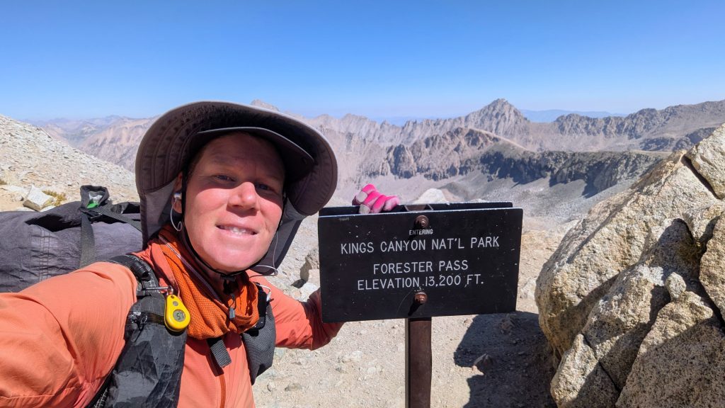
Day 13: Forester Pass, Sunday, Sep 14th, 2025, 0640-1730.
22 mi to Crabtree Meadow, elevation 10,640′. 5120’\4850′.
I did figure out an amended plan by day’s end, one that would take in some of the SSHR and still get me to KMS before I ran out of food. But for this day, I just focused on the easy trail in front of me. I say easy, even though this involved hiking over Forester pass, the highpoint of the PCT / JMT at 13,200′ and seemingly the nemesis of many of the backpackers I met this day. Several even ‘wished me luck’ in getting over the pass. To me, it seemed like a straightforward endeavor and foregone conclusion. Why did I need luck? I didn’t dare convey to them my thoughts that following the PCT was a cop-out, at least relative to my SSHR plans. The SSHR departed the trail north of Forester to head over Junction Pass, directly to the east. It actually aligned with the old JMT and sounded pretty interesting, except for all the talus and sliding scree. My knees revolted against the idea.
I ascended for 8 miles along the broad valley of Bubbs creek. It was a really mellow climb, partly through the trees and then across immense fields of rock. On this bright and beautiful day, I didn’t have a care in the world. But I can only imagine how this basin must look during a storm. I caught up to 2 guys that were just breaking camp and then hopscotched with them for awhile. I passed another group of 4 in the last mile leading up to the pass. At the top, I was surprised to look back and not see any of the others on the switchbacks below. I guess my pace was pretty fast, as I seemed to leave them all far behind. I didn’t linger on top the pass, as I was eager to take a lunch break near the pretty tarns below. I practically skipped down the amazing switchbacks on the south side of the pass. They were so smooth and craftily built into the rock face, a feat a human engineering! They’d come at a cost though, as at least one man had died during the trail’s initial construction in the 1930’s. It was incredible to recall the history of this area (much of which was elaborately described by Steve Roper’s guidebook in the first few chapters).
I stopped for a leisurely lunch at the bottom of the headwall, content to gaze up at it, hopeful I would see some of the tiny backpacking figures work the switchbacks down. It’s such a formidable wall, it really took some audacity to build the trail over it. I also got to spend some quality time with the too-friendly Forester marmots. Several crept up on me while I ate, obviously used to getting handouts…no, I did NOT give them any of my food. While I may sometimes get a little hands-y with birds, particularly grouse, I definitely draw the line at intentionally feeding wildlife (I’ve been very careful and successful at avoiding unintentional feedings, as well). Even still, I greatly enjoyed the marmots’ company, allowing one a quick sniff of my foot. It eventually grew tired of my lack of offerings, or my smelly feet, and cuddled under a rock next to me, so cute!


I took it easy through the rest of the day, as did the mellow trail. I recalled how much I relished this section in 2018, finally feeling assured that I’d made it through the Sierra before the snow hit. All I had left was to climb Mt Whitney, then it was smooth sailing to KMS and even the Mexican border beyond. I felt a different urgency and calling this time around. I yearned to head right back into the Sierra for more of the high route! If the fire started to be better contained, I intended to go back up Bishop Pass to hike north, experiencing the parts of the SHR that I skipped. In a few days, I’d see what the air quality maps showed. As for the air quality thus far, I couldn’t have made a better choice. This day was so spectacularly clear, and it just kept getting better as I went south. I had nice views of the backside of Mt Whitney, Mt Kaweah and other ranges. I entered the realm of the gnarled foxtail pine (relative of the bristlecone pine), and the late afternoon sun on their beautiful red wood was striking. I forgot just how incredible these trees are!


It was a good day for just cruising in walking bliss, passing through these broad basins and plateaus of rock, sand and sky. The trail stretched to infinity and I was surprised how quiet it was, too. I think I only saw one or 2 other people in the afternoon. At the end of the day, on a whim, I turned off on the side trail to Crabtree meadow. I’d conjured a plot to either raid the hikerbox for some extra food, or yogi some off JMT hikers, which tended to always be carrying more than they needed. If successful, I could dedicate the next day to hiking an alternate section, part of the SSHR. The FarOut comments mentioned a hikerbox in one of the bear boxes near the ranger station. Sure enough, I found some decent items that would have sufficed. But just as I suspected, a guy camping nearby also had extra meals, so he shared a Mountain House dinner…score! I immediately started planning my route for the next day, which conveniently started from my campsite. As an aside, Crabtree Meadow is also the staging point for PCT hikers wishing to climb Mt Whitney. Since I previously did it in 2018, I decided to dedicate my time to hiking something different this year.
Day 14: Best Day Yet!, Monday, Sep 15th, 2025, 0630-1730.
17.5 mi up Crabtree valley, over Crabtree Pass, down Miter Canyon, rejoining PCT to Chicken Spring Lake, elevation 11,270′. (4 miles on the PCT).
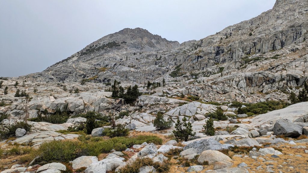
I was so glad I took this little detour for the day, because it was hands-down my best day yet in the Sierra! Starting off, I hiked cross country across a few meadows to reach the faint Crabtree Lakes trail. I love the challenge of following a faint trail, especially when there’s no serious bushwhacking involved. I followed it past 2 gorgeous lakes, at which point it petered out in the rock. Then it was a simple matter of following obvious contours. To reach the uppermost lake, a nearly perfectly smooth chute of granite slab rock guided the way for almost a mile. I was surrounded by talus on either side, so it was like being in a magical tunnel of nice and easy rock, a trail crafted by nature. It was so much fun to hike.
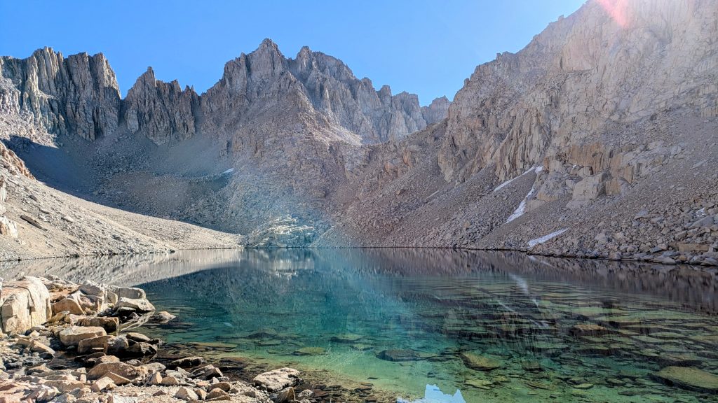
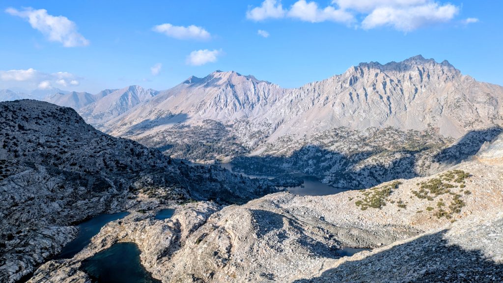
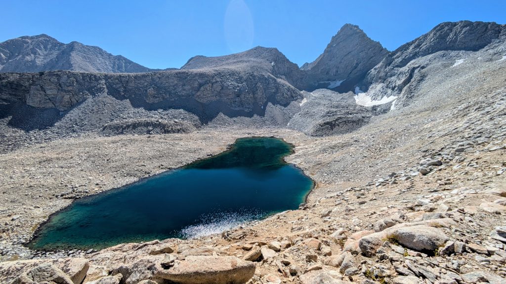
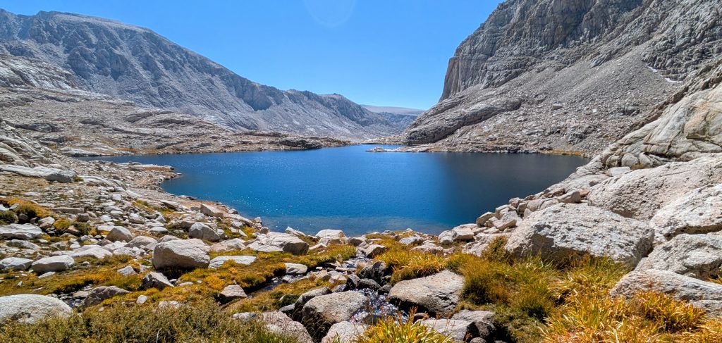
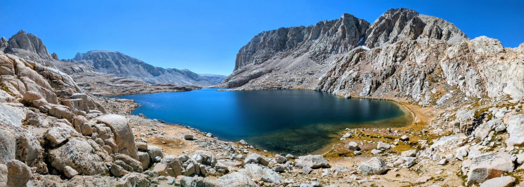
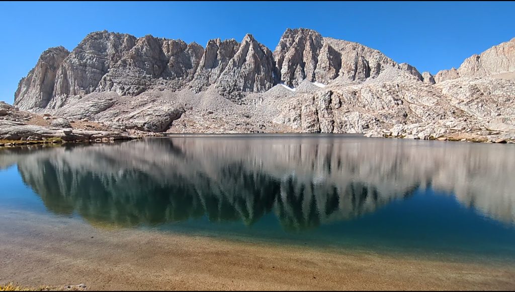
I reached the upper Crabtree lake and paused to study the pass. It looked difficult, but I knew better than to get worked up about it prematurely. Sure enough, as soon as I reached the base, I could see that the angles were a lot less steep than I thought. As I started up, I even came across a use trail which was easy to follow to the top. There were beautiful views of Crabtree and Miter basins. Here, I also joined the SSHR. Working my way down to Sky Blue Lake entailed some of the most fun route-finding of the whole trip. It was just difficult enough to keep me on my toes, but not so challenging that it made me nervous. The difficulty was due to a couple of large rock bands (cliffs) that required some zig-zagging. I found some really nice ramps of solid granite slab that were heavenly to descend. And there were tons of small tarns and lakes, which usually help in navigation, but can also be confusing when you mix them up. As a bonus, I even found some fossils. This whole basin was an extremely fun puzzle to solve, aided by the casualness of such perfect weather conditions.


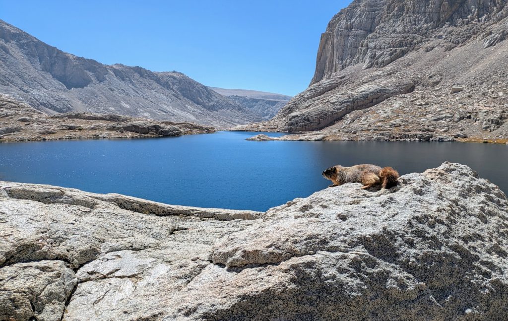
My reward at the end was one of the most epic lakes I’ve ever seen, aptly named Sky Blue Lake. I took so many pictures of it on the way down. I also came across a wise marmot perched atop the perfect rock with a view of the lake. This marmot was so at peace that he was fast asleep. I’m sorry, but I just couldn’t resist the urge to creep up on him. I got to within an arms-length before he finally woke. Thankfully he didn’t freak out or even seem too upset, casually walking over to another rock to lay down. My apologies Mr. Marmot, but I’d say it’s only fair after all the times your relatives have creeped-on me.
As I walked along the tranquil shores, I spotted a golden trout swimming parallel, matching my pace. This gave me the inspiration to go for a swim. Since there was no one around, I took off all my clothes and went for the plunge. Oh yes it was cold, but so worth it! Just like the marmot, I laid down on a rock to sun and dry, while also enjoying my lunch. Frolicking naked with the marmots and fish, what a way to live! It was so hard to pull myself away from this, my favorite lake yet, but alas there was more to see for the afternoon. I walked easily down the wide Miter basin, picking up use trail here and there. As I diverged from the valley to traverse to Soldier Lake, I finally saw a group of about 8 backpackers in a line, appearing to be on a guided tour. I wondered if they saw me. I cherished my solo adventuring in this moment, reflecting on the feelings of freedom and independence this particular day had blessed me with.
My route led down a steep gully to Soldier Lake, which was fun, but sadly brought me back onto heavily-used trail. The lake was also rather disappointing…perhaps a dream to some but just nothing near as spectacular as the many lakes I passed earlier. I saw a few backpackers nearby, not surprised that the traffic had picked up again. What did surprise me was what I encountered next. I entered a nearby meadow and saw movement at the far end…a herd of about 10 bighorn sheep! I whipped my phone out in time to capture some video and shots of their white butts, but unfortunately not much else. I certainly surprised them because they took off running up a hill and were quickly out of sight. Sierra bighorn are exceedingly rare to spot and are in fact listed as an Endangered Species. For this reason, most of the individuals I saw were wearing radio collars. I was so elated, I could barely contain my squeals of joy. I came upon an Americorps trail crew only 15 minutes later, so of course I had to stop to tell them about my awesome day…and thank them for their hard work. One of the kids was really into trees, so I chatted with him for awhile about foxtail pines. Luckily they were on a break at the time, so I wasn’t keeping them from their important tasks.


I finished my day’s detour on the Upper Rock Creek Trail, following it to where it crossed the PCT, then walked the final 4 miles to Chicken Spring lake. My alternate (longer by about a mile and a half) bypassed 12 PCT miles, which I’d say was the best swap I ever made. Just as I exited Sequoia National Park, I enjoyed sweeping views down into the Kern River valley. Then I passed a guy wearing a PCTA volunteer shirt, so I stopped again to chat. Rodger, I think his name was, was from San Diego and completing a section. He offered me another Mountain House meal and I had a hard time saying no, seeing how big his pack was. Somehow I’d managed to increase my food weight over the past day, but I’d be eating it all soon. I did really appreciate the additional calories, as I’d been pushing a few long and exhausting days in the Sierra. The extra exertion due to the altitude and cold definitely caused me to burn through calories faster, all the more so when I was scrambling over rocks and sketchy passes.
I enjoyed the last of the afternoon light across Chicken Spring lake as I made my way down. My Peakfinder app indicated that Mt Baden Powell was visible from this vantage, but I couldn’t quite make it out at over 150 miles distant. I was happy my timing lined up for camping at this final Sierra lake along the PCT. I contemplated the 700+ miles to the south, fresh on my mind after hiking them a 2nd time this spring, and was shocked to realize that this is indeed the last natural lake, period! Yes, the PCT passes a couple reservoirs such as Lake Morena and Silverwood. But such bodies of water feel like something entirely different compared to what the Cascades and Sierra offer. To my knowledge, they are all man-made, or at least significantly altered. It’s kind of a sad fact of life for the SOBO PCT hiker transitioning from nearly 2 thousand miles of beautiful mountain lakes to the desert ridgelines of southern California, devoid entirely of such lakes. Water was to become quite scarce even before reaching KMS, as I was already well aware of.


While Chicken Spring Lake didn’t hold a candle to Sky Blue Lake and the hundreds of others along the SHR, it’s still quite special in being either the first or last, depending on one’s direction. So I celebrated it this night, especially since it also supplied an abundance of magnificent foxtail pines. I parked my tent under a granddaddy of one and enjoyed a peaceful night, even amongst a plethora of neighboring tents. I was feeling so much stoke after this day that I would have slept well anywhere.
Day 15: Nothing Too Exciting, Tuesday, Sep 16th, 2025, 0630-1840.
32 mi to halfway down Cow creek, elevation 8320′. 3720\6680.
Coming off an extreme high from the day before, this day was frankly pretty mundane and routine. I mean, I kind of set myself up for such a let-down, both literally and figuratively. The views of the Owens valley early in the morning were nice, but I’d already seen this entire section once before and was asking myself if it was worth it to put in the miles a second time. In retrospect, I should have done some more research and taken an alternate trail down along the Kern River. Or I could have hiked out at Cottonwood Pass to Lone Pine, then dedicated an extra day or 2 somewhere else in the Sierra. But no matter, I had the resources and energy, plus a feeling that I needed to reach KMS, just to bring things full circle. It was where I ended my Desert thru-hike in May and I felt a pull to end this hike there again. I had one goal this day, and that was to crush miles, allowing for an early arrival in KMS the next. I knew I’d be dropping many thousands of feet in elevation and that the trail was cruisey. A lack of water also prompted a big day.
I passed a few guys within the first few miles, one of whom was taking a dump right next to the trail. I walked up on him just as he was shoving a rock over his immense pile of crap and toilet paper. And yes, it was obnoxiously squishing out from beneath the rock. It disgusted me so much, I wanted to scream at him. Then again, being a solo female, I didn’t want to deal with a confrontation and so just walked away, silently fuming. I’m not good at being polite while also pissed at someone for disregarding LNT principles. I admire those that can get their point across politely and effectively, but I know that’s not me. I hope he was really embarrassed, but I’m sure the encounter did nothing to change his ways. It only served to make me grumpy for a long time afterward. No doubt I’ve committed plenty of LNT infractions in my backpacking past, but at least I long since stopped using toilet paper, preferring a bottle bidet instead. No trash, no fuss. Maybe I should have demonstrated the technique to this guy…talk about embarrassing.
I picked up water at Dutch spring, had lunch and more water at Death Canyon Spring, then hiked 9 miles up and over the shoulder of Olancha Peak. Imagining many more poorly situated and dug catholes (plus cows), I collected my last water for the day at the very top of Cow creek, then walked down about 2 and 1/2 miles to a campsite. I saw about 12 people all day, along with some cows in the valley, 1 lizard and 1 grouse. There were lots of of chipmunks, squirrels, little birds and hawks, too. I said goodby to the foxtail pines and made my camp under Jeffrey pines, instead. That was my day in a nutshell.
Day 16: KMS, Wednesday, Sep 17th, 2025, 0640-1200.
14.5 mi to Kennedy Meadows South, elevation 6150′.
I hoped to be in ‘town’ for lunch, so I beat feet as fast as I could. I enjoyed hiking through the broad meadows along the Kern river early in the morning, with frost all over the sage. I crossed over the bridge, hiked over a plateau, and then foraging for pinon pines nuts on the way down. They’d been plentiful in the spring, but I couldn’t find a single one now. At the second bridge crossing, I caught up to Mythic, a SOBO woman who was finishing a couple large sections of the PCT. I hiked with her the rest of the way to KMS and as my luck would have it, her husband was meeting her with their car. I hadn’t even been trying to score a ride, yet one found me. They offered to drive me all the way down to Inyokern, where I could easily catch the Eastern Sierra Transit shuttle up to Bishop. Perfect!
I signed out in the trailhead log, the 2nd time I’d done so this year. I guess this was technically the finish point of my summer hike, but already I was plotting another week in the Sierra, staging out of Bishop. We stopped to get burgers at the KMS General Store, where I was reunited with all the cute pets that live there (2 mini Aussie shepherds and a deaf cat, Bandit). I was also surprised to see a familiar face, my SOBO friend Brian from Stehekin/Leavenworth/Snoqualmie. He and another SOBO guy had skipped northern California in order to make it through the Sierra, same as I had done. They got ahead of me because they also skipped from Yosemite to Kearsarge Pass because of the smoke. They planned to come back another year to hike the parts they missed, as so many were having to do these days. It was fun to briefly catch up with them, but short-lived in consideration of my ride. I was sad to spend such a short amount of time in KMS this time, but really there wasn’t much going on. Triple Crown Outfitters was already closed for the season and Grumpys looked empty as well. I was glad I got to see the place in May, when all the NOBOs were starting to bunch up and the scene was buzzing with excitement. Spending 2 full days and nights there was certainly enough to get my fill. Who knows if I’ll ever be back.


Mystic and her husband dropped me off at the Inyokern bus stop and I only had to wait about an hour for the shuttle. I got pretty lucky, since it only runs north once a day. The driver was also really nice, accommodating me by dropping me off along his refueling route, saving me a long walk to the hostel. During the ride, I checked the air quality maps, weather forecast and the fire status, all of which indicated greatly improved conditions for hiking north of Bishop Pass. The fire was already 85% contained and heavy rain was forecasted over the next 2 days. I checked into the hostel and the manager offered me a work-for-stay option for a 2nd night, which I decided to take him up on. It seemed wise to wait out the rainy weather, plus I needed a little extra time to plan for my final leg in the Sierra.
Zero in Bishop, Thursday, Sep 18th, 2025
I spent the morning helping with chores in the hostel, then studied my maps for the SHR. I also went to Schat’s Bakery to load up on some goodies. What an incredible place…I can’t believe it took me 4 visits to Bishop before I finally visited! Then I went to the PO to pick up my package and mail some stuff home. Later in the day, I ran into Purple and his friend Willow, who were also hiking around the Sierra and visiting the hostel to take a shower. I met Purple on the PCT in WA when he was thru-hiking NOBO. He now had his wheels and offered me a ride to the trailhead the next day, since they were starting a loop hike from there as well. Once again, I had great luck finding a ride! That night, I booked a one way flight from Reno to Denver for a week later, giving me a hard schedule to stick to for this last segment.