Day 7: Back on the SHR, Sunday, Sep 7th, 2025, 0700-1800.
15.5 mi to Bench Canyon, elevation 9,670′.
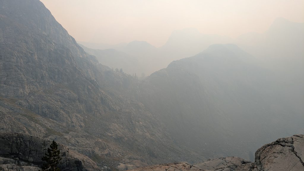
It was a really slow start this morning, given my huge day before, plus 2 late nights of hiking in a row. The first thing I noticed was the smell of smoke, then was pretty astonished to see the sky, or rather the lack there of. A heavy layer of smoke filled the valley overnight. When planning this next leg in Tuolumne Meadows 2 days prior, I’d contemplated saving Half Dome for this morning. Thank goodness I pushed hard and made it to the top the day before! I did get some cool pictures of the eerie red sunrise over Merced lake in the morning. I paused to watch an osprey hunt for fish, then began the big climb out of the valley.
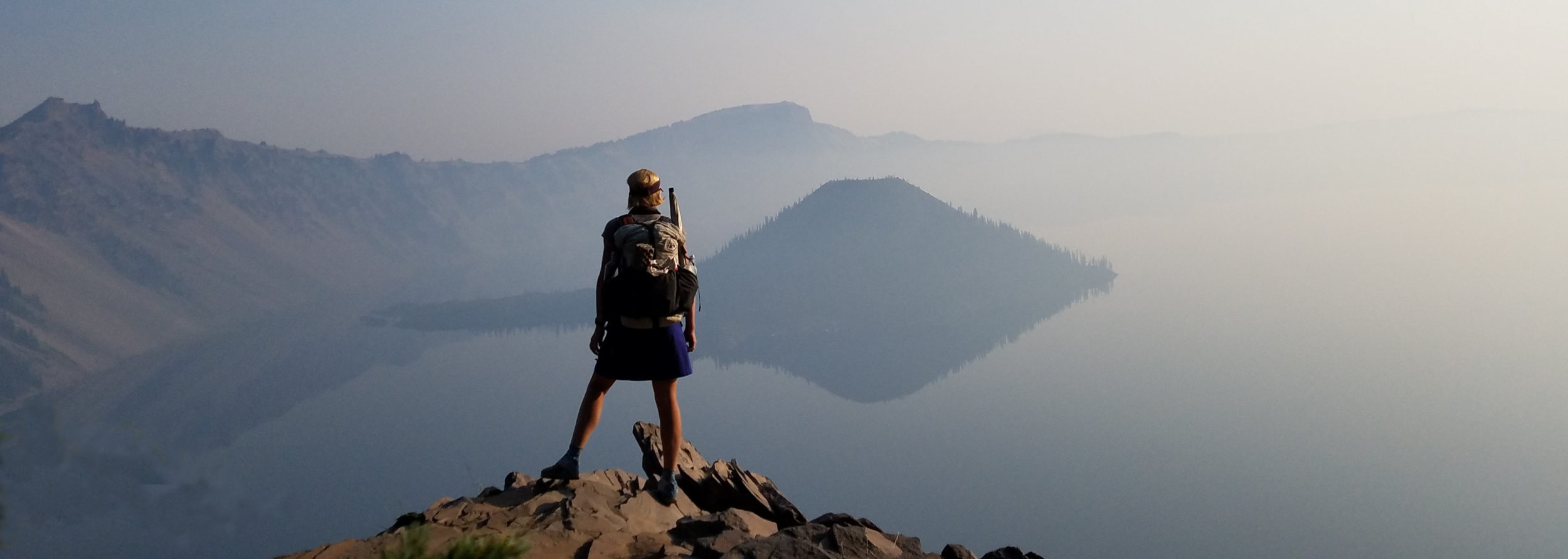
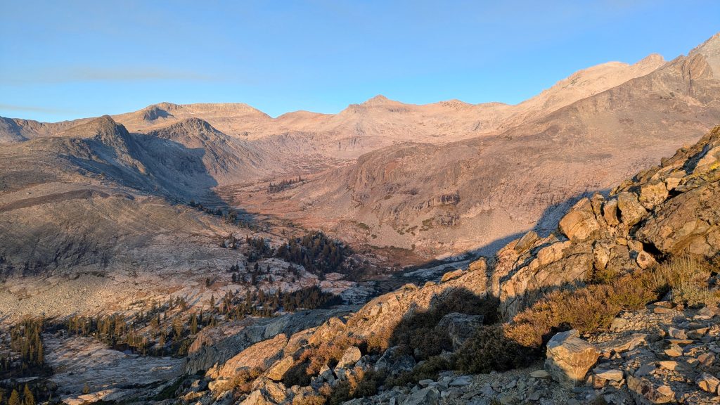
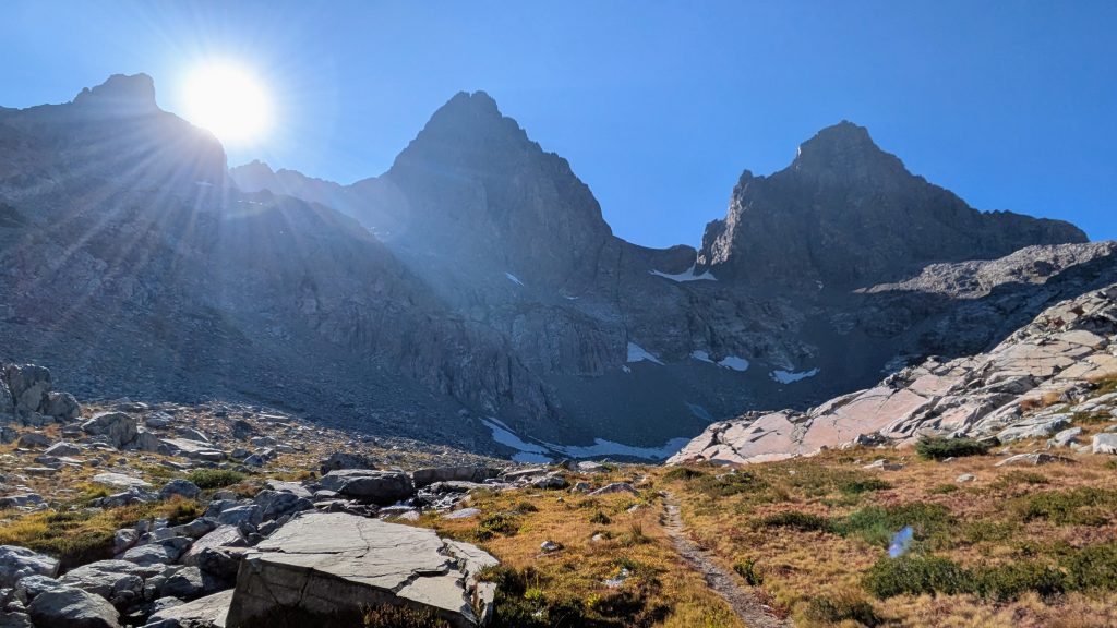
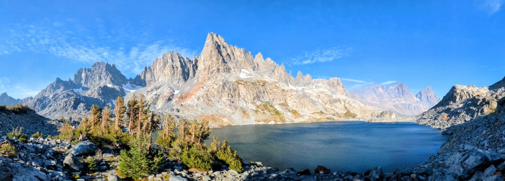
I finally rejoined the SHR after 5 miles, which led me even higher above the Merced valley. Breathing the smoke while gaining thousands of feet of elevation all morning sucked. My lungs actually hurt and I was coughing up some phlegm. Not good! I joined the Iceberg Pass Trail, which went high enough to finally escape most of the smoke. I took a long lunch break at Lylle Creek, followed by a last series of switchbacks. I really felt like I was dragging a$$ by that point, but thankfully I was about to break free of the trail, trees and smoke. I met 2 men that were going down and we chatted briefly. Otherwise I had the mountains to myself all day. Just after this, I left the trail for good to begin some fun cross country travel. I started off in the trees, which is always a challenge because it’s hard to see the points I’m aiming for. But once in the open tundra, navigation all the way to Blue Lake Pass was a breeze. The smoke was almost completely gone and I had views of Foerster Peak, Mount Lyell and the Clark Range.


It was pretty straightforward getting up the pass, just some talus and a few little ledges to negotiate. From there, I had nice views of Mount Ritter, Banner Peak and the Minarets to the southeast. But I could also see the huge plume of smoke coming from the Garnet fire to the southwest. If and when the wind shifted just a little, I was going to be inundated once again. It didn’t bode well for the next few days. I followed some nice green ramps down from the pass on the north side, which ended in a slab chute that was fun to scramble down. I passed upper Blue Lake and then met a fellow solo hiker, Martin, at lower Blue Lake. We chatted about the high route for a bit and he seemed very knowledgeable and nice. I contemplated stopping to camp with him, but there was plenty of daylight left to go at least another mile or 2, all downhill into Bench Canyon. I knew traversing past the Ritter Range the following day was going to a really tough one, so I figured I should get as many miles done today as I could. Hiking free-style down the valley in the late afternoon was heavenly…what a beautiful, chill section. I found a nice strand of trees and pools of running water to stop near for the night.

Day 8: Smokey & Hard, Monday, Sep 8th, 2025, 0640-1730.
9.5 mi to just above Ediza Lake, elevation 9,440′.
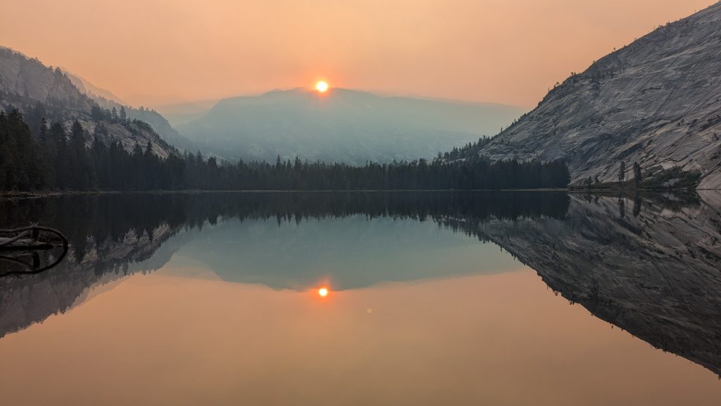
Smoke filled the valley after I went to sleep and I woke around midnight feeling like I was suffocating. The full moon looked like an evil red eye in the sky, very foreboding. I was already nervous about the route ahead, so the added anxiety over the smoke was not good. It made me feel trapped, since there was nowhere I could actually go in the dark. So I laid awake for awhile wondering what to do come morning. I could go southwest down the valley, eventually picking up a trail, but that would probably just mean even heavier smoke. The only other 2 options were to follow the convoluted route forward, still heading southeast kind of towards the smoke, or to backtrack a day and half the way I’d come. I did not wish to retreat, but I also wasn’t sure I could navigate forward very well if I could barely see where I was going.
The smoke cleared a little by morning, but the air still reeked. I decided to press on, even though I knew it was probably a bad idea. My route went up thousands of feet through very rugged terrain most of the day. I’d read a lot of comments that this was one of the toughest stretches on the high route, so my timing with the smoke was not good. One blog conveyed that the 3 hikers only managed to travel 6 miles ALL DAY through this part, and they were going down, not up. I personally knew 2 of them and that they were all strong, highly accomplished long distance hikers. One was basically a Sierra expert: Rockin, my source for info on the YHR as well. To add an additional layer of complexity, their blogs and Steve Roper’s guidebook were both written from a northbound perspective. I was having to read the notes multiple times and then turn all the details around 180 degrees to make sense of them going southbound. This was really hard, as I wasn’t simply heading towards an observable pass or lake, but rather traversing complex terrain with many hidden and subtle bumps, channels, and ledges that I needed to find.


I enjoyed capturing these cool sunrise photos as I made my way up the benches…so much rock and smoke stood before me. The rock passed in my wake but the smoke just kept increasing, unfortunately.
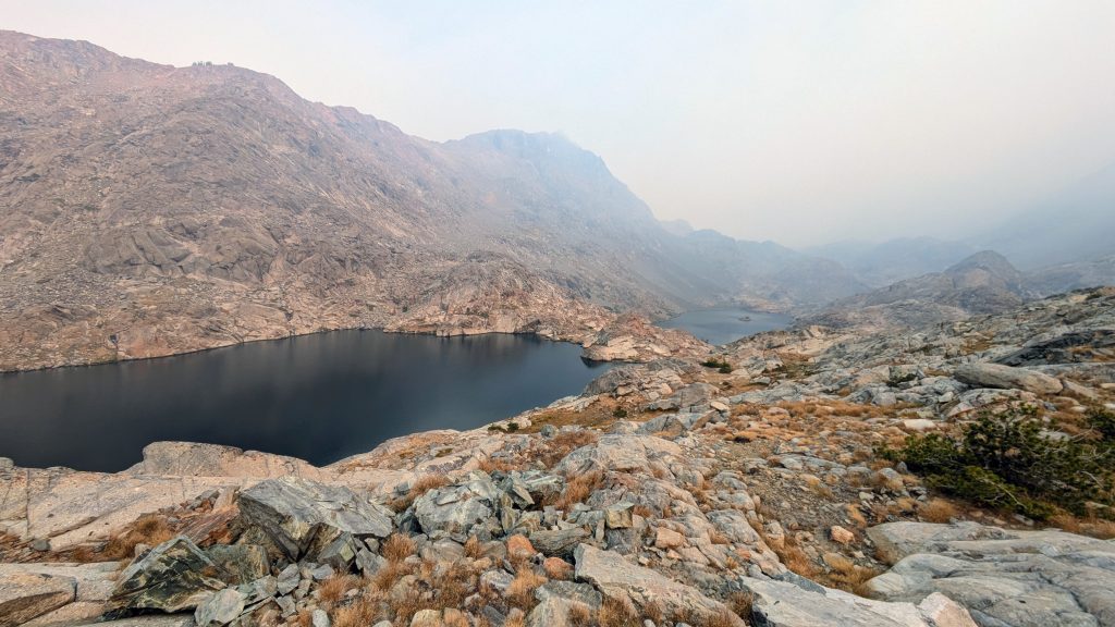
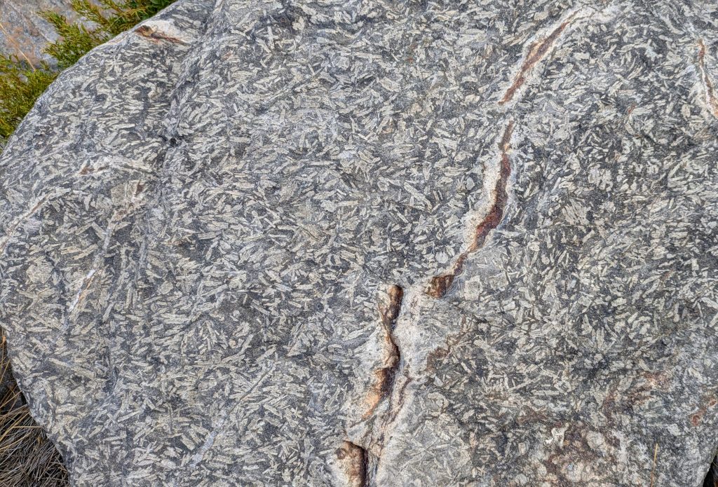
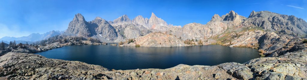
I made it to the Twin Island Lakes in decent time, but knew from the blogs that the next mile and a half were going to be the trickiest. There were a series of about three 500′ step-ups that required precise navigation, as in finding the one ledge that goes up, otherwise get cliffed-out. This was of course the point when the smoke came in the heaviest, so that I couldn’t even make out the tops of Ritter and Banner. From the Upper Twin Lake, I spied my intended climb along a 400 ft waterfall, which looked impossible. I stared at it for the longest time, trying to spot the route leading to the top. I convinced myself that I must be looking at the wrong waterfall entirely and that I needed to hike further to get a better vantage point. Traveling along the rocky lake shores at least took my mind off the difficulties for a bit. The were some cool formations which I thought were fossils, but according to one blog are instead: A Tertiary roof pendant of intermediate composition that got intruded by a lighter phase of granite. The phenocrysts of feldspar (the long thin crystals) in the rock cooled first. This detailed description came from a geology professor’s blog, so I believe it.
I crossed the outlet of northern Twin Island Lake, just a stone-throw above where it plunges down hundreds of feet to form the North Fork of the San Joaquin River. It was a simple rock-hop, no wet feet, which is quite the advantage of hiking in September. For early season hikers, this can be one of the most difficult water crossings of the SHR. Then just as I suspected, as I got closer to the waterfall, the path became very obvious and was in fact pretty easy. I even found an actual use trail. There were many more complicated parts after this but I slowly found my way, matching landmarks to what I read in the guidebook and saw on my maps. Just as I reached Lake Catherine, I made my first and only blunder in going too high and east, then having to come down a steep bluff to reach the lake. With it in sight, I felt like I should be in the clear, but no. I got stuck at a little slab drop of about 10 ft. Rather than just turn back to find a better way, I forced it, lowering my pack to scramble down after it. Where my pack landed was more off-kilter than a realized, so after I let go of my line, it tumbled down another 10 ft. Many of the contents spilled out, making it look like a yard sale. I just sat there disgruntled, then managed a chuckle. The lake was my target for a well-earned lunch break, but this stupid little detour cost me at least 45 minutes…part of which was retrieving the spilled crap. All because I let my guard down just for a moment at the top, so it goes with micro-navigation.

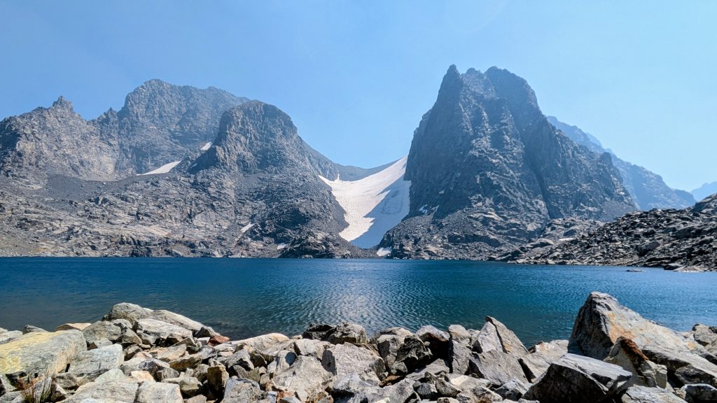
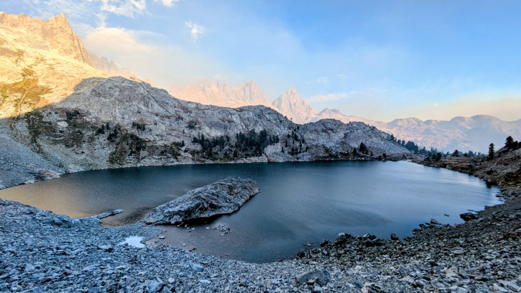
Luckily nothing in my pack was broken or lost and more importantly, I remained intact. So far my only injuries had been the cuts on my legs from the bushwhacky trail to Half Dome and a small cut on my ankle this day, suffered from a rolled rock. Then I took a little tumble when my foot caught on a piece of talus, still heading down to the lake. Luckily I was already low and caught myself easily. I really needed to take a break when I did. I filtered some beautiful water and admired the views of Banner and Ritter across the lake. The smoke had mostly cleared once again, so I could breathe a bit easier, even at 11k’. I’d earlier had some pretty bad coughing fits, so I was definitely doing damage to my lungs. But my only complaint at the time was the cold wind blowing across the lake, which gave me chills, cutting short my lunch. I would have liked to have gone for a swim, but it didn’t work out this day.
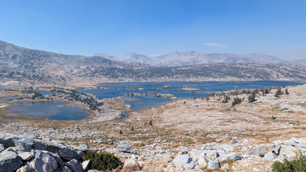
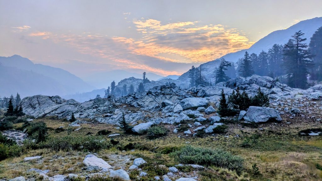
Resuming the route, I found it pretty tedious going around the lake, up a few hundred feet over North Glacier Pass, and then down through fields of nothing but talus the whole way. Finally I made it to some grassy meadows, successfully having navigated the crux of this section. It was all downhill from here (except for the 4 or 5 passes I still had today and the next). For the rest of the afternoon, I kind of went on auto-mode, finding the route much more straightforward and I daresay easy. I bumbled my way down to Thousand Island lake, across a cool peninsula, over an easy unnamed pass, and finally over White Bark Pass. I dropped down towards Ediza lake, where I spied a cluster of big lodgepoles to park under for the night. I washed off in a nearby creek, freezing my butt off. I went this entire day without seeing a single person. But I also only traveled a mere 9.5 miles, maybe a little more since I meandered about quite a bit route finding. But that’s a pretty decent distance given the difficulty and poor air quality of this day. The smoke cleared nicely by the end, but I expected it to be back. It was pretty windy all afternoon and night, so I was glad I made it down into the trees. Wind was not good for the fire, though.
Day 9: Reds Meadow, Tuesday, Sep 9th, 2025, 0640-1300.
10 mi to Reds Meadow, elevation 7650′. Then ride out to Bishop.
I had some cool views in the morning, with the smoke choking the valley, causing nice sunrise colors. I followed trail all the way up to Iceberg lake, passing a guy without a pack, who I guess was probably camped at Ediza lake. He was the first person I’d seen since lower Blue Lake. I followed decent use trail around the lake and up over the pass to Cecile lake. Normally there’s an ice field that makes for a sketchy traverse above the lake, but my path was completely clear. The talus and gradient let up along Cecile lake, where I met 2 women, Jenice and Amy, hiking the SHR northbound. It was fun to chat with them, sharing stories of difficulties and griefs. They asked me about the section coming up and I tried to not sound like a fear-mongerer: It’s slow going… this was the gist of my thoughts on it. I navigated a class 3 chute down to the Minaret lakes, but found it easy following more use trail.
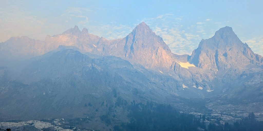
The views of the lakes and Minaret spires behind them were phenomenal through this stretch. It’s deservedly a popular area, with pretty easy access, so I wasn’t surprised to start encountering a few backpackers and climbers. But given the poor air quality, the area was relatively quiet. I watched as a giant plume of smoke billowed from behind the towers, a sure sign that the fire had grown after the windy conditions overnight and the day before. Already I was working out a new plan for once I made it down to Reds Meadow. It seemed like a forgone conclusion that I would need to get off trail entirely or skip down further south. In a hurry to escape the smoke, I decided to take the Minaret creek trail to connect faster to the PCT/JMT and onto Reds Meadow. The official SHR continued for 6 miles over Nancy Pass, then down the Becks Lake trail to RM, but I didn’t see anything significant on the map that I’d be missing out on if I took the alternate. In fact, many commenters on the FB group suggested doing this. The trail was easy and fast, heading downhill for about 4 miles until I intersected the PCT/JMT. Along the way, I passed a group of 4 backpackers, who would later prove invaluable. From there, it was a swift jaunt past the Devil’s Postpile and into RM.
I was surprised to find RM to be a ghost town. The proprietors were busy getting things stored for the winter, as they’d just made the impromptu decision to close a few weeks early…the upcoming weekend, in fact. The road construction situation (which I was completely unaware of until arriving) had really take a bite out of their business. Due to a major rebuild of this single road into the valley, there were only 2 open time periods for vehicles to convoy in and out each day…8 am and 3 pm. I was aware that the shuttle to Mammoth only ran weekends by this point, but had assumed it would be an easy hitch out in the afternoon. But there were barely any vehicles able to come and go in accordance with the road closures. Now to add to all this, the fire and smoke had chased away the remaining few visitors to the area.
Fortunately for me, my incredible luck in hitching held true. As soon as I arrived, I saw Ralph the local camp host offering a ride to another hiker. I ran up to them excitedly and asked if I could join. Sure thing, we’d all just have to wait until the 3 pm convoy. Whew, that was easy! I could have very well been stuck all day and overnight, or even longer, had I not arrived early enough to secure a ride. Instead, I had just enough time to enjoy a burger from the cafe and chat with the 3 other hikers. One guy was on the JMT and another was actually on the SHR…I’d just managed to catch up with him. But now were were all getting off trail. Air quality maps and the wx forecast painted a dismal picture…the smoke would only get worse over the next several days. Already it was nearly impossible to see the nearby ranges, so what was the point in hiking the Sierra if I couldn’t see them? Not to mention the damage being done to my lungs.
After a short while, the 4 backpackers I passed on the way down arrived and I began chatting with them. As my luck would also have it, they were driving their jeep out. While they didn’t have room on the way to Mammoth ski resort (the terminus of the construction convoy), they had a second car parked there, belonging to the other 2 in their party. Laura and Chad, owners of the jeep, were then set to drive back to San Diego, passing Bishop on the way. I asked if I and another hiker could get a ride with them once we all got to the ski area, and they agreed! This was perfect, as I’d decided Bishop was the best place to go in order to re-work my plans.
On the drive out, all I could think about was how bad the smoke was. The area had that red-sky-post-apocalyptic feel to it, with thick smoke enshrouding all of Mammoth. But at least the smoke diminished significantly as we drove south to Bishop. Laura and Chad were so kind to drop me off right outside the Hostel California. I arrived around 5 pm, allowing plenty of time to take a much-needed shower (after 10 days), do laundry and get some food. That night, I looked at a number of air quality maps to best gauge the trajectory of the smoke. It was moving across the Sierra in a NE direction, then getting trapped in the Inyo valley and circulating south. But it was rather clear in the high Sierra south of Bishop Pass. I woke the next morning not even able to see the prominent line of the Eastern Sierra from town, so I promptly decided to take a zero to let more time pass, adjusting my plans accordingly. There were more thunderstorms forecasted this day, so I hoped the rain might squash the fire and smoke a bit, as it had done on Day 2 of my trip. Later I read reports that Yosemite had to be evacuated due to the toxic air quality…this even included all the rangers. I made a good call getting off trail! I spent the day trying to air out my gear, which wreaked of smoke. I met lots of JMT hikers, a group of friendly Japanese boulderers, and some eclectic locals working at the hostel. And I ate a lot of good food…Bishop is such a great trail town to get stuck in!
Zero in Bishop, Wednesday, Sep 10th, 2025
Twig! I somehow missed these! You are a prolific writer and sitting here in dreary NJ, I am re-living the SHR through your writing!
I am meeting up with a friend around August 6 th to head from Bishop to Cirque Pass via Thunderbolt Pass then loop back over Knapsack Pass back to South Lake.
Jenice will join me on Aug 17th starting from South Lake over Lamark Col to Darwin Bench then head north West over Alpine Col to catch the SHR near Golden Trout Lakes onto Reds.
I’ll return to Yosemite to rock climb with a friend then complete the SHR to Twin Lks. side, head down the ridge to connect again with the SHR. Our crazy plan so he gets the full experience, is to hike from TM to Spuller Lk to Saddlebag Lk. We’ll pick up climbing gear there. Head around the North side, drop camping gear, at Conness Lks. Then rock climb to the Summit. Hike down the ridge to the East side, back to our gear. Stash climbing gear to be picked up by a friend, and continue on to TL.
Wherever your adventures lead, I hope they are joyfilled and safe!
Nice to hear from you Amy! Your plans sound awesome. Just the other day, a friend reached out wanting to know if I wanted to hike the SHR with him in 2026. I would like to, since I really only did about half of it this past year. Having familiarity with repeat sections would certainly be a help and I’d love to see more. Maybe I’ll see you out there again!