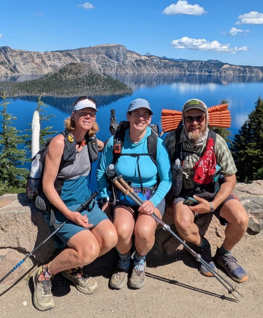
Day 35, Sunday, Aug 17th, 2025, 1730-1900. Bend.
5.5 mi from HWY 58 / Lake Odell to Hidden Lake, mm 752, 1100’up\380’down, elevation 5840′. Jill and Robert graciously treated us to their specialty pancakes in the morning, then drove us into town to do some grocery shopping at Trader Joes and Costco. I didn’t really need much but it was fun hanging out. The other hiker (sorry I can’t remember her name now) and I bought Costco shakes and a large pizza to share with our hosts, a small token of our appreciation. They dropped us off at REI, where we were to meet our respective rides back to trail. After a miscommunication with the Trail Angel that had offered to give me a ride to Willamette Pass (Shelter Cove, he was already taking 2 other hikers), I got stranded at REI for several hours. Robert came to my rescue again, picking me up and driving me halfway down the highway, on his way to a realty photo shoot. He was on a deadline, but still proposed giving me a ride the rest of the way in between his shoots, in the event I wasn’t able to get a hitch. I hated to ask him for anything else, after he and Jill had already done so much for me. Thankfully the other Trail Angel came through, taking pity when he saw me hitching the side of the road on the way back from his first trip. It was an awkward situation, but at least were were able to reconcile the misunderstanding and I appreciated his time and effort getting me back to trail. I’ll also add that I almost always offer to compensate rides for gas and expenses, which I certainly did in this situation. I myself give rides to the Florida Trail, a 120 mile round trip for me, so I know all that’s entailed in these scenarios. My time is free, but gas is not, so I always appreciate the offer of a donation.
I was so relieved to finally start waking again. Trail Days was fun, but I’m not sure it was worth all the hassle and money. Now I could focus on nothing but the trail for the rest of the week. I knew I had lots of travel logistics to once again figure out when I got to Ashland, but for now, I could breathe easy. The early evening brought the threat of some rain showers, but thankfully I stayed dry on the quiet walk up to my campsite. I don’t think I saw a single hiker and had the small lake all to myself, just the way I like it. I really needed some solitude after such an overstimulating weekend.
Day 36, Monday, Aug 18th, 2025, 0610-1900. Diamond Peak
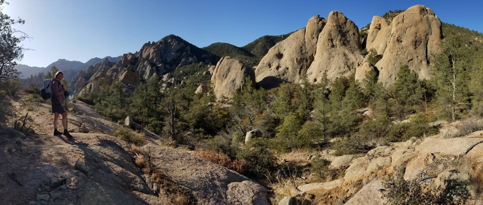
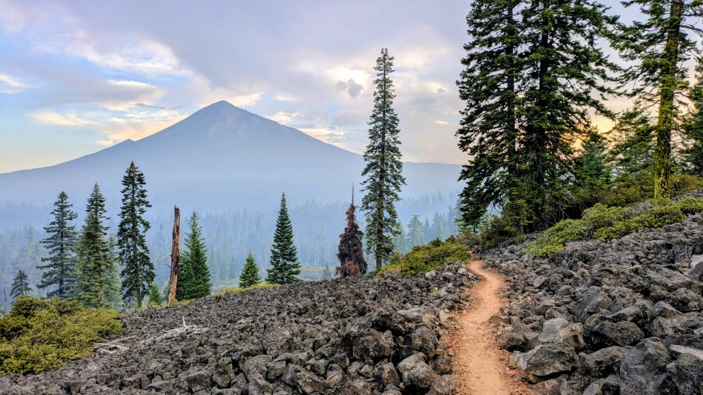
35.5 mi to north of Miller Lake, mm 787.2, 5470’up\4880’down, elevation 6440′. Feeling energized after my first and only zero days (3 in a row!), I crushed it this day. I was on point with all my miles, that is to say I made 12 by 10 am and 22 by 2 p.m. I spent the morning wrapping around the base of Diamond Peak, miles that were new to me, as I’d taken the alternate route from Shelter Cove in 2018. The peak looked like a fun climb, but I passed it by. I stopped for a short break at Summit Lake, then another at the Wendigo pass water cache. Thanks again Devilfish! I committed to carrying a little extra water for the rest of the day, rather than hiking the steep side trail down to a spring in 6 miles. For me, this meant only about 2.5 liters for 11 miles to a dry campsite on the ridge. But I’d need to go another 11 miles the next morning, in order to get to Thielsen creek (a 22 mile dry stretch, no big deal). There was the option of hiking about a mile off trail (one way) to Maidu Lake, which I’d done last time. But after dealing with such long carries on my desert hikes, I was a pro at managing my water. I certainly didn’t feel the need to add extra miles this time.


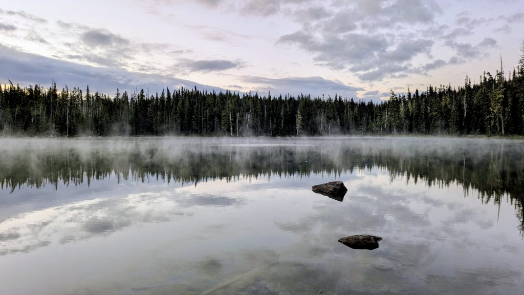
Sunrise over Odell Lake, a weird party mask I found on trail, and Cowhorn Mountain
I passed about 60 NOBOs all day, a significant drop from previous days. It was extremely quiet in the morning, probably because most were taking the alternate from Wendigo pass to Shelter Cove (the one I took in 2018). But I also figured there were fewer because of the gap created by Trail Days. The terrain was pretty easy and there was nothing much to do but walk all day, and so I did. My campsite was another dry make-shift one that I can’t even picture now, it was that unremarkable I guess.
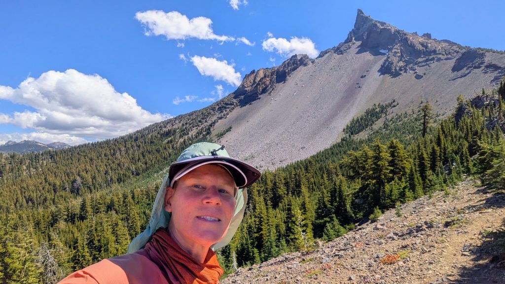
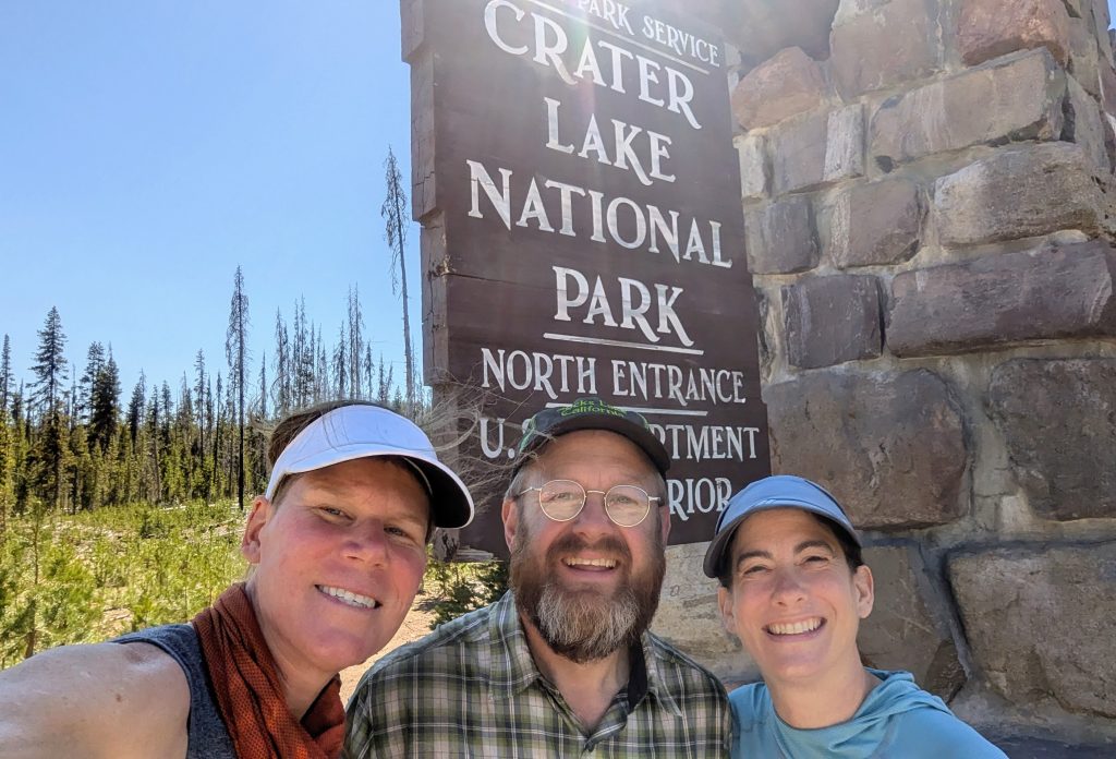
Day 37, Tuesday, Aug 19th, 2025, 0620-1500. Crater Lake.
23.5 mi to HWY 138 (plus 3.5 road walk and side hike / skipped 11.5 miles of trail in favor of going for a swim), mm 806.5, 2400’up\2880’down, elevation 6440′. I made quick miles up to Thielsen Creek (11 by 10 am), where I took a short break to collect water. On the way, I passed the OR/WA highpoint, which is so anticlimactic that it’s a bit of a joke on the PCT. I was already higher when I went to the top of Old Snowy. At the junction to Thielsen Peak summit, I couldn’t resist climbing a ways (once again exceeding the highpoint) in order to get views of Mount Shasta, which I could just barely make out. I didn’t want to go as far as the summit, so I only allowed about an hour on the side trip. I guess it was worth it to also get a last glimpse of Diamond Peak and the Sisters. But I was feeling rushed because I really wanted to make it to Crater Lake in time to hike down to the lake this day. Yet getting to the road where I would need to then try to hitch to the trailhead meant a 30+ mile day, and I was now well behind schedule.
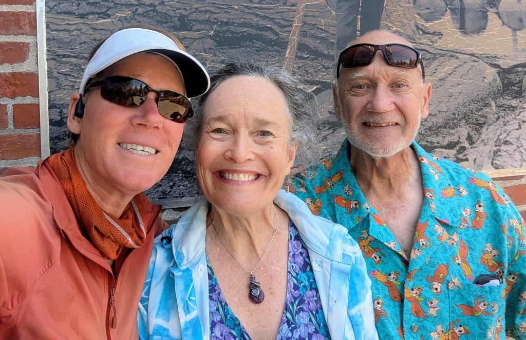
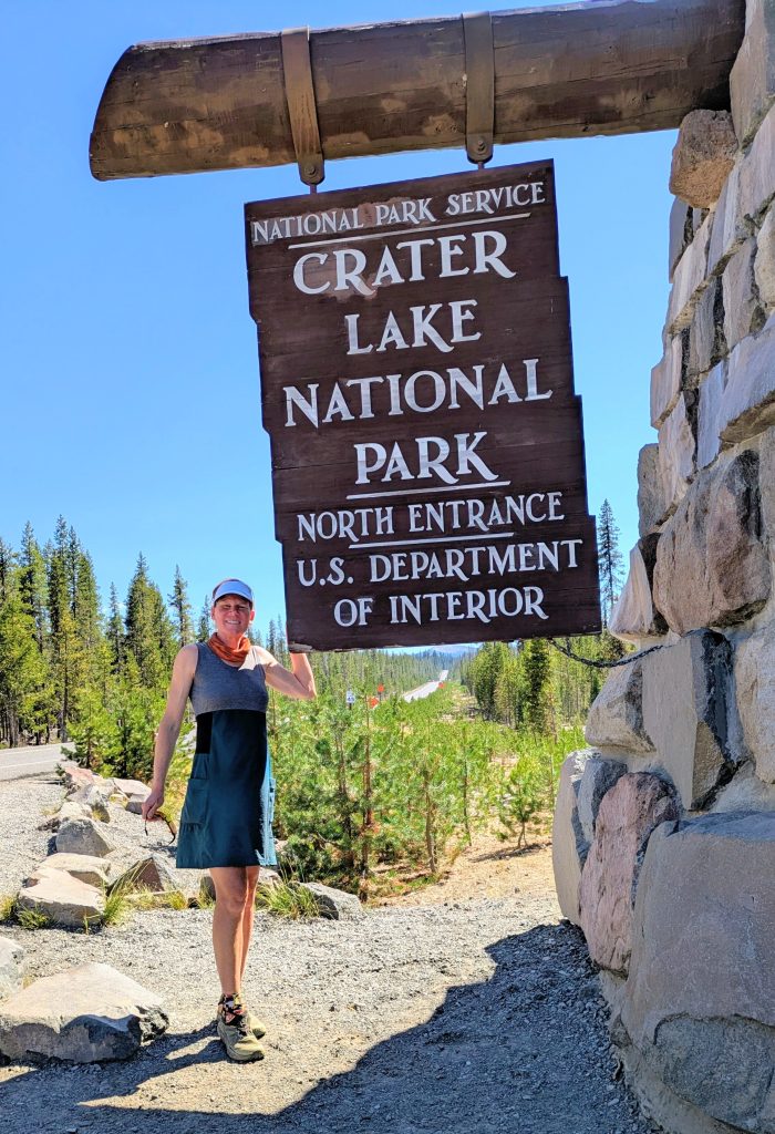
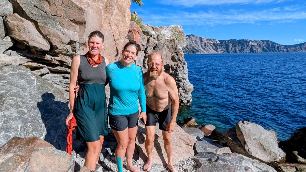
I continued on to reach the water cache just before hwy 138 at 1:30 p.m. While taking a short lunch break there, I had an epiphany. Actually, it was Jockstrap’s 15k speed challenge, left in the notes, that sparked my devious thoughts. Why did I need to hike this flat stretch through the monotonous lodgepole forest, with no views? I could set a speed record by jumping in a car instead! This would hopefully help me achieve my overall goal of going for a swim in Crater Lake this day. So I walked about a mile and a half west on the highway and turned south onto the North Crater Lake entrance. I put out my thumb right by the welcome sign, which is usually a good spot because people stop to take pictures there. I was surprised when quite a few cars passed me by; but no bother, I knew my perfect ride would find me eventually. Finally a rental car stopped, in which I could see the occupants staring at me with mouths agape. The instant recognition seized me, I gasped: it was Mockingbird and Rock and Roll (Celeste and Rick), who I met on top of Springer Mountain in 2024! It was my first day on the Benton MacKaye Trail and they had been hiking the Pinhoti. We were all flabbergasted to meet up again in this way!
I did know they were hiking the PCT this year, so it wasn’t a complete surprise. In fact, they started NOBO just days behind me. Our paths didn’t cross in the spring, but I expected to pass them on trail at some point, just not in a rental car when I was needing a ride. As luck would have it, Mockingbird was coming back from a visit home and R&R had rented the car to drive her back to trail, then was returning home to start a new job. Their plans for the afternoon were exactly the same as mine: go for a swim! How serendipitous that I decided to take this alternate to Crater Lake! Sometimes yellow-blazing really pays off 🙂 Plus, it was so hot this day…I could be dying from the heat in a 9 mile dry stretch or be relaxing lake side with friends…easy call. This was actually a must-do side-trip, since the Park Service warned that the trail would be closed for reconstruction for up to 5 years, starting in 2026. I didn’t hike down to the lake in 2018 and I wouldn’t have the opportunity for the foreseeable future. It was maybe now or never.
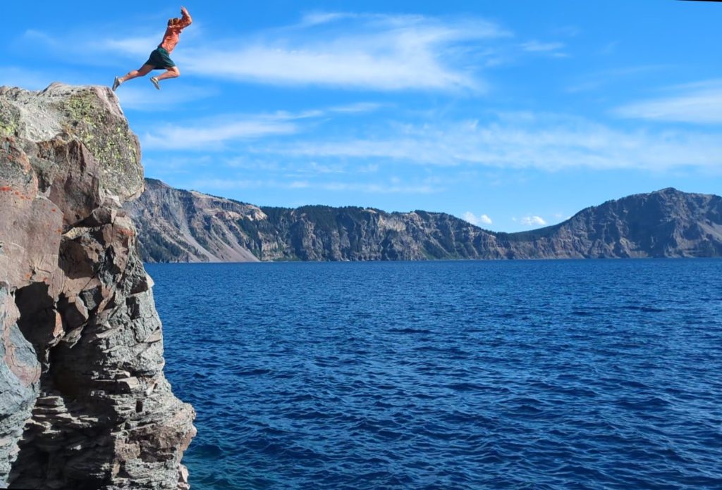
My friends made room for me and we drove straight to the trailhead. The trail was 2.2 miles round trip, easy for us but more of a challenge for the many tourists that have to walk it to catch their boat ride on the lake. At the bottom, we all jumped off the 20-ft high rock. I even jumped for a 2nd time, it was so much fun. I got lots of water up my nose both times, but knocked off all the dirt and felt so refreshed afterward.
The climb back up to the rim was easy, especially since I was cold from the swim. Crater Lake boasts having some of the clearest, deepest and coldest water, so I also grabbed some to filter and drink…it tasted pretty good on the hike up. After so much fun, we decided to celebrate some more. We drove to the Rim village and had a wonderful meal at the lodge. I ordered meatloaf with mashed potatoes and squash. It was enough food to save some for breakfast the next morning. To cap off the night, we drove down to Mazama village to grab free spots in the PCT area, located in the commercial campground. It was dark by the time we arrived, but we easily found a couple tent sites. As I was setting up, I heard a booming voice coming from the opposite side of the large area, more than 100 feet away. I’d recognize that voice anywhere and followed it to its source. I ran up to Foggy in the dark to give him a big hug (noro be damned), surprising the hell out of him. He was confused how I got behind him and we spent awhile catching up on all that had happened since Cascade Locks. It was so awesome to see all these friends this day and I went to sleep with a big smile on my face.
Day 38, Wednesday, Aug 20th, 2025, 0800-1930. Crater Lake Part 2.
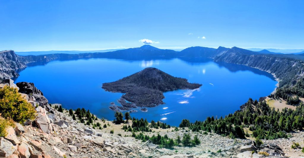
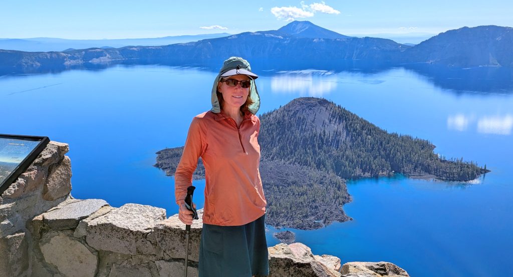
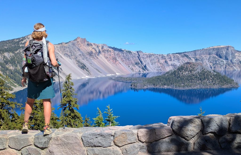
11 mi to beautiful forest, mm 835, 1450’up\1570’down, elevation 7100′. The night before, Mockingbird, R&R and I hatched an interesting plan for this day, stemming around how to efficiently get me back on trail on the north side of the rim, while they hiked in the opposite direction. So they let me drive their rental car up to the rim for sunrise, where I ate my left-over meatloaf dinner parked at one of the overlooks. I left the keys hidden under the car, so that they would have their wheels waiting for them at the end of the day. I started the Rim Trail, slack-packing south, and shortly was on top the Watchman’s Tower (another side trip I didn’t do last time). The views were spectacular, as they always seem to be at Crater Lake, even when there’s a ton of wildefire smoke. The lake was so brilliantly blue, as were the skies this time. So I could see Mt Shasta and the terrain to the south very well, with California getting closer every day. I could also just make out the Sisters. Who knew Oregon had such vast views? Good thing I hiked it a 2nd time in a year with hardly any wildfires.
After leaving the tower, I had the trail almost to myself until the very end. I ran into Mockingbird and Rock and Roll just as I finished near the Rim Village. It was fun to take tourist pictures with them, plus hang out for a bit. I figured this was the last time I’d see them, at least on this trail, but we sure fit in some quality times! After my skipping around the day before, I didn’t feel like walking back to Mazama Village, so I decided to hitch this part as well. I got a ride with a woman pretty easily, even though it’s technically illegal to hitch in a National Park, or so say the rangers at Arches NP. I picked up my resupply box (hand-delivered by Mr President after Trail Days), then went to pack the rest of my gear that I’d left in the campground. I took a mid-day shower with my clothes on to cool off, as it was very hot. After, I went back to the store to hang out with a bunch of interesting hikers, including a few 2021 AT alums that I hadn’t met before. I lingered for awhile, letting the heat of the day dissipate into the evening. I ate a random dinner from the hikerbox and chased it down with a hikerbox margarita mixer that I chilled in the store’s ice vending freezer. Foggy was long gone, as were any other SOBOs, so I hiked out solo on the road, back to the red line and in a few miles to a magnificent forest of Doug Fir. The setting sun cast a magical light as I found a great stealth campsite among the huge trees.
Day 39, Thursday, Aug 21st, 2025, 0630-1930. Devil’s Peak.
35 mi to south of Christi’s spring, mm 870, 4600’up\4560’down, elevation 6280′. I woke with a migraine, no doubt from the stupid Margarita drink the day before. Other than this, it was a pretty uneventful day. I walked all the way up to lunch with just the water I carried from Mazama, which was only half a liter after breakfast. This was just enough to get me through 17 miles…a bit of a miscalculation when leaving town and perhaps another reason I get migraines, hmm. Not surprisingly, I felt dehydrated upon reaching Honeymoon Springs, but drank a lot while there. I even made a soup for lunch. For once, I walked more miles than the number of NOBOs I passed, up until mile 11. The numbers picked up after this, but were still only about 60 total all day. Yes, sometimes there’s nothing better to do than count people.
It was a hot climb to the ridge of Devil’s Peak, where I realized that there was no more water until my intended destination for the night. It was a good thing I brought several liters from Honeymoon Springs. I caught up to Goldfish, a SOBO I first met near Mount Hood. He was very surprised that I was behind him, thus I explained the saga of Trail Days. I walked through several large burn areas this day, so I put my umbrella up for much of the afternoon. I reached the spring junction at the end of the day and was surprised to see some hikers having a campfire right next to the trail. I did my best to remind them that there was a statewide fire ban in effect (which is pretty much the case every year along the entire PCT) and their reply was that it was okay because some of them had been rangers once before. What a ridiculous excuse. It was in the upper ’80s and very dry…perfect conditions for a wildfire to get started. Besides, I don’t understand why anybody would want to sit next to a campfire when it’s already so hot, coupled with the experience of hiking through so many burn areas. I just don’t get it. I didn’t say anything more to them, collected my water as fast as I could, and left. I found a quiet stealth camp half a mile south, glad to be a little ways away from the fire and group of dill weeds. Luckily there was no wind this night, but the very next day I got news of a fire that had started near Diamond Peak, closing a section of the PCT. I hope those guys enjoying their illegal campfire also enjoyed having to work around fire closures.
Day 40, Friday, Aug 22nd, 2025, 0620-1930. Mt McLaughlin & Fish Lake.
17 mi to HWY 140 (including 6 mile RT to top of peak), mm 880.8, 3600’up\4920’down, elevation 5030′. I woke feeling ambitious, so I decided today was the day I’d finally climb a volcano: Mt McLaughlin. There’s not a whole lot mentioned about this lesser peak, given its remote location and somewhat unimpressive 9,493′ stature. It’s the lowest in Oregon’s chain of six major volcanic peaks, the others being Mt Hood, Jefferson and the 3 Sisters. I could barely even see it as I hiked past in 2018, due to all the smoke. But it was my last chance to bag a volcano along the trail, after passing on ambitions to hike Glacier Peak, Mt Adams, South Sister and Mt Thielsen. I hiked 7 miles as a warm-up in the early morning, then stashed most of my gear at the trail junction. I started at 8:25 a.m. and it took a little over 2 hours to hike 3 miles to the top, gaining 3,000 ft in elevation. The first mile was very easy, the 2nd a little harder, and the 3rd was a beast. There was sliding sand, talus and pumice to negotiate. Many of my steps sunk right back down to where I started.


Once at the top, I had great views of Mt Shasta and Preston Peak in California, the latter one that I saw regularly on the Bigfoot Trail. To the north, I could see the span of Crater Lake, Mt Thielsen, Diamond Peak, and even the Sisters. For the first time all trip, the valleys also held some wildfire smoke…and so it begins, I thought. At least I got the best of WA and OR done before the smoke finally caught me this year. Surprisingly, I had the summit to myself the entire time. I started down at 10:45 a.m. and reached the trail junction half an hour after noon, so the journey took me almost 4 hours exactly. I pushed pretty hard the whole way, so the exertion left me rather exhausted, plus the temperature was close to 90 degrees by this time.
I hiked another quick 4 miles down to the highway, eager to hitch into Fish Lake Resort to recuperate through the afternoon. My timing was perfect and it was a good excuse to make yet another pit stop I’d neglected on my first PCT hike. I caught a ride almost immediately from a couple with 3 kids in the back. They were only the 2nd car to come along, which took me by surprise, as I had just started walking the road west. I was actually in the midst of joining another hiker I spied further down, trying to hitch after a guard rail section. Fortunately the couple had room for him, in addition to me and the kids, because I certainly hadn’t intended to poach his ride. He said he’d been waiting for almost an hour, so I was happy to get both of us a ride. His name was Scientist and lo and behold, he was also from Miami. I hung out with him and some other friendly hikers at the resort all afternoon. I had a pretty decent chicken sandwich with fries and an awesome chocolate milkshake, plus 2 sodas.
After peak bagging and stuffing my face, I felt like passing out. Instead, I tried to do some last minute business on my phone, as I needed to get stuff shipped for my next phase in the Sierra. Before setting off around 6 pm, I went for a swim in the lake. I walked back to the highway and got a quick ride. In fact, a guy towing a trailer turned around to pick me up. His name was Bob and he was very kind to give me a ride back to the trailhead, saving me a 2 mile road walk. I contemplated hiking south a few miles, but the upcoming lava field would have made finding a campsite difficult. So I settled with camping near the highway. I pitched my tent right next to a roaring stream so that it would drown out any vehicle noise, which did the trick. I didn’t make many trail miles this day, but summiting Mt McLaughlin and Fish Lake Resort were well worth it.
Day 41, Saturday, Aug 23rd, 2025, 0630-1900. Hyatte Lake.
31.5 mi to Hyatt lake campground, mm 911.6, 4000’up\4000’down, elevation 5100′. I woke to the smell of smoke in the air and the valleys were pretty socked-in. I’d read that there was a big wildfire near Bend, so I think that’s where it was coming from. I was glad I took the afternoon off the day before, because it would have sucked to walk through the lava in the heat. But this morning was the perfect temperature for tackling this stretch, which is actually pretty neat the way the trail has been smoothed-over through the jagged lava rocks. A lot of work must have gone into making it so level. I got some nice views of Mt McLaughlin, growing ever smaller behind me.
About 10 miles into the day, I stopped at the Brown Mt Shelter and was surprised to see Plate there. I’d briefly met him at White Pass, nearly a month before. He was even more surprised to see me, assuming I was far ahead of him…the Trail Days shake-up. We had similar paces, so started hiking together. Shortly after, we came to a road where 2 ladies, Gigi and Christy, were just starting to set up their trail magic table. We helped them out, then helped ourselves to all their treats. The provided just about everything, including burgers and watermelon. For once, I hit a hiker feed before I stopped for my lunch break, so it was perfect. We stayed for awhile, then reluctantly started hiking in the heat for the rest of the afternoon. But hey, at least I finally had some company to make the time pass quickly. We even added a 3rd person to our group, Blue, another SOBO I had yet to meet. We walked a little extra longer to make it to Hyatt lake, a commercial campground with a special PCT area that was off in the woods and really nice. It felt so good to be able to take a hot shower in the evening! This was my last full day hiking in Oregon, so I’m glad it was such a chill and rewarding experience.
Day 42, Sunday, Aug 24th, 2025, 0630-1500. Ashland, The End.
22 mi to I-5, mm 935, 1000’up\1500’down, elevation 4300′. I set out with Plate and Blue in the morning. We took a short-cut at a dirt road, which cut off about 2 miles. I didn’t care a whole lot about these last 20 miles into Ashland, as I didn’t recall them being all that exciting. Once again there was smoke obstructing the distant views, but I did get a few glimpses of Mt Shasta. I could also see Ashland for quite some time, as the trail arched around the ridgelines, first south and then west. I hiked with the guys until just after lunch, then opted to follow a dirt road for awhile. It paralleled the trail for a few miles and I just wanted to take it easy. It wasn’t much of a short cut, as I came back to the trail only minutes before they did. We reached the road leading under I-5 and all started walking towards Callahan’s Lodge, figuring we’d more easily find a ride there, but were picked up in no time by a local. He dropped us off in downtown Ashland, where we joined forces with Goldfish to get a room for 4 at the Columbia hotel. The room was set-up with bunk beds and it was in a really cool old building in the heart of downtown. I guess it’s more of a hostel than a hotel, with a very artsy and eclectic theme. It’s definitely very popular with PCT hikers, as there were quite a few staying ($50 a night for a bunk, which includes bathrobes!). SOBO Alias, who I met at Shelter Cove, was also there. It was a great time being in town with all the SOBO guys. Goldfish and I had Thai food for dinner that night, then we all hit up the Indian lunch buffet the next day. Yum!


Transition: Monday, Aug 25th-Sunday Aug 31st
Then of course it was time to say goodby to all my new-found trail buddies, as I was done with Oregon and skipping down to the Sierra. In truth, beyond where I got off trail to go into Ashland, there are still 27 miles of the PCT to the OR/CA border. After that, it would have been another 27 miles through NoCal to connect to where I picked up the trail in 2023 (a total of 54 miles). But just as in the last 50 miles that I skipped in southern Washington, I just didn’t care about these segments. More importantly, had I continued on, I would have ended up in Seiad Valley, where the logistics of getting back to the I-5 corridor would have probably been complicated. In all (including my road walk shortcuts, alternates and side-hikes), I walked 426 miles through Oregon. The official PCT mileage is listed as 455, so I wasn’t too far off.
It was far easier to begin my travels south from Ashland, though not as simple as I would have liked. According to the Amtrak planner, to catch the train to Sacramento, I would have needed to take a bus to Medford, then another bus to Klamath Falls, the closest train station. I had assumed there was one in Medford, but no. Instead, I opted to hitch south on I-5, trying to get to the next train station in Dunsmuir. Admittedly, this was not the greatest or safest strategy. I got kind of a sketchy ride from Ashland to Yreka, then spent hours taking a local bus to Mt Shasta. This actually worked out pretty great, as I was able to have dinner with my friend Karaoke, a 2022 PNT alum and my fabulous trail angel in 2023. She dropped me off at the Dunsmuir train station at 9 pm, which was no more than a wooden bench in a run down industrial area. I waited for hours for the train, which was scheduled for 12:30 am, but was over an hour late. What a way to ring in my birthday. I tried to get some sleep on the train and was in Sacramento first thing in the morning, where my friend Alan picked me up. I stayed with him for 4 days, then met up with my friend Cookie to get a ride to Pinecrest, site of where I ended my 2023 hike and gateway to the Sierra. I’ll pick up where I left off here when I start my Sierra High Route series of blogs. Thanks for reading!
Hi Twig❣️😃👋🏻 Great read, as always❣️😎👊🏻 You continue to be the consummate pro, and your knowledge of the Trails in the U.S.—unparalleled ❣️😮 Your Trail connections are so timely and sweet, almost unanimously❣️🥰 You have a wonderful Christmas, my friend❣️♥️🤗 Your TN Trail angel loves ya❣️♥️🤗👊🏻 Happy Trails❣️🥾🥾🥾😃
I always appreciate all your comments Emojo. It’s heartwarming to know you still follow me on my travels. I miss you and love you too 🙂