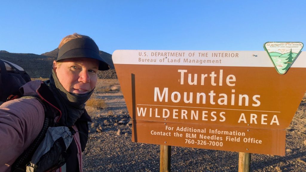
Thursday, Feb 27th 2025, 0600-1710
HWY 95 to west Turtle Mtns Wilderness Boundary mm79, Section 6
24 miles.
The wind picked up even more overnight, so I decided to put my tent into ‘bivy mode’ to reduce the flapping. I discovered this trick on past hikes. I just have to remove my center trekking pole, leaving everything else as is. I don’t mind having the walls collapsed on top me too much… it’s probably even extra insulation against the cold. I also took a Benadryl and put in my ear plugs, both because of the noise of the highway and the wind. All these hacks worked brilliantly. I was dead to the world most of the night.
In the morning, I reinserted my pole so I could get ready inside my once-again tent. I loaded my pack with all my new food and 2 remaining gallons of water (I had 3 in the cache and used 1 overnight), somehow managing to make it all fit. Plus, all the trash I was carrying from cutting 4 one gallon water jugs into pieces and stuffing them into ziplocks (a Buck30 tip that I very much appreciated!). I was even carrying a pair of small scissors for this task.
I was really hoping to find a boondocker that might take my trash, but the only one I passed was locked up tight, the occupants still asleep. Flagging down a passing vehicle on the highway seemed like way too much of a reach, so I just became resigned to carrying it all…for the next 73 miles. The reason I had so much water is because I wasn’t sure I’d find any in the guzzler’s for many miles. The last water reports were from Sketchy, made over a month prior. She braved this hard section, not knowing if there was any water. Buck30 had reported from Nov 2024, but he’d gone a different route through section 6 because he knew how bad the water situation might be. I can’t even imagine how much water Sketchy must have been carrying, given no information for over a year. And she went out of her way to visit and report on nearly every single water source along the route. She finished the DWTH around the time I was just getting started.
Back then, there were 6 hikers ahead of me, and thus lots of sets of footprints in section 1. But Cookie and Tictoc had to get off after just a few days due to injury. Then another couple abandoned the route in section 6, but I didn’t know why. I saw their footprints as far as this day and a little the next, but then no more. Nate also took a slightly different route through S6, so by the end of the day, all I saw were Sketchy’s occasional and vague prints. Nate and Sketchy had already finished by the time I got to Parker, so I was the only one left on the route. It felt kind of special to be the last woman standing.
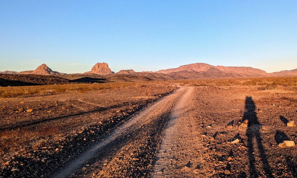
As much as the Whipple mountains had felt like the hump of the route to get through, I also thought of this day as being yet another hump. Really, all of section 6 was the hump to get through, and then it was downhill from there. Figuratively, because there was still a lot of climbing in sections 7 and 8, no doubt. But today was going to be especially hard because I had so much water (16 lbs!). I also had to negotiate what the notes described as the crux of the route.
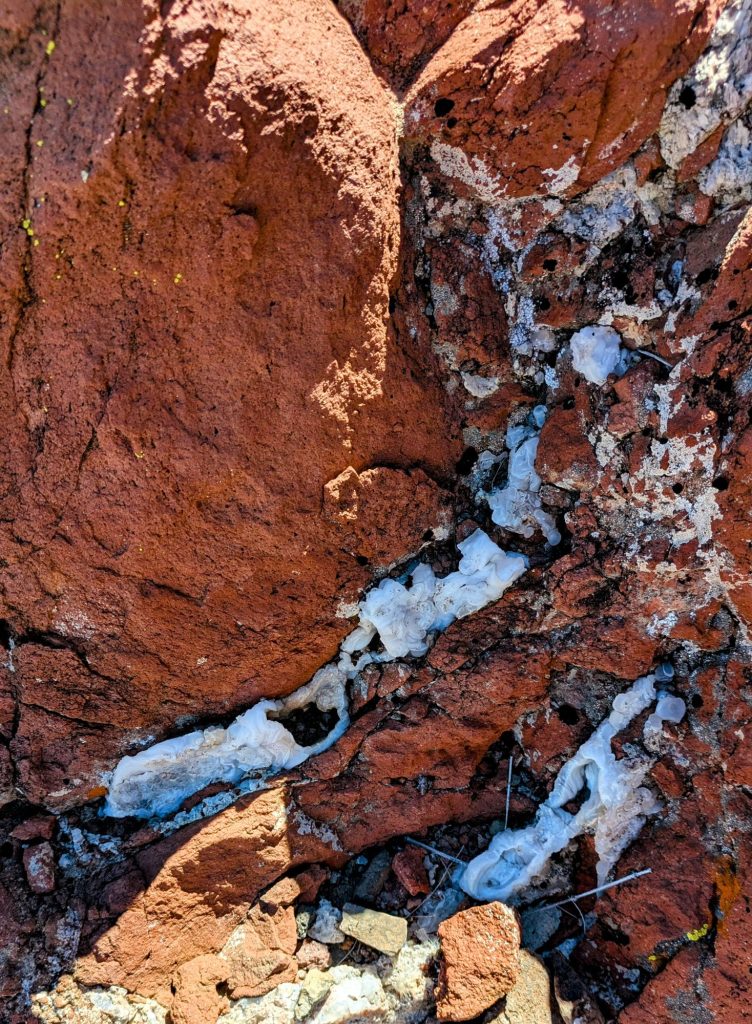
I walked a BLM road for many miles, until it ended at Gary wash. Then I walked up the braided wash, into the Turtle Mountain Wilderness. Since I took Brett’s blue alternate across the valley, I missed his main route that went past Mopah spring and peaks. I didn’t figure the spring would have any water, anyway. But the peaks looked really cool and I was sad to read in the notes that the area contained lots of Chalcedony stones
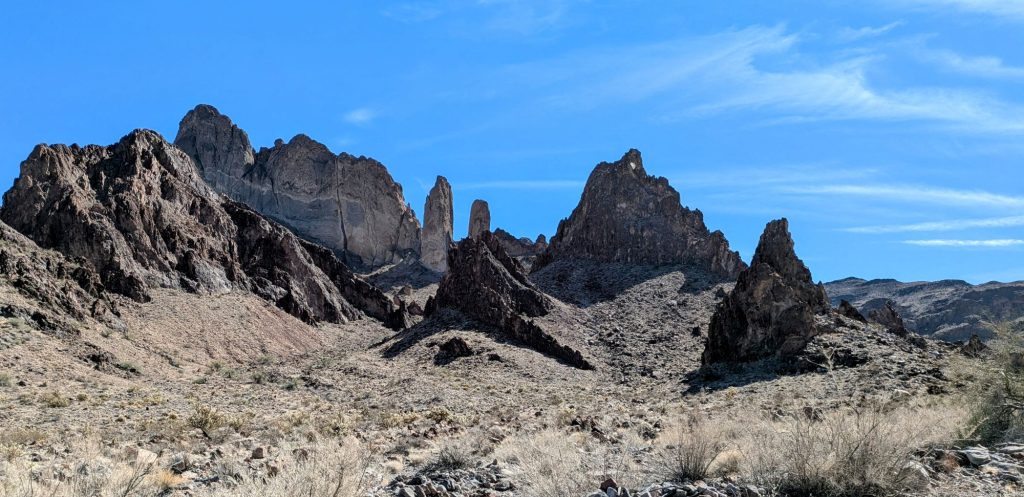
I need not have regretted taking the 9-mile-shorter alternate, because I think the scenery I saw in the Turtle Mountains more than made up for the missed Mopahs. Also, there was the largest collection of Chalcedony in the Turtles that I’d seen yet. I even found large veins of it where it was breaking out of the rocks. It was so cool to see, but slowed me down as usual. I probably bent over to look at a piece every 3 minutes.
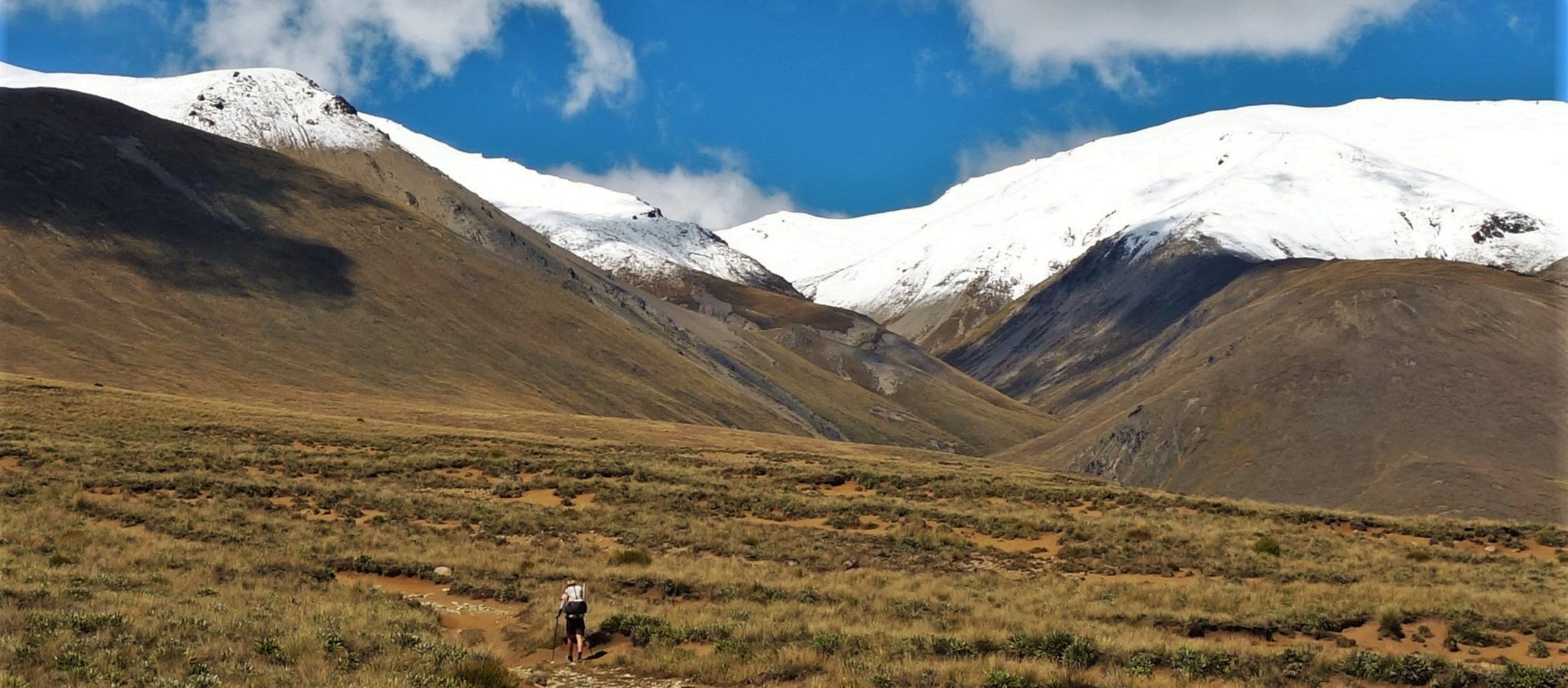
A series of ever smaller and rockier washes brought me to a steep pass and an even steeper descent. The notes indicated that this was the crux, which made me a little nervous. I wasn’t keen on doing any scrambling with such a heavy pack.
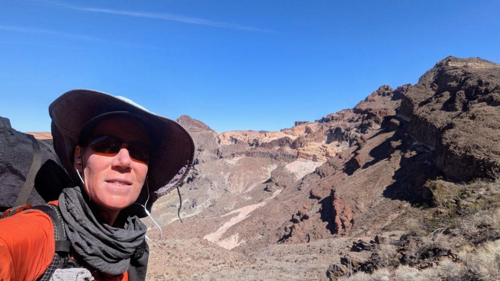
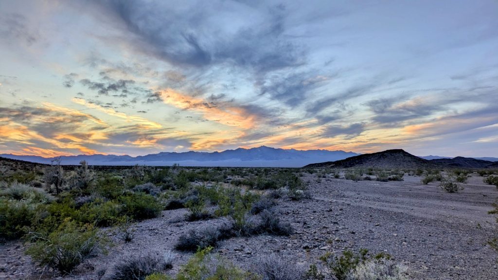
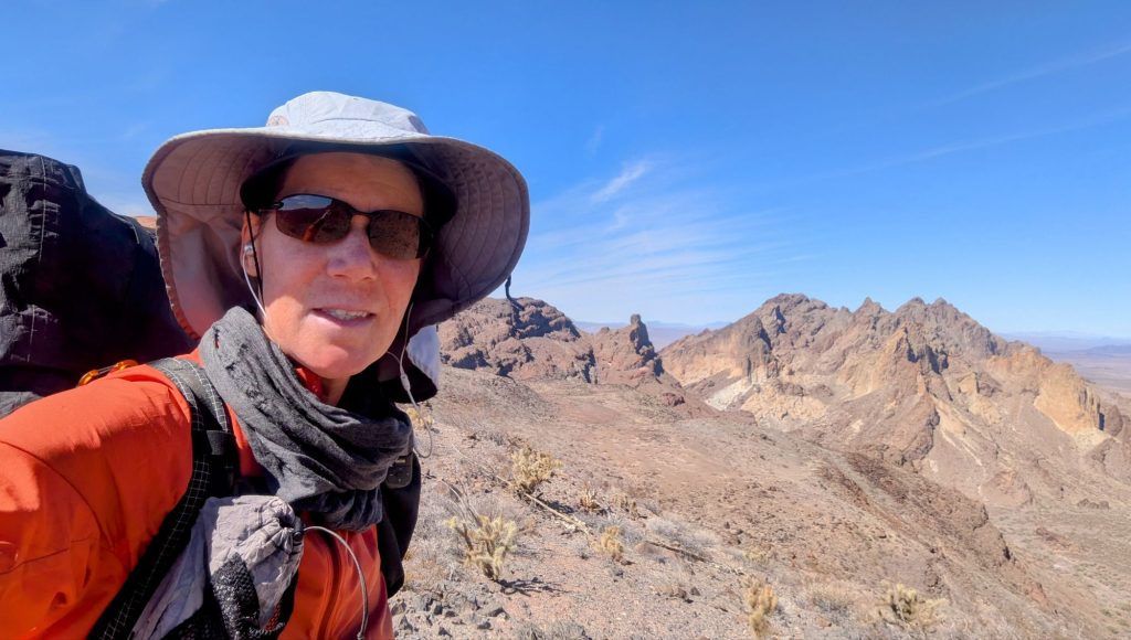
The scenery from the pass was quite spectacular. I dare say it was the best view of the entire trip so far. Brett had alerted me to this fact and he was right! Unfortunately, my pictures of the range failed to capture any of the grandeur. The Turtle mountains had many interesting colors and shapes. There were bands of white and red, pink and even purple. It was clear that many of the giant columns and pinnacles were the leftover cores of volcanoes. My photos just look washed out and the sheer size of the formations didn’t come through. Oh well, I’ll never forget this area and will definitely try to visit it again.
I pressed on, anxious to get the crux done. Fortunately, it turned out to be no big deal. I found the game trails that Brett noted, then negotiated a tricky spot around a pour-off in the exceedingly steep gully, but it was all stuff I’d done on the Hayduke. I was even calm enough to spend some time inspecting more Chalcedony that I found in the steepest part. I don’t know why I’m so attracted to that stuff.
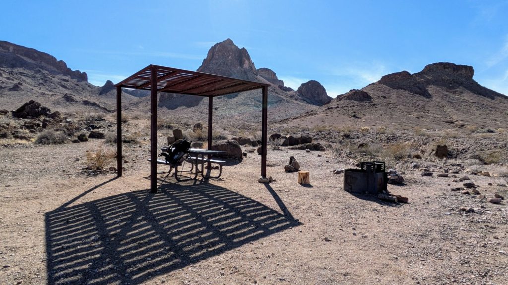
I followed a large wash down out of the valley, but little did I know there was even more to the Turtles. There was an old road which led to an established BLM campsite, complete with a picnic table and shade canopy. How anyone ever made it out this far in a vehicle, I had no idea. I took a short break there, then hiked an actual trail for a bit, which had been converted from an old mining route. There were mine relics all over the area. There were also many cool buttes and pinnacles, all still part of the Turtle Mountain range.

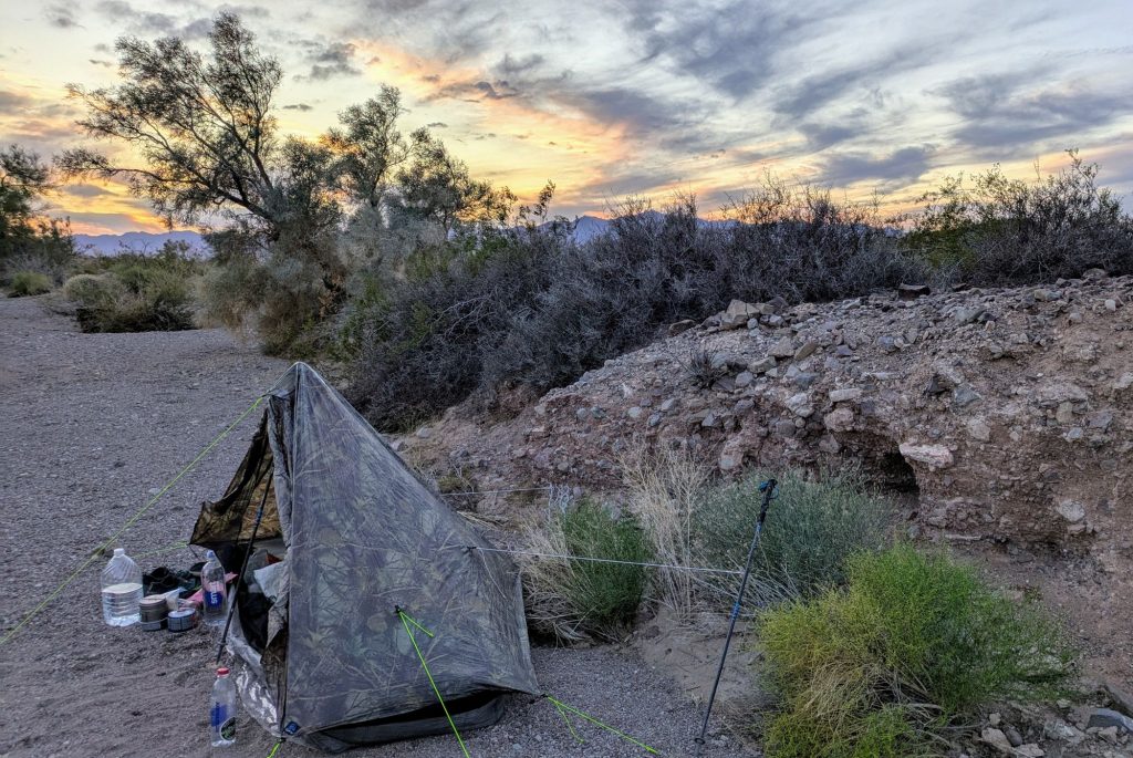
The trail petered out and once again I was walking through washes, going cross country and trying to follow ancient roads across the desert pavement. It was a pretty relaxing way to end the day, with easy walking through the valley towards the next range, the Old Woman Mountains. I pulled up just a few miles short of a guzzler, the first potential water source since Whipple wash. I didn’t need water since I was still carrying over a gallon and a half. I found a nice little wash with lots of palo verde trees that was offering good protection from the wind. I watched a beautiful sunset over the Old Woman mountains, the range I’d be navigating the next day. I couldn’t think of a much more desolate and quiet place to spend the night. This section sure was living up to all my expectations!