Friday, Feb 14th 2025, 0720-1820
North Big Horn Mtns mm25 to End of Section 4, mm50
25 miles.
The overnight rain started just as I was finishing dinner in my tent…yes I eat in my tent cause it’s not like there’s anything out here that will go for my food. Water maybe, but not the food. I barely want my food. It rained all night, off and on, but was only a mere drizzle. It was probably the most peaceful night I ever spent in my tent while getting rained on. I just loved it, especially the sound. Bliss!
It was still raining in the morning, so I delayed my start for a bit. I packed a wet tent and enjoyed leaving a trace in the form of a tent footprint. Like all footprints in the desert, it would be erased, in this case sooner rather than later. Unlike previous days, my umbrella was up first thing in the morning (for the rain, not sun), but shortly I didn’t need it the rest of the day.
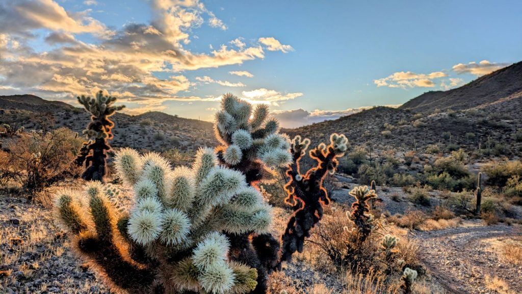
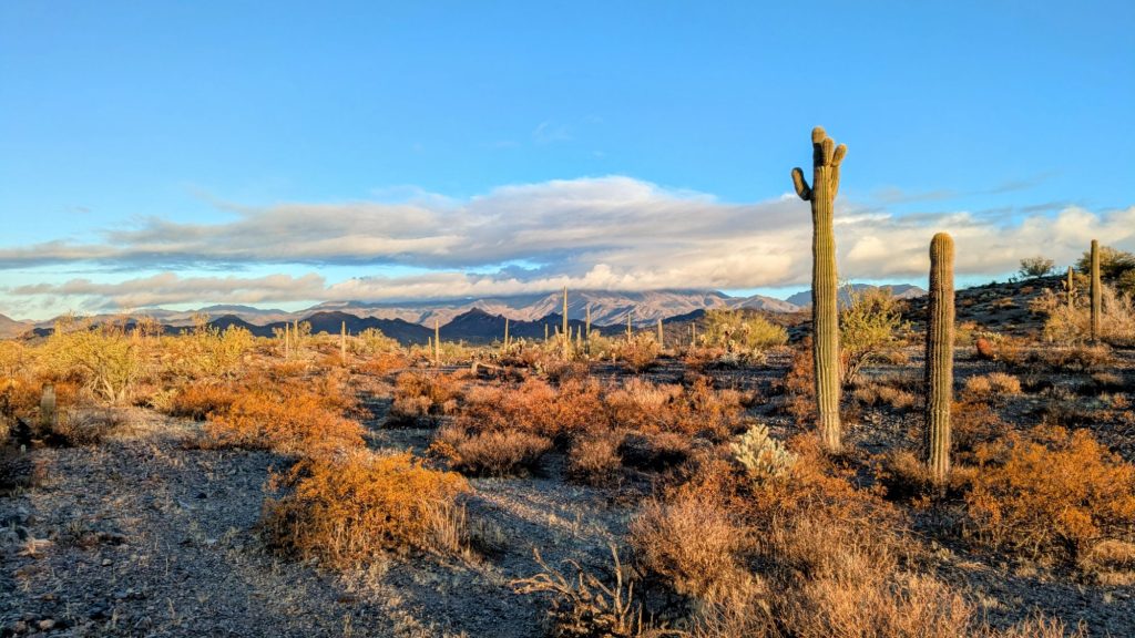
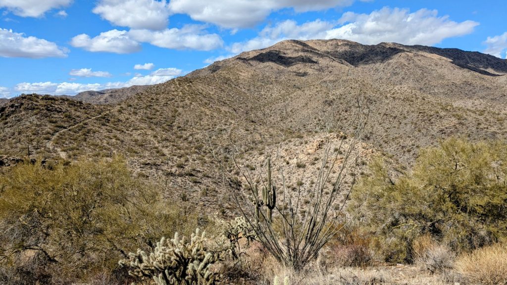
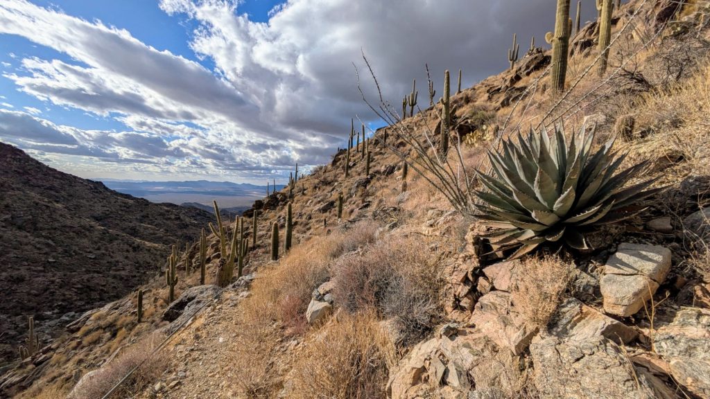
I continued up the wash and eventually joined an old mining road that meandered nicely through the hills. It stopped raining as soon as the sun was up and the clouds began dissipating immediately. This series of events seemed to awaken the desert like I’d never seen before. All the birds were singing, especially the cactus wrens. I hadn’t heard any in a long time and suddenly they were everywhere. Maybe I just got lucky because the vegetation seemed a lot more dense and vibrant in this area, almost like Saguaro National Park. But certainly the rains helped ‘liven’ it up. Even the Teddy Bear Cholla looked soft and fluffy. But Au contraire, it’s actually one of the worst things a person can bumble into. The ends fall off into balls that have an ability to jump up and grab your calf. I can usually dislodge them with my trekking pole, but the wounds left behind from the spines tend to hurt for a bit.
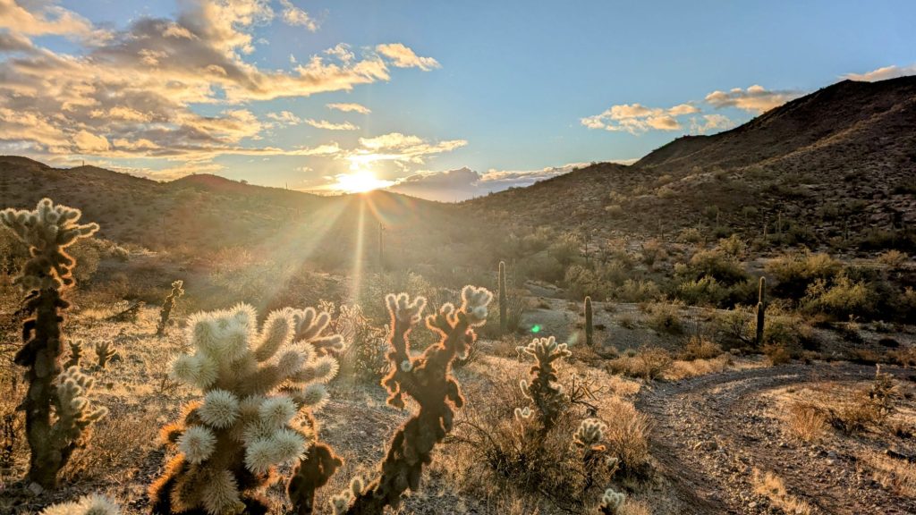
I couldn’t stop taking pictures, relishing in the magic of the desert after a mellow rain. It was so beautiful everywhere I looked. The rain was glistening in the sun, giving the poor scorched plants a whole new look.
As I neared a paved highway, I passed a large group of boondockers that seemed to be part of one caravan. They looked like they were gearing up for a big weekend, with lots of trailers and ORVs staged. There were more pulling in as I crossed the highway. There I came to my one and only water source for the day, Tiger Well. The water was very good, straight out of a float valve from a solar well. I stopped for a while to camel-up. There were a bunch of cows in the adjacent corral, who started mooing at me. Probably because they were starving and thought I might feed them some hay. These were the most emaciated cows I’d seen yet. Their ribs and haunches were very visible under their scraggly hides. I thought it amounted to a case of animal cruelty and neglect, but I was in no position to protest. At least they had good water.
I moved on pretty quickly because there was a guy on a motorcycle who kept driving by, giving me the creeps. But it was silly to think someone could be capable of stalking me. The route had so many twists and turns and bouts of cross country. Without also having the route info, a stalker would soon be lost. Some of the old roads I followed were even quite impassable…like the old mining road I was about to take up the mountain. Only someone on foot could have followed me at that point, then good luck to them trying to keep up. I moved too fast and with the confidence of knowing where I was going.
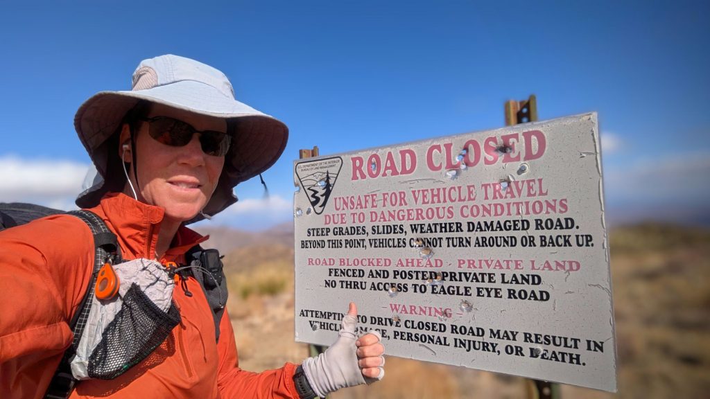
A series of roads led to the proximity of a mining claim and private property, which had to be avoided at all costs. Apparently there were many aggressive signs posted, as well as cameras, giving the impression of what was described as a “gun nut” occupying the territory. I didn’t get close enough to see for myself, turning away from the property well ahead of time.
My own father was a gun nut, or as he put it, a collector. I knew these people were generally mostly harmless but also, you never know. My feelings about guns are heavily based on seeing how the “hobby” changed my dad, and not for the better. I think it was a destructive obsession and paranoia, pointless to a fault, and could have also contributed to the disease that killed him. He did a lot of reloading and I’m sure all that lead exposure was bad for his health. Lead is a well-documented carcinogen and he died from cancer, so…. But, hey what do those scientists and public health people know anyway!
The route around the property had been described as convoluted, but didn’t turn out to be all that bad. While walking down a wash, I found a few small pools of water, leftover from the rain. Then I heard a snort and realized this area too was being guarded. A squadron of javelina were defending this precious resource, and rightfully so! It was all they’d gotten in weeks. They were kind to give me a courtesy warning and pass, so I moved off quickly to leave them to their water. Wildlife only invest their efforts in what is crucial to their survival…a lesson we might learn from if we weren’t so busy trying to destroy everything around us. And these javelina seemed much more amiable than the gun nut, at least.
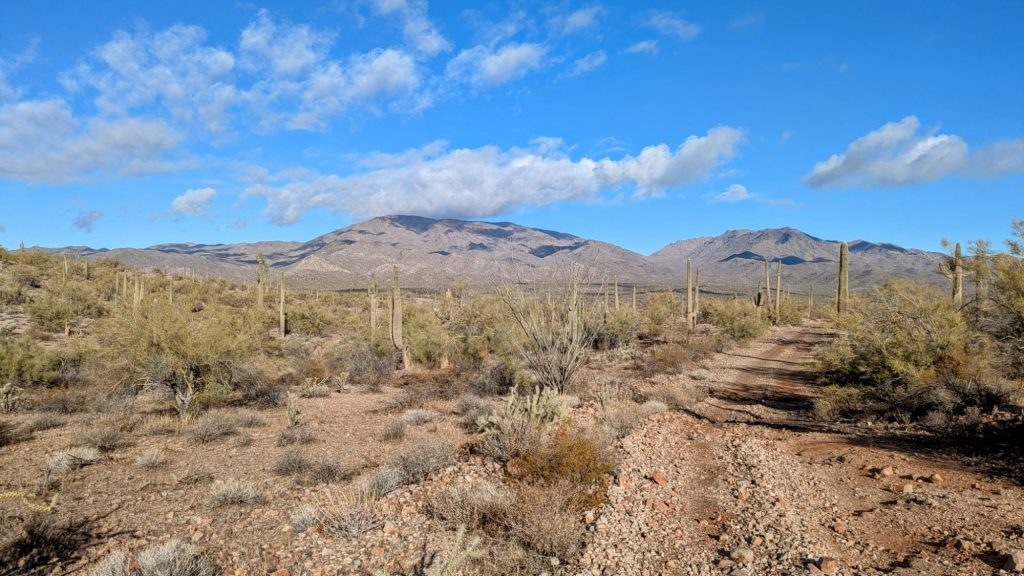
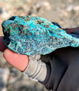
I began climbing first an old mining road, which turned into a wash, then road again. There were a lot of mining relics…old stone formations (fireplace), test pits, etc. And lots of rocks that I call turquoise, but I’m not sure about this. These blue and green tinged minerals show up whenever there are mine tailings.
The road ended and I began a steep half mile climb along a ridge to connect to the final road to the top. I thought this 3500′ and 6 mile climb might take 2-3 hours. But it was almost double that, or at least it felt like it. This was also not the day to try to be pulling a 25 miler, but that’s what I stupidly had planned. The infinite and steep rocky mining road to the top really kicked my butt. I tried to reason that 3500′ was no worse than many of the 14ers I’d done. Plus elevation wasn’t a factor, I could breathe just fine. But the terrain and having a heavy pack (carrying enough water for the day and night) really slowed me down. I didn’t reach the summit until 3 pm.
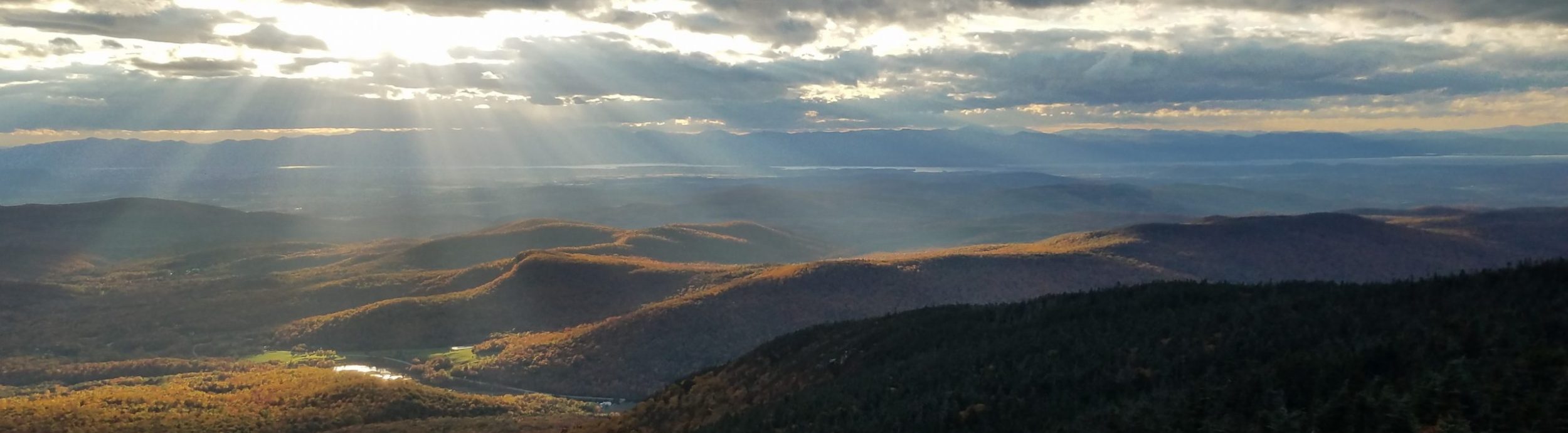
At least whenever I took breaks, I could look back to see the entire route I’d hiked over the past week. More and more bits were revealed as I went up. The Big Horns, Saddle mountain, Signal Peak, Woolsey, and the Maricopa Mountains. Finally I spotted one mountain I’d been hoping to see again, Table Top, which I passed on day 9 of this trip! Thinking back, from that mountain I could still see Mt Lemmon, which is where I started this hike. What an incredible time and distance these 2 viewpoints connected! Peakfinder verified my sighting. So cool!
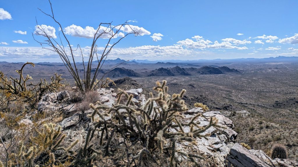
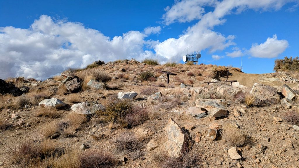
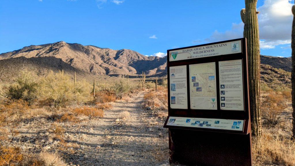
Of course, since there was a different, well-maintained road to the summit, there were also a bunch of communication towers and equipment. Harquahala is the highest mountain in southwest Arizona at 5681 ft, so it makes for an ideal highpoint. It’s also the high point of the Desert Winter Thru Hike hike (though I’d been higher going over Romero pass on day 2 of my bonus section from the AZT).

The views from the top were quite spectacular, as I expected. But it was so windy and cold, I couldn’t stay for long. I’d planned to have lunch at one of the picnic tables, but that was a no-go. I also had to hurry down before I lost daylight. I certainly didn’t want to camp up there in such blustery conditions. A fire lookout would have been a cool spot to hang out inside, but alas, there was none.
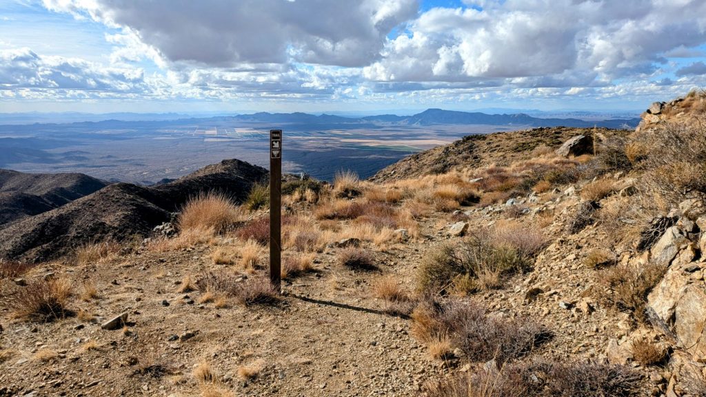
At least there was a really nice pack trail leading down the other side. I bombed down it, still feeling energy despite basically hiking all day without any substantial breaks, or eating enough food. I certainly didn’t drink enough water, trying to ration what I was carrying, but that’s par for the course. The crack the trail followed was very scenic, with amazing views to the valley below and mountains beyond.
I couldn’t help but worry about the Harcuver mountain range to the west, which I knew I had to go up and over in a day. I was too fatigued to think about yet another taxing climb (let’s hear it for the AT!). Those mountains stared at me, challenging me. Or were they feeling intimidated having just seen me go over Harquahala? Of course, mountains don’t think or feel anything…and they don’t make for the best valentine partners either. But Harquahala was all I had for a romantic time this day, and it was plenty enough.
I made it all the way to the highway, but pulled up short to camp amongst the cows, doing a nero into town the next morning. There was a motel room available for $80, but I wasn’t sure I could get a hitch, especially with it starting to get dark. It was better to save my money. The hotel receptionist made sure to remind me it was Valentine’s day. Yeah thanks lady, but I had cows and coyotes for company. I think even if I had a hiking buddy, it would be awkward, wishing I was at home with my real partner instead. Probably he also prefers that I’m alone, rather than with some other dude out in the wilderness. I figured it’s just easier and better this way.
Pretty interesting country and experiences for your hiking Valentine’s Day, Twig❣️
You sure have accrued a lot of wisdom on your journeying, and your attitude moving ahead, always, is totally admirable❣️😃🥰
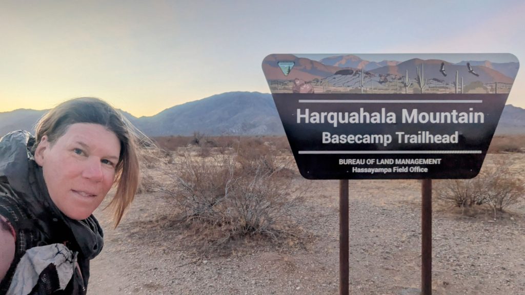
Did you see any condors out there? 🤔 That sign you stood next to had them painted on it❣️😮♥️😎 That would surely be a sight to behold❣️♥️
You are always an inspiration, my friend❣️🙂 Love ya, gal❣️🥰
Happy Trails❣️🥾🥾🥾😃
Thanks Emoji 😁